7,7 km | 8,8 km-effort
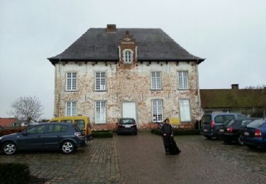
casteel van horst
emileverschueren
Utente
Lunghezza
18,6 km
Altitudine massima
92 m
Dislivello positivo
200 m
Km-Effort
21 km
Altitudine minima
23 m
Dislivello negativo
199 m
Boucle
Sì
Data di creazione :
2019-04-24 16:28:00.936
Ultima modifica :
2019-04-24 16:28:01.198
4h38
Difficoltà : Sconosciuto
Applicazione GPS da escursionismo GRATUITA
Chi siamo
Percorso Marcia di 18,6 km da scoprire a Vlaanderen, Vlaams-Brabant, Tielt-Winge. Questo percorso è proposto da emileverschueren.
Localizzazione
Paese:
Belgium
Regione :
Vlaanderen
Dipartimento/Provincia :
Vlaams-Brabant
Comune :
Tielt-Winge
Località :
Sint-Joris-Winge
Partenza:(Dec)
Partenza:(UTM)
631902 ; 5642721 (31U) N.
Commenti
Percorsi nelle vicinanze
Werveldtwandelpad
A piedi
Facile
Lubbeek,
Vlaanderen,
Vlaams-Brabant,
Belgium
9,4 km | 10,7 km-effort
2h 25min
Sì
Wingewandeling
A piedi
Facile
Holsbeek,
Vlaanderen,
Vlaams-Brabant,
Belgium
3,3 km | 3,6 km-effort
48min
Sì
Peersewandeling
A piedi
Facile
Holsbeek,
Vlaanderen,
Vlaams-Brabant,
Belgium
3,4 km | 3,9 km-effort
52min
Sì
Domeinwandeling
A piedi
Facile
Holsbeek,
Vlaanderen,
Vlaams-Brabant,
Belgium
3,2 km | 3,5 km-effort
47min
Sì
De Spicht
A piedi
Facile
Lubbeek,
Vlaanderen,
Vlaams-Brabant,
Belgium
9,9 km | 11,3 km-effort
2h 33min
Sì
De Spicht Oranje bol
A piedi
Facile
Lubbeek,
Vlaanderen,
Vlaams-Brabant,
Belgium
4,5 km | 5,6 km-effort
1h 16min
Sì
Tieltse Motte Oranje bol
A piedi
Facile
Tielt-Winge,
Vlaanderen,
Vlaams-Brabant,
Belgium
8,4 km | 9,5 km-effort
2h 10min
Sì
Tieltse Motte Rode driehoek
A piedi
Facile
Tielt-Winge,
Vlaanderen,
Vlaams-Brabant,
Belgium
10,3 km | 11,6 km-effort
2h 38min
Sì