![](/images/other/stat-length.png)
![Percorso Bicicletta Saint-Martin-de-Castillon - La Véloroute - Voie Verte du Calavon - Photo](https://media.geolcdn.com/t/1900/400/ext.pjpeg?maxdim=2&url=https%3A%2F%2Fservices.sitytrail.com%2FGeolivesWS%2FDownloadMedia.ashx%3FTrailID%3D375432%26Media%3D492bf258-2a21-4a95-9687-f1dbf28d9a2a.jpg)
La Véloroute - Voie Verte du Calavon
Vélo Loisir Provence
Randonnées de Vélo Loisir Provence GUIDE+
![Lunghezza](/images/other/stat-length.png)
![Altitudine massima](https://static1.geolcdn.com/siteimages/upload/files/1508320355ic_sort_altitude_max_24dp.png)
![Dislivello positivo](https://static1.geolcdn.com/siteimages/upload/files/1508320355ic_sort_den_pos_24dp.png)
![Km-Effort](/images/other/stat-length.png)
![Altitudine minima](https://static1.geolcdn.com/siteimages/upload/files/1508320355ic_sort_altitude_min_24dp.png)
![Dislivello negativo](https://static1.geolcdn.com/siteimages/upload/files/1508320355ic_sort_den_neg_24dp.png)
![Boucle](https://static1.geolcdn.com/siteimages/upload/files/16400158638029165_repeat_loop_refresh_sync_direction_icon.png)
![Tag](https://services.sitytrail.com/GeolivesWS/DownloadMedia.ashx?TrailID=375432&Media=balise.png)
![Bicicletta](https://static1.geolcdn.com/sitytour/trail-icons/200.png)
2h05
Difficoltà : Facile
![Scannerizza questo codice QR per aprire il percorso nell'applicazione SityTrail](https://capi.geolives.com/qq0zvz2zws4bq2lad0pu/sitytour/trails/375432/qr.png?size=200)
Applicazione GPS da escursionismo GRATUITA
Chi siamo
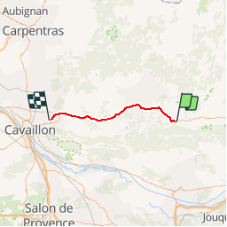
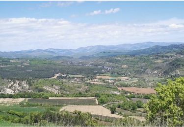
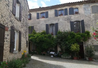
Percorso Bicicletta di 37 km da scoprire a Provenza-Alpi-Costa Azzurra, Vaucluse, Saint-Martin-de-Castillon. Questo percorso è proposto da Vélo Loisir Provence.
Descrizione
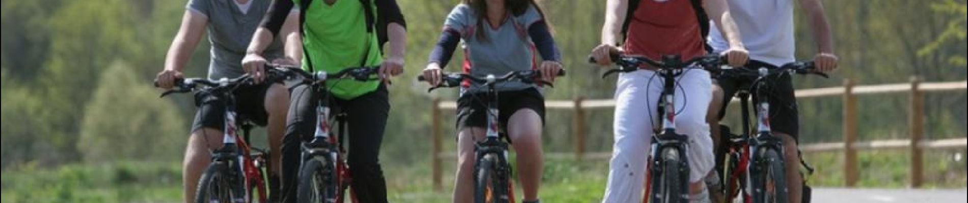
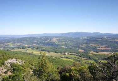
“La Véloroute de Calavon”, The Greenway Cycle route : The Ultimate Family cycling outing, no cars no gradient ! This itinerary uses for the majority of its length, the old railway line route from Cavaillon – Apt – Volx. The entire distance, except for 2 km / 1 ¼ miles at “Le Chene”, is greenway. “La Véloroute” (cycle path) begins near the village of Coustellet, then follow the Calavon valley and finishes at the foot of the Luberon on the D 48 which continues through to Castellet. It is a very pleasant route along which one can see a Roman bridge, cross the town of Apt in total safety on viaducs and with beautiful view. The country side becomes even more beautiful along the banks of the Calavon and the slopes of the Luberon with its high perched villages. The circuit “Autour du Luberon” takes up the route once you arrive at the end of this linear itinerary.
Localizzazione
Commenti
Percorsi nelle vicinanze
![Percorso Marcia Auribeau - Le Mourre Nègre - Photo](https://media.geolcdn.com/t/375/260/ext.jpg?maxdim=2&url=https%3A%2F%2Fstatic1.geolcdn.com%2Fsiteimages%2Fupload%2Ffiles%2F1553511878bg_sport_marche.png)
![Marcia Marcia](https://static1.geolcdn.com/sitytour/trail-icons/101.png)
Marcia
![](/images/other/stat-length.png)
![](https://static1.geolcdn.com/siteimages/upload/files/16400158638029165_repeat_loop_refresh_sync_direction_icon.png)
![Percorso Marcia Auribeau - Auribeau Mourre Négre retour Auribeau - Photo](https://media.geolcdn.com/t/375/260/a5950379-bfff-488c-9748-ecf51b9bfe23.jpg&format=jpg&maxdim=2)
![Marcia Marcia](https://static1.geolcdn.com/sitytour/trail-icons/101.png)
Marcia
![](/images/other/stat-length.png)
![](https://static1.geolcdn.com/siteimages/upload/files/16400158638029165_repeat_loop_refresh_sync_direction_icon.png)
![Percorso Marcia Castellet-en-Luberon - Mourre du Grd Lubéron, crêtes et versant Nord - Photo](https://media.geolcdn.com/t/375/260/301a589c-0eae-4b76-b7e7-f2beafbfa250.jpg&format=jpg&maxdim=2)
![Marcia Marcia](https://static1.geolcdn.com/sitytour/trail-icons/101.png)
Marcia
![](/images/other/stat-length.png)
![](https://static1.geolcdn.com/siteimages/upload/files/16400158638029165_repeat_loop_refresh_sync_direction_icon.png)
![Percorso Marcia Saint-Martin-de-Castillon - T2021-03-28-16-35 - Photo](https://media.geolcdn.com/t/375/260/f5954e86-11dc-4277-8586-d3c42a2e7a55.jpg&format=jpg&maxdim=2)
![Marcia Marcia](https://static1.geolcdn.com/sitytour/trail-icons/101.png)
Marcia
![](/images/other/stat-length.png)
![](https://static1.geolcdn.com/siteimages/upload/files/16400158638029165_repeat_loop_refresh_sync_direction_icon.png)
![Percorso Marcia Auribeau - Auribeau. Mourre-Nègre - Photo](https://media.geolcdn.com/t/375/260/5a35ebf4-91df-4555-a784-dbaa73f02eb9.jpg&format=jpg&maxdim=2)
![Marcia Marcia](https://static1.geolcdn.com/sitytour/trail-icons/101.png)
Marcia
![](/images/other/stat-length.png)
![](https://static1.geolcdn.com/siteimages/upload/files/16400158638029165_repeat_loop_refresh_sync_direction_icon.png)
![Percorso Marcia Auribeau - Moure Negre - Photo](https://media.geolcdn.com/t/375/260/becff8d0-1777-4ae0-99e1-058e990cfbe2.jpg&format=jpg&maxdim=2)
![Marcia Marcia](https://static1.geolcdn.com/sitytour/trail-icons/101.png)
Marcia
![](/images/other/stat-length.png)
![](https://static1.geolcdn.com/siteimages/upload/files/16400158638029165_repeat_loop_refresh_sync_direction_icon.png)
![Percorso Marcia Castellet-en-Luberon - St Martin de Castillon - Caseneuve - Photo](https://media.geolcdn.com/t/375/260/e3e858ef-987c-42e0-9cfc-e9567aa06a01.jpg&format=jpg&maxdim=2)
![Marcia Marcia](https://static1.geolcdn.com/sitytour/trail-icons/101.png)
Marcia
![](/images/other/stat-length.png)
![](https://static1.geolcdn.com/siteimages/upload/files/16400158638029165_repeat_loop_refresh_sync_direction_icon.png)
![Mountainbike Mountainbike](https://static1.geolcdn.com/sitytour/trail-icons/202.png)
Mountainbike
![](/images/other/stat-length.png)
![](https://static1.geolcdn.com/siteimages/upload/files/16400158638029165_repeat_loop_refresh_sync_direction_icon.png)
![Percorso Marcia Auribeau - auribeau - Photo](https://media.geolcdn.com/t/375/260/324db42c-4d31-4935-a471-7d40beb7a7a2.jpg&format=jpg&maxdim=2)
![Marcia Marcia](https://static1.geolcdn.com/sitytour/trail-icons/101.png)
Marcia
![](/images/other/stat-length.png)
![](https://static1.geolcdn.com/siteimages/upload/files/16400158638029165_repeat_loop_refresh_sync_direction_icon.png)