Percorso A piedi L'Abergement-Sainte-Colombe - P . L' abergement St Colombe - Les cfoix Jean - Foichot - Boullerand - Abbaye des Barres - Le Charmois et retour par Le Champ salin .  - Photo

P . L' abergement St Colombe - Les cfoix Jean - Foichot - Boullerand - Abbaye des Barres - Le Charmois et retour par Le Champ salin .

© OpenStreetMap contributors
Lunghezza
Lunghezza
8,5 km
Altitudine massima
Altitudine massima
208 m
Dislivello positivo
Dislivello positivo
55 m
Km-Effort
Km-Effort  
9,3 km
Altitudine minima
Altitudine minima
182 m
Dislivello negativo
Dislivello negativo
55 m
Boucle
Boucle
Sì
Data di creazione :
2023-07-25 13:43:23.085
Ultima modifica :
2023-07-25 13:46:45.244

(0 Recensione)

A piedi
A piedi
2h06
Difficoltà : Facile

Scannerizza questo codice QR per aprire il percorso nell'applicazione SityTrail

Applicazione GPS da escursionismo GRATUITA

Logo SityTrail SityTrail

IGN / Istituti geografici

Scarica SityTrail dall'App Store Scarica SityTrail da Google Play

Logo SityTrail SityTrail World

Il mondo è tuo

Scarica SityTrail dall'App Store Scarica SityTrail da Google Play Scarica SityTrail da Huawei AppGallery

Chi siamo

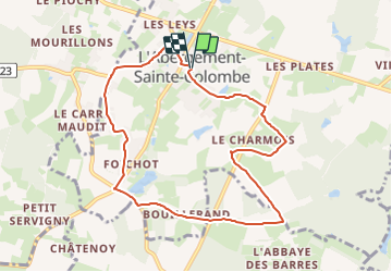
Percorso A piedi di 8,5 km da scoprire a Borgogna-Franca Contea, Saône-et-Loire, L'Abergement-Sainte-Colombe. Questo percorso è proposto da jeanpaulcheyssac.

Descrizione

Départ : Parking mairie , salle des Fêtes .

Profilo altimetrico

Localizzazione

Paese:
France
Regione :
Borgogna-Franca Contea
Dipartimento/Provincia :
Saône-et-Loire
Comune :
L'Abergement-Sainte-Colombe
Località :
Unknown
Partenza:(UTM)
653338 ; 5179620 (31T) N.

Percorsi nelle vicinanze

Percorso A piedi Tronchy - P . Tronchy - Les Cottins - La Vendue - Les Vallots - Abbaye des Barres - Le GD Creuilly et retour .  - Photo
A piedi
jeanpaulcheyssac

A piedi

Facile
Tronchy, Borgogna-Franca Contea, Saône-et-Loire, France
9,6 km | 10,9 km-effort
2h 28min
Sì
Percorso A piedi Tronchy - P . Tronchy - Etang EDF - Le GD Creuilliy- Abbaye des Barres - Les Vallots et retour au Cottins  - Photo
A piedi
jeanpaulcheyssac

A piedi

Facile
Tronchy, Borgogna-Franca Contea, Saône-et-Loire, France
6,9 km | 8 km-effort
1h 48min
Sì
Percorso A piedi Saint-Christophe-en-Bresse - G . St Christophe en Bresse - Les morillons - Le petit Servigny - le pont rouge - Chatenoy - Le carré maudit et retour .  - Photo
A piedi
jeanpaulcheyssac

A piedi

Facile
Saint-Christophe-en-Bresse, Borgogna-Franca Contea, Saône-et-Loire, France
10,1 km | 11,1 km-effort
2h 31min
Sì
Percorso Marcia L'Abergement-Sainte-Colombe - G . L' Abergement St Colombe - Les Clousiaux - étang du Timon - Les Montmorts - La Gd Taule - Les Leys et retour .  - Photo
Marcia
jeanpaulcheyssac

Marcia

Medio
L'Abergement-Sainte-Colombe, Borgogna-Franca Contea, Saône-et-Loire, France
9,9 km | 11,1 km-effort
2h 31min
Sì
Percorso Marcia Ouroux-sur-Saône - G . Ouroux sur Saone - La platière - GD Servigny - PT Servigny - Pont Rouge et retour  - Photo
Marcia
jeanpaulcheyssac

Marcia

Medio
Ouroux-sur-Saône, Borgogna-Franca Contea, Saône-et-Loire, France
10,4 km | 11,2 km-effort
2h 32min
Sì
Percorso Marcia Ouroux-sur-Saône - G . Ouroux sur Saone - La platière - GD Servigny - PT Servigny - Pont Rouge et retour  - Photo
Marcia
jeanpaulcheyssac

Marcia

Medio
Ouroux-sur-Saône, Borgogna-Franca Contea, Saône-et-Loire, France
10,4 km | 11,2 km-effort
2h 32min
Sì
Percorso Marcia Ouroux-sur-Saône - G . Ouroux sur Saone - La platière - GD Servigny - PT Servigny - Pont Rouge et retour  - Photo
Marcia
jeanpaulcheyssac

Marcia

Medio
Ouroux-sur-Saône, Borgogna-Franca Contea, Saône-et-Loire, France
10,4 km | 11,2 km-effort
2h 32min
Sì
Percorso Marcia Saint-Martin-en-Bresse - G . La Madeleine - Les Marlins - La Foret - Colnand - Bellefond - et retour  - Photo
Marcia
jeanpaulcheyssac

Marcia

Difficile
Saint-Martin-en-Bresse, Borgogna-Franca Contea, Saône-et-Loire, France
13,4 km | 14,8 km-effort
3h 22min
Sì
Percorso Marcia Ouroux-sur-Saône - TP . Ouroux sur Saone - Les Clefs - Le Bourg - Voie verte et retour  - Photo
Marcia
jeanpaulcheyssac

Marcia

Facile
Ouroux-sur-Saône, Borgogna-Franca Contea, Saône-et-Loire, France
5,5 km | 5,9 km-effort
1h 20min
Sì


Chiudi
I miei abbonamenti