![](/images/other/stat-length.png)
![Percorso A piedi Sankt Michael im Lungau - Wanderweg 98, Aineck Rundwanderweg - Photo](https://media.geolcdn.com/t/1900/400/98cf76b6-458f-4b64-94e0-0f78b06abc14.jpeg&format=pjpeg&maxdim=2)
Wanderweg 98, Aineck Rundwanderweg
SityTrail - itinéraires balisés pédestres
Tous les sentiers balisés d’Europe GUIDE+
![Lunghezza](/images/other/stat-length.png)
Lunghezza
13 km
![Altitudine massima](https://static1.geolcdn.com/siteimages/upload/files/1508320355ic_sort_altitude_max_24dp.png)
Altitudine massima
2207 m
![Dislivello positivo](https://static1.geolcdn.com/siteimages/upload/files/1508320355ic_sort_den_pos_24dp.png)
Dislivello positivo
656 m
![Km-Effort](/images/other/stat-length.png)
Km-Effort
22 km
![Altitudine minima](https://static1.geolcdn.com/siteimages/upload/files/1508320355ic_sort_altitude_min_24dp.png)
Altitudine minima
1630 m
![Dislivello negativo](https://static1.geolcdn.com/siteimages/upload/files/1508320355ic_sort_den_neg_24dp.png)
Dislivello negativo
651 m
![Boucle](https://static1.geolcdn.com/siteimages/upload/files/16400158638029165_repeat_loop_refresh_sync_direction_icon.png)
Boucle
Sì
Tag
Data di creazione :
2022-02-16 16:48:46.82
Ultima modifica :
2022-03-03 12:25:55.431
![A piedi](https://static1.geolcdn.com/sitytour/trail-icons/100.png)
4h56
Difficoltà : Medio
![Scannerizza questo codice QR per aprire il percorso nell'applicazione SityTrail](https://capi.geolives.com/qq0zvz2zws4bq2lad0pu/sitytour/trails/3127963/qr.png?size=200)
Applicazione GPS da escursionismo GRATUITA
Chi siamo
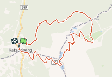
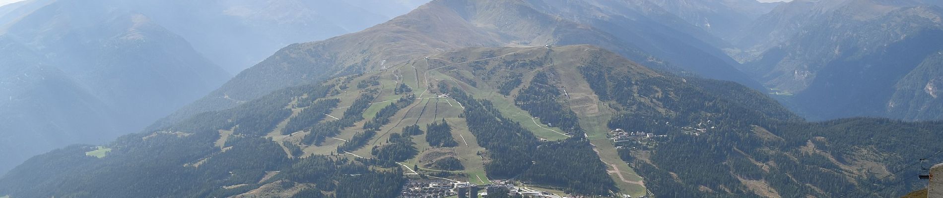
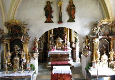
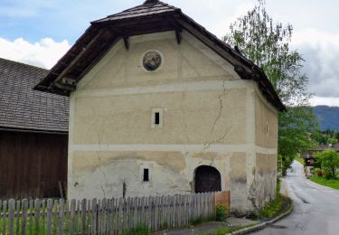
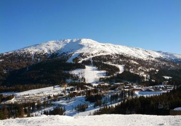
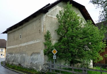
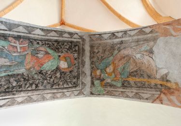
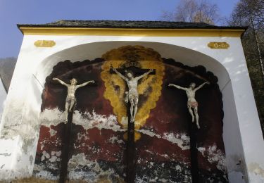
Percorso A piedi di 13 km da scoprire a Salisburgo, Bezirk Tamsweg, Sankt Michael im Lungau. Questo percorso è proposto da SityTrail - itinéraires balisés pédestres.
Descrizione
Trail created by TVB St. Michael im Lungau.
Symbol: rot-weiß-rot 91
Localizzazione
Paese:
Austria
Regione :
Salisburgo
Dipartimento/Provincia :
Bezirk Tamsweg
Comune :
Sankt Michael im Lungau
Località :
Unknown
Partenza:(Dec)
Partenza:(UTM)
394824 ; 5212755 (33T) N.
Commenti
Percorsi nelle vicinanze
![Percorso A piedi Sankt Michael im Lungau - Wanderweg 90, Saumoos - Rundwanderweg - Photo](https://media.geolcdn.com/t/375/260/0ae10204-ec5c-4221-bfef-5aa343a5d6e0.jpeg&format=jpg&maxdim=2)
![A piedi A piedi](https://static1.geolcdn.com/sitytour/trail-icons/100.png)
Wanderweg 90, Saumoos - Rundwanderweg
A piedi
Facile
Sankt Michael im Lungau,
Salisburgo,
Bezirk Tamsweg,
Austria
![](/images/other/stat-length.png)
9 km | 10,7 km-effort
2h 25min
![](https://static1.geolcdn.com/siteimages/upload/files/16400158638029165_repeat_loop_refresh_sync_direction_icon.png)
No
![Percorso A piedi Sankt Michael im Lungau - Wanderweg 94, Speyereck - Bergwanderung - Photo](https://media.geolcdn.com/t/375/260/977b81a0-530e-47e3-b2e5-576f46ae6f99.jpeg&format=jpg&maxdim=2)
![A piedi A piedi](https://static1.geolcdn.com/sitytour/trail-icons/100.png)
Wanderweg 94, Speyereck - Bergwanderung
A piedi
Medio
Sankt Michael im Lungau,
Salisburgo,
Bezirk Tamsweg,
Austria
![](/images/other/stat-length.png)
11,3 km | 23 km-effort
5h 17min
![](https://static1.geolcdn.com/siteimages/upload/files/16400158638029165_repeat_loop_refresh_sync_direction_icon.png)
No
![Percorso A piedi Sankt Michael im Lungau - Wanderweg 93, Grubental - Rundwanderweg - Photo](https://media.geolcdn.com/t/375/260/9119b55d-52c5-4440-8883-e0e71640e841.jpeg&format=jpg&maxdim=2)
![A piedi A piedi](https://static1.geolcdn.com/sitytour/trail-icons/100.png)
Wanderweg 93, Grubental - Rundwanderweg
A piedi
Facile
Sankt Michael im Lungau,
Salisburgo,
Bezirk Tamsweg,
Austria
![](/images/other/stat-length.png)
5,9 km | 11,6 km-effort
2h 38min
![](https://static1.geolcdn.com/siteimages/upload/files/16400158638029165_repeat_loop_refresh_sync_direction_icon.png)
No
![Percorso A piedi Sankt Michael im Lungau - Wanderweg 56, Martiniberg Rundwanderweg - Photo](https://media.geolcdn.com/t/375/260/4123e658-b57d-4ae7-928d-bd43da8a7ded.jpeg&format=jpg&maxdim=2)
![A piedi A piedi](https://static1.geolcdn.com/sitytour/trail-icons/100.png)
Wanderweg 56, Martiniberg Rundwanderweg
A piedi
Facile
Sankt Michael im Lungau,
Salisburgo,
Bezirk Tamsweg,
Austria
![](/images/other/stat-length.png)
9,5 km | 15,2 km-effort
3h 26min
![](https://static1.geolcdn.com/siteimages/upload/files/16400158638029165_repeat_loop_refresh_sync_direction_icon.png)
Sì
![Percorso A piedi Sankt Michael im Lungau - Wanderweg 99, St. Michael-Katschberg Rundwanderweg - Photo](https://media.geolcdn.com/t/375/260/b440003b-5bc7-4f0a-81b7-5bfc99d09f8b.jpeg&format=jpg&maxdim=2)
![A piedi A piedi](https://static1.geolcdn.com/sitytour/trail-icons/100.png)
Wanderweg 99, St. Michael-Katschberg Rundwanderweg
A piedi
Medio
Sankt Michael im Lungau,
Salisburgo,
Bezirk Tamsweg,
Austria
![](/images/other/stat-length.png)
16,5 km | 26 km-effort
6h 0min
![](https://static1.geolcdn.com/siteimages/upload/files/16400158638029165_repeat_loop_refresh_sync_direction_icon.png)
No
![Percorso A piedi Sankt Michael im Lungau - Wanderweg 91, Hollerberger Rundwanderweg - Photo](https://media.geolcdn.com/t/375/260/9bbb3358-4203-47f7-a27c-7c662cabe28f.jpeg&format=jpg&maxdim=2)
![A piedi A piedi](https://static1.geolcdn.com/sitytour/trail-icons/100.png)
Wanderweg 91, Hollerberger Rundwanderweg
A piedi
Facile
Sankt Michael im Lungau,
Salisburgo,
Bezirk Tamsweg,
Austria
![](/images/other/stat-length.png)
13,5 km | 18,9 km-effort
4h 17min
![](https://static1.geolcdn.com/siteimages/upload/files/16400158638029165_repeat_loop_refresh_sync_direction_icon.png)
Sì
![Percorso A piedi Sankt Michael im Lungau - Wanderweg 95, Glashüttenrundweg - Photo](https://media.geolcdn.com/t/375/260/5e84d42f-0104-4aa5-802a-823ba4b52cdf.jpeg&format=jpg&maxdim=2)
![A piedi A piedi](https://static1.geolcdn.com/sitytour/trail-icons/100.png)
Wanderweg 95, Glashüttenrundweg
A piedi
Facile
Sankt Michael im Lungau,
Salisburgo,
Bezirk Tamsweg,
Austria
![](/images/other/stat-length.png)
6,5 km | 10 km-effort
2h 16min
![](https://static1.geolcdn.com/siteimages/upload/files/16400158638029165_repeat_loop_refresh_sync_direction_icon.png)
No
![Percorso A piedi Sankt Michael im Lungau - Wanderweg 96, Oberweißburger Rundweg - Photo](https://media.geolcdn.com/t/375/260/0f056bc1-639c-4902-a567-d56905ab170d.jpeg&format=jpg&maxdim=2)
![A piedi A piedi](https://static1.geolcdn.com/sitytour/trail-icons/100.png)
Wanderweg 96, Oberweißburger Rundweg
A piedi
Facile
Sankt Michael im Lungau,
Salisburgo,
Bezirk Tamsweg,
Austria
![](/images/other/stat-length.png)
9,8 km | 12,4 km-effort
2h 48min
![](https://static1.geolcdn.com/siteimages/upload/files/16400158638029165_repeat_loop_refresh_sync_direction_icon.png)
Sì
![Percorso A piedi Sankt Michael im Lungau - Wanderweg 92, Mühlsteig Rundwanderweg - Photo](https://media.geolcdn.com/t/375/260/5e84d42f-0104-4aa5-802a-823ba4b52cdf.jpeg&format=jpg&maxdim=2)
![A piedi A piedi](https://static1.geolcdn.com/sitytour/trail-icons/100.png)
Wanderweg 92, Mühlsteig Rundwanderweg
A piedi
Facile
Sankt Michael im Lungau,
Salisburgo,
Bezirk Tamsweg,
Austria
![](/images/other/stat-length.png)
6,9 km | 10,7 km-effort
2h 26min
![](https://static1.geolcdn.com/siteimages/upload/files/16400158638029165_repeat_loop_refresh_sync_direction_icon.png)
Sì