![](/images/other/stat-length.png)
![Percorso A piedi Reichenthal - 10 Mühlenwanderweg - Photo](https://media.geolcdn.com/t/1900/400/ec44a342-6928-4837-acfd-22a524c2a098.jpeg&format=pjpeg&maxdim=2)
10 Mühlenwanderweg
SityTrail - itinéraires balisés pédestres
Tous les sentiers balisés d’Europe GUIDE+
![Lunghezza](/images/other/stat-length.png)
Lunghezza
12,9 km
![Altitudine massima](https://static1.geolcdn.com/siteimages/upload/files/1508320355ic_sort_altitude_max_24dp.png)
Altitudine massima
720 m
![Dislivello positivo](https://static1.geolcdn.com/siteimages/upload/files/1508320355ic_sort_den_pos_24dp.png)
Dislivello positivo
234 m
![Km-Effort](/images/other/stat-length.png)
Km-Effort
16,2 km
![Altitudine minima](https://static1.geolcdn.com/siteimages/upload/files/1508320355ic_sort_altitude_min_24dp.png)
Altitudine minima
605 m
![Dislivello negativo](https://static1.geolcdn.com/siteimages/upload/files/1508320355ic_sort_den_neg_24dp.png)
Dislivello negativo
288 m
![Boucle](https://static1.geolcdn.com/siteimages/upload/files/16400158638029165_repeat_loop_refresh_sync_direction_icon.png)
Boucle
No
Tag
Data di creazione :
2022-02-16 16:45:01.37
Ultima modifica :
2022-03-03 11:29:20.27
![A piedi](https://static1.geolcdn.com/sitytour/trail-icons/100.png)
3h41
Difficoltà : Facile
![Scannerizza questo codice QR per aprire il percorso nell'applicazione SityTrail](https://capi.geolives.com/qq0zvz2zws4bq2lad0pu/sitytour/trails/3127744/qr.png?size=200)
Applicazione GPS da escursionismo GRATUITA
Chi siamo
Percorso A piedi di 12,9 km da scoprire a Oberösterreich, Bezirk Urfahr-Umgebung, Reichenthal. Questo percorso è proposto da SityTrail - itinéraires balisés pédestres.
Descrizione
Trail created by Gemeinde Reichental.
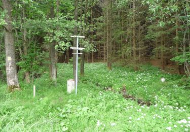
Symbol: gelbe Hinweispfeile mit Schwarzer Aufschrift 10 Mühlewandwerweg
Localizzazione
Paese:
Austria
Regione :
Oberösterreich
Dipartimento/Provincia :
Bezirk Urfahr-Umgebung
Comune :
Reichenthal
Località :
Unknown
Partenza:(Dec)
Partenza:(UTM)
453762 ; 5377259 (33U) N.
Commenti
Percorsi nelle vicinanze
![Percorso A piedi Schenkenfelden - Wanderweg 62 - Photo](https://media.geolcdn.com/t/375/260/5088698e-a5b9-41c2-889f-3f76d3de30d8.jpeg&format=jpg&maxdim=2)
![A piedi A piedi](https://static1.geolcdn.com/sitytour/trail-icons/100.png)
Wanderweg 62
A piedi
Facile
Schenkenfelden,
Oberösterreich,
Bezirk Urfahr-Umgebung,
Austria
![](/images/other/stat-length.png)
4,5 km | 5,4 km-effort
1h 14min
![](https://static1.geolcdn.com/siteimages/upload/files/16400158638029165_repeat_loop_refresh_sync_direction_icon.png)
No
![Percorso A piedi Schenkenfelden - Wanderweg 61 - Photo](https://media.geolcdn.com/t/375/260/d021891a-515b-45b7-b6ea-10a8c6d31157.jpeg&format=jpg&maxdim=2)
![A piedi A piedi](https://static1.geolcdn.com/sitytour/trail-icons/100.png)
Wanderweg 61
A piedi
Facile
Schenkenfelden,
Oberösterreich,
Bezirk Urfahr-Umgebung,
Austria
![](/images/other/stat-length.png)
12,3 km | 16,2 km-effort
3h 41min
![](https://static1.geolcdn.com/siteimages/upload/files/16400158638029165_repeat_loop_refresh_sync_direction_icon.png)
Sì
![Percorso A piedi Schenkenfelden - Wanderweg 65 - Photo](https://media.geolcdn.com/t/375/260/126dbe98-8f86-4124-bd10-b7d04d159f86.jpeg&format=jpg&maxdim=2)
![A piedi A piedi](https://static1.geolcdn.com/sitytour/trail-icons/100.png)
Wanderweg 65
A piedi
Facile
Schenkenfelden,
Oberösterreich,
Bezirk Urfahr-Umgebung,
Austria
![](/images/other/stat-length.png)
11,4 km | 14,4 km-effort
3h 15min
![](https://static1.geolcdn.com/siteimages/upload/files/16400158638029165_repeat_loop_refresh_sync_direction_icon.png)
Sì
![Percorso A piedi Schenkenfelden - Märchenwanderweg - Photo](https://media.geolcdn.com/t/375/260/d021891a-515b-45b7-b6ea-10a8c6d31157.jpeg&format=jpg&maxdim=2)
![A piedi A piedi](https://static1.geolcdn.com/sitytour/trail-icons/100.png)
Märchenwanderweg
A piedi
Facile
Schenkenfelden,
Oberösterreich,
Bezirk Urfahr-Umgebung,
Austria
![](/images/other/stat-length.png)
3,1 km | 4,6 km-effort
1h 2min
![](https://static1.geolcdn.com/siteimages/upload/files/16400158638029165_repeat_loop_refresh_sync_direction_icon.png)
Sì
![Percorso A piedi Bad Leonfelden - Grasslmühl-Runde - Photo](https://media.geolcdn.com/t/375/260/7b46c5e4-b7ae-4c0b-a9b4-5d410b92945d.jpeg&format=jpg&maxdim=2)
![A piedi A piedi](https://static1.geolcdn.com/sitytour/trail-icons/100.png)
Grasslmühl-Runde
A piedi
Facile
Bad Leonfelden,
Oberösterreich,
Bezirk Urfahr-Umgebung,
Austria
![](/images/other/stat-length.png)
12,4 km | 16,4 km-effort
3h 43min
![](https://static1.geolcdn.com/siteimages/upload/files/16400158638029165_repeat_loop_refresh_sync_direction_icon.png)
Sì
![Percorso A piedi Bad Leonfelden - Pannholz Runde - Photo](https://media.geolcdn.com/t/375/260/30db9486-5c87-40ea-ac10-fec50f59fdd2.jpeg&format=jpg&maxdim=2)
![A piedi A piedi](https://static1.geolcdn.com/sitytour/trail-icons/100.png)
Pannholz Runde
A piedi
Facile
Bad Leonfelden,
Oberösterreich,
Bezirk Urfahr-Umgebung,
Austria
![](/images/other/stat-length.png)
8,4 km | 11 km-effort
2h 29min
![](https://static1.geolcdn.com/siteimages/upload/files/16400158638029165_repeat_loop_refresh_sync_direction_icon.png)
Sì
![Percorso A piedi Bad Leonfelden - Rading-Weigetschlag-Ablege-Sternstein 11 - Photo](https://media.geolcdn.com/t/375/260/07afe276-6584-4077-bea1-2e37df7a0d5f.jpeg&format=jpg&maxdim=2)
![A piedi A piedi](https://static1.geolcdn.com/sitytour/trail-icons/100.png)
Rading-Weigetschlag-Ablege-Sternstein 11
A piedi
Facile
Bad Leonfelden,
Oberösterreich,
Bezirk Urfahr-Umgebung,
Austria
![](/images/other/stat-length.png)
5,6 km | 9,7 km-effort
2h 12min
![](https://static1.geolcdn.com/siteimages/upload/files/16400158638029165_repeat_loop_refresh_sync_direction_icon.png)
No