![](/images/other/stat-length.png)
![Percorso A piedi Sankt Thomas am Blasenstein - AT-S9 - Photo](https://media.geolcdn.com/t/1900/400/ext.pjpeg?maxdim=2&url=https%3A%2F%2Fmedia.geolcdn.com%2Ff%2F6e0f7bbe-186b-48c7-976a-d57694f65512.jpeg)
AT-S9
SityTrail - itinéraires balisés pédestres
Tous les sentiers balisés d’Europe PRO
![Lunghezza](/images/other/stat-length.png)
Lunghezza
15,6 km
![Altitudine massima](https://static1.geolcdn.com/siteimages/upload/files/1508320355ic_sort_altitude_max_24dp.png)
Altitudine massima
706 m
![Dislivello positivo](https://static1.geolcdn.com/siteimages/upload/files/1508320355ic_sort_den_pos_24dp.png)
Dislivello positivo
519 m
![Km-Effort](/images/other/stat-length.png)
Km-Effort
23 km
![Altitudine minima](https://static1.geolcdn.com/siteimages/upload/files/1508320355ic_sort_altitude_min_24dp.png)
Altitudine minima
349 m
![Dislivello negativo](https://static1.geolcdn.com/siteimages/upload/files/1508320355ic_sort_den_neg_24dp.png)
Dislivello negativo
513 m
![Boucle](https://static1.geolcdn.com/siteimages/upload/files/16400158638029165_repeat_loop_refresh_sync_direction_icon.png)
Boucle
Sì
Tag
Data di creazione :
2022-02-16 16:38:02.296
Ultima modifica :
2022-03-03 10:09:32.207
![A piedi](https://static1.geolcdn.com/sitytour/trail-icons/100.png)
5h07
Difficoltà : Medio
![Scannerizza questo codice QR per aprire il percorso nell'applicazione SityTrail](https://capi.geolives.com/qq0zvz2zws4bq2lad0pu/sitytour/trails/3127444/qr.png?size=200)
Applicazione GPS da escursionismo GRATUITA
Chi siamo
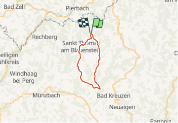
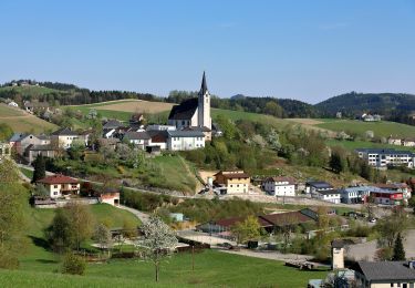
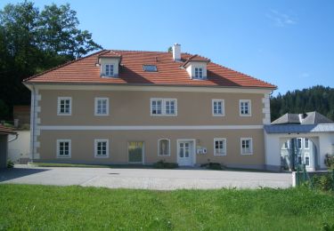
Percorso A piedi di 15,6 km da scoprire a Oberösterreich, Bezirk Perg, Sankt Thomas am Blasenstein. Questo percorso è proposto da SityTrail - itinéraires balisés pédestres.
Descrizione
Trail created by Gemeinde Sankt Thomas am Blasenstein.
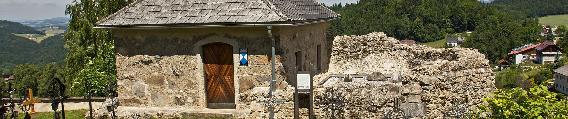
Symbol: grüne Tafel mit weißem Text S9
Localizzazione
Paese:
Austria
Regione :
Oberösterreich
Dipartimento/Provincia :
Bezirk Perg
Comune :
Sankt Thomas am Blasenstein
Località :
Unknown
Partenza:(Dec)
Partenza:(UTM)
483426 ; 5352334 (33U) N.
Commenti
Percorsi nelle vicinanze
![Percorso A piedi Pabneukirchen - Drei-Dörfer-Rundweg - Photo](https://media.geolcdn.com/t/375/260/ext.jpg?maxdim=2&url=https%3A%2F%2Fmedia.geolcdn.com%2Ff%2F027a37a4-b40a-48b7-9b50-29da9e3f7960.jpeg)
![A piedi A piedi](https://static1.geolcdn.com/sitytour/trail-icons/100.png)
Drei-Dörfer-Rundweg
A piedi
Facile
Pabneukirchen,
Oberösterreich,
Bezirk Perg,
Austria
![](/images/other/stat-length.png)
9,2 km | 12,6 km-effort
2h 51min
![](https://static1.geolcdn.com/siteimages/upload/files/16400158638029165_repeat_loop_refresh_sync_direction_icon.png)
Sì
![Percorso A piedi Pabneukirchen - Unter-Pabneukirchen Rundweg - Photo](https://media.geolcdn.com/t/375/260/ext.jpg?maxdim=2&url=https%3A%2F%2Fmedia.geolcdn.com%2Ff%2Fbaad22a6-9f57-4109-9b39-0d5f1204fa7a.jpeg)
![A piedi A piedi](https://static1.geolcdn.com/sitytour/trail-icons/100.png)
Unter-Pabneukirchen Rundweg
A piedi
Facile
Pabneukirchen,
Oberösterreich,
Bezirk Perg,
Austria
![](/images/other/stat-length.png)
5,3 km | 7,8 km-effort
1h 46min
![](https://static1.geolcdn.com/siteimages/upload/files/16400158638029165_repeat_loop_refresh_sync_direction_icon.png)
No
![Percorso A piedi Pabneukirchen - Schnitzer-Rundweg - Photo](https://media.geolcdn.com/t/375/260/ext.jpg?maxdim=2&url=https%3A%2F%2Fmedia.geolcdn.com%2Ff%2F78e6f358-d850-4ce0-ae6b-02b51479020e.jpeg)
![A piedi A piedi](https://static1.geolcdn.com/sitytour/trail-icons/100.png)
Schnitzer-Rundweg
A piedi
Facile
Pabneukirchen,
Oberösterreich,
Bezirk Perg,
Austria
![](/images/other/stat-length.png)
4,5 km | 6,2 km-effort
1h 23min
![](https://static1.geolcdn.com/siteimages/upload/files/16400158638029165_repeat_loop_refresh_sync_direction_icon.png)
No
![Percorso A piedi Pabneukirchen - Stilles Tal Weg - Photo](https://media.geolcdn.com/t/375/260/ext.jpg?maxdim=2&url=https%3A%2F%2Fmedia.geolcdn.com%2Ff%2F7a95d285-03dc-48f5-b1b5-139c93e1019b.jpeg)
![A piedi A piedi](https://static1.geolcdn.com/sitytour/trail-icons/100.png)
Stilles Tal Weg
A piedi
Facile
Pabneukirchen,
Oberösterreich,
Bezirk Perg,
Austria
![](/images/other/stat-length.png)
6,6 km | 8,3 km-effort
1h 52min
![](https://static1.geolcdn.com/siteimages/upload/files/16400158638029165_repeat_loop_refresh_sync_direction_icon.png)
No
![Percorso A piedi Pabneukirchen - Hubertus-Hochbuchberg-Rundweg - Photo](https://media.geolcdn.com/t/375/260/ext.jpg?maxdim=2&url=https%3A%2F%2Fmedia.geolcdn.com%2Ff%2F027a37a4-b40a-48b7-9b50-29da9e3f7960.jpeg)
![A piedi A piedi](https://static1.geolcdn.com/sitytour/trail-icons/100.png)
Hubertus-Hochbuchberg-Rundweg
A piedi
Facile
Pabneukirchen,
Oberösterreich,
Bezirk Perg,
Austria
![](/images/other/stat-length.png)
7,2 km | 11,2 km-effort
2h 32min
![](https://static1.geolcdn.com/siteimages/upload/files/16400158638029165_repeat_loop_refresh_sync_direction_icon.png)
No
![Percorso A piedi Pabneukirchen - Romantiktal-Maseldorf - Photo](https://media.geolcdn.com/t/375/260/ext.jpg?maxdim=2&url=https%3A%2F%2Fmedia.geolcdn.com%2Ff%2F78e6f358-d850-4ce0-ae6b-02b51479020e.jpeg)
![A piedi A piedi](https://static1.geolcdn.com/sitytour/trail-icons/100.png)
Romantiktal-Maseldorf
A piedi
Facile
Pabneukirchen,
Oberösterreich,
Bezirk Perg,
Austria
![](/images/other/stat-length.png)
7,1 km | 10 km-effort
2h 15min
![](https://static1.geolcdn.com/siteimages/upload/files/16400158638029165_repeat_loop_refresh_sync_direction_icon.png)
No
![Percorso A piedi Rechberg - Der Naturparkweg - Photo](https://media.geolcdn.com/t/375/260/ext.jpg?maxdim=2&url=https%3A%2F%2Fmedia.geolcdn.com%2Ff%2F00512289-f987-447a-ab17-ceceb9e1f3a0.jpeg)
![A piedi A piedi](https://static1.geolcdn.com/sitytour/trail-icons/100.png)
Der Naturparkweg
A piedi
Facile
Rechberg,
Oberösterreich,
Bezirk Perg,
Austria
![](/images/other/stat-length.png)
7,5 km | 11,2 km-effort
2h 32min
![](https://static1.geolcdn.com/siteimages/upload/files/16400158638029165_repeat_loop_refresh_sync_direction_icon.png)
Sì
![Percorso A piedi Rechberg - Weg Schwammerling - Photo](https://media.geolcdn.com/t/375/260/ext.jpg?maxdim=2&url=https%3A%2F%2Fmedia.geolcdn.com%2Ff%2F8ad41e96-6c1e-442a-b845-0992d1acc119.jpeg)
![A piedi A piedi](https://static1.geolcdn.com/sitytour/trail-icons/100.png)
Weg Schwammerling
A piedi
Facile
Rechberg,
Oberösterreich,
Bezirk Perg,
Austria
![](/images/other/stat-length.png)
4 km | 5,6 km-effort
1h 16min
![](https://static1.geolcdn.com/siteimages/upload/files/16400158638029165_repeat_loop_refresh_sync_direction_icon.png)
Sì
![Percorso A piedi Pierbach - Zweibergweg - Photo](https://media.geolcdn.com/t/375/260/ext.jpg?maxdim=2&url=https%3A%2F%2Fmedia.geolcdn.com%2Ff%2Ff1127007-b968-4f59-8462-a2230ad7a38e.jpeg)
![A piedi A piedi](https://static1.geolcdn.com/sitytour/trail-icons/100.png)
Zweibergweg
A piedi
Facile
Pierbach,
Oberösterreich,
Bezirk Freistadt,
Austria
![](/images/other/stat-length.png)
10,3 km | 15 km-effort
3h 24min
![](https://static1.geolcdn.com/siteimages/upload/files/16400158638029165_repeat_loop_refresh_sync_direction_icon.png)
Sì