![](/images/other/stat-length.png)
![Percorso A piedi Schönbrunn - Rundwanderweg Hirschhorn 3: Großer Moosbrunn-Weg - Photo](https://media.geolcdn.com/t/1900/400/ext.pjpeg?maxdim=2&url=https%3A%2F%2Fmedia.geolcdn.com%2Ff%2F46037067-8701-4359-a3cd-a00a59c9d191.jpeg)
Rundwanderweg Hirschhorn 3: Großer Moosbrunn-Weg
SityTrail - itinéraires balisés pédestres
Tous les sentiers balisés d’Europe PRO
![Lunghezza](/images/other/stat-length.png)
Lunghezza
15 km
![Altitudine massima](https://static1.geolcdn.com/siteimages/upload/files/1508320355ic_sort_altitude_max_24dp.png)
Altitudine massima
467 m
![Dislivello positivo](https://static1.geolcdn.com/siteimages/upload/files/1508320355ic_sort_den_pos_24dp.png)
Dislivello positivo
430 m
![Km-Effort](/images/other/stat-length.png)
Km-Effort
21 km
![Altitudine minima](https://static1.geolcdn.com/siteimages/upload/files/1508320355ic_sort_altitude_min_24dp.png)
Altitudine minima
122 m
![Dislivello negativo](https://static1.geolcdn.com/siteimages/upload/files/1508320355ic_sort_den_neg_24dp.png)
Dislivello negativo
441 m
![Boucle](https://static1.geolcdn.com/siteimages/upload/files/16400158638029165_repeat_loop_refresh_sync_direction_icon.png)
Boucle
Sì
Tag
Data di creazione :
2022-02-11 18:43:04.541
Ultima modifica :
2022-02-11 18:43:04.541
![A piedi](https://static1.geolcdn.com/sitytour/trail-icons/100.png)
4h43
Difficoltà : Medio
![Scannerizza questo codice QR per aprire il percorso nell'applicazione SityTrail](https://capi.geolives.com/qq0zvz2zws4bq2lad0pu/sitytour/trails/3099740/qr.png?size=200)
Applicazione GPS da escursionismo GRATUITA
Chi siamo
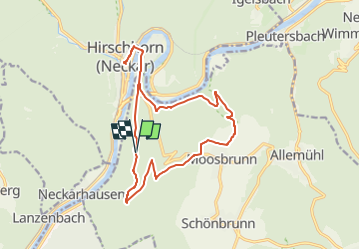
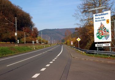
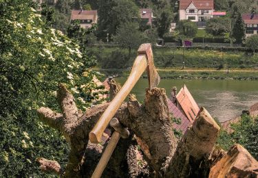
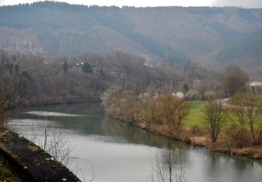
Percorso A piedi di 15 km da scoprire a Baden-Württemberg, Rhein-Neckar-Kreis, Schönbrunn. Questo percorso è proposto da SityTrail - itinéraires balisés pédestres.
Descrizione
Symbol: weiße H3 im oben offenen Kreis, darin ein 'H'
Localizzazione
Paese:
Germany
Regione :
Baden-Württemberg
Dipartimento/Provincia :
Rhein-Neckar-Kreis
Comune :
Schönbrunn
Località :
Unknown
Partenza:(Dec)
Partenza:(UTM)
492841 ; 5474882 (32U) N.
Commenti
Percorsi nelle vicinanze
![Percorso A piedi Neckarsteinach - Rundwanderweg Neckarsteinach Kreuzschlag 4: Felsenmeer-Weg - Photo](https://media.geolcdn.com/t/375/260/ext.jpg?maxdim=2&url=https%3A%2F%2Fmedia.geolcdn.com%2Ff%2Ffffb875e-e6c4-48f5-a00c-f9b284216e39.jpeg)
![A piedi A piedi](https://static1.geolcdn.com/sitytour/trail-icons/100.png)
Rundwanderweg Neckarsteinach Kreuzschlag 4: Felsenmeer-Weg
A piedi
Facile
Neckarsteinach,
Assia,
Kreis Bergstraße,
Germany
![](/images/other/stat-length.png)
7,5 km | 9,1 km-effort
2h 3min
![](https://static1.geolcdn.com/siteimages/upload/files/16400158638029165_repeat_loop_refresh_sync_direction_icon.png)
Sì
![Percorso A piedi Neckarsteinach - Rundwanderweg Neckarsteinach Kaisereiche 9: Philosophen-Weg - Photo](https://media.geolcdn.com/t/375/260/ext.jpg?maxdim=2&url=https%3A%2F%2Fmedia.geolcdn.com%2Ff%2F3df774ce-6159-4bdc-aed3-cbf9ce3c0ead.jpeg)
![A piedi A piedi](https://static1.geolcdn.com/sitytour/trail-icons/100.png)
Rundwanderweg Neckarsteinach Kaisereiche 9: Philosophen-Weg
A piedi
Facile
Neckarsteinach,
Assia,
Kreis Bergstraße,
Germany
![](/images/other/stat-length.png)
5,4 km | 7,9 km-effort
1h 47min
![](https://static1.geolcdn.com/siteimages/upload/files/16400158638029165_repeat_loop_refresh_sync_direction_icon.png)
Sì
![Percorso A piedi Neckarsteinach - Rundwanderweg Neckarsteinach Kaisereiche 11: Mannheimer-Hütten-Weg - Photo](https://media.geolcdn.com/t/375/260/ext.jpg?maxdim=2&url=https%3A%2F%2Fmedia.geolcdn.com%2Ff%2Fb63ebb44-4101-4286-8655-bf0dbed665ee.jpeg)
![A piedi A piedi](https://static1.geolcdn.com/sitytour/trail-icons/100.png)
Rundwanderweg Neckarsteinach Kaisereiche 11: Mannheimer-Hütten-Weg
A piedi
Facile
Neckarsteinach,
Assia,
Kreis Bergstraße,
Germany
![](/images/other/stat-length.png)
3,5 km | 5,6 km-effort
1h 16min
![](https://static1.geolcdn.com/siteimages/upload/files/16400158638029165_repeat_loop_refresh_sync_direction_icon.png)
Sì
![Percorso A piedi Neckarsteinach - Rundwanderweg Neckarsteinach Kaisereiche 10: Goetheblick-Weg - Photo](https://media.geolcdn.com/t/375/260/ext.jpg?maxdim=2&url=https%3A%2F%2Fmedia.geolcdn.com%2Ff%2F3df774ce-6159-4bdc-aed3-cbf9ce3c0ead.jpeg)
![A piedi A piedi](https://static1.geolcdn.com/sitytour/trail-icons/100.png)
Rundwanderweg Neckarsteinach Kaisereiche 10: Goetheblick-Weg
A piedi
Facile
Neckarsteinach,
Assia,
Kreis Bergstraße,
Germany
![](/images/other/stat-length.png)
6,8 km | 9,8 km-effort
2h 13min
![](https://static1.geolcdn.com/siteimages/upload/files/16400158638029165_repeat_loop_refresh_sync_direction_icon.png)
Sì
![Percorso A piedi Neckarsteinach - Rundwanderweg Neckarsteinach 2: Lanzenbach-Weg - Photo](https://media.geolcdn.com/t/375/260/ext.jpg?maxdim=2&url=https%3A%2F%2Fmedia.geolcdn.com%2Ff%2F91e668e9-b9d4-4603-825f-40df00691003.jpeg)
![A piedi A piedi](https://static1.geolcdn.com/sitytour/trail-icons/100.png)
Rundwanderweg Neckarsteinach 2: Lanzenbach-Weg
A piedi
Facile
Neckarsteinach,
Assia,
Kreis Bergstraße,
Germany
![](/images/other/stat-length.png)
13,3 km | 17,8 km-effort
4h 2min
![](https://static1.geolcdn.com/siteimages/upload/files/16400158638029165_repeat_loop_refresh_sync_direction_icon.png)
Sì
![Percorso A piedi Neckarsteinach - Rundwanderweg Neckarsteinach 4: Ruhstein-Weg - Photo](https://media.geolcdn.com/t/375/260/ext.jpg?maxdim=2&url=https%3A%2F%2Fmedia.geolcdn.com%2Ff%2F96d072dd-e918-4a37-b2bc-5e91275721de.jpeg)
![A piedi A piedi](https://static1.geolcdn.com/sitytour/trail-icons/100.png)
Rundwanderweg Neckarsteinach 4: Ruhstein-Weg
A piedi
Facile
Neckarsteinach,
Assia,
Kreis Bergstraße,
Germany
![](/images/other/stat-length.png)
9,8 km | 13,5 km-effort
3h 4min
![](https://static1.geolcdn.com/siteimages/upload/files/16400158638029165_repeat_loop_refresh_sync_direction_icon.png)
Sì
![Percorso A piedi Neckarsteinach - Rundwanderweg Neckarhausen 1: Michelbuch-Weg - Photo](https://media.geolcdn.com/t/375/260/ext.jpg?maxdim=2&url=https%3A%2F%2Fmedia.geolcdn.com%2Ff%2F9d9551d9-6a8a-4a04-8195-014bb7ae8dea.jpeg)
![A piedi A piedi](https://static1.geolcdn.com/sitytour/trail-icons/100.png)
Rundwanderweg Neckarhausen 1: Michelbuch-Weg
A piedi
Facile
Neckarsteinach,
Assia,
Kreis Bergstraße,
Germany
![](/images/other/stat-length.png)
10,4 km | 15 km-effort
3h 23min
![](https://static1.geolcdn.com/siteimages/upload/files/16400158638029165_repeat_loop_refresh_sync_direction_icon.png)
Sì
![Percorso A piedi Hirschhorn - Rundwanderweg Hirschhorn 7: Brombach-Weg - Photo](https://media.geolcdn.com/t/375/260/ext.jpg?maxdim=2&url=https%3A%2F%2Fmedia.geolcdn.com%2Ff%2F9b4b7a6a-0974-4205-bf1f-ae91b271096d.jpeg)
![A piedi A piedi](https://static1.geolcdn.com/sitytour/trail-icons/100.png)
Rundwanderweg Hirschhorn 7: Brombach-Weg
A piedi
Facile
Hirschhorn,
Assia,
Kreis Bergstraße,
Germany
![](/images/other/stat-length.png)
12,7 km | 18,8 km-effort
4h 16min
![](https://static1.geolcdn.com/siteimages/upload/files/16400158638029165_repeat_loop_refresh_sync_direction_icon.png)
Sì
![Percorso A piedi Schönbrunn - Rundwanderweg Neckaralm 2: Moosbrunn-Weg - Photo](https://media.geolcdn.com/t/375/260/ext.jpg?maxdim=2&url=https%3A%2F%2Fmedia.geolcdn.com%2Ff%2F86c638bb-bd7c-455e-93de-42eff0f3724d.jpeg)
![A piedi A piedi](https://static1.geolcdn.com/sitytour/trail-icons/100.png)
Rundwanderweg Neckaralm 2: Moosbrunn-Weg
A piedi
Facile
Schönbrunn,
Baden-Württemberg,
Rhein-Neckar-Kreis,
Germany
![](/images/other/stat-length.png)
9,2 km | 13,2 km-effort
2h 59min
![](https://static1.geolcdn.com/siteimages/upload/files/16400158638029165_repeat_loop_refresh_sync_direction_icon.png)
Sì