![](/images/other/stat-length.png)
![Percorso A piedi Harz (LK Goslar) - Rundwanderweg 1 - Photo](https://media.geolcdn.com/t/1900/400/6a73bd32-225f-4ca9-8742-55e55946a9e3.jpeg&format=pjpeg&maxdim=2)
Rundwanderweg 1
SityTrail - itinéraires balisés pédestres
Tous les sentiers balisés d’Europe GUIDE+
![Lunghezza](/images/other/stat-length.png)
Lunghezza
4,3 km
![Altitudine massima](https://static1.geolcdn.com/siteimages/upload/files/1508320355ic_sort_altitude_max_24dp.png)
Altitudine massima
570 m
![Dislivello positivo](https://static1.geolcdn.com/siteimages/upload/files/1508320355ic_sort_den_pos_24dp.png)
Dislivello positivo
16 m
![Km-Effort](/images/other/stat-length.png)
Km-Effort
5,1 km
![Altitudine minima](https://static1.geolcdn.com/siteimages/upload/files/1508320355ic_sort_altitude_min_24dp.png)
Altitudine minima
366 m
![Dislivello negativo](https://static1.geolcdn.com/siteimages/upload/files/1508320355ic_sort_den_neg_24dp.png)
Dislivello negativo
213 m
![Boucle](https://static1.geolcdn.com/siteimages/upload/files/16400158638029165_repeat_loop_refresh_sync_direction_icon.png)
Boucle
No
Tag
Data di creazione :
2022-02-11 17:05:42.092
Ultima modifica :
2022-02-11 17:05:42.092
![A piedi](https://static1.geolcdn.com/sitytour/trail-icons/100.png)
1h09
Difficoltà : Facile
![Scannerizza questo codice QR per aprire il percorso nell'applicazione SityTrail](https://capi.geolives.com/qq0zvz2zws4bq2lad0pu/sitytour/trails/3097297/qr.png?size=200)
Applicazione GPS da escursionismo GRATUITA
Chi siamo
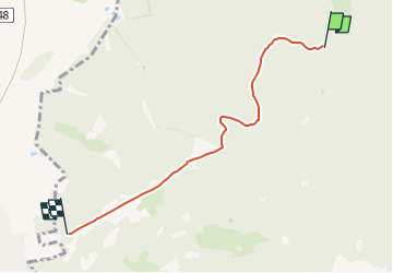
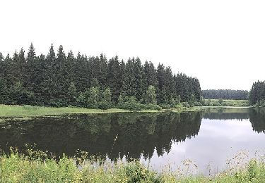
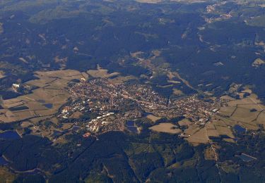
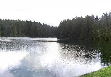
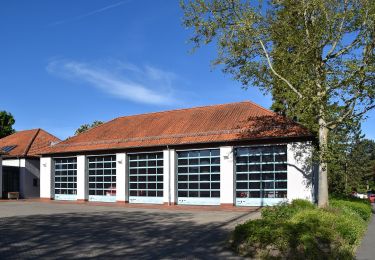
Percorso A piedi di 4,3 km da scoprire a Niedersachsen, Landkreis Goslar, Harz (LK Goslar). Questo percorso è proposto da SityTrail - itinéraires balisés pédestres.
Descrizione
Symbol: roter Kreis mit Dreieck Nr. 1
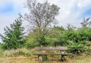
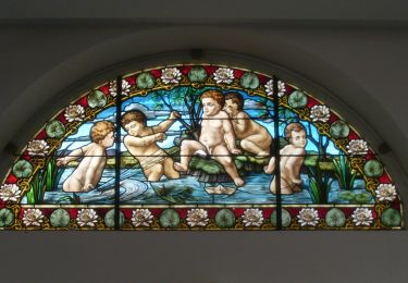
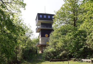
Localizzazione
Paese:
Germany
Regione :
Niedersachsen
Dipartimento/Provincia :
Landkreis Goslar
Comune :
Harz (LK Goslar)
Località :
Unknown
Partenza:(Dec)
Partenza:(UTM)
585917 ; 5751846 (32U) N.
Commenti
Percorsi nelle vicinanze
![Percorso A piedi Bad Salzdetfurth - Sölter-Weg - Photo](https://media.geolcdn.com/t/375/260/578f3805-2242-484c-a9e4-a5ea73bea3fd.jpeg&format=jpg&maxdim=2)
![A piedi A piedi](https://static1.geolcdn.com/sitytour/trail-icons/100.png)
Sölter-Weg
A piedi
Difficile
Bad Salzdetfurth,
Niedersachsen,
Landkreis Hildesheim,
Germany
![](/images/other/stat-length.png)
27 km | 37 km-effort
8h 20min
![](https://static1.geolcdn.com/siteimages/upload/files/16400158638029165_repeat_loop_refresh_sync_direction_icon.png)
No
![Percorso A piedi Bad Salzdetfurth - R2 Rundwanderweg Ziegenberg - Photo](https://media.geolcdn.com/t/375/260/05f0189d-c0b9-4fc4-ad87-c395a8c87244.jpeg&format=jpg&maxdim=2)
![A piedi A piedi](https://static1.geolcdn.com/sitytour/trail-icons/100.png)
R2 Rundwanderweg Ziegenberg
A piedi
Facile
Bad Salzdetfurth,
Niedersachsen,
Landkreis Hildesheim,
Germany
![](/images/other/stat-length.png)
8,8 km | 12,2 km-effort
2h 46min
![](https://static1.geolcdn.com/siteimages/upload/files/16400158638029165_repeat_loop_refresh_sync_direction_icon.png)
Sì
![Percorso A piedi Bad Salzdetfurth - R1 Rundwanderweg um den Sothenberg - Photo](https://media.geolcdn.com/t/375/260/05f0189d-c0b9-4fc4-ad87-c395a8c87244.jpeg&format=jpg&maxdim=2)
![A piedi A piedi](https://static1.geolcdn.com/sitytour/trail-icons/100.png)
R1 Rundwanderweg um den Sothenberg
A piedi
Facile
Bad Salzdetfurth,
Niedersachsen,
Landkreis Hildesheim,
Germany
![](/images/other/stat-length.png)
4,2 km | 6,1 km-effort
1h 22min
![](https://static1.geolcdn.com/siteimages/upload/files/16400158638029165_repeat_loop_refresh_sync_direction_icon.png)
Sì
![Percorso A piedi Goslar - Harly Rundwanderweg 1 - Photo](https://media.geolcdn.com/t/375/260/021c8b09-c12a-48aa-a9f4-916877c70a12.jpeg&format=jpg&maxdim=2)
![A piedi A piedi](https://static1.geolcdn.com/sitytour/trail-icons/100.png)
Harly Rundwanderweg 1
A piedi
Facile
Goslar,
Niedersachsen,
Landkreis Goslar,
Germany
![](/images/other/stat-length.png)
3,2 km | 4,2 km-effort
56min
![](https://static1.geolcdn.com/siteimages/upload/files/16400158638029165_repeat_loop_refresh_sync_direction_icon.png)
Sì
![Percorso A piedi Goslar - Harly Rundwanderweg 3 - Photo](https://media.geolcdn.com/t/375/260/2ba72d2a-799a-4259-a779-84743af688fd.jpeg&format=jpg&maxdim=2)
![A piedi A piedi](https://static1.geolcdn.com/sitytour/trail-icons/100.png)
Harly Rundwanderweg 3
A piedi
Facile
Goslar,
Niedersachsen,
Landkreis Goslar,
Germany
![](/images/other/stat-length.png)
5,2 km | 6,7 km-effort
1h 30min
![](https://static1.geolcdn.com/siteimages/upload/files/16400158638029165_repeat_loop_refresh_sync_direction_icon.png)
Sì
![Percorso A piedi Clausthal-Zellerfeld - Prinzen / Flambacher Teiche - Photo](https://media.geolcdn.com/t/375/260/9544bb55-423a-4dcd-a560-c97b3ab924ca.jpeg&format=jpg&maxdim=2)
![A piedi A piedi](https://static1.geolcdn.com/sitytour/trail-icons/100.png)
Prinzen / Flambacher Teiche
A piedi
Facile
Clausthal-Zellerfeld,
Niedersachsen,
Landkreis Goslar,
Germany
![](/images/other/stat-length.png)
5 km | 6,5 km-effort
1h 28min
![](https://static1.geolcdn.com/siteimages/upload/files/16400158638029165_repeat_loop_refresh_sync_direction_icon.png)
Sì
![Percorso A piedi Clausthal-Zellerfeld - Clausthaler Teiche - Photo](https://media.geolcdn.com/t/375/260/9a2df3cb-02c5-40ea-9acf-0413a0a73c36.jpeg&format=jpg&maxdim=2)
![A piedi A piedi](https://static1.geolcdn.com/sitytour/trail-icons/100.png)
Clausthaler Teiche
A piedi
Facile
Clausthal-Zellerfeld,
Niedersachsen,
Landkreis Goslar,
Germany
![](/images/other/stat-length.png)
4,5 km | 5,5 km-effort
1h 15min
![](https://static1.geolcdn.com/siteimages/upload/files/16400158638029165_repeat_loop_refresh_sync_direction_icon.png)
Sì
![Percorso A piedi Clausthal-Zellerfeld - HK 4: Neckelnberg, Seesen - Bad Grund - Wildemann - Langelsheim - Photo](https://media.geolcdn.com/t/375/260/c054374a-437a-4e3b-a74f-17eca2481959.jpeg&format=jpg&maxdim=2)
![A piedi A piedi](https://static1.geolcdn.com/sitytour/trail-icons/100.png)
HK 4: Neckelnberg, Seesen - Bad Grund - Wildemann - Langelsheim
A piedi
Facile
Clausthal-Zellerfeld,
Niedersachsen,
Landkreis Goslar,
Germany
![](/images/other/stat-length.png)
9,7 km | 12,2 km-effort
2h 45min
![](https://static1.geolcdn.com/siteimages/upload/files/16400158638029165_repeat_loop_refresh_sync_direction_icon.png)
No
![Percorso A piedi Clausthal-Zellerfeld - HK 8: Osterode - Clausthal-Zellerfeld - Goslar - Photo](https://media.geolcdn.com/t/375/260/a1f07da8-33b6-492c-9051-bb7199e48b68.jpeg&format=jpg&maxdim=2)
![A piedi A piedi](https://static1.geolcdn.com/sitytour/trail-icons/100.png)
HK 8: Osterode - Clausthal-Zellerfeld - Goslar
A piedi
Facile
Clausthal-Zellerfeld,
Niedersachsen,
Landkreis Goslar,
Germany
![](/images/other/stat-length.png)
11,5 km | 14,7 km-effort
3h 20min
![](https://static1.geolcdn.com/siteimages/upload/files/16400158638029165_repeat_loop_refresh_sync_direction_icon.png)
No