![](/images/other/stat-length.png)
![Percorso A piedi Prien am Chiemsee - Rundweg 3 - Photo](https://media.geolcdn.com/t/1900/400/ext.pjpeg?maxdim=2&url=https%3A%2F%2Fmedia.geolcdn.com%2Ff%2F7bb57ae5-1b46-4149-aa12-0dfc6655c779.jpeg)
Rundweg 3
SityTrail - itinéraires balisés pédestres
Tous les sentiers balisés d’Europe PRO
![Lunghezza](/images/other/stat-length.png)
Lunghezza
8,9 km
![Altitudine massima](https://static1.geolcdn.com/siteimages/upload/files/1508320355ic_sort_altitude_max_24dp.png)
Altitudine massima
571 m
![Dislivello positivo](https://static1.geolcdn.com/siteimages/upload/files/1508320355ic_sort_den_pos_24dp.png)
Dislivello positivo
140 m
![Km-Effort](/images/other/stat-length.png)
Km-Effort
10,8 km
![Altitudine minima](https://static1.geolcdn.com/siteimages/upload/files/1508320355ic_sort_altitude_min_24dp.png)
Altitudine minima
519 m
![Dislivello negativo](https://static1.geolcdn.com/siteimages/upload/files/1508320355ic_sort_den_neg_24dp.png)
Dislivello negativo
140 m
![Boucle](https://static1.geolcdn.com/siteimages/upload/files/16400158638029165_repeat_loop_refresh_sync_direction_icon.png)
Boucle
Sì
Tag
Data di creazione :
2022-02-11 16:46:55.677
Ultima modifica :
2022-02-11 16:46:55.677
![A piedi](https://static1.geolcdn.com/sitytour/trail-icons/100.png)
2h26
Difficoltà : Facile
![Scannerizza questo codice QR per aprire il percorso nell'applicazione SityTrail](https://capi.geolives.com/qq0zvz2zws4bq2lad0pu/sitytour/trails/3096839/qr.png?size=200)
Applicazione GPS da escursionismo GRATUITA
Chi siamo
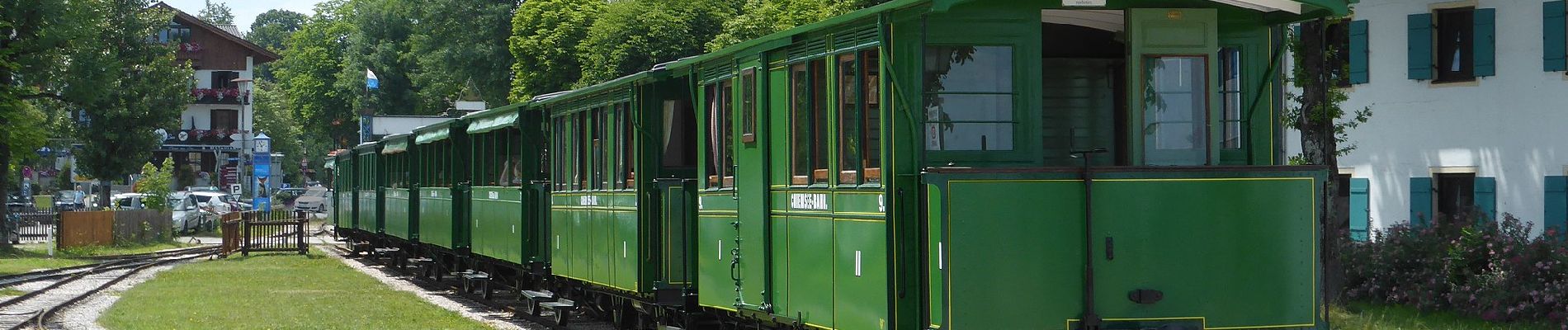
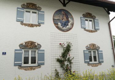
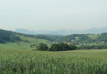
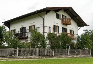
Percorso A piedi di 8,9 km da scoprire a Baviera, Landkreis Rosenheim, Prien am Chiemsee. Questo percorso è proposto da SityTrail - itinéraires balisés pédestres.
Descrizione
Symbol: Grüne Wegweisschilder mit weißer Schrift "Rundweg 3" oder kleine, weiße Schilder mit grünem Pfeil und Zahl.
Localizzazione
Paese:
Germany
Regione :
Baviera
Dipartimento/Provincia :
Landkreis Rosenheim
Comune :
Prien am Chiemsee
Località :
Unknown
Partenza:(Dec)
Partenza:(UTM)
301117 ; 5303459 (33T) N.
Commenti
Percorsi nelle vicinanze
![Percorso A piedi Prien am Chiemsee - Priener Postkartenweg - Photo](https://media.geolcdn.com/t/375/260/ext.jpg?maxdim=2&url=https%3A%2F%2Fmedia.geolcdn.com%2Ff%2Fe02e5267-41a2-46b2-a4c0-10b7a412546e.jpeg)
![A piedi A piedi](https://static1.geolcdn.com/sitytour/trail-icons/100.png)
Priener Postkartenweg
A piedi
Facile
Prien am Chiemsee,
Baviera,
Landkreis Rosenheim,
Germany
![](/images/other/stat-length.png)
4,8 km | 6 km-effort
1h 22min
![](https://static1.geolcdn.com/siteimages/upload/files/16400158638029165_repeat_loop_refresh_sync_direction_icon.png)
No
![Percorso A piedi Prien am Chiemsee - Rundweg 2 - Photo](https://media.geolcdn.com/t/375/260/ext.jpg?maxdim=2&url=https%3A%2F%2Fmedia.geolcdn.com%2Ff%2Fe02e5267-41a2-46b2-a4c0-10b7a412546e.jpeg)
![A piedi A piedi](https://static1.geolcdn.com/sitytour/trail-icons/100.png)
Rundweg 2
A piedi
Facile
Prien am Chiemsee,
Baviera,
Landkreis Rosenheim,
Germany
![](/images/other/stat-length.png)
7,3 km | 9,3 km-effort
2h 6min
![](https://static1.geolcdn.com/siteimages/upload/files/16400158638029165_repeat_loop_refresh_sync_direction_icon.png)
Sì
![Percorso A piedi Frasdorf - Herzogweg - Photo](https://media.geolcdn.com/t/375/260/ext.jpg?maxdim=2&url=https%3A%2F%2Fmedia.geolcdn.com%2Ff%2F9b520f38-837e-4f82-bec5-3443748c6377.jpeg)
![A piedi A piedi](https://static1.geolcdn.com/sitytour/trail-icons/100.png)
Herzogweg
A piedi
Facile
Frasdorf,
Baviera,
Landkreis Rosenheim,
Germany
![](/images/other/stat-length.png)
4,1 km | 5,2 km-effort
1h 10min
![](https://static1.geolcdn.com/siteimages/upload/files/16400158638029165_repeat_loop_refresh_sync_direction_icon.png)
No
![Percorso A piedi Rimsting - Chiemsee Rundweg - Photo](https://media.geolcdn.com/t/375/260/ext.jpg?maxdim=2&url=https%3A%2F%2Fmedia.geolcdn.com%2Ff%2Fa3783cef-8491-4f1d-8527-28c3198aef67.jpeg)
![A piedi A piedi](https://static1.geolcdn.com/sitytour/trail-icons/100.png)
Chiemsee Rundweg
A piedi
Molto difficile
Rimsting,
Baviera,
Landkreis Rosenheim,
Germany
![](/images/other/stat-length.png)
58 km | 66 km-effort
14h 57min
![](https://static1.geolcdn.com/siteimages/upload/files/16400158638029165_repeat_loop_refresh_sync_direction_icon.png)
Sì
![Percorso A piedi Prien am Chiemsee - Rundweg 1 - Photo](https://media.geolcdn.com/t/375/260/ext.jpg?maxdim=2&url=https%3A%2F%2Fmedia.geolcdn.com%2Ff%2F3a34bc52-9a86-4da3-b0da-5309ee43fba5.jpeg)
![A piedi A piedi](https://static1.geolcdn.com/sitytour/trail-icons/100.png)
Rundweg 1
A piedi
Facile
Prien am Chiemsee,
Baviera,
Landkreis Rosenheim,
Germany
![](/images/other/stat-length.png)
3,9 km | 5,4 km-effort
1h 13min
![](https://static1.geolcdn.com/siteimages/upload/files/16400158638029165_repeat_loop_refresh_sync_direction_icon.png)
Sì
![Percorso A piedi Chiemsee - Rundweg - Tour 1 - Photo](https://media.geolcdn.com/t/375/260/ext.jpg?maxdim=2&url=https%3A%2F%2Fmedia.geolcdn.com%2Ff%2Fddfa5a3a-103c-4358-a1be-47d68e697cb0.jpeg)
![A piedi A piedi](https://static1.geolcdn.com/sitytour/trail-icons/100.png)
Rundweg - Tour 1
A piedi
Facile
Chiemsee,
Baviera,
Landkreis Rosenheim,
Germany
![](/images/other/stat-length.png)
4 km | 4,6 km-effort
1h 3min
![](https://static1.geolcdn.com/siteimages/upload/files/16400158638029165_repeat_loop_refresh_sync_direction_icon.png)
Sì
![Percorso A piedi Chiemsee - Rundweg - Tour 2 - Photo](https://media.geolcdn.com/t/375/260/ext.jpg?maxdim=2&url=https%3A%2F%2Fmedia.geolcdn.com%2Ff%2Fc589e373-20ec-4a86-9891-32bd0698d01a.jpeg)
![A piedi A piedi](https://static1.geolcdn.com/sitytour/trail-icons/100.png)
Rundweg - Tour 2
A piedi
Facile
Chiemsee,
Baviera,
Landkreis Rosenheim,
Germany
![](/images/other/stat-length.png)
4,7 km | 5,6 km-effort
1h 15min
![](https://static1.geolcdn.com/siteimages/upload/files/16400158638029165_repeat_loop_refresh_sync_direction_icon.png)
Sì
![Percorso A piedi Bad Endorf - Wanderweg 16 - Bad Endorf - Photo](https://media.geolcdn.com/t/375/260/ext.jpg?maxdim=2&url=https%3A%2F%2Fmedia.geolcdn.com%2Ff%2Fd4576c82-5f44-4a90-b157-f67182de83b4.jpeg)
![A piedi A piedi](https://static1.geolcdn.com/sitytour/trail-icons/100.png)
Wanderweg 16 - Bad Endorf
A piedi
Facile
Bad Endorf,
Baviera,
Landkreis Rosenheim,
Germany
![](/images/other/stat-length.png)
5,3 km | 6,5 km-effort
1h 28min
![](https://static1.geolcdn.com/siteimages/upload/files/16400158638029165_repeat_loop_refresh_sync_direction_icon.png)
No
![Percorso A piedi Bad Endorf - Obst- und Kulturweg (OKW) - Photo](https://media.geolcdn.com/t/375/260/ext.jpg?maxdim=2&url=https%3A%2F%2Fmedia.geolcdn.com%2Ff%2Feb8c3b49-a6d4-403c-a9ef-e0c0e14b2dcc.jpeg)
![A piedi A piedi](https://static1.geolcdn.com/sitytour/trail-icons/100.png)
Obst- und Kulturweg (OKW)
A piedi
Facile
Bad Endorf,
Baviera,
Landkreis Rosenheim,
Germany
![](/images/other/stat-length.png)
6,4 km | 8,8 km-effort
1h 59min
![](https://static1.geolcdn.com/siteimages/upload/files/16400158638029165_repeat_loop_refresh_sync_direction_icon.png)
No