![](/images/other/stat-length.png)
![Percorso A piedi Oberviechtach - Goldlehrpfad - Photo](https://media.geolcdn.com/t/1900/400/ext.pjpeg?maxdim=2&url=https%3A%2F%2Fstatic1.geolcdn.com%2Fsiteimages%2Fupload%2Ffiles%2F1545311037marcheuse_200dpi.jpg)
Goldlehrpfad
SityTrail - itinéraires balisés pédestres
Tous les sentiers balisés d’Europe GUIDE+
![Lunghezza](/images/other/stat-length.png)
Lunghezza
3,3 km
![Altitudine massima](https://static1.geolcdn.com/siteimages/upload/files/1508320355ic_sort_altitude_max_24dp.png)
Altitudine massima
600 m
![Dislivello positivo](https://static1.geolcdn.com/siteimages/upload/files/1508320355ic_sort_den_pos_24dp.png)
Dislivello positivo
53 m
![Km-Effort](/images/other/stat-length.png)
Km-Effort
4 km
![Altitudine minima](https://static1.geolcdn.com/siteimages/upload/files/1508320355ic_sort_altitude_min_24dp.png)
Altitudine minima
569 m
![Dislivello negativo](https://static1.geolcdn.com/siteimages/upload/files/1508320355ic_sort_den_neg_24dp.png)
Dislivello negativo
59 m
![Boucle](https://static1.geolcdn.com/siteimages/upload/files/16400158638029165_repeat_loop_refresh_sync_direction_icon.png)
Boucle
Sì
Tag
Data di creazione :
2022-02-11 15:16:03.239
Ultima modifica :
2022-02-11 15:16:03.239
![A piedi](https://static1.geolcdn.com/sitytour/trail-icons/100.png)
54m
Difficoltà : Facile
![Scannerizza questo codice QR per aprire il percorso nell'applicazione SityTrail](https://capi.geolives.com/qq0zvz2zws4bq2lad0pu/sitytour/trails/3094175/qr.png?size=200)
Applicazione GPS da escursionismo GRATUITA
Chi siamo
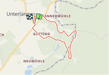
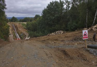
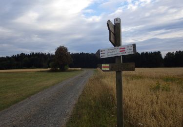
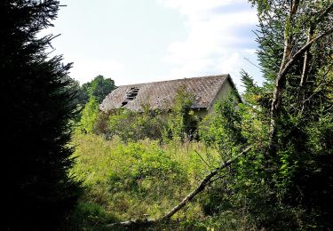
Percorso A piedi di 3,3 km da scoprire a Baviera, Landkreis Schwandorf, Oberviechtach. Questo percorso è proposto da SityTrail - itinéraires balisés pédestres.
Descrizione
Symbol: Auf blauem Grund ein gelber, unregelmäßiger Kreis, darin ein gelber Punkt.
Localizzazione
Paese:
Germany
Regione :
Baviera
Dipartimento/Provincia :
Landkreis Schwandorf
Comune :
Oberviechtach
Località :
Unknown
Partenza:(Dec)
Partenza:(UTM)
317482 ; 5487236 (33U) N.
Commenti
Percorsi nelle vicinanze
![Percorso A piedi Hošťka - Vyhlídková naučná stezka - Photo](https://media.geolcdn.com/t/375/260/de5fa688-c472-4e93-ac35-43eb0e649d0c.jpeg&format=jpg&maxdim=2)
![A piedi A piedi](https://static1.geolcdn.com/sitytour/trail-icons/100.png)
Vyhlídková naučná stezka
A piedi
Facile
Hošťka,
Jihozápad,
Plzeňský kraj,
Czech Republic
![](/images/other/stat-length.png)
13,6 km | 16,8 km-effort
3h 48min
![](https://static1.geolcdn.com/siteimages/upload/files/16400158638029165_repeat_loop_refresh_sync_direction_icon.png)
Sì
![Percorso A piedi Přimda - naučná stezka Přimda - Photo](https://media.geolcdn.com/t/375/260/e1e6d3f2-fe9e-4d62-8210-f9dffe466772.jpeg&format=jpg&maxdim=2)
![A piedi A piedi](https://static1.geolcdn.com/sitytour/trail-icons/100.png)
naučná stezka Přimda
A piedi
Facile
Přimda,
Jihozápad,
Plzeňský kraj,
Czech Republic
![](/images/other/stat-length.png)
7,7 km | 11,3 km-effort
2h 34min
![](https://static1.geolcdn.com/siteimages/upload/files/16400158638029165_repeat_loop_refresh_sync_direction_icon.png)
Sì
![Percorso A piedi Rybník - [M] Rybník - Rybník CZ/D - Photo](https://media.geolcdn.com/t/375/260/3e72288d-7700-4a27-9695-4c0fe2037764.jpeg&format=jpg&maxdim=2)
![A piedi A piedi](https://static1.geolcdn.com/sitytour/trail-icons/100.png)
[M] Rybník - Rybník CZ/D
A piedi
Facile
Rybník,
Jihozápad,
Plzeňský kraj,
Czech Republic
![](/images/other/stat-length.png)
3,5 km | 4,5 km-effort
1h 1min
![](https://static1.geolcdn.com/siteimages/upload/files/16400158638029165_repeat_loop_refresh_sync_direction_icon.png)
No
![Percorso A piedi Rozvadov - [M] Okružní naučná stezka Kolowratova - Photo](https://media.geolcdn.com/t/375/260/48bd39eb-9e5f-4fa1-b21c-b0525a6f7f06.jpeg&format=jpg&maxdim=2)
![A piedi A piedi](https://static1.geolcdn.com/sitytour/trail-icons/100.png)
[M] Okružní naučná stezka Kolowratova
A piedi
Medio
Rozvadov,
Jihozápad,
Plzeňský kraj,
Czech Republic
![](/images/other/stat-length.png)
17 km | 20 km-effort
4h 36min
![](https://static1.geolcdn.com/siteimages/upload/files/16400158638029165_repeat_loop_refresh_sync_direction_icon.png)
Sì
![Percorso A piedi Bělá nad Radbuzou - 3 Nepomukweg - Photo](https://media.geolcdn.com/t/375/260/395eeab1-c2f5-43fc-9b14-49cffd2df5f4.jpeg&format=jpg&maxdim=2)
![A piedi A piedi](https://static1.geolcdn.com/sitytour/trail-icons/100.png)
3 Nepomukweg
A piedi
Facile
Bělá nad Radbuzou,
Jihozápad,
Plzeňský kraj,
Czech Republic
![](/images/other/stat-length.png)
3,3 km | 4,2 km-effort
56min
![](https://static1.geolcdn.com/siteimages/upload/files/16400158638029165_repeat_loop_refresh_sync_direction_icon.png)
No
![Percorso A piedi Třemešné - NS Milíře a vodní mlýny - Photo](https://media.geolcdn.com/t/375/260/1e1d1215-b635-4dfa-b119-84d7ab9a1ded.jpeg&format=jpg&maxdim=2)
![A piedi A piedi](https://static1.geolcdn.com/sitytour/trail-icons/100.png)
NS Milíře a vodní mlýny
A piedi
Medio
Třemešné,
Jihozápad,
Plzeňský kraj,
Czech Republic
![](/images/other/stat-length.png)
18,5 km | 25 km-effort
5h 42min
![](https://static1.geolcdn.com/siteimages/upload/files/16400158638029165_repeat_loop_refresh_sync_direction_icon.png)
Sì
![Percorso A piedi Stadlern - Bayern-Böhmen-Runde 1 - Photo](https://media.geolcdn.com/t/375/260/5c6815e6-3769-4191-92da-29f50be62a8f.jpeg&format=jpg&maxdim=2)
![A piedi A piedi](https://static1.geolcdn.com/sitytour/trail-icons/100.png)
Bayern-Böhmen-Runde 1
A piedi
Facile
Stadlern,
Baviera,
Landkreis Schwandorf,
Germany
![](/images/other/stat-length.png)
12,6 km | 17,6 km-effort
3h 59min
![](https://static1.geolcdn.com/siteimages/upload/files/16400158638029165_repeat_loop_refresh_sync_direction_icon.png)
Sì
![Percorso A piedi Schönsee - Bayern-Böhmen-Runde 2 - Photo](https://media.geolcdn.com/t/375/260/1bf5b631-87d9-4d98-a1f8-ac378680ac95.jpeg&format=jpg&maxdim=2)
![A piedi A piedi](https://static1.geolcdn.com/sitytour/trail-icons/100.png)
Bayern-Böhmen-Runde 2
A piedi
Facile
Schönsee,
Baviera,
Landkreis Schwandorf,
Germany
![](/images/other/stat-length.png)
9,4 km | 12,9 km-effort
2h 56min
![](https://static1.geolcdn.com/siteimages/upload/files/16400158638029165_repeat_loop_refresh_sync_direction_icon.png)
Sì
![Percorso A piedi Rozvadov - [Ž] Rybničná -;Pod ovčím kopcem - Photo](https://media.geolcdn.com/t/375/260/cbd477a6-9e51-410c-896f-089efa643184.jpeg&format=jpg&maxdim=2)
![A piedi A piedi](https://static1.geolcdn.com/sitytour/trail-icons/100.png)
[Ž] Rybničná -;Pod ovčím kopcem
A piedi
Facile
Rozvadov,
Jihozápad,
Plzeňský kraj,
Czech Republic
![](/images/other/stat-length.png)
9,1 km | 12,4 km-effort
2h 48min
![](https://static1.geolcdn.com/siteimages/upload/files/16400158638029165_repeat_loop_refresh_sync_direction_icon.png)
No