![](/images/other/stat-length.png)
![Percorso A piedi Friedrichshafen - Ortsrundweg Kluftern - Südrunde - Photo](https://media.geolcdn.com/t/1900/400/ext.pjpeg?maxdim=2&url=https%3A%2F%2Fmedia.geolcdn.com%2Ff%2F24eac72b-5d33-4d11-abeb-8e8d2d4a2164.jpeg)
Ortsrundweg Kluftern - Südrunde
SityTrail - itinéraires balisés pédestres
Tous les sentiers balisés d’Europe PRO
![Lunghezza](/images/other/stat-length.png)
Lunghezza
7,1 km
![Altitudine massima](https://static1.geolcdn.com/siteimages/upload/files/1508320355ic_sort_altitude_max_24dp.png)
Altitudine massima
470 m
![Dislivello positivo](https://static1.geolcdn.com/siteimages/upload/files/1508320355ic_sort_den_pos_24dp.png)
Dislivello positivo
115 m
![Km-Effort](/images/other/stat-length.png)
Km-Effort
8,6 km
![Altitudine minima](https://static1.geolcdn.com/siteimages/upload/files/1508320355ic_sort_altitude_min_24dp.png)
Altitudine minima
410 m
![Dislivello negativo](https://static1.geolcdn.com/siteimages/upload/files/1508320355ic_sort_den_neg_24dp.png)
Dislivello negativo
115 m
![Boucle](https://static1.geolcdn.com/siteimages/upload/files/16400158638029165_repeat_loop_refresh_sync_direction_icon.png)
Boucle
Sì
Tag
Data di creazione :
2022-02-11 15:01:07.203
Ultima modifica :
2022-02-11 15:01:07.203
![A piedi](https://static1.geolcdn.com/sitytour/trail-icons/100.png)
1h57
Difficoltà : Facile
![Scannerizza questo codice QR per aprire il percorso nell'applicazione SityTrail](https://capi.geolives.com/qq0zvz2zws4bq2lad0pu/sitytour/trails/3093779/qr.png?size=200)
Applicazione GPS da escursionismo GRATUITA
Chi siamo
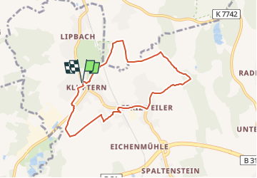
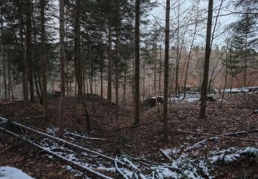
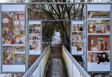
Percorso A piedi di 7,1 km da scoprire a Baden-Württemberg, Bodenseekreis, Friedrichshafen. Questo percorso è proposto da SityTrail - itinéraires balisés pédestres.
Descrizione
Symbol: schwarzer Buchstabe K in einem durch eine Pfeil unterbrochenen Kreis
Localizzazione
Paese:
Germany
Regione :
Baden-Württemberg
Dipartimento/Provincia :
Bodenseekreis
Comune :
Friedrichshafen
Località :
Unknown
Partenza:(Dec)
Partenza:(UTM)
530013 ; 5282244 (32T) N.
Commenti
Percorsi nelle vicinanze
![Percorso A piedi Friedrichshafen - Planetenweg Kluftern - Photo](https://media.geolcdn.com/t/375/260/ext.jpg?maxdim=2&url=https%3A%2F%2Fmedia.geolcdn.com%2Ff%2F46733009-a77d-469a-8bf1-fb80e19f2d17.jpeg)
![A piedi A piedi](https://static1.geolcdn.com/sitytour/trail-icons/100.png)
Planetenweg Kluftern
A piedi
Facile
Friedrichshafen,
Baden-Württemberg,
Bodenseekreis,
Germany
![](/images/other/stat-length.png)
5,5 km | 6,5 km-effort
1h 28min
![](https://static1.geolcdn.com/siteimages/upload/files/16400158638029165_repeat_loop_refresh_sync_direction_icon.png)
Sì
![Percorso A piedi Bermatingen - Rundweg B5 - Photo](https://media.geolcdn.com/t/375/260/ext.jpg?maxdim=2&url=https%3A%2F%2Fmedia.geolcdn.com%2Ff%2F5fa6ab2f-fb20-4449-9ac8-ef50196935f6.jpeg)
![A piedi A piedi](https://static1.geolcdn.com/sitytour/trail-icons/100.png)
Rundweg B5
A piedi
Facile
Bermatingen,
Baden-Württemberg,
Bodenseekreis,
Germany
![](/images/other/stat-length.png)
12,3 km | 15,6 km-effort
3h 32min
![](https://static1.geolcdn.com/siteimages/upload/files/16400158638029165_repeat_loop_refresh_sync_direction_icon.png)
Sì
![Percorso A piedi Bermatingen - Rundweg B4 - Photo](https://media.geolcdn.com/t/375/260/ext.jpg?maxdim=2&url=https%3A%2F%2Fmedia.geolcdn.com%2Ff%2Fab7b3cca-1476-48a6-afce-358eba7428e2.jpeg)
![A piedi A piedi](https://static1.geolcdn.com/sitytour/trail-icons/100.png)
Rundweg B4
A piedi
Facile
Bermatingen,
Baden-Württemberg,
Bodenseekreis,
Germany
![](/images/other/stat-length.png)
7,2 km | 9,5 km-effort
2h 8min
![](https://static1.geolcdn.com/siteimages/upload/files/16400158638029165_repeat_loop_refresh_sync_direction_icon.png)
Sì
![Percorso A piedi Bermatingen - Rundweg B3 - Photo](https://media.geolcdn.com/t/375/260/ext.jpg?maxdim=2&url=https%3A%2F%2Fmedia.geolcdn.com%2Ff%2Fba1a7fea-e706-4424-b12c-59b17b649f8e.jpeg)
![A piedi A piedi](https://static1.geolcdn.com/sitytour/trail-icons/100.png)
Rundweg B3
A piedi
Facile
Bermatingen,
Baden-Württemberg,
Bodenseekreis,
Germany
![](/images/other/stat-length.png)
4,2 km | 5,5 km-effort
1h 14min
![](https://static1.geolcdn.com/siteimages/upload/files/16400158638029165_repeat_loop_refresh_sync_direction_icon.png)
Sì
![Percorso A piedi Bermatingen - Rundweg B2 - Photo](https://media.geolcdn.com/t/375/260/ext.jpg?maxdim=2&url=https%3A%2F%2Fmedia.geolcdn.com%2Ff%2Fcd072049-360e-431c-bd2c-80671c66591d.jpeg)
![A piedi A piedi](https://static1.geolcdn.com/sitytour/trail-icons/100.png)
Rundweg B2
A piedi
Facile
Bermatingen,
Baden-Württemberg,
Bodenseekreis,
Germany
![](/images/other/stat-length.png)
6,9 km | 8,1 km-effort
1h 50min
![](https://static1.geolcdn.com/siteimages/upload/files/16400158638029165_repeat_loop_refresh_sync_direction_icon.png)
Sì
![Percorso A piedi Bermatingen - Rundweg B1 - Photo](https://media.geolcdn.com/t/375/260/ext.jpg?maxdim=2&url=https%3A%2F%2Fmedia.geolcdn.com%2Ff%2Fcd072049-360e-431c-bd2c-80671c66591d.jpeg)
![A piedi A piedi](https://static1.geolcdn.com/sitytour/trail-icons/100.png)
Rundweg B1
A piedi
Facile
Bermatingen,
Baden-Württemberg,
Bodenseekreis,
Germany
![](/images/other/stat-length.png)
3,3 km | 3,7 km-effort
50min
![](https://static1.geolcdn.com/siteimages/upload/files/16400158638029165_repeat_loop_refresh_sync_direction_icon.png)
Sì
![Percorso A piedi Markdorf - Wanderwege Markdorf: Froschweg - Photo](https://media.geolcdn.com/t/375/260/ext.jpg?maxdim=2&url=https%3A%2F%2Fmedia.geolcdn.com%2Ff%2F925776c0-f370-41fd-bf89-cf33cc203a47.jpeg)
![A piedi A piedi](https://static1.geolcdn.com/sitytour/trail-icons/100.png)
Wanderwege Markdorf: Froschweg
A piedi
Facile
Markdorf,
Baden-Württemberg,
Bodenseekreis,
Germany
![](/images/other/stat-length.png)
4,9 km | 6 km-effort
1h 22min
![](https://static1.geolcdn.com/siteimages/upload/files/16400158638029165_repeat_loop_refresh_sync_direction_icon.png)
No
![Percorso A piedi Immenstaad am Bodensee - Apfel- und Weinspazierweg Immenstaad - Photo](https://media.geolcdn.com/t/375/260/ext.jpg?maxdim=2&url=https%3A%2F%2Fmedia.geolcdn.com%2Ff%2Fb33bc6f1-1882-4bf6-8253-2fc20d7975df.jpeg)
![A piedi A piedi](https://static1.geolcdn.com/sitytour/trail-icons/100.png)
Apfel- und Weinspazierweg Immenstaad
A piedi
Facile
Immenstaad am Bodensee,
Baden-Württemberg,
Bodenseekreis,
Germany
![](/images/other/stat-length.png)
7,5 km | 8,8 km-effort
2h 0min
![](https://static1.geolcdn.com/siteimages/upload/files/16400158638029165_repeat_loop_refresh_sync_direction_icon.png)
Sì
![Percorso A piedi Markdorf - Wanderwege Markdorf: Hasenweg - Photo](https://media.geolcdn.com/t/375/260/ext.jpg?maxdim=2&url=https%3A%2F%2Fmedia.geolcdn.com%2Ff%2F8ac18547-bf20-4a6b-880d-3d5127ac3f5f.jpeg)
![A piedi A piedi](https://static1.geolcdn.com/sitytour/trail-icons/100.png)
Wanderwege Markdorf: Hasenweg
A piedi
Facile
Markdorf,
Baden-Württemberg,
Bodenseekreis,
Germany
![](/images/other/stat-length.png)
9,1 km | 10,1 km-effort
2h 17min
![](https://static1.geolcdn.com/siteimages/upload/files/16400158638029165_repeat_loop_refresh_sync_direction_icon.png)
Sì