![](/images/other/stat-length.png)
![Percorso A piedi Bestensee - Sutschke-Rundwanderweg - Photo](https://media.geolcdn.com/t/1900/400/1b782297-3266-4c39-bc55-ebe5dcdd5a1f.jpeg&format=pjpeg&maxdim=2)
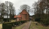
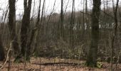
Sutschke-Rundwanderweg
SityTrail - itinéraires balisés pédestres
Tous les sentiers balisés d’Europe GUIDE+
![Lunghezza](/images/other/stat-length.png)
Lunghezza
7,8 km
![Altitudine massima](https://static1.geolcdn.com/siteimages/upload/files/1508320355ic_sort_altitude_max_24dp.png)
Altitudine massima
54 m
![Dislivello positivo](https://static1.geolcdn.com/siteimages/upload/files/1508320355ic_sort_den_pos_24dp.png)
Dislivello positivo
46 m
![Km-Effort](/images/other/stat-length.png)
Km-Effort
8,5 km
![Altitudine minima](https://static1.geolcdn.com/siteimages/upload/files/1508320355ic_sort_altitude_min_24dp.png)
Altitudine minima
35 m
![Dislivello negativo](https://static1.geolcdn.com/siteimages/upload/files/1508320355ic_sort_den_neg_24dp.png)
Dislivello negativo
47 m
![Boucle](https://static1.geolcdn.com/siteimages/upload/files/16400158638029165_repeat_loop_refresh_sync_direction_icon.png)
Boucle
Sì
Tag
Data di creazione :
2022-02-11 14:30:43.0
Ultima modifica :
2022-02-11 14:30:43.0
![A piedi](https://static1.geolcdn.com/sitytour/trail-icons/100.png)
1h55
Difficoltà : Facile
![Scannerizza questo codice QR per aprire il percorso nell'applicazione SityTrail](https://capi.geolives.com/qq0zvz2zws4bq2lad0pu/sitytour/trails/3092707/qr.png?size=200)
Applicazione GPS da escursionismo GRATUITA
Chi siamo
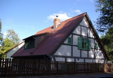
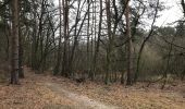
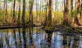
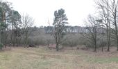
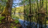
Percorso A piedi di 7,8 km da scoprire a Brandeburgo, Dahme-Spreewald, Bestensee. Questo percorso è proposto da SityTrail - itinéraires balisés pédestres.
Descrizione
Trail created by Gemeinde Bestensee.
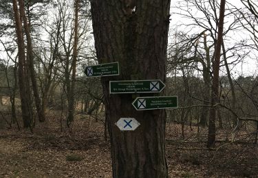
Symbol: blaues Kreuz auf weißem Grund
Localizzazione
Paese:
Germany
Regione :
Brandeburgo
Dipartimento/Provincia :
Dahme-Spreewald
Comune :
Bestensee
Località :
Unknown
Partenza:(Dec)
Partenza:(UTM)
405581 ; 5789064 (33U) N.
Commenti
Percorsi nelle vicinanze
![Percorso A piedi Mittenwalde - Historischer Landweg Rangsdorf-Königs Wusterhausen - Photo](https://media.geolcdn.com/t/375/260/16c944a7-a918-4bec-9b1b-a46eff50e168.jpeg&format=jpg&maxdim=2)
![A piedi A piedi](https://static1.geolcdn.com/sitytour/trail-icons/100.png)
Historischer Landweg Rangsdorf-Königs Wusterhausen
A piedi
Facile
Mittenwalde,
Brandeburgo,
Dahme-Spreewald,
Germany
![](/images/other/stat-length.png)
6,2 km | 6,6 km-effort
1h 30min
![](https://static1.geolcdn.com/siteimages/upload/files/16400158638029165_repeat_loop_refresh_sync_direction_icon.png)
No
![Percorso A piedi Mittenwalde - Wanderweg Sutschketal - Ostseite Krummer See - Photo](https://media.geolcdn.com/t/375/260/20cd188a-f82c-4f4b-94ac-7e5ea1d56520.jpeg&format=jpg&maxdim=2)
![A piedi A piedi](https://static1.geolcdn.com/sitytour/trail-icons/100.png)
Wanderweg Sutschketal - Ostseite Krummer See
A piedi
Facile
Mittenwalde,
Brandeburgo,
Dahme-Spreewald,
Germany
![](/images/other/stat-length.png)
4,2 km | 4,7 km-effort
1h 3min
![](https://static1.geolcdn.com/siteimages/upload/files/16400158638029165_repeat_loop_refresh_sync_direction_icon.png)
No
![Percorso A piedi Bestensee - Historischer Wanderweg Groß Besten - Photo](https://media.geolcdn.com/t/375/260/0c50e288-c358-4dfe-b25e-611b85af8c98.jpeg&format=jpg&maxdim=2)
![A piedi A piedi](https://static1.geolcdn.com/sitytour/trail-icons/100.png)
Historischer Wanderweg Groß Besten
A piedi
Facile
Bestensee,
Brandeburgo,
Dahme-Spreewald,
Germany
![](/images/other/stat-length.png)
3,1 km | 3,5 km-effort
47min
![](https://static1.geolcdn.com/siteimages/upload/files/16400158638029165_repeat_loop_refresh_sync_direction_icon.png)
Sì
![Percorso A piedi Bestensee - Wanderweg Sutschketal - Photo](https://media.geolcdn.com/t/375/260/69f0c8d6-c16a-474c-aa46-ddf7b52d5252.jpeg&format=jpg&maxdim=2)
![A piedi A piedi](https://static1.geolcdn.com/sitytour/trail-icons/100.png)
Wanderweg Sutschketal
A piedi
Facile
Bestensee,
Brandeburgo,
Dahme-Spreewald,
Germany
![](/images/other/stat-length.png)
6 km | 6,6 km-effort
1h 29min
![](https://static1.geolcdn.com/siteimages/upload/files/16400158638029165_repeat_loop_refresh_sync_direction_icon.png)
No
![Percorso A piedi Königs Wusterhausen - 1. Permanenter DVV-Wanderweg Königs Wusterhausen - Photo](https://media.geolcdn.com/t/375/260/d77992ac-f831-4076-a5cd-4c5c1174f3f0.jpeg&format=jpg&maxdim=2)
![A piedi A piedi](https://static1.geolcdn.com/sitytour/trail-icons/100.png)
1. Permanenter DVV-Wanderweg Königs Wusterhausen
A piedi
Facile
Königs Wusterhausen,
Brandeburgo,
Dahme-Spreewald,
Germany
![](/images/other/stat-length.png)
5,7 km | 6,3 km-effort
1h 25min
![](https://static1.geolcdn.com/siteimages/upload/files/16400158638029165_repeat_loop_refresh_sync_direction_icon.png)
No
![Percorso A piedi Bestensee - Rundweg um den Pätzer Vorder- und Hintersee - Photo](https://media.geolcdn.com/t/375/260/0c50e288-c358-4dfe-b25e-611b85af8c98.jpeg&format=jpg&maxdim=2)
![A piedi A piedi](https://static1.geolcdn.com/sitytour/trail-icons/100.png)
Rundweg um den Pätzer Vorder- und Hintersee
A piedi
Facile
Bestensee,
Brandeburgo,
Dahme-Spreewald,
Germany
![](/images/other/stat-length.png)
16,7 km | 18,3 km-effort
4h 8min
![](https://static1.geolcdn.com/siteimages/upload/files/16400158638029165_repeat_loop_refresh_sync_direction_icon.png)
Sì
![Percorso A piedi Königs Wusterhausen - Rundweg Großer Tonteich - Photo](https://media.geolcdn.com/t/375/260/8674b4be-6f29-4a5b-a75a-b2528f282214.jpeg&format=jpg&maxdim=2)
![A piedi A piedi](https://static1.geolcdn.com/sitytour/trail-icons/100.png)
Rundweg Großer Tonteich
A piedi
Facile
Königs Wusterhausen,
Brandeburgo,
Dahme-Spreewald,
Germany
![](/images/other/stat-length.png)
9,7 km | 10,6 km-effort
2h 24min
![](https://static1.geolcdn.com/siteimages/upload/files/16400158638029165_repeat_loop_refresh_sync_direction_icon.png)
Sì
![Percorso A piedi Mittenwalde - Schenkendorfer Wanderweg - Photo](https://media.geolcdn.com/t/375/260/fb998c82-2094-4730-985e-962656cd2b88.jpeg&format=jpg&maxdim=2)
![A piedi A piedi](https://static1.geolcdn.com/sitytour/trail-icons/100.png)
Schenkendorfer Wanderweg
A piedi
Facile
Mittenwalde,
Brandeburgo,
Dahme-Spreewald,
Germany
![](/images/other/stat-length.png)
7,4 km | 7,9 km-effort
1h 47min
![](https://static1.geolcdn.com/siteimages/upload/files/16400158638029165_repeat_loop_refresh_sync_direction_icon.png)
Sì
![Percorso A piedi Bestensee - Rundweg Tongruben Pätz/Gräbendorf - Photo](https://media.geolcdn.com/t/375/260/8674b4be-6f29-4a5b-a75a-b2528f282214.jpeg&format=jpg&maxdim=2)
![A piedi A piedi](https://static1.geolcdn.com/sitytour/trail-icons/100.png)
Rundweg Tongruben Pätz/Gräbendorf
A piedi
Facile
Bestensee,
Brandeburgo,
Dahme-Spreewald,
Germany
![](/images/other/stat-length.png)
16,6 km | 18,3 km-effort
4h 8min
![](https://static1.geolcdn.com/siteimages/upload/files/16400158638029165_repeat_loop_refresh_sync_direction_icon.png)
Sì