![](/images/other/stat-length.png)
![Percorso A piedi Südheide - Früher Europäischer Fernwanderweg E1, Hermannsburg - Photo](https://media.geolcdn.com/t/1900/400/23f24924-672d-438f-8d23-0fd0f383ce7a.jpeg&format=pjpeg&maxdim=2)
Früher Europäischer Fernwanderweg E1, Hermannsburg
SityTrail - itinéraires balisés pédestres
Tous les sentiers balisés d’Europe GUIDE+
![Lunghezza](/images/other/stat-length.png)
Lunghezza
4,2 km
![Altitudine massima](https://static1.geolcdn.com/siteimages/upload/files/1508320355ic_sort_altitude_max_24dp.png)
Altitudine massima
73 m
![Dislivello positivo](https://static1.geolcdn.com/siteimages/upload/files/1508320355ic_sort_den_pos_24dp.png)
Dislivello positivo
29 m
![Km-Effort](/images/other/stat-length.png)
Km-Effort
4,6 km
![Altitudine minima](https://static1.geolcdn.com/siteimages/upload/files/1508320355ic_sort_altitude_min_24dp.png)
Altitudine minima
58 m
![Dislivello negativo](https://static1.geolcdn.com/siteimages/upload/files/1508320355ic_sort_den_neg_24dp.png)
Dislivello negativo
35 m
![Boucle](https://static1.geolcdn.com/siteimages/upload/files/16400158638029165_repeat_loop_refresh_sync_direction_icon.png)
Boucle
No
Tag
Data di creazione :
2022-02-11 14:23:03.181
Ultima modifica :
2022-02-11 14:23:03.181
![A piedi](https://static1.geolcdn.com/sitytour/trail-icons/100.png)
1h03
Difficoltà : Facile
![Scannerizza questo codice QR per aprire il percorso nell'applicazione SityTrail](https://capi.geolives.com/qq0zvz2zws4bq2lad0pu/sitytour/trails/3092546/qr.png?size=200)
Applicazione GPS da escursionismo GRATUITA
Chi siamo
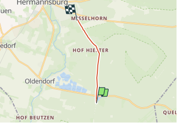
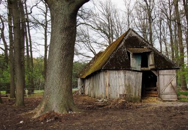
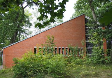
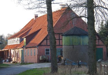
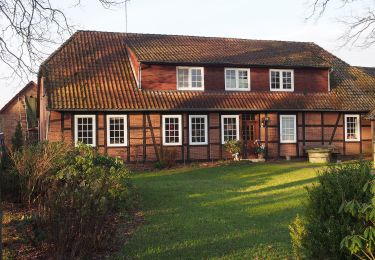
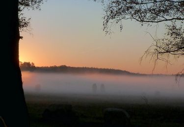
Percorso A piedi di 4,2 km da scoprire a Niedersachsen, Landkreis Celle, Südheide. Questo percorso è proposto da SityTrail - itinéraires balisés pédestres.
Descrizione
früher/previous route
Localizzazione
Paese:
Germany
Regione :
Niedersachsen
Dipartimento/Provincia :
Landkreis Celle
Comune :
Südheide
Località :
Hermannsburg
Partenza:(Dec)
Partenza:(UTM)
575855 ; 5849380 (32U) N.
Commenti
Percorsi nelle vicinanze
![Percorso A piedi Südheide - Südheide 'Auf den Spuren des großen Waldbrandes' W11m (mittlere Tour) - Photo](https://media.geolcdn.com/t/375/260/846828bc-e0e3-4c57-bd53-395e709b2ffc.jpeg&format=jpg&maxdim=2)
![A piedi A piedi](https://static1.geolcdn.com/sitytour/trail-icons/100.png)
Südheide 'Auf den Spuren des großen Waldbrandes' W11m (mittlere Tour)
A piedi
Facile
Südheide,
Niedersachsen,
Landkreis Celle,
Germany
![](/images/other/stat-length.png)
8,8 km | 10 km-effort
2h 16min
![](https://static1.geolcdn.com/siteimages/upload/files/16400158638029165_repeat_loop_refresh_sync_direction_icon.png)
Sì
![Percorso A piedi Südheide - Südheide 'Auf den Spuren des großen Waldbrandes' W11l (lange Tour) - Photo](https://media.geolcdn.com/t/375/260/846828bc-e0e3-4c57-bd53-395e709b2ffc.jpeg&format=jpg&maxdim=2)
![A piedi A piedi](https://static1.geolcdn.com/sitytour/trail-icons/100.png)
Südheide 'Auf den Spuren des großen Waldbrandes' W11l (lange Tour)
A piedi
Facile
Südheide,
Niedersachsen,
Landkreis Celle,
Germany
![](/images/other/stat-length.png)
15,3 km | 16,9 km-effort
3h 51min
![](https://static1.geolcdn.com/siteimages/upload/files/16400158638029165_repeat_loop_refresh_sync_direction_icon.png)
Sì
![Percorso A piedi Eschede - Südheide 'Dem Förster über die Schulter geschaut' W12l (lange Tour) - Photo](https://media.geolcdn.com/t/375/260/8ea2d961-7f4f-41b3-9ce6-e49a68c13c58.jpeg&format=jpg&maxdim=2)
![A piedi A piedi](https://static1.geolcdn.com/sitytour/trail-icons/100.png)
Südheide 'Dem Förster über die Schulter geschaut' W12l (lange Tour)
A piedi
Facile
Eschede,
Niedersachsen,
Landkreis Celle,
Germany
![](/images/other/stat-length.png)
13,7 km | 14,8 km-effort
3h 22min
![](https://static1.geolcdn.com/siteimages/upload/files/16400158638029165_repeat_loop_refresh_sync_direction_icon.png)
Sì
![Percorso A piedi Südheide - Südheide 'Im Reich der Heidschnucken' W10l (lange Tour) - Photo](https://media.geolcdn.com/t/375/260/27a108f9-f9d7-4ad1-b78d-c6fcc650549c.jpeg&format=jpg&maxdim=2)
![A piedi A piedi](https://static1.geolcdn.com/sitytour/trail-icons/100.png)
Südheide 'Im Reich der Heidschnucken' W10l (lange Tour)
A piedi
Facile
Südheide,
Niedersachsen,
Landkreis Celle,
Germany
![](/images/other/stat-length.png)
12,8 km | 14,4 km-effort
3h 16min
![](https://static1.geolcdn.com/siteimages/upload/files/16400158638029165_repeat_loop_refresh_sync_direction_icon.png)
Sì
![Percorso A piedi Südheide - Südheide 'In einem Bächlein helle' W6l (lange Tour) - Photo](https://media.geolcdn.com/t/375/260/23f24924-672d-438f-8d23-0fd0f383ce7a.jpeg&format=jpg&maxdim=2)
![A piedi A piedi](https://static1.geolcdn.com/sitytour/trail-icons/100.png)
Südheide 'In einem Bächlein helle' W6l (lange Tour)
A piedi
Facile
Südheide,
Niedersachsen,
Landkreis Celle,
Germany
![](/images/other/stat-length.png)
6,9 km | 7,7 km-effort
1h 44min
![](https://static1.geolcdn.com/siteimages/upload/files/16400158638029165_repeat_loop_refresh_sync_direction_icon.png)
Sì
![Percorso A piedi Südheide - Südheide 'In einem Bächlein helle' W6m (mittlere Tour) - Photo](https://media.geolcdn.com/t/375/260/c4c87f59-a37f-4aeb-9af1-0eb0f440b18b.jpeg&format=jpg&maxdim=2)
![A piedi A piedi](https://static1.geolcdn.com/sitytour/trail-icons/100.png)
Südheide 'In einem Bächlein helle' W6m (mittlere Tour)
A piedi
Facile
Südheide,
Niedersachsen,
Landkreis Celle,
Germany
![](/images/other/stat-length.png)
16 km | 17,8 km-effort
4h 2min
![](https://static1.geolcdn.com/siteimages/upload/files/16400158638029165_repeat_loop_refresh_sync_direction_icon.png)
Sì
![Percorso A piedi Südheide - Südheide 'In einem Bächlein helle' W6k (kurze Tour) - Photo](https://media.geolcdn.com/t/375/260/861a0def-8066-41af-a881-07851c1183c8.jpeg&format=jpg&maxdim=2)
![A piedi A piedi](https://static1.geolcdn.com/sitytour/trail-icons/100.png)
Südheide 'In einem Bächlein helle' W6k (kurze Tour)
A piedi
Facile
Südheide,
Niedersachsen,
Landkreis Celle,
Germany
![](/images/other/stat-length.png)
11,4 km | 12,6 km-effort
2h 52min
![](https://static1.geolcdn.com/siteimages/upload/files/16400158638029165_repeat_loop_refresh_sync_direction_icon.png)
Sì
![Percorso A piedi Südheide - Südheide 'Im Reich der Heidschnucken' W10m (mittlere Tour) = Heidepanoramaweg - Photo](https://media.geolcdn.com/t/375/260/999cc457-1b41-48b9-9cc5-5373c9fcfa38.jpeg&format=jpg&maxdim=2)
![A piedi A piedi](https://static1.geolcdn.com/sitytour/trail-icons/100.png)
Südheide 'Im Reich der Heidschnucken' W10m (mittlere Tour) = Heidepanoramaweg
A piedi
Facile
Südheide,
Niedersachsen,
Landkreis Celle,
Germany
![](/images/other/stat-length.png)
7,7 km | 8,7 km-effort
1h 58min
![](https://static1.geolcdn.com/siteimages/upload/files/16400158638029165_repeat_loop_refresh_sync_direction_icon.png)
Sì
![Percorso A piedi Eschede - Südheide 'Dem Förster über die Schulter geschaut' W12k (kurze Tour) - Photo](https://media.geolcdn.com/t/375/260/ext.jpg?maxdim=2&url=https%3A%2F%2Fstatic1.geolcdn.com%2Fsiteimages%2Fupload%2Ffiles%2F1545311037marcheuse_200dpi.jpg)
![A piedi A piedi](https://static1.geolcdn.com/sitytour/trail-icons/100.png)
Südheide 'Dem Förster über die Schulter geschaut' W12k (kurze Tour)
A piedi
Facile
Eschede,
Niedersachsen,
Landkreis Celle,
Germany
![](/images/other/stat-length.png)
4,8 km | 5,3 km-effort
1h 12min
![](https://static1.geolcdn.com/siteimages/upload/files/16400158638029165_repeat_loop_refresh_sync_direction_icon.png)
Sì