Percorso A piedi Ahorntal - Großer Ahorntalrundweg - Photo

Großer Ahorntalrundweg

Tous les sentiers balisés d’Europe GUIDE+

© OpenStreetMap contributors
Lunghezza
Lunghezza
23 km
Altitudine massima
Altitudine massima
554 m
Dislivello positivo
Dislivello positivo
674 m
Km-Effort
Km-Effort  
32 km
Altitudine minima
Altitudine minima
386 m
Dislivello negativo
Dislivello negativo
681 m
Boucle
Boucle
Sì
Tag
Tag
Data di creazione :
2022-02-11 13:32:46.883
Ultima modifica :
2022-02-11 13:32:46.883

(0 Recensione)

A piedi
A piedi
7h09
Difficoltà : Difficile

Scannerizza questo codice QR per aprire il percorso nell'applicazione SityTrail

Applicazione GPS da escursionismo GRATUITA

Logo SityTrail SityTrail

IGN / Istituti geografici

Scarica SityTrail dall'App Store Scarica SityTrail da Google Play

Logo SityTrail SityTrail World

Il mondo è tuo

Scarica SityTrail dall'App Store Scarica SityTrail da Google Play Scarica SityTrail da Huawei AppGallery

Chi siamo

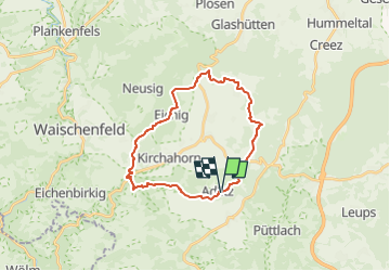
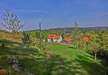
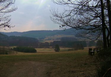
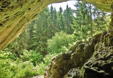
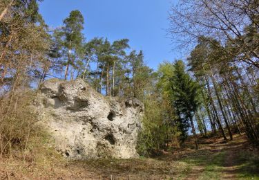
Percorso A piedi di 23 km da scoprire a Baviera, Landkreis Bayreuth, Ahorntal. Questo percorso è proposto da SityTrail - itinéraires balisés pédestres.

Descrizione

Trail created by Gemeinde Ahorntal.

Symbol: Grünes Ahornblatt

Profilo altimetrico

Foto

Localizzazione

Paese:
Germany
Regione :
Baviera
Dipartimento/Provincia :
Landkreis Bayreuth
Comune :
Ahorntal
Località :
Unknown
Partenza:(UTM)
675150 ; 5521541 (32U) N.

Percorsi nelle vicinanze

Percorso A piedi Ahorntal - Zu Höhlenbär und Millionär - Photo
A piedi
GUIDE+

A piedi

Facile
Ahorntal, Baviera, Landkreis Bayreuth, Germany
8,3 km | 11,6 km-effort
2h 38min
Sì
Percorso A piedi Ahorntal - Rundweg Ahorntal (Roter Ring) - Photo
A piedi
GUIDE+

A piedi

Facile
Ahorntal, Baviera, Landkreis Bayreuth, Germany
4 km | 5,5 km-effort
1h 14min
No
Percorso A piedi Pottenstein - Rundweg durch die Bärenschlucht - Photo
A piedi
GUIDE+

A piedi

Facile
Pottenstein, Baviera, Landkreis Bayreuth, Germany
5,2 km | 7 km-effort
1h 35min
Sì
Percorso A piedi Pegnitz - Trockau Rundwanderweg Nr. 2 - Photo
A piedi
GUIDE+

A piedi

Facile
Pegnitz, Baviera, Landkreis Bayreuth, Germany
9,5 km | 12,8 km-effort
2h 55min
No
Percorso A piedi Pottenstein - Rundweg Haselbrunn - Photo
A piedi
GUIDE+

A piedi

Facile
Pottenstein, Baviera, Landkreis Bayreuth, Germany
4,8 km | 6,5 km-effort
1h 29min
Sì
Percorso A piedi Pottenstein - Rundweg Püttlach-Ruppertshöhe - Photo
A piedi
GUIDE+

A piedi

Facile
Pottenstein, Baviera, Landkreis Bayreuth, Germany
5,8 km | 8,4 km-effort
1h 53min
Sì
Percorso A piedi Pottenstein - Püttlach-Hohenmirsbach - Photo
A piedi
GUIDE+

A piedi

Facile
Pottenstein, Baviera, Landkreis Bayreuth, Germany
8,1 km | 11,6 km-effort
2h 38min
No
Percorso A piedi Pottenstein - Haßlacher Rundwanderweg - Photo
A piedi
GUIDE+

A piedi

Facile
Pottenstein, Baviera, Landkreis Bayreuth, Germany
7,3 km | 9,2 km-effort
2h 6min
Sì
Percorso A piedi Pottenstein - Rundweg Püttlach - Photo
A piedi
GUIDE+

A piedi

Facile
Pottenstein, Baviera, Landkreis Bayreuth, Germany
6,1 km | 8 km-effort
1h 49min
Sì


Chiudi
I miei abbonamenti