Percorso Marcia Cassis - Calanques of Port-Miou and Port Pin - Photo

Calanques of Port-Miou and Port Pin

 JN-PARTNERS
JN-PARTNERS

Utente

© OpenStreetMap contributors
Lunghezza
Lunghezza
5,4 km
Altitudine massima
Altitudine massima
149 m
Dislivello positivo
Dislivello positivo
239 m
Km-Effort
Km-Effort  
8,5 km
Altitudine minima
Altitudine minima
8 m
Dislivello negativo
Dislivello negativo
237 m
Boucle
Boucle
Sì
Data di creazione :
2014-12-10 00:00:00.0
Ultima modifica :
2014-12-10 00:00:00.0

(0 Recensione)

Marcia
Marcia
1h47
Difficoltà : Medio

Scannerizza questo codice QR per aprire il percorso nell'applicazione SityTrail

Applicazione GPS da escursionismo GRATUITA

Logo SityTrail SityTrail

IGN / Istituti geografici

Scarica SityTrail dall'App Store Scarica SityTrail da Google Play

Logo SityTrail SityTrail World

Il mondo è tuo

Scarica SityTrail dall'App Store Scarica SityTrail da Google Play Scarica SityTrail da Huawei AppGallery

Chi siamo

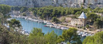
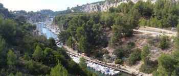
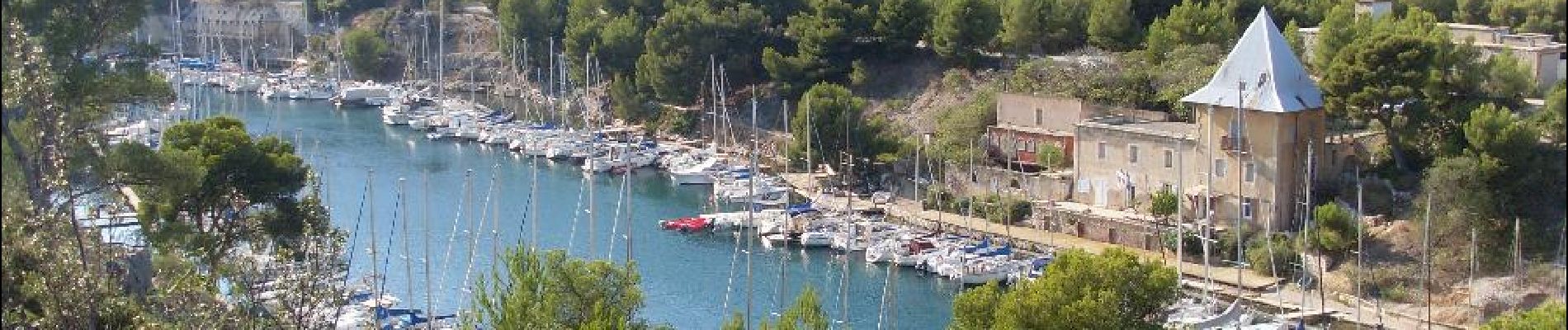
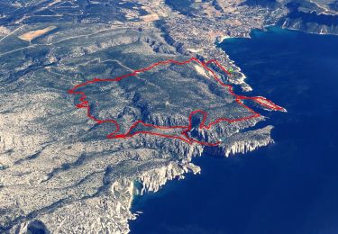
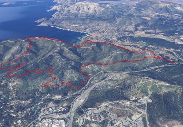
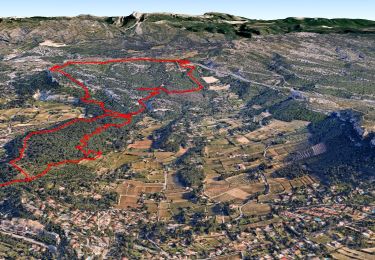
Percorso Marcia di 5,4 km da scoprire a Provenza-Alpi-Costa Azzurra, Bouches-du-Rhône, Cassis. Questo percorso è proposto da JN-PARTNERS.

Descrizione

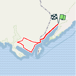
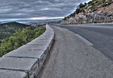
From the entrance to the Presqu’île car park (green trail n°8a), walk about 400m along Avenue Notre Dame, and take the path on the left to the Calanque of Port-Miou. Continue about 800m along the calanque (green trail n°8) until the path starts to rise, it takes you up to a small ridge?. Leave the trail and follow the path on the left towards the Col which takes you to the Calanque of Port-Pin?. From the beach, leave the green trail n°8 and take the blue trail N°4 (clockwise along the circular path). This path rises steeply and then turns downhill towards the En-Vau headland and then rises gradually again up to a viewing platform overlooking the calanque (Watch out! This is a nature area and there are no protection barriers). Follow the path until you reach the Cadeiron Belvedere and then on to the point?. At the crossroads, return to the Calanque of Port-Pin by the path on your right. From the beach?, you can return along the same path that you took at the start.

Profilo altimetrico

Foto

Punti di interesse

Punto di interesse Cassis - Port Miou - Photo
JN-PARTNERS
CASSIS 
Punto di interesse Cassis - Port-Miou - Photo
JN-PARTNERS
CASSIS 

Localizzazione

Paese:
France
Regione :
Provenza-Alpi-Costa Azzurra
Dipartimento/Provincia :
Bouches-du-Rhône
Comune :
Cassis
Località :
Unknown
Partenza:(Dec)
Partenza:(UTM)
704865 ; 4787457 (31T) N.

Percorsi nelle vicinanze

Percorso Bici da strada Cassis - 7909608-TRIMRS2017_Parcours Bike L V5 - Photo
Bici da strada
GUIDE+

Bici da strada

Medio
(1)
Cassis, Provenza-Alpi-Costa Azzurra, Bouches-du-Rhône, France
21 km | 26 km-effort
1h 31min
No
Percorso Marcia Cassis - SityTrail - Les 3 Calanques - Cassis - Photo
Marcia
GUIDE
affinetataille

Marcia

Difficile
(1)
Cassis, Provenza-Alpi-Costa Azzurra, Bouches-du-Rhône, France
16,6 km | 25 km-effort
6h 0min
Sì
Percorso Marcia Cassis - SityTrail - cassis la couronne - Photo
Marcia
GUIDE
affinetataille

Marcia

Medio
(3)
Cassis, Provenza-Alpi-Costa Azzurra, Bouches-du-Rhône, France
16,1 km | 24 km-effort
6h 0min
Sì
Percorso Marcia Cassis - les calanques de Cassis - Photo
Marcia
th.feur

Marcia

Medio
(1)
Cassis, Provenza-Alpi-Costa Azzurra, Bouches-du-Rhône, France
15,9 km | 23 km-effort
6h 2min
No
Percorso Marcia Cassis - Traversée des Calanques 1/2 - Photo
Marcia
GUIDE
R@ph

Marcia

Difficile
(1)
Cassis, Provenza-Alpi-Costa Azzurra, Bouches-du-Rhône, France
16,9 km | 32 km-effort
6h 19min
No
Percorso Marcia Marsiglia - Calanques - Aiguille Eissadon - Col Devenson - En vau - Col l'Oule - Photo
Marcia
GUIDE
R@ph

Marcia

Difficile
(2)
Marsiglia, Provenza-Alpi-Costa Azzurra, Bouches-du-Rhône, France
14,6 km | 22 km-effort
4h 48min
Sì
Percorso Marcia Cassis - La Pointe Sud d'en Vau, depuis Cassis - Photo
Marcia
tracegps

Marcia

Medio
(2)
Cassis, Provenza-Alpi-Costa Azzurra, Bouches-du-Rhône, France
7,7 km | 11,9 km-effort
3h 30min
Sì
Percorso Marcia Cassis - Rando Cassis - Mont Gibaou - Photo
Marcia
tracegps

Marcia

Difficile
(4)
Cassis, Provenza-Alpi-Costa Azzurra, Bouches-du-Rhône, France
9,2 km | 14,3 km-effort
3h 0min
Sì
Percorso Marcia Cassis - Le Mont Gibaou **(cassis 13) - Photo
Marcia
GUIDE
affinetataille

Marcia

Medio
Cassis, Provenza-Alpi-Costa Azzurra, Bouches-du-Rhône, France
12,5 km | 18,7 km-effort
6h 0min
Sì


Chiudi
I miei abbonamenti