![](/images/other/stat-length.png)
![Percorso A piedi Jachenau - AV Weg 492 (Staffel) - Photo](https://media.geolcdn.com/t/1900/400/66e66eb8-5351-4c7f-9d5f-795d2a6523b8.jpeg&format=pjpeg&maxdim=2)
AV Weg 492 (Staffel)
SityTrail - itinéraires balisés pédestres
Tous les sentiers balisés d’Europe GUIDE+
![Lunghezza](/images/other/stat-length.png)
Lunghezza
7,5 km
![Altitudine massima](https://static1.geolcdn.com/siteimages/upload/files/1508320355ic_sort_altitude_max_24dp.png)
Altitudine massima
1423 m
![Dislivello positivo](https://static1.geolcdn.com/siteimages/upload/files/1508320355ic_sort_den_pos_24dp.png)
Dislivello positivo
801 m
![Km-Effort](/images/other/stat-length.png)
Km-Effort
16,1 km
![Altitudine minima](https://static1.geolcdn.com/siteimages/upload/files/1508320355ic_sort_altitude_min_24dp.png)
Altitudine minima
738 m
![Dislivello negativo](https://static1.geolcdn.com/siteimages/upload/files/1508320355ic_sort_den_neg_24dp.png)
Dislivello negativo
168 m
![Boucle](https://static1.geolcdn.com/siteimages/upload/files/16400158638029165_repeat_loop_refresh_sync_direction_icon.png)
Boucle
No
Tag
Data di creazione :
2022-02-11 13:25:58.337
Ultima modifica :
2022-02-11 13:25:58.337
![A piedi](https://static1.geolcdn.com/sitytour/trail-icons/100.png)
3h39
Difficoltà : Facile
![Scannerizza questo codice QR per aprire il percorso nell'applicazione SityTrail](https://capi.geolives.com/qq0zvz2zws4bq2lad0pu/sitytour/trails/3090298/qr.png?size=200)
Applicazione GPS da escursionismo GRATUITA
Chi siamo
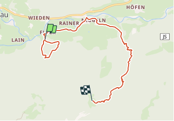
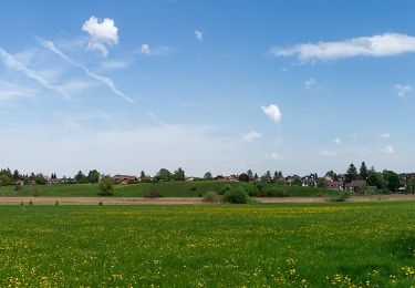
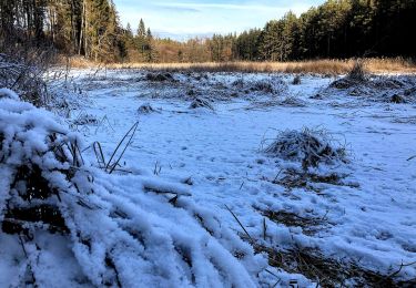
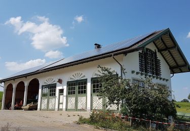
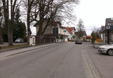
Percorso A piedi di 7,5 km da scoprire a Baviera, Landkreis Bad Tölz-Wolfratshausen, Jachenau. Questo percorso è proposto da SityTrail - itinéraires balisés pédestres.
Descrizione
Trail created by DAV Sektion Lenggries.
Localizzazione
Paese:
Germany
Regione :
Baviera
Dipartimento/Provincia :
Landkreis Bad Tölz-Wolfratshausen
Comune :
Jachenau
Località :
Unknown
Partenza:(Dec)
Partenza:(UTM)
684405 ; 5274527 (32T) N.
Commenti
Percorsi nelle vicinanze
![Percorso Marcia Gemeinde Leutasch - Leutascher Geistelklamm - Photo](https://media.geolcdn.com/t/375/260/ext.jpg?maxdim=2&url=https%3A%2F%2Fservices.sitytrail.com%2FGeolivesWS%2FDownloadMedia.ashx%3FTrailID%3D450001%26Media%3Dfix__20150723133419.jpg)
![Marcia Marcia](https://static1.geolcdn.com/sitytour/trail-icons/101.png)
Leutascher Geistelklamm
Marcia
Facile
(1)
Gemeinde Leutasch,
Tirolo,
Bezirk Innsbruck-Land,
Austria
![](/images/other/stat-length.png)
6,4 km | 9,8 km-effort
3h 8min
![](https://static1.geolcdn.com/siteimages/upload/files/16400158638029165_repeat_loop_refresh_sync_direction_icon.png)
Sì
![Percorso A piedi Murnau am Staffelsee - Guglhör-Rundweg - Photo](https://media.geolcdn.com/t/375/260/1f28d88b-888e-451e-a172-91645cca2d48.jpeg&format=jpg&maxdim=2)
![A piedi A piedi](https://static1.geolcdn.com/sitytour/trail-icons/100.png)
Guglhör-Rundweg
A piedi
Facile
Murnau am Staffelsee,
Baviera,
Landkreis Garmisch-Partenkirchen,
Germany
![](/images/other/stat-length.png)
11,4 km | 14,7 km-effort
3h 19min
![](https://static1.geolcdn.com/siteimages/upload/files/16400158638029165_repeat_loop_refresh_sync_direction_icon.png)
Sì
![Percorso A piedi Iffeldorf - Osterseen-Wanderweg 5 - Photo](https://media.geolcdn.com/t/375/260/b70ae96d-b01f-4237-84de-74fc7b6b526c.jpeg&format=jpg&maxdim=2)
![A piedi A piedi](https://static1.geolcdn.com/sitytour/trail-icons/100.png)
Osterseen-Wanderweg 5
A piedi
Facile
Iffeldorf,
Baviera,
Landkreis Weilheim-Schongau,
Germany
![](/images/other/stat-length.png)
4,4 km | 5,3 km-effort
1h 11min
![](https://static1.geolcdn.com/siteimages/upload/files/16400158638029165_repeat_loop_refresh_sync_direction_icon.png)
Sì
![Percorso A piedi Iffeldorf - Osterseen-Wanderweg 8 - Photo](https://media.geolcdn.com/t/375/260/c62e2ceb-9609-4e74-9a3a-2132ca727114.jpeg&format=jpg&maxdim=2)
![A piedi A piedi](https://static1.geolcdn.com/sitytour/trail-icons/100.png)
Osterseen-Wanderweg 8
A piedi
Facile
Iffeldorf,
Baviera,
Landkreis Weilheim-Schongau,
Germany
![](/images/other/stat-length.png)
4 km | 4,8 km-effort
1h 5min
![](https://static1.geolcdn.com/siteimages/upload/files/16400158638029165_repeat_loop_refresh_sync_direction_icon.png)
Sì
![Percorso A piedi Spatzenhausen - Riegsee-Rundweg - Photo](https://media.geolcdn.com/t/375/260/4fc9fcae-e331-4a5c-ad65-aa53c79356e3.jpeg&format=jpg&maxdim=2)
![A piedi A piedi](https://static1.geolcdn.com/sitytour/trail-icons/100.png)
Riegsee-Rundweg
A piedi
Facile
Spatzenhausen,
Baviera,
Landkreis Garmisch-Partenkirchen,
Germany
![](/images/other/stat-length.png)
8,8 km | 10 km-effort
2h 16min
![](https://static1.geolcdn.com/siteimages/upload/files/16400158638029165_repeat_loop_refresh_sync_direction_icon.png)
Sì
![Percorso A piedi Penzberg - Rundweg 13 Mitte - Photo](https://media.geolcdn.com/t/375/260/7b4422b1-99e8-48bf-bd65-5d73e3f4fde6.jpeg&format=jpg&maxdim=2)
![A piedi A piedi](https://static1.geolcdn.com/sitytour/trail-icons/100.png)
Rundweg 13 Mitte
A piedi
Facile
Penzberg,
Baviera,
Landkreis Weilheim-Schongau,
Germany
![](/images/other/stat-length.png)
5,9 km | 6,9 km-effort
1h 33min
![](https://static1.geolcdn.com/siteimages/upload/files/16400158638029165_repeat_loop_refresh_sync_direction_icon.png)
No
![Percorso A piedi Sindelsdorf - Rundweg 14 Süd - Photo](https://media.geolcdn.com/t/375/260/40bb7edb-96b0-4709-890f-60ad745213eb.jpeg&format=jpg&maxdim=2)
![A piedi A piedi](https://static1.geolcdn.com/sitytour/trail-icons/100.png)
Rundweg 14 Süd
A piedi
Facile
Sindelsdorf,
Baviera,
Landkreis Weilheim-Schongau,
Germany
![](/images/other/stat-length.png)
5,3 km | 5,5 km-effort
1h 14min
![](https://static1.geolcdn.com/siteimages/upload/files/16400158638029165_repeat_loop_refresh_sync_direction_icon.png)
No
![Percorso Marcia Gemeinde Scharnitz - La Voie de l’Aigle : J7 - Photo](https://media.geolcdn.com/t/375/260/b7aeda0d-22e9-4493-a84f-d759a36662b2.jpg&format=jpg&maxdim=2)
![Marcia Marcia](https://static1.geolcdn.com/sitytour/trail-icons/101.png)
La Voie de l’Aigle : J7
Marcia
Molto difficile
Gemeinde Scharnitz,
Tirolo,
Bezirk Innsbruck-Land,
Austria
![](/images/other/stat-length.png)
15,3 km | 34 km-effort
5h 51min
![](https://static1.geolcdn.com/siteimages/upload/files/16400158638029165_repeat_loop_refresh_sync_direction_icon.png)
No
![Percorso A piedi Bad Wiessee - Wanderweg 611a - Bayerische Voralpen - Photo](https://media.geolcdn.com/t/375/260/0d1e1d70-b794-4e95-901f-df3907e0d83f.jpeg&format=jpg&maxdim=2)
![A piedi A piedi](https://static1.geolcdn.com/sitytour/trail-icons/100.png)
Wanderweg 611a - Bayerische Voralpen
A piedi
Facile
Bad Wiessee,
Baviera,
Landkreis Miesbach,
Germany
![](/images/other/stat-length.png)
5,2 km | 7 km-effort
1h 35min
![](https://static1.geolcdn.com/siteimages/upload/files/16400158638029165_repeat_loop_refresh_sync_direction_icon.png)
No