


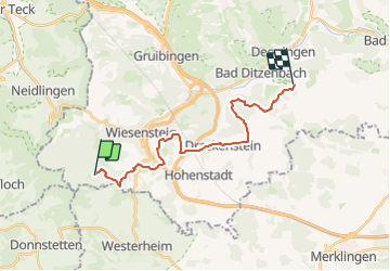

9 km | 12,6 km-effort

Tous les sentiers balisés d’Europe GUIDE+


Applicazione GPS da escursionismo GRATUITA
 SityTrail
IGN / Istituti geografici
SityTrail World
Il mondo è tuo
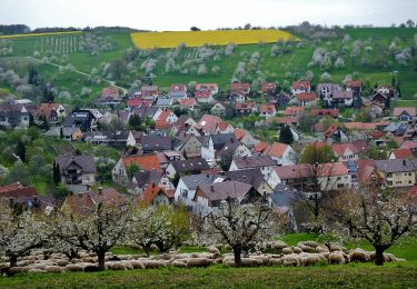
Percorso A piedi di 17,8 km da scoprire a Baden-Württemberg, Landkreis Reutlingen, Gomadingen. Questo percorso è proposto da SityTrail - itinéraires balisés pédestres.
Trail created by Schwäbischer Albverein.
Nebenweg des Schwäbischen Albvereins (rote Gabel)
Symbol: rote Gabel auf weißem Grund


A piedi
A piedi
A piedi
A piedi

A piedi
A piedi
A piedi
A piedi
A piedi