![](/images/other/stat-length.png)
![Percorso A piedi Engelthal - Engelthal -5- - Photo](https://media.geolcdn.com/t/1900/400/a1f3534e-df95-4c50-bc70-4845747dc8ff.jpeg&format=pjpeg&maxdim=2)
Engelthal -5-
SityTrail - itinéraires balisés pédestres
Tous les sentiers balisés d’Europe GUIDE+
![Lunghezza](/images/other/stat-length.png)
Lunghezza
7,4 km
![Altitudine massima](https://static1.geolcdn.com/siteimages/upload/files/1508320355ic_sort_altitude_max_24dp.png)
Altitudine massima
440 m
![Dislivello positivo](https://static1.geolcdn.com/siteimages/upload/files/1508320355ic_sort_den_pos_24dp.png)
Dislivello positivo
145 m
![Km-Effort](/images/other/stat-length.png)
Km-Effort
9,4 km
![Altitudine minima](https://static1.geolcdn.com/siteimages/upload/files/1508320355ic_sort_altitude_min_24dp.png)
Altitudine minima
352 m
![Dislivello negativo](https://static1.geolcdn.com/siteimages/upload/files/1508320355ic_sort_den_neg_24dp.png)
Dislivello negativo
153 m
![Boucle](https://static1.geolcdn.com/siteimages/upload/files/16400158638029165_repeat_loop_refresh_sync_direction_icon.png)
Boucle
Sì
Tag
Data di creazione :
2022-02-11 13:02:41.397
Ultima modifica :
2022-02-11 13:02:41.397
![A piedi](https://static1.geolcdn.com/sitytour/trail-icons/100.png)
2h08
Difficoltà : Facile
![Scannerizza questo codice QR per aprire il percorso nell'applicazione SityTrail](https://capi.geolives.com/qq0zvz2zws4bq2lad0pu/sitytour/trails/3088987/qr.png?size=200)
Applicazione GPS da escursionismo GRATUITA
Chi siamo
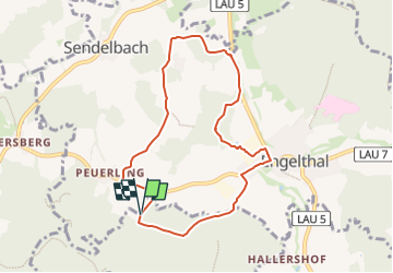
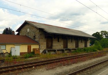
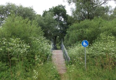
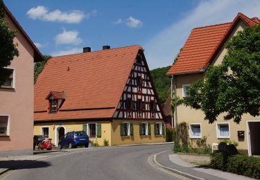
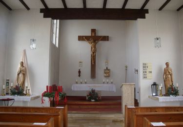
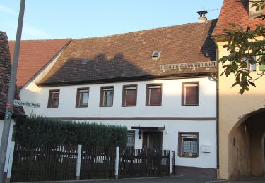
Percorso A piedi di 7,4 km da scoprire a Baviera, Landkreis Nürnberger Land, Engelthal. Questo percorso è proposto da SityTrail - itinéraires balisés pédestres.
Descrizione
Trail created by Gemeinde Engelthal.
geprüft (Dez. 2014 by cycling_zno)
Symbol: Weiße 5 auf grünem Rechteck
Localizzazione
Paese:
Germany
Regione :
Baviera
Dipartimento/Provincia :
Landkreis Nürnberger Land
Comune :
Engelthal
Località :
Unknown
Partenza:(Dec)
Partenza:(UTM)
672127 ; 5481974 (32U) N.
Commenti
Percorsi nelle vicinanze
![Percorso A piedi Leinburg - Im Buchenwald - Photo](https://media.geolcdn.com/t/375/260/4d1231e1-4bdb-4a19-afaf-48cfde7b893d.jpeg&format=jpg&maxdim=2)
![A piedi A piedi](https://static1.geolcdn.com/sitytour/trail-icons/100.png)
Im Buchenwald
A piedi
Facile
Leinburg,
Baviera,
Landkreis Nürnberger Land,
Germany
![](/images/other/stat-length.png)
10,8 km | 14,8 km-effort
3h 21min
![](https://static1.geolcdn.com/siteimages/upload/files/16400158638029165_repeat_loop_refresh_sync_direction_icon.png)
Sì
![Percorso A piedi Henfenfeld - Rundweg Henfenfeld – Reschenberg-Klosterberg-Pass - Photo](https://media.geolcdn.com/t/375/260/e0336b8f-eabb-4082-8864-c7d008328474.jpeg&format=jpg&maxdim=2)
![A piedi A piedi](https://static1.geolcdn.com/sitytour/trail-icons/100.png)
Rundweg Henfenfeld – Reschenberg-Klosterberg-Pass
A piedi
Facile
Henfenfeld,
Baviera,
Landkreis Nürnberger Land,
Germany
![](/images/other/stat-length.png)
5,4 km | 7,6 km-effort
1h 43min
![](https://static1.geolcdn.com/siteimages/upload/files/16400158638029165_repeat_loop_refresh_sync_direction_icon.png)
Sì
![Percorso A piedi Henfenfeld - Rundweg Henfenfeld – Klosterberg - Photo](https://media.geolcdn.com/t/375/260/479f68cb-f7bf-44f8-8088-33053462fc3e.jpeg&format=jpg&maxdim=2)
![A piedi A piedi](https://static1.geolcdn.com/sitytour/trail-icons/100.png)
Rundweg Henfenfeld – Klosterberg
A piedi
Facile
Henfenfeld,
Baviera,
Landkreis Nürnberger Land,
Germany
![](/images/other/stat-length.png)
10,2 km | 13,5 km-effort
3h 3min
![](https://static1.geolcdn.com/siteimages/upload/files/16400158638029165_repeat_loop_refresh_sync_direction_icon.png)
Sì
![Percorso A piedi Hersbruck - Hersbrucker Rundweg Nr. 6 - Photo](https://media.geolcdn.com/t/375/260/df7643cf-d09e-4aae-9beb-40c1ce40d632.jpeg&format=jpg&maxdim=2)
![A piedi A piedi](https://static1.geolcdn.com/sitytour/trail-icons/100.png)
Hersbrucker Rundweg Nr. 6
A piedi
Facile
Hersbruck,
Baviera,
Landkreis Nürnberger Land,
Germany
![](/images/other/stat-length.png)
8,3 km | 9,8 km-effort
2h 13min
![](https://static1.geolcdn.com/siteimages/upload/files/16400158638029165_repeat_loop_refresh_sync_direction_icon.png)
Sì
![Percorso A piedi Schönberg - Nessenbach-Runde - Photo](https://media.geolcdn.com/t/375/260/2b967ae6-761a-4b4d-b3f6-e8c432b699a5.jpeg&format=jpg&maxdim=2)
![A piedi A piedi](https://static1.geolcdn.com/sitytour/trail-icons/100.png)
Nessenbach-Runde
A piedi
Facile
Schönberg,
Baviera,
Landkreis Nürnberger Land,
Germany
![](/images/other/stat-length.png)
7,6 km | 8,9 km-effort
2h 1min
![](https://static1.geolcdn.com/siteimages/upload/files/16400158638029165_repeat_loop_refresh_sync_direction_icon.png)
Sì
![Percorso A piedi Offenhausen - Mühlenweg Hammerbachtal - Photo](https://media.geolcdn.com/t/375/260/cc970669-b5f9-479d-a3d1-5ba7e63a7bbe.jpeg&format=jpg&maxdim=2)
![A piedi A piedi](https://static1.geolcdn.com/sitytour/trail-icons/100.png)
Mühlenweg Hammerbachtal
A piedi
Medio
Offenhausen,
Baviera,
Landkreis Nürnberger Land,
Germany
![](/images/other/stat-length.png)
16,4 km | 20 km-effort
4h 35min
![](https://static1.geolcdn.com/siteimages/upload/files/16400158638029165_repeat_loop_refresh_sync_direction_icon.png)
No
![Percorso A piedi Offenhausen - Engelthal -8 - - Photo](https://media.geolcdn.com/t/375/260/efff14fc-fad6-456a-a55b-62fd245a578c.jpeg&format=jpg&maxdim=2)
![A piedi A piedi](https://static1.geolcdn.com/sitytour/trail-icons/100.png)
Engelthal -8 -
A piedi
Facile
Offenhausen,
Baviera,
Landkreis Nürnberger Land,
Germany
![](/images/other/stat-length.png)
5,4 km | 7,1 km-effort
1h 37min
![](https://static1.geolcdn.com/siteimages/upload/files/16400158638029165_repeat_loop_refresh_sync_direction_icon.png)
No
![Percorso A piedi Engelthal - Engelthal -3- - Photo](https://media.geolcdn.com/t/375/260/c04aa537-71df-4cf7-88fd-b9c215d1ed12.jpeg&format=jpg&maxdim=2)
![A piedi A piedi](https://static1.geolcdn.com/sitytour/trail-icons/100.png)
Engelthal -3-
A piedi
Facile
Engelthal,
Baviera,
Landkreis Nürnberger Land,
Germany
![](/images/other/stat-length.png)
4,9 km | 7,1 km-effort
1h 36min
![](https://static1.geolcdn.com/siteimages/upload/files/16400158638029165_repeat_loop_refresh_sync_direction_icon.png)
Sì
![Percorso A piedi Hersbruck - Hersbrucker Rundweg Nr. 5 - Photo](https://media.geolcdn.com/t/375/260/6fa717c0-6d01-4cb9-ab6a-b0f542c0be64.jpeg&format=jpg&maxdim=2)
![A piedi A piedi](https://static1.geolcdn.com/sitytour/trail-icons/100.png)
Hersbrucker Rundweg Nr. 5
A piedi
Facile
Hersbruck,
Baviera,
Landkreis Nürnberger Land,
Germany
![](/images/other/stat-length.png)
7,3 km | 9,7 km-effort
2h 12min
![](https://static1.geolcdn.com/siteimages/upload/files/16400158638029165_repeat_loop_refresh_sync_direction_icon.png)
Sì