![](/images/other/stat-length.png)
![Percorso A piedi Dahlen - Rundweg Schmannewitz-Brehms Ruhe-Schmannewitz - Photo](https://media.geolcdn.com/t/1900/400/40606e92-b9d3-4d76-922a-15a2edc40fce.jpeg&format=pjpeg&maxdim=2)
Rundweg Schmannewitz-Brehms Ruhe-Schmannewitz
SityTrail - itinéraires balisés pédestres
Tous les sentiers balisés d’Europe GUIDE+
![Lunghezza](/images/other/stat-length.png)
Lunghezza
4,6 km
![Altitudine massima](https://static1.geolcdn.com/siteimages/upload/files/1508320355ic_sort_altitude_max_24dp.png)
Altitudine massima
191 m
![Dislivello positivo](https://static1.geolcdn.com/siteimages/upload/files/1508320355ic_sort_den_pos_24dp.png)
Dislivello positivo
51 m
![Km-Effort](/images/other/stat-length.png)
Km-Effort
5,3 km
![Altitudine minima](https://static1.geolcdn.com/siteimages/upload/files/1508320355ic_sort_altitude_min_24dp.png)
Altitudine minima
151 m
![Dislivello negativo](https://static1.geolcdn.com/siteimages/upload/files/1508320355ic_sort_den_neg_24dp.png)
Dislivello negativo
58 m
![Boucle](https://static1.geolcdn.com/siteimages/upload/files/16400158638029165_repeat_loop_refresh_sync_direction_icon.png)
Boucle
Sì
Tag
Data di creazione :
2022-02-11 12:58:31.345
Ultima modifica :
2022-02-11 12:58:31.345
![A piedi](https://static1.geolcdn.com/sitytour/trail-icons/100.png)
1h12
Difficoltà : Facile
![Scannerizza questo codice QR per aprire il percorso nell'applicazione SityTrail](https://capi.geolives.com/qq0zvz2zws4bq2lad0pu/sitytour/trails/3088737/qr.png?size=200)
Applicazione GPS da escursionismo GRATUITA
Chi siamo
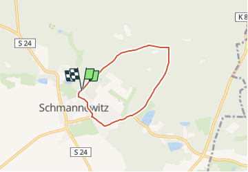
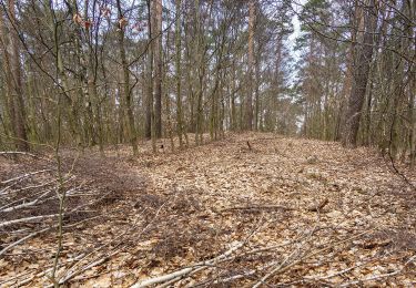
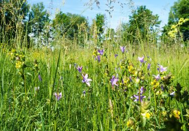
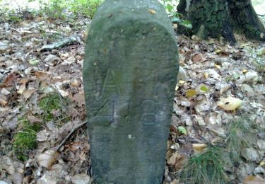
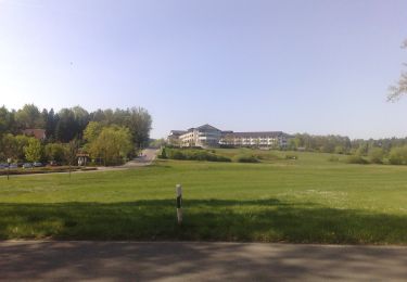
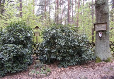
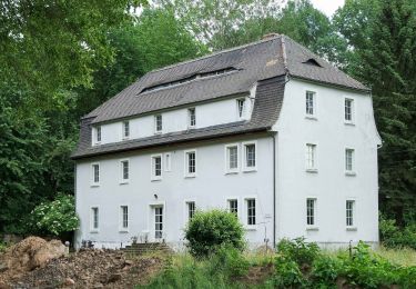
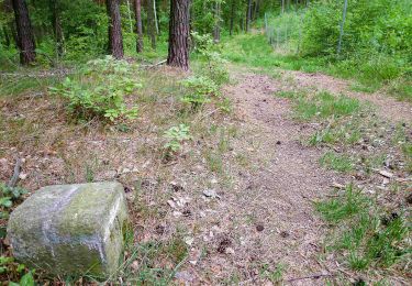
Percorso A piedi di 4,6 km da scoprire a Sassonia, Nordsachsen, Dahlen. Questo percorso è proposto da SityTrail - itinéraires balisés pédestres.
Descrizione
Symbol: Roter Punkt auf weißem Grund
Localizzazione
Paese:
Germany
Regione :
Sassonia
Dipartimento/Provincia :
Nordsachsen
Comune :
Dahlen
Località :
Unknown
Partenza:(Dec)
Partenza:(UTM)
360082 ; 5696302 (33U) N.
Commenti
Percorsi nelle vicinanze
![Percorso A piedi Dahlen - Ochsensaal-Hohburg - Photo](https://media.geolcdn.com/t/375/260/d10b8129-2394-484c-b9d2-32890c2c44e8.jpeg&format=jpg&maxdim=2)
![A piedi A piedi](https://static1.geolcdn.com/sitytour/trail-icons/100.png)
Ochsensaal-Hohburg
A piedi
Medio
Dahlen,
Sassonia,
Nordsachsen,
Germany
![](/images/other/stat-length.png)
23 km | 26 km-effort
6h 1min
![](https://static1.geolcdn.com/siteimages/upload/files/16400158638029165_repeat_loop_refresh_sync_direction_icon.png)
No
![Percorso A piedi Belgern-Schildau - Rundweg Schildau - Photo](https://media.geolcdn.com/t/375/260/2eb7fc33-2225-4391-ad5c-2bd1704870b3.jpeg&format=jpg&maxdim=2)
![A piedi A piedi](https://static1.geolcdn.com/sitytour/trail-icons/100.png)
Rundweg Schildau
A piedi
Facile
Belgern-Schildau,
Sassonia,
Nordsachsen,
Germany
![](/images/other/stat-length.png)
7,6 km | 8,8 km-effort
1h 59min
![](https://static1.geolcdn.com/siteimages/upload/files/16400158638029165_repeat_loop_refresh_sync_direction_icon.png)
Sì
![Percorso A piedi Dahlen - Taura-Jägereiche - Photo](https://media.geolcdn.com/t/375/260/75f22deb-5127-4b36-80e8-2ba7b5b72561.jpeg&format=jpg&maxdim=2)
![A piedi A piedi](https://static1.geolcdn.com/sitytour/trail-icons/100.png)
Taura-Jägereiche
A piedi
Facile
Dahlen,
Sassonia,
Nordsachsen,
Germany
![](/images/other/stat-length.png)
4,9 km | 5,3 km-effort
1h 12min
![](https://static1.geolcdn.com/siteimages/upload/files/16400158638029165_repeat_loop_refresh_sync_direction_icon.png)
No
![Percorso A piedi Dahlen - Torgau-Taura-Jägereiche - Photo](https://media.geolcdn.com/t/375/260/0ace93a8-dbce-49b7-a39f-2f0493ce5cff.jpeg&format=jpg&maxdim=2)
![A piedi A piedi](https://static1.geolcdn.com/sitytour/trail-icons/100.png)
Torgau-Taura-Jägereiche
A piedi
Medio
Dahlen,
Sassonia,
Nordsachsen,
Germany
![](/images/other/stat-length.png)
24 km | 26 km-effort
5h 58min
![](https://static1.geolcdn.com/siteimages/upload/files/16400158638029165_repeat_loop_refresh_sync_direction_icon.png)
No
![Percorso A piedi Dahlen - Rundweg Reudnitz-Jägereiche-Lausa-Reudnitz - Photo](https://media.geolcdn.com/t/375/260/90228715-55ef-4da2-8959-41553cb8f176.jpeg&format=jpg&maxdim=2)
![A piedi A piedi](https://static1.geolcdn.com/sitytour/trail-icons/100.png)
Rundweg Reudnitz-Jägereiche-Lausa-Reudnitz
A piedi
Facile
Dahlen,
Sassonia,
Nordsachsen,
Germany
![](/images/other/stat-length.png)
9,8 km | 11,9 km-effort
2h 41min
![](https://static1.geolcdn.com/siteimages/upload/files/16400158638029165_repeat_loop_refresh_sync_direction_icon.png)
Sì
![Percorso A piedi Dahlen - Rundweg Schmannewitz-Rote Brücke-Schmannewitz - Photo](https://media.geolcdn.com/t/375/260/40606e92-b9d3-4d76-922a-15a2edc40fce.jpeg&format=jpg&maxdim=2)
![A piedi A piedi](https://static1.geolcdn.com/sitytour/trail-icons/100.png)
Rundweg Schmannewitz-Rote Brücke-Schmannewitz
A piedi
Facile
Dahlen,
Sassonia,
Nordsachsen,
Germany
![](/images/other/stat-length.png)
10,3 km | 12,4 km-effort
2h 48min
![](https://static1.geolcdn.com/siteimages/upload/files/16400158638029165_repeat_loop_refresh_sync_direction_icon.png)
Sì
![Percorso A piedi Dahlen - Rundweg Schmannewitz-Jägereiche-Schmannewitz - Photo](https://media.geolcdn.com/t/375/260/62847759-4f6c-49e8-80eb-39953b24ef2e.jpeg&format=jpg&maxdim=2)
![A piedi A piedi](https://static1.geolcdn.com/sitytour/trail-icons/100.png)
Rundweg Schmannewitz-Jägereiche-Schmannewitz
A piedi
Facile
Dahlen,
Sassonia,
Nordsachsen,
Germany
![](/images/other/stat-length.png)
9,5 km | 11,1 km-effort
2h 31min
![](https://static1.geolcdn.com/siteimages/upload/files/16400158638029165_repeat_loop_refresh_sync_direction_icon.png)
Sì
![Percorso A piedi Dahlen - Dahlen - Forsthaus Dröschkau - Photo](https://media.geolcdn.com/t/375/260/f64a2fd7-1b9f-4adf-b64a-4c89290c85f1.jpeg&format=jpg&maxdim=2)
![A piedi A piedi](https://static1.geolcdn.com/sitytour/trail-icons/100.png)
Dahlen - Forsthaus Dröschkau
A piedi
Medio
Dahlen,
Sassonia,
Nordsachsen,
Germany
![](/images/other/stat-length.png)
18 km | 21 km-effort
4h 47min
![](https://static1.geolcdn.com/siteimages/upload/files/16400158638029165_repeat_loop_refresh_sync_direction_icon.png)
No
![Percorso A piedi Belgern-Schildau - Schildau - Sitzenroda - Ochsensaal - Schildau - Photo](https://media.geolcdn.com/t/375/260/8577c0c9-b585-44b8-b5af-375805145549.jpeg&format=jpg&maxdim=2)
![A piedi A piedi](https://static1.geolcdn.com/sitytour/trail-icons/100.png)
Schildau - Sitzenroda - Ochsensaal - Schildau
A piedi
Facile
Belgern-Schildau,
Sassonia,
Nordsachsen,
Germany
![](/images/other/stat-length.png)
14,4 km | 16,1 km-effort
3h 40min
![](https://static1.geolcdn.com/siteimages/upload/files/16400158638029165_repeat_loop_refresh_sync_direction_icon.png)
Sì