![](/images/other/stat-length.png)
![Percorso A piedi Tongeren - Evermaruspad - Photo](https://media.geolcdn.com/t/1900/400/f7674873-62f0-49d5-a77c-72417cfbbe5a.jpeg&format=pjpeg&maxdim=2)
Evermaruspad
SityTrail - itinéraires balisés pédestres
Tous les sentiers balisés d’Europe GUIDE+
![Lunghezza](/images/other/stat-length.png)
Lunghezza
10,1 km
![Altitudine massima](https://static1.geolcdn.com/siteimages/upload/files/1508320355ic_sort_altitude_max_24dp.png)
Altitudine massima
113 m
![Dislivello positivo](https://static1.geolcdn.com/siteimages/upload/files/1508320355ic_sort_den_pos_24dp.png)
Dislivello positivo
68 m
![Km-Effort](/images/other/stat-length.png)
Km-Effort
11 km
![Altitudine minima](https://static1.geolcdn.com/siteimages/upload/files/1508320355ic_sort_altitude_min_24dp.png)
Altitudine minima
85 m
![Dislivello negativo](https://static1.geolcdn.com/siteimages/upload/files/1508320355ic_sort_den_neg_24dp.png)
Dislivello negativo
67 m
![Boucle](https://static1.geolcdn.com/siteimages/upload/files/16400158638029165_repeat_loop_refresh_sync_direction_icon.png)
Boucle
Sì
Tag
Data di creazione :
2022-02-09 18:33:22.148
Ultima modifica :
2022-02-09 18:33:22.148
![A piedi](https://static1.geolcdn.com/sitytour/trail-icons/100.png)
2h30
Difficoltà : Facile
![Scannerizza questo codice QR per aprire il percorso nell'applicazione SityTrail](https://capi.geolives.com/qq0zvz2zws4bq2lad0pu/sitytour/trails/3084433/qr.png?size=200)
Applicazione GPS da escursionismo GRATUITA
Chi siamo
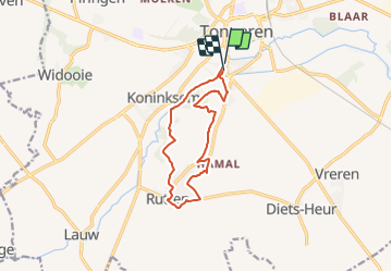
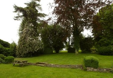
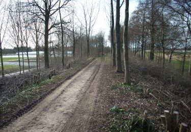
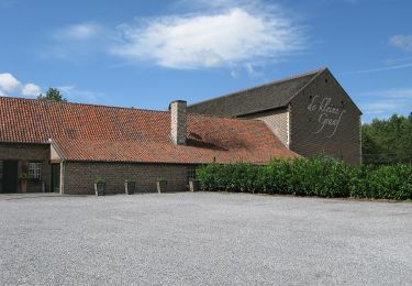
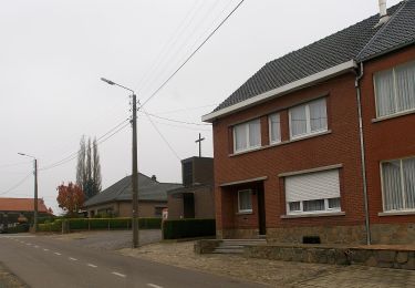
Percorso A piedi di 10,1 km da scoprire a Vlaanderen, Limburg, Tongeren. Questo percorso è proposto da SityTrail - itinéraires balisés pédestres.
Descrizione
Trail created by Stad Tongeren.
Localizzazione
Paese:
Belgium
Regione :
Vlaanderen
Dipartimento/Provincia :
Limburg
Comune :
Tongeren
Località :
Tongeren
Partenza:(Dec)
Partenza:(UTM)
673443 ; 5627574 (31U) N.
Commenti
Percorsi nelle vicinanze
![Percorso Marcia Tongeren - 2021-10-23_19h52m36_1502 - Photo](https://media.geolcdn.com/t/375/260/d71d4a1e-f4de-4acf-94ea-656bc11edf66.jpg&format=jpg&maxdim=2)
![Marcia Marcia](https://static1.geolcdn.com/sitytour/trail-icons/101.png)
2021-10-23_19h52m36_1502
Marcia
Facile
(2)
Tongeren,
Vlaanderen,
Limburg,
Belgium
![](/images/other/stat-length.png)
12,6 km | 14,3 km-effort
3h 15min
![](https://static1.geolcdn.com/siteimages/upload/files/16400158638029165_repeat_loop_refresh_sync_direction_icon.png)
Sì
![Percorso A piedi Kortessem - pittoreske-kerkdorpen-startplaats-zammelen-oranje - Photo](https://media.geolcdn.com/t/375/260/fc718cb3-95ec-485f-a77f-edadc1be0696.jpeg&format=jpg&maxdim=2)
![A piedi A piedi](https://static1.geolcdn.com/sitytour/trail-icons/100.png)
pittoreske-kerkdorpen-startplaats-zammelen-oranje
A piedi
Facile
(1)
Kortessem,
Vlaanderen,
Limburg,
Belgium
![](/images/other/stat-length.png)
6,4 km | 7,3 km-effort
1h 39min
![](https://static1.geolcdn.com/siteimages/upload/files/16400158638029165_repeat_loop_refresh_sync_direction_icon.png)
Sì
![Percorso Marcia Tongeren - Tongres - Photo](https://media.geolcdn.com/t/375/260/e6784500-8094-4a7e-b3d4-8606bc9495c2.jpg&format=jpg&maxdim=2)
![Marcia Marcia](https://static1.geolcdn.com/sitytour/trail-icons/101.png)
![Percorso Marcia Tongeren - Promenade de la beauté cachée à Lauw - Photo](https://media.geolcdn.com/t/375/260/e09aa99f-84cb-4b46-8a0c-50d633d5a7ef.jpg&format=jpg&maxdim=2)
![Marcia Marcia](https://static1.geolcdn.com/sitytour/trail-icons/101.png)
Promenade de la beauté cachée à Lauw
Marcia
Medio
(5)
Tongeren,
Vlaanderen,
Limburg,
Belgium
![](/images/other/stat-length.png)
5,8 km | 6,5 km-effort
1h 27min
![](https://static1.geolcdn.com/siteimages/upload/files/16400158638029165_repeat_loop_refresh_sync_direction_icon.png)
Sì
![Percorso A piedi Tongeren - Rond de bronnen van de Mombeek - Photo](https://media.geolcdn.com/t/375/260/13e3acb7-2467-4a11-bfa7-f876dab6b0eb.jpeg&format=jpg&maxdim=2)
![A piedi A piedi](https://static1.geolcdn.com/sitytour/trail-icons/100.png)
Rond de bronnen van de Mombeek
A piedi
Facile
Tongeren,
Vlaanderen,
Limburg,
Belgium
![](/images/other/stat-length.png)
8 km | 8,9 km-effort
2h 1min
![](https://static1.geolcdn.com/siteimages/upload/files/16400158638029165_repeat_loop_refresh_sync_direction_icon.png)
Sì
![Percorso A piedi Tongeren - Widooie - Photo](https://media.geolcdn.com/t/375/260/1460d0c9-37d5-4e75-86eb-ce79ff244b22.jpeg&format=jpg&maxdim=2)
![A piedi A piedi](https://static1.geolcdn.com/sitytour/trail-icons/100.png)
![Percorso A piedi Tongeren - Molsterbos - Photo](https://media.geolcdn.com/t/375/260/3c500f4e-d8ab-4470-8eed-45fbfc940cd4.jpeg&format=jpg&maxdim=2)
![A piedi A piedi](https://static1.geolcdn.com/sitytour/trail-icons/100.png)
![Percorso A piedi Tongeren - 's Herenelderen - Photo](https://media.geolcdn.com/t/375/260/5ab8c445-6053-4792-93e2-8364cf86f17e.jpeg&format=jpg&maxdim=2)
![A piedi A piedi](https://static1.geolcdn.com/sitytour/trail-icons/100.png)
's Herenelderen
A piedi
Facile
Tongeren,
Vlaanderen,
Limburg,
Belgium
![](/images/other/stat-length.png)
6,5 km | 7,3 km-effort
1h 39min
![](https://static1.geolcdn.com/siteimages/upload/files/16400158638029165_repeat_loop_refresh_sync_direction_icon.png)
Sì
![Percorso A piedi Tongeren - Rutten - Photo](https://media.geolcdn.com/t/375/260/128745d3-c995-43bd-9aeb-f310fcbdef14.jpeg&format=jpg&maxdim=2)
![A piedi A piedi](https://static1.geolcdn.com/sitytour/trail-icons/100.png)
La der] Ça devient une tradition de terminer l'année par une dernière randonnée à Tongres avant un pré-réveillon sur la Grand-Place, près d'Ambiorix, au pied de la Basilique Notre-Dame.