![](/images/other/stat-length.png)
![Percorso Mountainbike Mont-de-l'Enclus - Lanscape around Mont de l’Enclus - Photo](https://media.geolcdn.com/t/1900/400/ext.pjpeg?maxdim=2&url=https%3A%2F%2Fpivotmedia.tourismewallonie.be%2FANX-02-020D-00DS%2FANX-02-020D-00DS.jpg)
Lanscape around Mont de l’Enclus
Commissariat général au Tourisme
Randonnées du CGT GUIDE+
![Lunghezza](/images/other/stat-length.png)
Lunghezza
21 km
![Altitudine massima](https://static1.geolcdn.com/siteimages/upload/files/1508320355ic_sort_altitude_max_24dp.png)
Altitudine massima
154 m
![Dislivello positivo](https://static1.geolcdn.com/siteimages/upload/files/1508320355ic_sort_den_pos_24dp.png)
Dislivello positivo
375 m
![Km-Effort](/images/other/stat-length.png)
Km-Effort
26 km
![Altitudine minima](https://static1.geolcdn.com/siteimages/upload/files/1508320355ic_sort_altitude_min_24dp.png)
Altitudine minima
12 m
![Dislivello negativo](https://static1.geolcdn.com/siteimages/upload/files/1508320355ic_sort_den_neg_24dp.png)
Dislivello negativo
375 m
![Boucle](https://static1.geolcdn.com/siteimages/upload/files/16400158638029165_repeat_loop_refresh_sync_direction_icon.png)
Boucle
Sì
Data di creazione :
2022-02-08 11:37:11.032
Ultima modifica :
2022-02-21 10:18:39.161
![Mountainbike](https://static1.geolcdn.com/sitytour/trail-icons/202.png)
1h48
Difficoltà : Medio
![Scannerizza questo codice QR per aprire il percorso nell'applicazione SityTrail](https://capi.geolives.com/qq0zvz2zws4bq2lad0pu/sitytour/trails/3081447/qr.png?size=200)
Applicazione GPS da escursionismo GRATUITA
Chi siamo
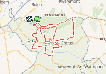
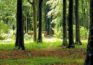
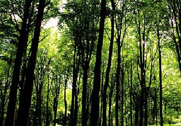
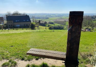
Percorso Mountainbike di 21 km da scoprire a Wallonie, Hainaut, Mont-de-l'Enclus. Questo percorso è proposto da Commissariat général au Tourisme.
Descrizione
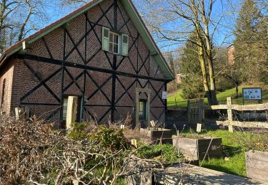
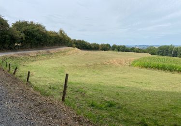
Trail created by Wallonie Picarde (Antenne Tournai) .
This circuit is only available in French and in Dutch. Please feel free to download the FR map card.
Localizzazione
Paese:
Belgium
Regione :
Wallonie
Dipartimento/Provincia :
Hainaut
Comune :
Mont-de-l'Enclus
Località :
Orroir
Partenza:(Dec)
Partenza:(UTM)
534024 ; 5623061 (31U) N.
Commenti
Percorsi nelle vicinanze
![Percorso Cavallo Mont-de-l'Enclus - Loop of Mont de l’Enclus - Photo](https://media.geolcdn.com/t/375/260/ext.jpg?maxdim=2&url=https%3A%2F%2Fpivotmedia.tourismewallonie.be%2FANX-02-000EIL%2FANX-02-000EIL.jpg)
![Cavallo Cavallo](https://static1.geolcdn.com/sitytour/trail-icons/300.png)
Loop of Mont de l’Enclus
Cavallo
Molto facile
(1)
Mont-de-l'Enclus,
Wallonie,
Hainaut,
Belgium
![](/images/other/stat-length.png)
21 km | 24 km-effort
Sconosciuto
![](https://static1.geolcdn.com/siteimages/upload/files/16400158638029165_repeat_loop_refresh_sync_direction_icon.png)
Sì
![Percorso A piedi Mont-de-l'Enclus - Entre Flandre et Wallonie - Photo](https://media.geolcdn.com/t/375/260/ext.jpg?maxdim=2&url=https%3A%2F%2Fpivotmedia.tourismewallonie.be%2FANX-02-000ENY%2FANX-02-000ENY.jpg)
![A piedi A piedi](https://static1.geolcdn.com/sitytour/trail-icons/100.png)
Entre Flandre et Wallonie
A piedi
Medio
(2)
Mont-de-l'Enclus,
Wallonie,
Hainaut,
Belgium
![](/images/other/stat-length.png)
18,6 km | 22 km-effort
5h 4min
![](https://static1.geolcdn.com/siteimages/upload/files/16400158638029165_repeat_loop_refresh_sync_direction_icon.png)
Sì
![Percorso A piedi Mont-de-l'Enclus - Entre Orroir et Ruien - Photo](https://media.geolcdn.com/t/375/260/ext.jpg?maxdim=2&url=https%3A%2F%2Fpivotmedia.tourismewallonie.be%2FANX-02-000EUH%2FANX-02-000EUH.jpg)
![A piedi A piedi](https://static1.geolcdn.com/sitytour/trail-icons/100.png)
Entre Orroir et Ruien
A piedi
Facile
Mont-de-l'Enclus,
Wallonie,
Hainaut,
Belgium
![](/images/other/stat-length.png)
9 km | 12,5 km-effort
2h 51min
![](https://static1.geolcdn.com/siteimages/upload/files/16400158638029165_repeat_loop_refresh_sync_direction_icon.png)
No
![Percorso A piedi Mont-de-l'Enclus - The legend of Liedericq - Photo](https://media.geolcdn.com/t/375/260/ext.jpg?maxdim=2&url=https%3A%2F%2Fpivotmedia.tourismewallonie.be%2FANX-02-03XZ-008D%2FANX-02-03XZ-008D.jpg)
![A piedi A piedi](https://static1.geolcdn.com/sitytour/trail-icons/100.png)
The legend of Liedericq
A piedi
Facile
Mont-de-l'Enclus,
Wallonie,
Hainaut,
Belgium
![](/images/other/stat-length.png)
5,6 km | 7,1 km-effort
1h 36min
![](https://static1.geolcdn.com/siteimages/upload/files/16400158638029165_repeat_loop_refresh_sync_direction_icon.png)
Sì
![Percorso A piedi Mont-de-l'Enclus - The Mont de l’Enclus Landscape Walking Tour - Photo](https://media.geolcdn.com/t/375/260/ext.jpg?maxdim=2&url=https%3A%2F%2Fpivotmedia.tourismewallonie.be%2FANX-02-000ENT%2FANX-02-000ENT.jpg)
![A piedi A piedi](https://static1.geolcdn.com/sitytour/trail-icons/100.png)
The Mont de l’Enclus Landscape Walking Tour
A piedi
Facile
(1)
Mont-de-l'Enclus,
Wallonie,
Hainaut,
Belgium
![](/images/other/stat-length.png)
6,1 km | 8,1 km-effort
1h 50min
![](https://static1.geolcdn.com/siteimages/upload/files/16400158638029165_repeat_loop_refresh_sync_direction_icon.png)
Sì
![Percorso A piedi Kluisbergen - Entre Kwaremont et Amougies - Photo](https://media.geolcdn.com/t/375/260/ext.jpg?maxdim=2&url=https%3A%2F%2Fpivotmedia.tourismewallonie.be%2FANX-02-000EUL%2FANX-02-000EUL.jpg)
![A piedi A piedi](https://static1.geolcdn.com/sitytour/trail-icons/100.png)
Entre Kwaremont et Amougies
A piedi
Facile
Kluisbergen,
Vlaanderen,
Provincia delle Fiandre Orientali,
Belgium
![](/images/other/stat-length.png)
9,1 km | 12 km-effort
2h 43min
![](https://static1.geolcdn.com/siteimages/upload/files/16400158638029165_repeat_loop_refresh_sync_direction_icon.png)
Sì
![Percorso Marcia Kluisbergen - Tour du Mont de l’Eclus 15 km - Photo](https://media.geolcdn.com/t/375/260/4ab646b3-5cdc-4d4a-b68d-deeae8dc0c3b.jpg&format=jpg&maxdim=2)
![Marcia Marcia](https://static1.geolcdn.com/sitytour/trail-icons/101.png)
Tour du Mont de l’Eclus 15 km
Marcia
Facile
Kluisbergen,
Vlaanderen,
Provincia delle Fiandre Orientali,
Belgium
![](/images/other/stat-length.png)
14,9 km | 18,3 km-effort
4h 14min
![](https://static1.geolcdn.com/siteimages/upload/files/16400158638029165_repeat_loop_refresh_sync_direction_icon.png)
Sì
![Percorso Marcia Kluisbergen - Kluisbergen Enclus 12 km - Photo](https://media.geolcdn.com/t/375/260/0141772c-40ce-4f4d-aca2-72d8d316d837.jpg&format=jpg&maxdim=2)
![Marcia Marcia](https://static1.geolcdn.com/sitytour/trail-icons/101.png)
Kluisbergen Enclus 12 km
Marcia
Molto facile
Kluisbergen,
Vlaanderen,
Provincia delle Fiandre Orientali,
Belgium
![](/images/other/stat-length.png)
11,9 km | 15,3 km-effort
3h 57min
![](https://static1.geolcdn.com/siteimages/upload/files/16400158638029165_repeat_loop_refresh_sync_direction_icon.png)
Sì
![Percorso Marcia Mont-de-l'Enclus - Amougies 16 km - Photo](https://media.geolcdn.com/t/375/260/96a7ba93-acbe-40e9-93bc-ba80e8065cb4.jpg&format=jpg&maxdim=2)
![Marcia Marcia](https://static1.geolcdn.com/sitytour/trail-icons/101.png)
Amougies 16 km
Marcia
Facile
Mont-de-l'Enclus,
Wallonie,
Hainaut,
Belgium
![](/images/other/stat-length.png)
16 km | 19,5 km-effort
3h 58min
![](https://static1.geolcdn.com/siteimages/upload/files/16400158638029165_repeat_loop_refresh_sync_direction_icon.png)
Sì