Percorso A piedi Viroinval - Centre de l'Europe des 15 - Photo

Centre de l'Europe des 15

Randonnées du CGT GUIDE+

© OpenStreetMap contributors
Lunghezza
Lunghezza
14,6 km
Altitudine massima
Altitudine massima
391 m
Dislivello positivo
Dislivello positivo
414 m
Km-Effort
Km-Effort  
20 km
Altitudine minima
Altitudine minima
182 m
Dislivello negativo
Dislivello negativo
414 m
Boucle
Boucle
Sì
Data di creazione :
2022-02-08 11:34:23.779
Ultima modifica :
2022-02-21 10:15:41.711

(0 Recensione)

A piedi
A piedi
4h34
Difficoltà : Medio

Scannerizza questo codice QR per aprire il percorso nell'applicazione SityTrail

Applicazione GPS da escursionismo GRATUITA

Logo SityTrail SityTrail

IGN / Istituti geografici

Scarica SityTrail dall'App Store Scarica SityTrail da Google Play

Logo SityTrail SityTrail World

Il mondo è tuo

Scarica SityTrail dall'App Store Scarica SityTrail da Google Play Scarica SityTrail da Huawei AppGallery

Chi siamo

Percorso A piedi di 14,6 km da scoprire a Wallonie, Namur, Viroinval. Questo percorso è proposto da Commissariat général au Tourisme.

Descrizione

Trail created by Pays des Lacs.


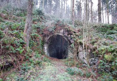
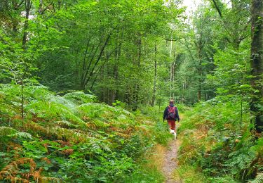
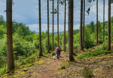
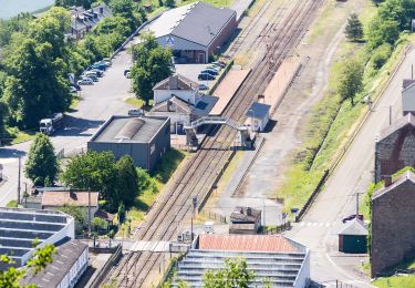
On 7 June 1995, the geographical centre of the EU 15 was in Viroinval. It is located in the place named ‘du Trou du Diable’ (the Devil’s hole) which is an old slate quarry where a glass cathedral was built. A choice of two hikes will take you there. A long 15-km route or the variant that reduces the trail to 9 km. The circuit goes through the woods to a boundary ridge that dominates the French Meuse with its panorama over the river and the towns of Fumay and Haybes. Old slate quarries, which was a flourishing industry until the dawn of the First World War, lie along the route. At the place named ‘Risque-Tout’ (Risk-it-All), you can reduce the hike to 9 km by taking the variant proposed to the right (green cross).


Profilo altimetrico

Foto

Localizzazione

Paese:
Belgium
Regione :
Wallonie
Dipartimento/Provincia :
Namur
Comune :
Viroinval
Località :
Unknown
Partenza:(UTM)
617388 ; 5542556 (31U) N.

Percorsi nelle vicinanze

Percorso Marcia Viroinval - Le Trou du Diable à Oignies en Thiérache - Photo
Marcia
GUIDE
Desrumaux

Marcia

Molto facile
(4)
Viroinval, Wallonie, Namur, Belgium
6,4 km | 9,1 km-effort
2h 32min
Sì
Percorso Marcia Viroinval - RF-Na-12 Oignies - Grande-boucle - Photo
Marcia
PRO

Marcia

Medio
(1)
Viroinval, Wallonie, Namur, Belgium
11 km | 14,2 km-effort
3h 2min
Sì
Percorso Marcia Viroinval - Balade à Le Mesnil - Viroinval - Photo
Marcia
GUIDE
Desrumaux

Marcia

Facile
Viroinval, Wallonie, Namur, Belgium
3,6 km | 4,8 km-effort
2h 16min
Sì
Percorso Marcia Viroinval - 2024-03-19_14h55m08_OTH-A0-008T-2Z7M - Photo
Marcia
GUIDE
Desrumaux

Marcia

Medio
Viroinval, Wallonie, Namur, Belgium
8,4 km | 11 km-effort
2h 29min
Sì
Percorso Marcia Viroinval - Balade à Regniessart - Viroinval - Photo
Marcia
GUIDE
Desrumaux

Marcia

Medio
Viroinval, Wallonie, Namur, Belgium
8,4 km | 10,6 km-effort
2h 24min
Sì
Percorso Marcia Viroinval - Balade à Oignies-en-Thiérache - Le Ry d'Alise - Photo
Marcia
GUIDE
Desrumaux

Marcia

Medio
Viroinval, Wallonie, Namur, Belgium
8,6 km | 11,8 km-effort
2h 40min
Sì
Percorso A piedi Fumay - Les Ardoisières de Fumay - Photo
A piedi
GUIDE+

A piedi

Facile
Fumay, Grande Est, Ardennes, France
7,8 km | 10,7 km-effort
2h 25min
No
Percorso A piedi Viroinval - Les Charmes - Photo
A piedi
GUIDE+

A piedi

Facile
Viroinval, Wallonie, Namur, Belgium
6,1 km | 8,5 km-effort
1h 56min
Sì
Percorso A piedi Viroinval - Les Crêtes - Robertsart - Photo
A piedi
GUIDE+

A piedi

Facile
Viroinval, Wallonie, Namur, Belgium
9,9 km | 13,6 km-effort
3h 5min
Sì


Chiudi
I miei abbonamenti