![](/images/other/stat-length.png)
![Percorso A piedi Walcourt - Au fil de Pry - Photo](https://media.geolcdn.com/t/1900/400/ext.pjpeg?maxdim=2&url=https%3A%2F%2Fpivotmedia.tourismewallonie.be%2FOTH-A0-004G-1A6F%2FOTH-A0-004G-1A6F.jpg)
Au fil de Pry
Commissariat général au Tourisme
Randonnées du CGT GUIDE+
![Lunghezza](/images/other/stat-length.png)
![Altitudine massima](https://static1.geolcdn.com/siteimages/upload/files/1508320355ic_sort_altitude_max_24dp.png)
![Dislivello positivo](https://static1.geolcdn.com/siteimages/upload/files/1508320355ic_sort_den_pos_24dp.png)
![Km-Effort](/images/other/stat-length.png)
![Altitudine minima](https://static1.geolcdn.com/siteimages/upload/files/1508320355ic_sort_altitude_min_24dp.png)
![Dislivello negativo](https://static1.geolcdn.com/siteimages/upload/files/1508320355ic_sort_den_neg_24dp.png)
![Boucle](https://static1.geolcdn.com/siteimages/upload/files/16400158638029165_repeat_loop_refresh_sync_direction_icon.png)
![A piedi](https://static1.geolcdn.com/sitytour/trail-icons/100.png)
1h35
Difficoltà : Facile
![Scannerizza questo codice QR per aprire il percorso nell'applicazione SityTrail](https://capi.geolives.com/qq0zvz2zws4bq2lad0pu/sitytour/trails/3080824/qr.png?size=200)
Applicazione GPS da escursionismo GRATUITA
Chi siamo
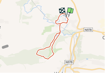
Percorso A piedi di 5,7 km da scoprire a Wallonie, Namur, Walcourt. Questo percorso è proposto da Commissariat général au Tourisme.
Descrizione
Trail created by Pays des Lacs.
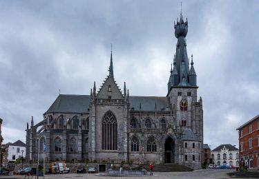
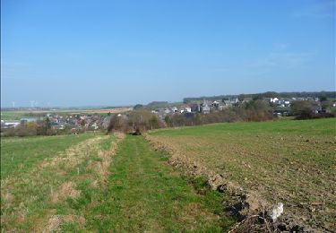
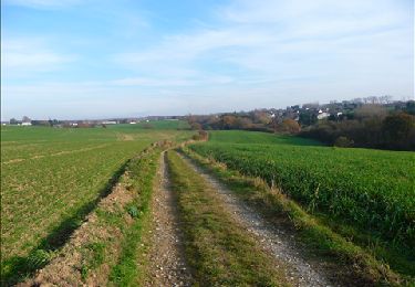
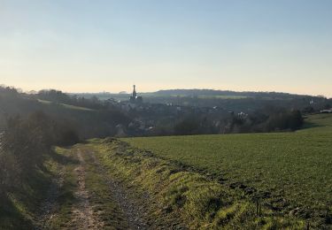
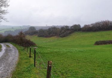
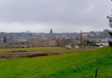
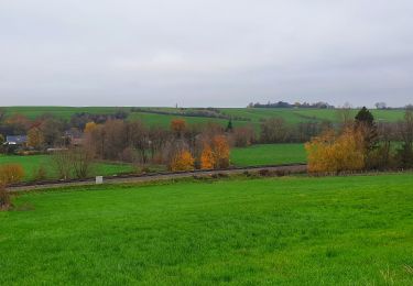
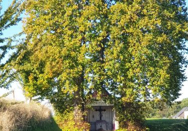
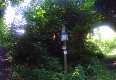
This walk in the village of Pry travels through narrow streets and woods, passing by a chapel and special sights, such as the pump in Place du Mayeur. At the railway, 19th-century lime kilns stand before the quarry, carved into a limestone massif. Upon leaving Pry, the route continues through the Cambier woods. After exiting the woods, you can enjoy an exceptional view of Walcourt and its basilica from the heights. In the Taille Chandelle woods, you can pass through a nature reserve, which is dedicated to the conservation of several species of birds and insects, such as butterflies. You will return to the village passing by ‘Al Rotche’, a rocky promontory which was the site of a Belgo-Roman sanctuary.
Localizzazione
Commenti
Percorsi nelle vicinanze
![Percorso Marcia Walcourt - GG-Na-17_Walcourt - Philippeville - Photo](https://media.geolcdn.com/t/375/260/0ead20f8-4d85-41da-a61f-64e7e946f31c.jpg&format=jpg&maxdim=2)
![Marcia Marcia](https://static1.geolcdn.com/sitytour/trail-icons/101.png)
Marcia
![](/images/other/stat-length.png)
![](https://static1.geolcdn.com/siteimages/upload/files/16400158638029165_repeat_loop_refresh_sync_direction_icon.png)
![Percorso Marcia Walcourt - Promenade à Chastrès - Photo](https://media.geolcdn.com/t/375/260/ext.jpg?maxdim=2&url=https%3A%2F%2Fservices.sitytrail.com%2FGeolivesWS%2FDownloadMedia.ashx%3FTrailID%3D117187%26Media%3D3da6a3b3-b81a-4fdc-a255-5d93ffb1cd0b.JPG)
![Marcia Marcia](https://static1.geolcdn.com/sitytour/trail-icons/101.png)
Marcia
![](/images/other/stat-length.png)
![](https://static1.geolcdn.com/siteimages/upload/files/16400158638029165_repeat_loop_refresh_sync_direction_icon.png)
![Percorso Marcia Walcourt - De Laneffe à Fraire par bois et campagnes - Photo](https://media.geolcdn.com/t/375/260/ext.jpg?maxdim=2&url=https%3A%2F%2Fservices.sitytrail.com%2FGeolivesWS%2FDownloadMedia.ashx%3FTrailID%3D95170%26Media%3Ddbcce443-4e55-417a-979c-b5ffbc4c1513.JPG)
![Marcia Marcia](https://static1.geolcdn.com/sitytour/trail-icons/101.png)
Marcia
![](/images/other/stat-length.png)
![](https://static1.geolcdn.com/siteimages/upload/files/16400158638029165_repeat_loop_refresh_sync_direction_icon.png)
![Percorso Marcia Walcourt - Randonnée autour de Walcourt - Photo](https://media.geolcdn.com/t/375/260/a37238d0-f00c-4fff-8a56-6d6b6e8a9220.jpg&format=jpg&maxdim=2)
![Marcia Marcia](https://static1.geolcdn.com/sitytour/trail-icons/101.png)
Marcia
![](/images/other/stat-length.png)
![](https://static1.geolcdn.com/siteimages/upload/files/16400158638029165_repeat_loop_refresh_sync_direction_icon.png)
![Percorso Marcia Walcourt - Balade à Walcourt - Photo](https://media.geolcdn.com/t/375/260/cc15b3fa-e158-4d51-b096-71bef2cb45f1.jpeg&format=jpg&maxdim=2)
![Marcia Marcia](https://static1.geolcdn.com/sitytour/trail-icons/101.png)
Marcia
![](/images/other/stat-length.png)
![](https://static1.geolcdn.com/siteimages/upload/files/16400158638029165_repeat_loop_refresh_sync_direction_icon.png)
![Percorso Marcia Walcourt - Balade à Yves-Gomezée - Walcourt - Photo](https://media.geolcdn.com/t/375/260/ce6fe3bc-56a4-4a73-8c7c-fe084ffe21fc.jpg&format=jpg&maxdim=2)
![Marcia Marcia](https://static1.geolcdn.com/sitytour/trail-icons/101.png)
Marcia
![](/images/other/stat-length.png)
![](https://static1.geolcdn.com/siteimages/upload/files/16400158638029165_repeat_loop_refresh_sync_direction_icon.png)
![Percorso Marcia Ham-sur-Heure-Nalinnes - Balade à Cours-sur-Heure - Photo](https://media.geolcdn.com/t/375/260/5caf1e11-e520-4f79-b22c-843995f1430c.jpeg&format=jpg&maxdim=2)
![Marcia Marcia](https://static1.geolcdn.com/sitytour/trail-icons/101.png)
Marcia
![](/images/other/stat-length.png)
![](https://static1.geolcdn.com/siteimages/upload/files/16400158638029165_repeat_loop_refresh_sync_direction_icon.png)
![Percorso Marcia Walcourt - Balade à Berzée - Walcourt - Photo](https://media.geolcdn.com/t/375/260/416ceed2-3b5b-40c8-8a28-534b846e663c.jpeg&format=jpg&maxdim=2)
![Marcia Marcia](https://static1.geolcdn.com/sitytour/trail-icons/101.png)
Marcia
![](/images/other/stat-length.png)
![](https://static1.geolcdn.com/siteimages/upload/files/16400158638029165_repeat_loop_refresh_sync_direction_icon.png)
![Mountainbike Mountainbike](https://static1.geolcdn.com/sitytour/trail-icons/202.png)
Mountainbike
![](/images/other/stat-length.png)
![](https://static1.geolcdn.com/siteimages/upload/files/16400158638029165_repeat_loop_refresh_sync_direction_icon.png)