![](/images/other/stat-length.png)
![Percorso Marcia Marche-en-Famenne - Balade calestienne avec ancienne carrière St Rémy - Photo](https://media.geolcdn.com/t/1900/400/ext.pjpeg?maxdim=2&url=https%3A%2F%2Fstatic1.geolcdn.com%2Fsiteimages%2Fupload%2Ffiles%2F1553511878bg_sport_marche.png)
Balade calestienne avec ancienne carrière St Rémy
agneslaloux
Utente
![Lunghezza](/images/other/stat-length.png)
Lunghezza
7,2 km
![Altitudine massima](https://static1.geolcdn.com/siteimages/upload/files/1508320355ic_sort_altitude_max_24dp.png)
Altitudine massima
311 m
![Dislivello positivo](https://static1.geolcdn.com/siteimages/upload/files/1508320355ic_sort_den_pos_24dp.png)
Dislivello positivo
157 m
![Km-Effort](/images/other/stat-length.png)
Km-Effort
9,3 km
![Altitudine minima](https://static1.geolcdn.com/siteimages/upload/files/1508320355ic_sort_altitude_min_24dp.png)
Altitudine minima
205 m
![Dislivello negativo](https://static1.geolcdn.com/siteimages/upload/files/1508320355ic_sort_den_neg_24dp.png)
Dislivello negativo
158 m
![Boucle](https://static1.geolcdn.com/siteimages/upload/files/16400158638029165_repeat_loop_refresh_sync_direction_icon.png)
Boucle
Sì
Data di creazione :
2021-02-11 19:24:37.668
Ultima modifica :
2021-02-11 19:34:56.116
![Marcia](https://static1.geolcdn.com/sitytour/trail-icons/101.png)
2h06
Difficoltà : Medio
![Scannerizza questo codice QR per aprire il percorso nell'applicazione SityTrail](https://capi.geolives.com/qq0zvz2zws4bq2lad0pu/sitytour/trails/2667933/qr.png?size=200)
Applicazione GPS da escursionismo GRATUITA
Chi siamo
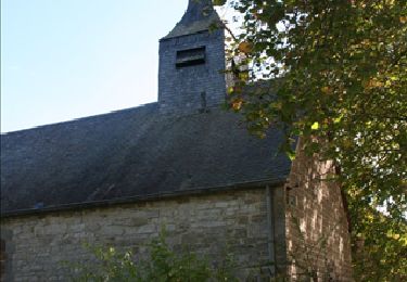
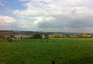
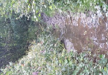
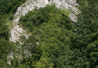
Percorso Marcia di 7,2 km da scoprire a Wallonie, Luxembourg, Marche-en-Famenne. Questo percorso è proposto da agneslaloux.
Descrizione
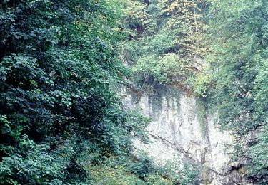
Départ Humain vers la station radioastronomie, Havrenne retour par le chemin St Rémy avec visite de l'ancienne carrière de marbre. Retour vers Humain
Localizzazione
Paese:
Belgium
Regione :
Wallonie
Dipartimento/Provincia :
Luxembourg
Comune :
Marche-en-Famenne
Località :
Humain
Partenza:(Dec)
Partenza:(UTM)
660985 ; 5563823 (31U) N.
Commenti
Percorsi nelle vicinanze
![Percorso Marcia Rochefort - Havrenne & de Saint-Remy Trappist Abbey - Photo](https://media.geolcdn.com/t/375/260/ext.jpg?maxdim=2&url=https%3A%2F%2Fservices.sitytrail.com%2FGeolivesWS%2FDownloadMedia.ashx%3FTrailID%3D215623%26Media%3Db529a95c-404d-4caa-9c09-6087624067bf.tif)
![Marcia Marcia](https://static1.geolcdn.com/sitytour/trail-icons/101.png)
Havrenne & de Saint-Remy Trappist Abbey
Marcia
Facile
(14)
Rochefort,
Wallonie,
Namur,
Belgium
![](/images/other/stat-length.png)
6 km | 7,1 km-effort
2h 0min
![](https://static1.geolcdn.com/siteimages/upload/files/16400158638029165_repeat_loop_refresh_sync_direction_icon.png)
Sì
![Percorso Motore Rochefort - Car tour - Heritage : churches, chapels and abbeys - Rochefort - Photo](https://media.geolcdn.com/t/375/260/ext.jpg?maxdim=2&url=https%3A%2F%2Fservices.sitytrail.com%2FGeolivesWS%2FDownloadMedia.ashx%3FTrailID%3D153103%26Media%3D05603f1b-9f7c-481f-bc84-6cc819555dbb.jpg)
![Motore Motore](https://static1.geolcdn.com/sitytour/trail-icons/400.png)
Car tour - Heritage : churches, chapels and abbeys - Rochefort
Motore
Facile
(5)
Rochefort,
Wallonie,
Namur,
Belgium
![](/images/other/stat-length.png)
65 km | 78 km-effort
2h 40min
![](https://static1.geolcdn.com/siteimages/upload/files/16400158638029165_repeat_loop_refresh_sync_direction_icon.png)
Sì
![Marcia Marcia](https://static1.geolcdn.com/sitytour/trail-icons/101.png)
GG2-Lu-34_Jemelle-Marche-en-Famenne (2021-11-04)
Marcia
Medio
(1)
Rochefort,
Wallonie,
Namur,
Belgium
![](/images/other/stat-length.png)
19,2 km | 24 km-effort
5h 32min
![](https://static1.geolcdn.com/siteimages/upload/files/16400158638029165_repeat_loop_refresh_sync_direction_icon.png)
No
![Percorso Motore Rochefort - Car tour : History, ruins and castles - Rochefort - Photo](https://media.geolcdn.com/t/375/260/ext.jpg?maxdim=2&url=https%3A%2F%2Fservices.sitytrail.com%2FGeolivesWS%2FDownloadMedia.ashx%3FTrailID%3D151964%26Media%3D42d24ade-2ff4-4533-8bb8-6f4ece52f552.jpg)
![Motore Motore](https://static1.geolcdn.com/sitytour/trail-icons/400.png)
Car tour : History, ruins and castles - Rochefort
Motore
Facile
(2)
Rochefort,
Wallonie,
Namur,
Belgium
![](/images/other/stat-length.png)
49 km | 60 km-effort
2h 20min
![](https://static1.geolcdn.com/siteimages/upload/files/16400158638029165_repeat_loop_refresh_sync_direction_icon.png)
Sì
![Percorso Marcia Marche-en-Famenne - Aye chapelle + Gerny - Photo](https://media.geolcdn.com/t/375/260/ext.jpg?maxdim=2&url=https%3A%2F%2Fservices.sitytrail.com%2FGeolivesWS%2FDownloadMedia.ashx%3FTrailID%3D122579%26Media%3D20120420144516.jpg)
![Marcia Marcia](https://static1.geolcdn.com/sitytour/trail-icons/101.png)
Aye chapelle + Gerny
Marcia
Facile
(3)
Marche-en-Famenne,
Wallonie,
Luxembourg,
Belgium
![](/images/other/stat-length.png)
6,6 km | 8,1 km-effort
1h 33min
![](https://static1.geolcdn.com/siteimages/upload/files/16400158638029165_repeat_loop_refresh_sync_direction_icon.png)
No
![Percorso Marcia Marche-en-Famenne - Humain -Serinchamps - Photo](https://media.geolcdn.com/t/375/260/ext.jpg?maxdim=2&url=https%3A%2F%2Fservices.sitytrail.com%2FGeolivesWS%2FDownloadMedia.ashx%3FTrailID%3D611526%26Media%3Dfix__20160809153034.jpg)
![Marcia Marcia](https://static1.geolcdn.com/sitytour/trail-icons/101.png)
Humain -Serinchamps
Marcia
Molto facile
(3)
Marche-en-Famenne,
Wallonie,
Luxembourg,
Belgium
![](/images/other/stat-length.png)
9,9 km | 12,3 km-effort
1h 47min
![](https://static1.geolcdn.com/siteimages/upload/files/16400158638029165_repeat_loop_refresh_sync_direction_icon.png)
Sì
![Percorso Bicicletta Rochefort - Nature - Cycle tour discovering Rochefort and the villages of Eprave, Lessive and Villers - Photo](https://media.geolcdn.com/t/375/260/ext.jpg?maxdim=2&url=https%3A%2F%2Fservices.sitytrail.com%2FGeolivesWS%2FDownloadMedia.ashx%3FTrailID%3D199291%26Media%3D15dd4efb-10a0-4ba4-87c1-30a3a9be99bf.JPG)
![Bicicletta Bicicletta](https://static1.geolcdn.com/sitytour/trail-icons/200.png)
Nature - Cycle tour discovering Rochefort and the villages of Eprave, Lessive...
Bicicletta
Facile
(3)
Rochefort,
Wallonie,
Namur,
Belgium
![](/images/other/stat-length.png)
23 km | 26 km-effort
2h 0min
![](https://static1.geolcdn.com/siteimages/upload/files/16400158638029165_repeat_loop_refresh_sync_direction_icon.png)
Sì
![Percorso Motore Rochefort - Car - Nature - Discovering the stones - Rochefort - Photo](https://media.geolcdn.com/t/375/260/ext.jpg?maxdim=2&url=https%3A%2F%2Fservices.sitytrail.com%2FGeolivesWS%2FDownloadMedia.ashx%3FTrailID%3D151960%26Media%3D5c8b813d-8d98-4afc-a42b-ee920e93b389.jpg)
![Motore Motore](https://static1.geolcdn.com/sitytour/trail-icons/400.png)
Car - Nature - Discovering the stones - Rochefort
Motore
Facile
(3)
Rochefort,
Wallonie,
Namur,
Belgium
![](/images/other/stat-length.png)
52 km | 64 km-effort
2h 0min
![](https://static1.geolcdn.com/siteimages/upload/files/16400158638029165_repeat_loop_refresh_sync_direction_icon.png)
Sì
![Percorso Equitazione Rochefort - SityTrail - Rochefort - Photo](https://media.geolcdn.com/t/375/260/ext.jpg?maxdim=2&url=https%3A%2F%2Fstatic1.geolcdn.com%2Fsiteimages%2Fupload%2Ffiles%2F1524743154cheval.jpg)
![Equitazione Equitazione](https://static1.geolcdn.com/sitytour/trail-icons/301.png)
SityTrail - Rochefort
Equitazione
Facile
(1)
Rochefort,
Wallonie,
Namur,
Belgium
![](/images/other/stat-length.png)
11,7 km | 14,6 km-effort
1h 54min
![](https://static1.geolcdn.com/siteimages/upload/files/16400158638029165_repeat_loop_refresh_sync_direction_icon.png)
Sì