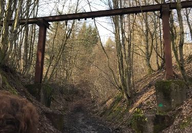
28 km | 37 km-effort
vtt moyenmoutier 14.04.19
vathi54
Utente
Lunghezza
30 km
Altitudine massima
743 m
Dislivello positivo
907 m
Km-Effort
42 km
Altitudine minima
314 m
Dislivello negativo
897 m
Boucle
No
Data di creazione :
2019-04-14 11:42:22.301
Ultima modifica :
2019-04-14 15:41:24.004
3h58
Difficoltà : Difficile
Applicazione GPS da escursionismo GRATUITA
Chi siamo
Percorso Mountainbike di 30 km da scoprire a Grande Est, Vosges, Moyenmoutier. Questo percorso è proposto da vathi54.
Localizzazione
Paese:
France
Regione :
Grande Est
Dipartimento/Provincia :
Vosges
Comune :
Moyenmoutier
Località :
Unknown
Partenza:(Dec)
Partenza:(UTM)
345818 ; 5360524 (32U) N.
Commenti
Percorsi nelle vicinanze
suuntoapp-HorsebackRiding-2024-04-14T08-00-40Z
Equitazione
Medio
(1)
Étival-Clairefontaine,
Grande Est,
Vosges,
France
4h 51min
Sì
roche de la mère henry
Marcia
Facile
(1)
Senones,
Grande Est,
Vosges,
France
9,6 km | 13,3 km-effort
2h 46min
No
sortie vtt 03112019 la trouche
Mountainbike
Medio
Raon-l'Étape,
Grande Est,
Vosges,
France
18,6 km | 26 km-effort
1h 45min
Sì
sortie vtt 14042019 Moyenmoutier
Mountainbike
Difficile
Moyenmoutier,
Grande Est,
Vosges,
France
30 km | 43 km-effort
3h 0min
No
tête du coquin
Mountainbike
Facile
(1)
Moyenmoutier,
Grande Est,
Vosges,
France
34 km | 46 km-effort
3h 33min
Sì
Chez Manu saint jean d’ormont
Equitazione
Medio
Moyenmoutier,
Grande Est,
Vosges,
France
20 km | 28 km-effort
3h 41min
Sì
Chez Manu 1ere sortie des jeunes
Equitazione
Facile
Moyenmoutier,
Grande Est,
Vosges,
France
10,6 km | 14,1 km-effort
1h 51min
Sì
Circuit de la Haute Pierre
A piedi
Facile
Moyenmoutier,
Grande Est,
Vosges,
France
9,3 km | 14,6 km-effort
3h 18min
Sì
VTT La Trouche- Neufmaisons 03/11/19
Mountainbike
Medio
Raon-l'Étape,
Grande Est,
Vosges,
France
19 km | 26 km-effort
2h 39min
Sì