Mont Gosford SityTrail > Percorsi > Outdoor > Canada > Québec > Le Granit > Saint-Augustin-de-Woburn SityTrail > Percorsi > Outdoor > Canada > Québec > Le Granit > Saint-Augustin-de-Woburn Mont Gosford lscheven Utente 3D © OpenStreetMap contributors Lunghezza 8,5 km Altitudine massima 1179 m Dislivello positivo 572 m Km-Effort 16,1 km Altitudine minima 625 m Dislivello negativo 572 m Boucle Sì Data di creazione : 2014-12-11 00:00:00.0 Ultima modifica : 2014-12-11 00:00:00.0 (0 Recensione) Marcia -- Difficoltà : Medio Applicazione GPS da escursionismo GRATUITA SityTrail IGN / Istituti geografici SityTrail World Il mondo è tuo Chi siamo 
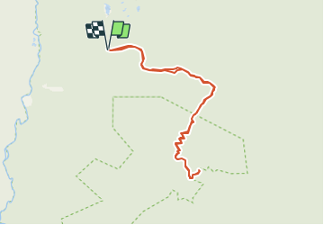
Percorso Marcia di 8,5 km da scoprire a Québec, Le Granit, Saint-Augustin-de-Woburn. Questo percorso è proposto da lscheven. Legende | Maggiori dettagli (PDF) Profilo altimetrico Legende > 15% 15% - 10% 10% - 5% di piatto 5% - 10% 10% - 15% 15% - 30% > 30% Punti di interesse lscheven Accueil SAINT-AUGUSTIN-DE-WOBURN lscheven Intersection 1 SAINT-AUGUSTIN-DE-WOBURN lscheven Intersection 2 SAINT-AUGUSTIN-DE-WOBURN lscheven Sommet - Mont Gosford SAINT-AUGUSTIN-DE-WOBURN lscheven Stationnement SAINT-AUGUSTIN-DE-WOBURN Localizzazione Paese: Canada Regione : Québec Dipartimento/Provincia : Le Granit Comune : Saint-Augustin-de-Woburn Località : Unknown Partenza:(Dec) 45.317774 / -70.884289 Partenza:(UTM) 352313 ; 5019979 (19T) N. Commenti Accedi per lasciare un commento o una valutazione Percorsi nelle vicinanze GUIDE Alizée.pee 2015-04-19 15:00:20 Marcia Medio Saint-Augustin-de-Woburn, Québec, Le Granit, Canada 13,4 km | 22 km-effort 4h 31min Sì