![](/images/other/stat-length.png)
![Percorso Marcia Belforêt-en-Perche - La Perrière : village millénaire - Photo](https://media.geolcdn.com/t/1900/400/ext.pjpeg?maxdim=2&url=https%3A%2F%2Fservices.sitytrail.com%2FGeolivesWS%2FDownloadMedia.ashx%3FTrailID%3D111665%26Media%3D7903_3.jpg)
La Perrière : village millénaire
tracegps
Utente
![Lunghezza](/images/other/stat-length.png)
Lunghezza
11,1 km
![Altitudine massima](https://static1.geolcdn.com/siteimages/upload/files/1508320355ic_sort_altitude_max_24dp.png)
Altitudine massima
246 m
![Dislivello positivo](https://static1.geolcdn.com/siteimages/upload/files/1508320355ic_sort_den_pos_24dp.png)
Dislivello positivo
222 m
![Km-Effort](/images/other/stat-length.png)
Km-Effort
14 km
![Altitudine minima](https://static1.geolcdn.com/siteimages/upload/files/1508320355ic_sort_altitude_min_24dp.png)
Altitudine minima
127 m
![Dislivello negativo](https://static1.geolcdn.com/siteimages/upload/files/1508320355ic_sort_den_neg_24dp.png)
Dislivello negativo
222 m
![Boucle](https://static1.geolcdn.com/siteimages/upload/files/16400158638029165_repeat_loop_refresh_sync_direction_icon.png)
Boucle
Sì
Data di creazione :
2014-12-10 00:00:00.0
Ultima modifica :
2014-12-10 00:00:00.0
![Marcia](https://static1.geolcdn.com/sitytour/trail-icons/101.png)
3h00
Difficoltà : Medio
![Scannerizza questo codice QR per aprire il percorso nell'applicazione SityTrail](https://capi.geolives.com/qq0zvz2zws4bq2lad0pu/sitytour/trails/111665/qr.png?size=200)
Applicazione GPS da escursionismo GRATUITA
Chi siamo
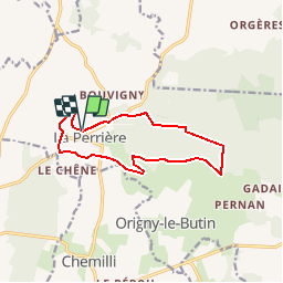
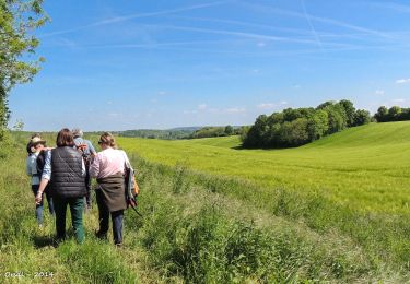
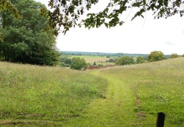
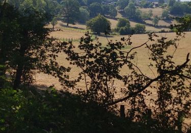
Percorso Marcia di 11,1 km da scoprire a Normandia, Orne, Belforêt-en-Perche. Questo percorso è proposto da tracegps.
Descrizione
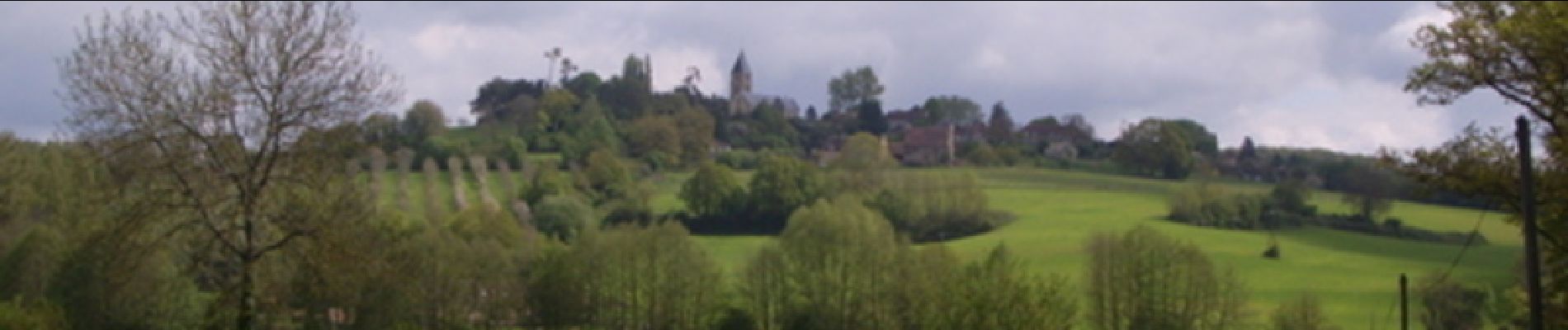
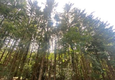
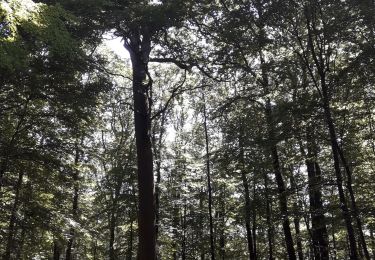
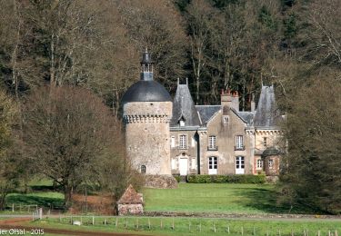
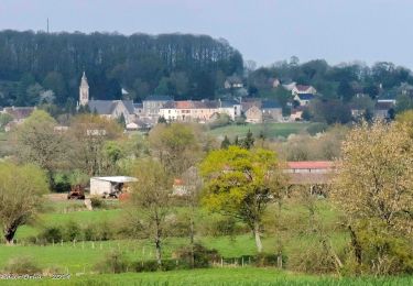
La Perrière : village millénaire. La forêt de Bellême s'étend sur les douces collines du Perche. Couverte de chênes majestueux, c'est un peu de la Gaule antique qui vit encore ici. Retrouvez les Coup de Cœur Randonnée dans l’Orne en Normandie.
Localizzazione
Paese:
France
Regione :
Normandia
Dipartimento/Provincia :
Orne
Comune :
Belforêt-en-Perche
Località :
Unknown
Partenza:(Dec)
Partenza:(UTM)
310618 ; 5362872 (31U) N.
Commenti
Percorsi nelle vicinanze
![Percorso Marcia Belforêt-en-Perche - La Perrière, forêt et village - Photo](https://media.geolcdn.com/t/375/260/577dee63-88bb-4820-9f32-19708dbf9028.jpg&format=jpg&maxdim=2)
![Marcia Marcia](https://static1.geolcdn.com/sitytour/trail-icons/101.png)
La Perrière, forêt et village
Marcia
Difficile
Belforêt-en-Perche,
Normandia,
Orne,
France
![](/images/other/stat-length.png)
11,1 km | 13,8 km-effort
3h 8min
![](https://static1.geolcdn.com/siteimages/upload/files/16400158638029165_repeat_loop_refresh_sync_direction_icon.png)
Sì
![Percorso Marcia Belforêt-en-Perche - le chêne de l'école - Photo](https://media.geolcdn.com/t/375/260/ff98d102-5639-4196-8c72-5f92c76ce997.jpg&format=jpg&maxdim=2)
![Marcia Marcia](https://static1.geolcdn.com/sitytour/trail-icons/101.png)
le chêne de l'école
Marcia
Molto facile
Belforêt-en-Perche,
Normandia,
Orne,
France
![](/images/other/stat-length.png)
15,7 km | 19,7 km-effort
6h 47min
![](https://static1.geolcdn.com/siteimages/upload/files/16400158638029165_repeat_loop_refresh_sync_direction_icon.png)
Sì
![Percorso Marcia Belforêt-en-Perche - La Perrière - Saint-Germain-de-la-Coudre via Bellême (TCP) 28 km - Photo](https://media.geolcdn.com/t/375/260/f8f9cc81-98b3-4885-ae43-f599f03cc6ff.jpg&format=jpg&maxdim=2)
![Marcia Marcia](https://static1.geolcdn.com/sitytour/trail-icons/101.png)
La Perrière - Saint-Germain-de-la-Coudre via Bellême (TCP) 28 km
Marcia
Medio
Belforêt-en-Perche,
Normandia,
Orne,
France
![](/images/other/stat-length.png)
28 km | 35 km-effort
7h 16min
![](https://static1.geolcdn.com/siteimages/upload/files/16400158638029165_repeat_loop_refresh_sync_direction_icon.png)
No
![Percorso Marcia Belforêt-en-Perche - La Perrière - Saint-Germain-de-la-Coudre via Igé (TCP) 27 km - Photo](https://media.geolcdn.com/t/375/260/e70793eb-3e3a-4fb9-8791-69252ddd8772.jpg&format=jpg&maxdim=2)
![Marcia Marcia](https://static1.geolcdn.com/sitytour/trail-icons/101.png)
La Perrière - Saint-Germain-de-la-Coudre via Igé (TCP) 27 km
Marcia
Facile
Belforêt-en-Perche,
Normandia,
Orne,
France
![](/images/other/stat-length.png)
27 km | 33 km-effort
7h 2min
![](https://static1.geolcdn.com/siteimages/upload/files/16400158638029165_repeat_loop_refresh_sync_direction_icon.png)
No
![Percorso Marcia Belforêt-en-Perche - La Perrière - Mortagne-au-Perche (TCP) 29 km - Photo](https://media.geolcdn.com/t/375/260/d8328879-50fd-44ca-9e33-04c0ec1d4331.jpg&format=jpg&maxdim=2)
![Marcia Marcia](https://static1.geolcdn.com/sitytour/trail-icons/101.png)
La Perrière - Mortagne-au-Perche (TCP) 29 km
Marcia
Difficile
Belforêt-en-Perche,
Normandia,
Orne,
France
![](/images/other/stat-length.png)
29 km | 34 km-effort
7h 18min
![](https://static1.geolcdn.com/siteimages/upload/files/16400158638029165_repeat_loop_refresh_sync_direction_icon.png)
No
![Percorso Marcia Belforêt-en-Perche - la perrière par la forêt - Photo](https://media.geolcdn.com/t/375/260/dc5026c3-20c4-40ca-bab8-55b19f74d196.jpg&format=jpg&maxdim=2)
![Marcia Marcia](https://static1.geolcdn.com/sitytour/trail-icons/101.png)
la perrière par la forêt
Marcia
Medio
Belforêt-en-Perche,
Normandia,
Orne,
France
![](/images/other/stat-length.png)
5,6 km | 7,6 km-effort
1h 45min
![](https://static1.geolcdn.com/siteimages/upload/files/16400158638029165_repeat_loop_refresh_sync_direction_icon.png)
Sì
![Percorso Marcia Belforêt-en-Perche - fourneaux gr jusqu'au ruisseau - Photo](https://media.geolcdn.com/t/375/260/b31f6ae7-3d4c-4741-ab3e-a7d27ca40061.jpg&format=jpg&maxdim=2)
![Marcia Marcia](https://static1.geolcdn.com/sitytour/trail-icons/101.png)
fourneaux gr jusqu'au ruisseau
Marcia
Medio
Belforêt-en-Perche,
Normandia,
Orne,
France
![](/images/other/stat-length.png)
5 km | 6,7 km-effort
1h 15min
![](https://static1.geolcdn.com/siteimages/upload/files/16400158638029165_repeat_loop_refresh_sync_direction_icon.png)
Sì
![Percorso Macchina Belforêt-en-Perche - 2025-02-12 VduP les Chaises - Photo](https://media.geolcdn.com/t/375/260/ext.jpg?maxdim=2&url=https%3A%2F%2Fstatic1.geolcdn.com%2Fsiteimages%2Fupload%2Ffiles%2F15247431544x4.jpg)
![Macchina Macchina](https://static1.geolcdn.com/sitytour/trail-icons/401.png)
2025-02-12 VduP les Chaises
Macchina
Belforêt-en-Perche,
Normandia,
Orne,
France
![](/images/other/stat-length.png)
52 km | 65 km-effort
4h 21min
![](https://static1.geolcdn.com/siteimages/upload/files/16400158638029165_repeat_loop_refresh_sync_direction_icon.png)
No
![Percorso Marcia Chemilli - ane - Photo](https://media.geolcdn.com/t/375/260/19e3a58d-7ee5-4672-83d0-dc8630fbd58f.jpg&format=jpg&maxdim=2)
![Marcia Marcia](https://static1.geolcdn.com/sitytour/trail-icons/101.png)