![](/images/other/stat-length.png)
- Percorsi
- Outdoor
- Ireland
- Sconosciuto
- County Donegal
- Inishowen Municipal District
Inishowen Municipal District, County Donegal : I migliori sentieri, percorsi e passeggiate
Inishowen Municipal District: Scopri i migliori percorsi: 3 percorsi a piedi. Tutti questi percorsi, itinerari e attività outdoor sono disponibili nelle nostre app SityTrail per smartphone e tablet.
I percorsi migliori (0})
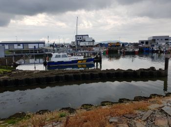
![Percorso A piedi Inishowen Municipal District - Inishowen Head Walk - Photo](https://media.geolcdn.com/t/350/260/b6dd7e3a-a7ff-4aca-9dea-2487ed0fdd5a.jpeg&format=jpg&maxdim=2)
![A piedi A piedi](https://static1.geolcdn.com/sitytour/trail-icons/100.png)
Km
#1 - Inishowen Head Walk
A piedi
Facile
Inishowen Municipal District,
Sconosciuto,
County Donegal,
Ireland
![](/images/other/stat-length.png)
8,4 km | 12,3 km-effort
2h 48min
![](https://static1.geolcdn.com/siteimages/upload/files/1508320355ic_sort_den_pos_24dp.png)
298 m
![](https://static1.geolcdn.com/siteimages/upload/files/1508320355ic_sort_den_neg_24dp.png)
295 m
![](https://static1.geolcdn.com/siteimages/upload/files/16400158638029165_repeat_loop_refresh_sync_direction_icon.png)
Sì
SityTrail - itinéraires balisés pédestres
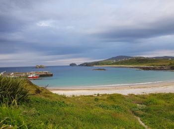
![Percorso A piedi Inishowen Municipal District - D'Arcy Magee Walk - Photo](https://media.geolcdn.com/t/350/260/d69ae54e-511d-4962-9675-1a2abe262ccf.jpeg&format=jpg&maxdim=2)
![A piedi A piedi](https://static1.geolcdn.com/sitytour/trail-icons/100.png)
Km
#2 - D'Arcy Magee Walk
A piedi
Facile
Inishowen Municipal District,
Sconosciuto,
County Donegal,
Ireland
![](/images/other/stat-length.png)
4,4 km | 5,5 km-effort
1h 14min
![](https://static1.geolcdn.com/siteimages/upload/files/1508320355ic_sort_den_pos_24dp.png)
80 m
![](https://static1.geolcdn.com/siteimages/upload/files/1508320355ic_sort_den_neg_24dp.png)
86 m
![](https://static1.geolcdn.com/siteimages/upload/files/16400158638029165_repeat_loop_refresh_sync_direction_icon.png)
Sì
SityTrail - itinéraires balisés pédestres
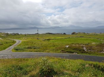
![Percorso Macchina Inishowen Municipal District - 190630 - Photo](https://media.geolcdn.com/t/350/260/1de5a655-672f-4d7c-b315-ef980c0cd2fe.jpg&format=jpg&maxdim=2)
![Macchina Macchina](https://static1.geolcdn.com/sitytour/trail-icons/401.png)
Km
#3 - 190630
Macchina
Molto facile
Inishowen Municipal District,
Sconosciuto,
County Donegal,
Ireland
![](/images/other/stat-length.png)
336 km | 382 km-effort
12h 13min
![](https://static1.geolcdn.com/siteimages/upload/files/1508320355ic_sort_den_pos_24dp.png)
3393 m
![](https://static1.geolcdn.com/siteimages/upload/files/1508320355ic_sort_den_neg_24dp.png)
3397 m
![](https://static1.geolcdn.com/siteimages/upload/files/16400158638029165_repeat_loop_refresh_sync_direction_icon.png)
No
pffrench
![Percorso Macchina Inishowen Municipal District - 190629giantsCauseway - Photo](https://media.geolcdn.com/t/350/260/2334b6f0-cd73-40f3-8748-9f2e7a14abfc.jpg&format=jpg&maxdim=2)
![Macchina Macchina](https://static1.geolcdn.com/sitytour/trail-icons/401.png)
Km
#4 - 190629giantsCauseway
Macchina
Molto facile
Inishowen Municipal District,
Sconosciuto,
County Donegal,
Ireland
![](/images/other/stat-length.png)
196 km | 221 km-effort
13h 8min
![](https://static1.geolcdn.com/siteimages/upload/files/1508320355ic_sort_den_pos_24dp.png)
1911 m
![](https://static1.geolcdn.com/siteimages/upload/files/1508320355ic_sort_den_neg_24dp.png)
1904 m
![](https://static1.geolcdn.com/siteimages/upload/files/16400158638029165_repeat_loop_refresh_sync_direction_icon.png)
No
pffrench
![Percorso Marcia Inishowen Municipal District - 190628Malin Head - Photo](https://media.geolcdn.com/t/350/260/9a979daf-4144-47d9-8a8b-46f7e19c59fd.jpg&format=jpg&maxdim=2)
![Marcia Marcia](https://static1.geolcdn.com/sitytour/trail-icons/101.png)
Km
#5 - 190628Malin Head
Marcia
Molto facile
Inishowen Municipal District,
Sconosciuto,
County Donegal,
Ireland
![](/images/other/stat-length.png)
7,3 km | 8 km-effort
3h 15min
![](https://static1.geolcdn.com/siteimages/upload/files/1508320355ic_sort_den_pos_24dp.png)
52 m
![](https://static1.geolcdn.com/siteimages/upload/files/1508320355ic_sort_den_neg_24dp.png)
50 m
![](https://static1.geolcdn.com/siteimages/upload/files/16400158638029165_repeat_loop_refresh_sync_direction_icon.png)
Sì
pffrench
5 percorsi visualizzati su 5
Applicazione GPS da escursionismo GRATUITA