![](/images/other/stat-length.png)
- Percorsi
- Outdoor
- Germany
- Niedersachsen
- Landkreis Göttingen
- Harz (Landkreis Göttingen)
Harz (Landkreis Göttingen), Landkreis Göttingen : I migliori sentieri, percorsi e passeggiate
Harz (Landkreis Göttingen): Scopri i migliori percorsi: 7 percorsi a piedi. Tutti questi percorsi, itinerari e attività outdoor sono disponibili nelle nostre app SityTrail per smartphone e tablet.
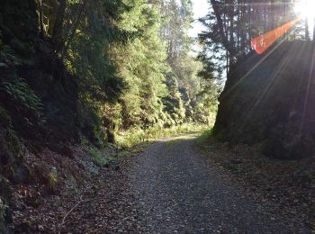
I percorsi migliori (0})
![Percorso A piedi Harz (Landkreis Göttingen) - Hutthaler Widerwaage - Photo](https://media.geolcdn.com/t/350/260/9c4fee32-c0d4-41c2-b0b2-1c2035f7e0e4.jpeg&format=jpg&maxdim=2)
![A piedi A piedi](https://static1.geolcdn.com/sitytour/trail-icons/100.png)
Km
A piedi
![](/images/other/stat-length.png)
![](https://static1.geolcdn.com/siteimages/upload/files/1508320355ic_sort_den_pos_24dp.png)
![](https://static1.geolcdn.com/siteimages/upload/files/1508320355ic_sort_den_neg_24dp.png)
![](https://static1.geolcdn.com/siteimages/upload/files/16400158638029165_repeat_loop_refresh_sync_direction_icon.png)
• Trail created by Harzklub. Symbol: Wasserrad auf blauem Grund
![Percorso A piedi Harz (Landkreis Göttingen) - Morgenbrodtsthaler Graben - Photo](https://media.geolcdn.com/t/350/260/3e6d776d-371f-4984-b235-54cfc1f0db3a.jpeg&format=jpg&maxdim=2)
![A piedi A piedi](https://static1.geolcdn.com/sitytour/trail-icons/100.png)
Km
A piedi
![](/images/other/stat-length.png)
![](https://static1.geolcdn.com/siteimages/upload/files/1508320355ic_sort_den_pos_24dp.png)
![](https://static1.geolcdn.com/siteimages/upload/files/1508320355ic_sort_den_neg_24dp.png)
![](https://static1.geolcdn.com/siteimages/upload/files/16400158638029165_repeat_loop_refresh_sync_direction_icon.png)
• Symbol: Wasserrad auf bleuem Grund
![Percorso A piedi Harz (Landkreis Göttingen) - Harzklub-Weg 28A - Photo](https://media.geolcdn.com/t/350/260/e593cc2f-5cd4-40b4-9e2a-6ddc84c76fce.jpeg&format=jpg&maxdim=2)
![A piedi A piedi](https://static1.geolcdn.com/sitytour/trail-icons/100.png)
Km
A piedi
![](/images/other/stat-length.png)
![](https://static1.geolcdn.com/siteimages/upload/files/1508320355ic_sort_den_pos_24dp.png)
![](https://static1.geolcdn.com/siteimages/upload/files/1508320355ic_sort_den_neg_24dp.png)
![](https://static1.geolcdn.com/siteimages/upload/files/16400158638029165_repeat_loop_refresh_sync_direction_icon.png)
![Percorso A piedi Harz (Landkreis Göttingen) - Harzer Baudensteig Etappe 3 - Photo](https://media.geolcdn.com/t/350/260/7645c896-f1b9-4d7e-8970-63b0eb9c17d2.jpeg&format=jpg&maxdim=2)
![A piedi A piedi](https://static1.geolcdn.com/sitytour/trail-icons/100.png)
Km
A piedi
![](/images/other/stat-length.png)
![](https://static1.geolcdn.com/siteimages/upload/files/1508320355ic_sort_den_pos_24dp.png)
![](https://static1.geolcdn.com/siteimages/upload/files/1508320355ic_sort_den_neg_24dp.png)
![](https://static1.geolcdn.com/siteimages/upload/files/16400158638029165_repeat_loop_refresh_sync_direction_icon.png)
![Percorso A piedi Harz (Landkreis Göttingen) - Harzer Baudensteig Etappe 5 - Photo](https://media.geolcdn.com/t/350/260/bfe7df08-6933-41e8-92d9-cb2249463953.jpeg&format=jpg&maxdim=2)
![A piedi A piedi](https://static1.geolcdn.com/sitytour/trail-icons/100.png)
Km
A piedi
![](/images/other/stat-length.png)
![](https://static1.geolcdn.com/siteimages/upload/files/1508320355ic_sort_den_pos_24dp.png)
![](https://static1.geolcdn.com/siteimages/upload/files/1508320355ic_sort_den_neg_24dp.png)
![](https://static1.geolcdn.com/siteimages/upload/files/16400158638029165_repeat_loop_refresh_sync_direction_icon.png)
• Sito web: http://harzerbaudensteig.de/etappe-5-von-bad-sachsa-nach-wieda.html
![Percorso A piedi Harz (Landkreis Göttingen) - Harzklub-Weg 16D - Photo](https://media.geolcdn.com/t/350/260/557d222e-94db-4a8c-bb9f-3a35e96cbf6f.jpeg&format=jpg&maxdim=2)
![A piedi A piedi](https://static1.geolcdn.com/sitytour/trail-icons/100.png)
Km
A piedi
![](/images/other/stat-length.png)
![](https://static1.geolcdn.com/siteimages/upload/files/1508320355ic_sort_den_pos_24dp.png)
![](https://static1.geolcdn.com/siteimages/upload/files/1508320355ic_sort_den_neg_24dp.png)
![](https://static1.geolcdn.com/siteimages/upload/files/16400158638029165_repeat_loop_refresh_sync_direction_icon.png)
![Percorso Marcia Harz (Landkreis Göttingen) - w-duitsland-rondwandeling-zorge-in-de-harz - Photo](https://media.geolcdn.com/t/350/260/ext.jpg?maxdim=2&url=https%3A%2F%2Fstatic1.geolcdn.com%2Fsiteimages%2Fupload%2Ffiles%2F1553511878bg_sport_marche.png)
![Marcia Marcia](https://static1.geolcdn.com/sitytour/trail-icons/101.png)
Km
Marcia
![](/images/other/stat-length.png)
![](https://static1.geolcdn.com/siteimages/upload/files/1508320355ic_sort_den_pos_24dp.png)
![](https://static1.geolcdn.com/siteimages/upload/files/1508320355ic_sort_den_neg_24dp.png)
![](https://static1.geolcdn.com/siteimages/upload/files/16400158638029165_repeat_loop_refresh_sync_direction_icon.png)
• More information on GPStracks.nl : http://www.gpstracks.nl
7 percorsi visualizzati su 7
Applicazione GPS da escursionismo GRATUITA