![](/images/other/stat-length.png)
- Percorsi
- Outdoor
- Germany
- Assia
- Odenwaldkreis
- Mossautal
Mossautal, Odenwaldkreis : I migliori sentieri, percorsi e passeggiate
Mossautal: Scopri i migliori percorsi: 21 percorsi a piedi. Tutti questi percorsi, itinerari e attività outdoor sono disponibili nelle nostre app SityTrail per smartphone e tablet.
I percorsi migliori (0})
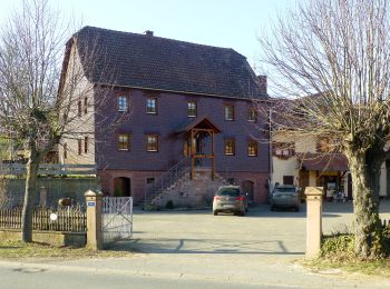
![Percorso A piedi Mossautal - Mossautaler Drachenweg 2: Fafnir - Photo](https://media.geolcdn.com/t/350/260/baa57736-b2a2-4076-ac41-580e052e4d6b.jpeg&format=jpg&maxdim=2)
![A piedi A piedi](https://static1.geolcdn.com/sitytour/trail-icons/100.png)
Km
A piedi
![](/images/other/stat-length.png)
![](https://static1.geolcdn.com/siteimages/upload/files/1508320355ic_sort_den_pos_24dp.png)
![](https://static1.geolcdn.com/siteimages/upload/files/1508320355ic_sort_den_neg_24dp.png)
![](https://static1.geolcdn.com/siteimages/upload/files/16400158638029165_repeat_loop_refresh_sync_direction_icon.png)
• Trail created by Odenwaldklub. Symbol: Grüne 2 im oben offenen Kreis, in der Öffnung ein MD
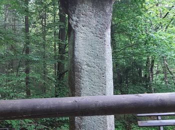
![Percorso A piedi Mossautal - Rundwanderweg Mossautal Harrasloch 3: Siegfriedbrunnen-Weg - Photo](https://media.geolcdn.com/t/350/260/02bd1f55-66ca-4c2c-82ce-b2dd1ef05987.jpeg&format=jpg&maxdim=2)
![A piedi A piedi](https://static1.geolcdn.com/sitytour/trail-icons/100.png)
Km
A piedi
![](/images/other/stat-length.png)
![](https://static1.geolcdn.com/siteimages/upload/files/1508320355ic_sort_den_pos_24dp.png)
![](https://static1.geolcdn.com/siteimages/upload/files/1508320355ic_sort_den_neg_24dp.png)
![](https://static1.geolcdn.com/siteimages/upload/files/16400158638029165_repeat_loop_refresh_sync_direction_icon.png)
• Trail created by Geo-Naturpark Bergstraße-Odenwald. Symbol: Gelbe 3 im gelben Kreis
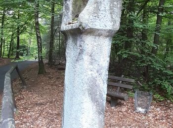
![Percorso A piedi Mossautal - Rundwanderweg Mossautal Harrasloch 2: Rotes-Wasser-Weg - Photo](https://media.geolcdn.com/t/350/260/cd4c4773-0c95-4456-abbb-01ec8f39eaea.jpeg&format=jpg&maxdim=2)
![A piedi A piedi](https://static1.geolcdn.com/sitytour/trail-icons/100.png)
Km
A piedi
![](/images/other/stat-length.png)
![](https://static1.geolcdn.com/siteimages/upload/files/1508320355ic_sort_den_pos_24dp.png)
![](https://static1.geolcdn.com/siteimages/upload/files/1508320355ic_sort_den_neg_24dp.png)
![](https://static1.geolcdn.com/siteimages/upload/files/16400158638029165_repeat_loop_refresh_sync_direction_icon.png)
• Trail created by Geo-Naturpark Bergstraße-Odenwald. Symbol: Gelbe 2 im gelben Kreis
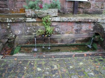
![Percorso A piedi Mossautal - Rundwanderweg Mossautal Harrasloch 5: Mornsbach-Weg - Photo](https://media.geolcdn.com/t/350/260/67ce6ccf-e025-46ee-8bc5-9edfdeda43a3.jpeg&format=jpg&maxdim=2)
![A piedi A piedi](https://static1.geolcdn.com/sitytour/trail-icons/100.png)
Km
A piedi
![](/images/other/stat-length.png)
![](https://static1.geolcdn.com/siteimages/upload/files/1508320355ic_sort_den_pos_24dp.png)
![](https://static1.geolcdn.com/siteimages/upload/files/1508320355ic_sort_den_neg_24dp.png)
![](https://static1.geolcdn.com/siteimages/upload/files/16400158638029165_repeat_loop_refresh_sync_direction_icon.png)
• Trail created by Geo-Naturpark Bergstraße-Odenwald. Symbol: Gelbe 5 im gelben Kreis
![Percorso A piedi Mossautal - Rundwanderweg Mossautal Lindelbrunnen 2: Hagen-Weg - Photo](https://media.geolcdn.com/t/350/260/efdb0f0b-fe75-490a-9466-0df0ece22420.jpeg&format=jpg&maxdim=2)
![A piedi A piedi](https://static1.geolcdn.com/sitytour/trail-icons/100.png)
Km
A piedi
![](/images/other/stat-length.png)
![](https://static1.geolcdn.com/siteimages/upload/files/1508320355ic_sort_den_pos_24dp.png)
![](https://static1.geolcdn.com/siteimages/upload/files/1508320355ic_sort_den_neg_24dp.png)
![](https://static1.geolcdn.com/siteimages/upload/files/16400158638029165_repeat_loop_refresh_sync_direction_icon.png)
• Trail created by Geo-Naturpark Bergstraße-Odenwald. Symbol: Gelbe 2 im gelben Kreis
![Percorso A piedi Mossautal - Rundwanderweg Dehnbuche 2: Lärmfeuer-Weg - Photo](https://media.geolcdn.com/t/350/260/57673ce8-198e-4236-9692-f43943072d1b.jpeg&format=jpg&maxdim=2)
![A piedi A piedi](https://static1.geolcdn.com/sitytour/trail-icons/100.png)
Km
A piedi
![](/images/other/stat-length.png)
![](https://static1.geolcdn.com/siteimages/upload/files/1508320355ic_sort_den_pos_24dp.png)
![](https://static1.geolcdn.com/siteimages/upload/files/1508320355ic_sort_den_neg_24dp.png)
![](https://static1.geolcdn.com/siteimages/upload/files/16400158638029165_repeat_loop_refresh_sync_direction_icon.png)
• Trail created by Geo-Naturpark Bergstraße-Odenwald. Symbol: Gelbe 2 im gelben Kreis
![Percorso A piedi Mossautal - Rundwanderweg Hiltersklingen 4: Hildegeresbrunnenweg - Photo](https://media.geolcdn.com/t/350/260/2a6bbbac-9df7-4265-9b8b-6c983cdf3871.jpeg&format=jpg&maxdim=2)
![A piedi A piedi](https://static1.geolcdn.com/sitytour/trail-icons/100.png)
Km
A piedi
![](/images/other/stat-length.png)
![](https://static1.geolcdn.com/siteimages/upload/files/1508320355ic_sort_den_pos_24dp.png)
![](https://static1.geolcdn.com/siteimages/upload/files/1508320355ic_sort_den_neg_24dp.png)
![](https://static1.geolcdn.com/siteimages/upload/files/16400158638029165_repeat_loop_refresh_sync_direction_icon.png)
• Trail created by Geo-Naturpark Bergstraße-Odenwald. Symbol: Weiße 4 in einem oben offenen Kreis, darüber weißes H
![Percorso A piedi Mossautal - Rundwanderweg Güttersbach 4: Mornsbach-Weg - Photo](https://media.geolcdn.com/t/350/260/67ce6ccf-e025-46ee-8bc5-9edfdeda43a3.jpeg&format=jpg&maxdim=2)
![A piedi A piedi](https://static1.geolcdn.com/sitytour/trail-icons/100.png)
Km
A piedi
![](/images/other/stat-length.png)
![](https://static1.geolcdn.com/siteimages/upload/files/1508320355ic_sort_den_pos_24dp.png)
![](https://static1.geolcdn.com/siteimages/upload/files/1508320355ic_sort_den_neg_24dp.png)
![](https://static1.geolcdn.com/siteimages/upload/files/16400158638029165_repeat_loop_refresh_sync_direction_icon.png)
• Trail created by Geo-Naturpark Bergstraße-Odenwald. Symbol: Weiße 4 in einem oben offenen Kreis, darüber weißes Gü
![Percorso A piedi Mossautal - Rundwanderweg Güttersbach 1: Strieth-Weg - Photo](https://media.geolcdn.com/t/350/260/67ce6ccf-e025-46ee-8bc5-9edfdeda43a3.jpeg&format=jpg&maxdim=2)
![A piedi A piedi](https://static1.geolcdn.com/sitytour/trail-icons/100.png)
Km
A piedi
![](/images/other/stat-length.png)
![](https://static1.geolcdn.com/siteimages/upload/files/1508320355ic_sort_den_pos_24dp.png)
![](https://static1.geolcdn.com/siteimages/upload/files/1508320355ic_sort_den_neg_24dp.png)
![](https://static1.geolcdn.com/siteimages/upload/files/16400158638029165_repeat_loop_refresh_sync_direction_icon.png)
• Trail created by Geo-Naturpark Bergstraße-Odenwald. Symbol: Weiße 1 in einem oben offenen Kreis, darüber weißes Gü
![Percorso A piedi Mossautal - Rundwanderweg Hüttental 8: Lindelbrunnen-Weg - Photo](https://media.geolcdn.com/t/350/260/baa57736-b2a2-4076-ac41-580e052e4d6b.jpeg&format=jpg&maxdim=2)
![A piedi A piedi](https://static1.geolcdn.com/sitytour/trail-icons/100.png)
Km
A piedi
![](/images/other/stat-length.png)
![](https://static1.geolcdn.com/siteimages/upload/files/1508320355ic_sort_den_pos_24dp.png)
![](https://static1.geolcdn.com/siteimages/upload/files/1508320355ic_sort_den_neg_24dp.png)
![](https://static1.geolcdn.com/siteimages/upload/files/16400158638029165_repeat_loop_refresh_sync_direction_icon.png)
• Trail created by Geo-Naturpark Bergstraße-Odenwald. Symbol: Weiße 8 in einem oben offenen Kreis, darüber weißes Hü
![Percorso A piedi Mossautal - Rundwanderweg Hüttental 9: Mösselbachweg - Photo](https://media.geolcdn.com/t/350/260/700f2d33-0b31-468a-a203-409d0e25462b.jpeg&format=jpg&maxdim=2)
![A piedi A piedi](https://static1.geolcdn.com/sitytour/trail-icons/100.png)
Km
A piedi
![](/images/other/stat-length.png)
![](https://static1.geolcdn.com/siteimages/upload/files/1508320355ic_sort_den_pos_24dp.png)
![](https://static1.geolcdn.com/siteimages/upload/files/1508320355ic_sort_den_neg_24dp.png)
![](https://static1.geolcdn.com/siteimages/upload/files/16400158638029165_repeat_loop_refresh_sync_direction_icon.png)
• Trail created by Geo-Naturpark Bergstraße-Odenwald. Symbol: Weiße 9 in einem oben offenen Kreis, darüber weißes Hü
![Percorso A piedi Mossautal - Rundwanderweg Güttersbach 6: Köhlerhüttenweg - Photo](https://media.geolcdn.com/t/350/260/efdb0f0b-fe75-490a-9466-0df0ece22420.jpeg&format=jpg&maxdim=2)
![A piedi A piedi](https://static1.geolcdn.com/sitytour/trail-icons/100.png)
Km
A piedi
![](/images/other/stat-length.png)
![](https://static1.geolcdn.com/siteimages/upload/files/1508320355ic_sort_den_pos_24dp.png)
![](https://static1.geolcdn.com/siteimages/upload/files/1508320355ic_sort_den_neg_24dp.png)
![](https://static1.geolcdn.com/siteimages/upload/files/16400158638029165_repeat_loop_refresh_sync_direction_icon.png)
• Trail created by Geo-Naturpark Bergstraße-Odenwald. Symbol: Weiße 6 in einem oben offenen Kreis, darüber weißes Gü
![Percorso A piedi Mossautal - Rundwanderweg Güttersbach 5: Fuchseichen-Weg - Photo](https://media.geolcdn.com/t/350/260/67ce6ccf-e025-46ee-8bc5-9edfdeda43a3.jpeg&format=jpg&maxdim=2)
![A piedi A piedi](https://static1.geolcdn.com/sitytour/trail-icons/100.png)
Km
A piedi
![](/images/other/stat-length.png)
![](https://static1.geolcdn.com/siteimages/upload/files/1508320355ic_sort_den_pos_24dp.png)
![](https://static1.geolcdn.com/siteimages/upload/files/1508320355ic_sort_den_neg_24dp.png)
![](https://static1.geolcdn.com/siteimages/upload/files/16400158638029165_repeat_loop_refresh_sync_direction_icon.png)
• Trail created by Geo-Naturpark Bergstraße-Odenwald. Symbol: Weiße 5 in einem oben offenen Kreis, darüber weißes Gü
![Percorso A piedi Mossautal - Rundwanderweg Güttersbach 3: Hüttenthal-Weg - Photo](https://media.geolcdn.com/t/350/260/700f2d33-0b31-468a-a203-409d0e25462b.jpeg&format=jpg&maxdim=2)
![A piedi A piedi](https://static1.geolcdn.com/sitytour/trail-icons/100.png)
Km
A piedi
![](/images/other/stat-length.png)
![](https://static1.geolcdn.com/siteimages/upload/files/1508320355ic_sort_den_pos_24dp.png)
![](https://static1.geolcdn.com/siteimages/upload/files/1508320355ic_sort_den_neg_24dp.png)
![](https://static1.geolcdn.com/siteimages/upload/files/16400158638029165_repeat_loop_refresh_sync_direction_icon.png)
• Trail created by Geo-Naturpark Bergstraße-Odenwald. Symbol: Weiße 3 in einem oben offenen Kreis, darüber weißes Gü
![Percorso A piedi Mossautal - Rundwanderweg Hüttental 6: Geisberg-Weg - Photo](https://media.geolcdn.com/t/350/260/baa57736-b2a2-4076-ac41-580e052e4d6b.jpeg&format=jpg&maxdim=2)
![A piedi A piedi](https://static1.geolcdn.com/sitytour/trail-icons/100.png)
Km
A piedi
![](/images/other/stat-length.png)
![](https://static1.geolcdn.com/siteimages/upload/files/1508320355ic_sort_den_pos_24dp.png)
![](https://static1.geolcdn.com/siteimages/upload/files/1508320355ic_sort_den_neg_24dp.png)
![](https://static1.geolcdn.com/siteimages/upload/files/16400158638029165_repeat_loop_refresh_sync_direction_icon.png)
• Trail created by Geo-Naturpark Bergstraße-Odenwald. Symbol: Weiße 6 in einem oben offenen Kreis, darüber weißes Hü
![Percorso A piedi Mossautal - Rundwanderweg Hiltersklingen 2: Dachsberg-Weg - Photo](https://media.geolcdn.com/t/350/260/c0c408ef-37cd-4633-b234-742b9dad92f4.jpeg&format=jpg&maxdim=2)
![A piedi A piedi](https://static1.geolcdn.com/sitytour/trail-icons/100.png)
Km
A piedi
![](/images/other/stat-length.png)
![](https://static1.geolcdn.com/siteimages/upload/files/1508320355ic_sort_den_pos_24dp.png)
![](https://static1.geolcdn.com/siteimages/upload/files/1508320355ic_sort_den_neg_24dp.png)
![](https://static1.geolcdn.com/siteimages/upload/files/16400158638029165_repeat_loop_refresh_sync_direction_icon.png)
• Trail created by Geo-Naturpark Bergstraße-Odenwald. Symbol: Weiße 2 in einem oben offenen Kreis, darüber weißes H
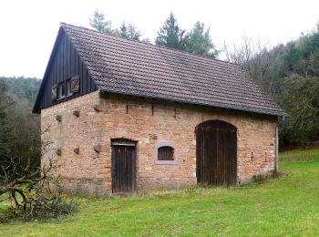
![Percorso A piedi Mossautal - Rundwanderweg Ober-Mossau 7: Neesstein-Weg - Photo](https://media.geolcdn.com/t/350/260/a876ddd2-9173-4230-a975-a6e1c802a0c9.jpeg&format=jpg&maxdim=2)
![A piedi A piedi](https://static1.geolcdn.com/sitytour/trail-icons/100.png)
Km
A piedi
![](/images/other/stat-length.png)
![](https://static1.geolcdn.com/siteimages/upload/files/1508320355ic_sort_den_pos_24dp.png)
![](https://static1.geolcdn.com/siteimages/upload/files/1508320355ic_sort_den_neg_24dp.png)
![](https://static1.geolcdn.com/siteimages/upload/files/16400158638029165_repeat_loop_refresh_sync_direction_icon.png)
• Trail created by Geo-Naturpark Bergstraße-Odenwald. Symbol: Weiße 7 in einem oben offenen Kreis, darüber weißes Mo
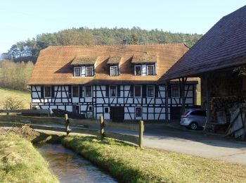
![Percorso A piedi Mossautal - Rundwanderweg Ober-Mossau 4: Lärmfeuer-Weg - Photo](https://media.geolcdn.com/t/350/260/d7fb3e69-437d-411e-8560-4efda7639a61.jpeg&format=jpg&maxdim=2)
![A piedi A piedi](https://static1.geolcdn.com/sitytour/trail-icons/100.png)
Km
A piedi
![](/images/other/stat-length.png)
![](https://static1.geolcdn.com/siteimages/upload/files/1508320355ic_sort_den_pos_24dp.png)
![](https://static1.geolcdn.com/siteimages/upload/files/1508320355ic_sort_den_neg_24dp.png)
![](https://static1.geolcdn.com/siteimages/upload/files/16400158638029165_repeat_loop_refresh_sync_direction_icon.png)
• Trail created by Geo-Naturpark Bergstraße-Odenwald. Symbol: Weiße 4 in einem oben offenen Kreis, darüber weißes Mo
![Percorso A piedi Mossautal - Rundwanderweg Hiltersklingen 3: Köhler-Hütten-Weg - Photo](https://media.geolcdn.com/t/350/260/2a6bbbac-9df7-4265-9b8b-6c983cdf3871.jpeg&format=jpg&maxdim=2)
![A piedi A piedi](https://static1.geolcdn.com/sitytour/trail-icons/100.png)
Km
A piedi
![](/images/other/stat-length.png)
![](https://static1.geolcdn.com/siteimages/upload/files/1508320355ic_sort_den_pos_24dp.png)
![](https://static1.geolcdn.com/siteimages/upload/files/1508320355ic_sort_den_neg_24dp.png)
![](https://static1.geolcdn.com/siteimages/upload/files/16400158638029165_repeat_loop_refresh_sync_direction_icon.png)
• Trail created by Geo-Naturpark Bergstraße-Odenwald. Symbol: Weiße 3 in einem oben offenen Kreis, darüber weißes H
![Percorso A piedi Mossautal - Rundwanderweg Hiltersklingen 7: Streitberg - Weg - Photo](https://media.geolcdn.com/t/350/260/2a6bbbac-9df7-4265-9b8b-6c983cdf3871.jpeg&format=jpg&maxdim=2)
![A piedi A piedi](https://static1.geolcdn.com/sitytour/trail-icons/100.png)
Km
A piedi
![](/images/other/stat-length.png)
![](https://static1.geolcdn.com/siteimages/upload/files/1508320355ic_sort_den_pos_24dp.png)
![](https://static1.geolcdn.com/siteimages/upload/files/1508320355ic_sort_den_neg_24dp.png)
![](https://static1.geolcdn.com/siteimages/upload/files/16400158638029165_repeat_loop_refresh_sync_direction_icon.png)
• Trail created by Geo-Naturpark Bergstraße-Odenwald. Symbol: Weiße 7 in einem oben offenen Kreis, darüber weißes H
20 percorsi visualizzati su 21
Applicazione GPS da escursionismo GRATUITA