![](/images/other/stat-length.png)
- Percorsi
- Outdoor
- Germany
- Renania-Palatinato
- Landkreis Mainz-Bingen
- Ingelheim am Rhein
Ingelheim am Rhein, Landkreis Mainz-Bingen : I migliori sentieri, percorsi e passeggiate
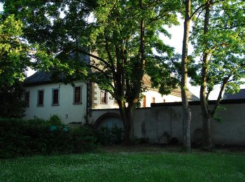
Ingelheim am Rhein: Scopri i migliori percorsi: 8 percorsi a piedi. Tutti questi percorsi, itinerari e attività outdoor sono disponibili nelle nostre app SityTrail per smartphone e tablet.
I percorsi migliori (0})
![Percorso A piedi Ingelheim am Rhein - Kaiserpfalzweg - Photo](https://media.geolcdn.com/t/350/260/fce84757-c52f-41cd-87c3-4d4da52e38d6.jpeg&format=jpg&maxdim=2)
![A piedi A piedi](https://static1.geolcdn.com/sitytour/trail-icons/100.png)
Km
A piedi
![](/images/other/stat-length.png)
![](https://static1.geolcdn.com/siteimages/upload/files/1508320355ic_sort_den_pos_24dp.png)
![](https://static1.geolcdn.com/siteimages/upload/files/1508320355ic_sort_den_neg_24dp.png)
![](https://static1.geolcdn.com/siteimages/upload/files/16400158638029165_repeat_loop_refresh_sync_direction_icon.png)
• Trail created by Stadt Ingelheim. Symbol: Violette Markierung mit Kaiserkrone
![Percorso A piedi Ingelheim am Rhein - Weinmeile - Photo](https://media.geolcdn.com/t/350/260/4accd213-898c-47e0-aedf-5ca5e51d22f5.jpeg&format=jpg&maxdim=2)
![A piedi A piedi](https://static1.geolcdn.com/sitytour/trail-icons/100.png)
Km
A piedi
![](/images/other/stat-length.png)
![](https://static1.geolcdn.com/siteimages/upload/files/1508320355ic_sort_den_pos_24dp.png)
![](https://static1.geolcdn.com/siteimages/upload/files/1508320355ic_sort_den_neg_24dp.png)
![](https://static1.geolcdn.com/siteimages/upload/files/16400158638029165_repeat_loop_refresh_sync_direction_icon.png)
• Symbol: grünes Irgendwas mit rechtsseitig im Dreieck, Spitze nach links, angeordneten 6 roten Tupfen, vermutlich rote...
![Percorso A piedi Ingelheim am Rhein - Wanderweg Mainzer Berg - Photo](https://media.geolcdn.com/t/350/260/b2dea8bf-12a6-4c90-89f4-3306a67cdad5.jpeg&format=jpg&maxdim=2)
![A piedi A piedi](https://static1.geolcdn.com/sitytour/trail-icons/100.png)
Km
A piedi
![](/images/other/stat-length.png)
![](https://static1.geolcdn.com/siteimages/upload/files/1508320355ic_sort_den_pos_24dp.png)
![](https://static1.geolcdn.com/siteimages/upload/files/1508320355ic_sort_den_neg_24dp.png)
![](https://static1.geolcdn.com/siteimages/upload/files/16400158638029165_repeat_loop_refresh_sync_direction_icon.png)
• Trail created by Ingelheim am Rhein. Symbol: weißes Schild mit braunem Rahmen und symbolischem Apfel in rot und Grün
![Percorso A piedi Ingelheim am Rhein - Panoramaweg - Photo](https://media.geolcdn.com/t/350/260/b2dea8bf-12a6-4c90-89f4-3306a67cdad5.jpeg&format=jpg&maxdim=2)
![A piedi A piedi](https://static1.geolcdn.com/sitytour/trail-icons/100.png)
Km
A piedi
![](/images/other/stat-length.png)
![](https://static1.geolcdn.com/siteimages/upload/files/1508320355ic_sort_den_pos_24dp.png)
![](https://static1.geolcdn.com/siteimages/upload/files/1508320355ic_sort_den_neg_24dp.png)
![](https://static1.geolcdn.com/siteimages/upload/files/16400158638029165_repeat_loop_refresh_sync_direction_icon.png)
• Trail created by Ingelheim am Rhein. Symbol: weißes Schild mit rotem Rahmen, darin ein schwarzer Kirchengrundriss
![Percorso A piedi Ingelheim am Rhein - Rundweg Westerberg - Photo](https://media.geolcdn.com/t/350/260/786eed27-c210-4f7d-b7c8-50423b81f5c7.jpeg&format=jpg&maxdim=2)
![A piedi A piedi](https://static1.geolcdn.com/sitytour/trail-icons/100.png)
Km
A piedi
![](/images/other/stat-length.png)
![](https://static1.geolcdn.com/siteimages/upload/files/1508320355ic_sort_den_pos_24dp.png)
![](https://static1.geolcdn.com/siteimages/upload/files/1508320355ic_sort_den_neg_24dp.png)
![](https://static1.geolcdn.com/siteimages/upload/files/16400158638029165_repeat_loop_refresh_sync_direction_icon.png)
• Trail created by Ingelheim am Rhein. Symbol: weißes Schild mit pinkem Rahmen und pinkem Pferdekopf
![Percorso A piedi Ingelheim am Rhein - Hiwweltour Bismarckturm Zuweg - Photo](https://media.geolcdn.com/t/350/260/7d26eb2e-c4bc-43e7-a3d9-4578adcc9342.jpeg&format=jpg&maxdim=2)
![A piedi A piedi](https://static1.geolcdn.com/sitytour/trail-icons/100.png)
Km
A piedi
![](/images/other/stat-length.png)
![](https://static1.geolcdn.com/siteimages/upload/files/1508320355ic_sort_den_pos_24dp.png)
![](https://static1.geolcdn.com/siteimages/upload/files/1508320355ic_sort_den_neg_24dp.png)
![](https://static1.geolcdn.com/siteimages/upload/files/16400158638029165_repeat_loop_refresh_sync_direction_icon.png)
• Symbol: gelbes Schild, unten "Zuweg" in schwarz, darüber schwarzes rechteck, darin ein gelbes Schreibschrift-h, darun...
![Percorso A piedi Ingelheim am Rhein - Selztal-Runde - Photo](https://media.geolcdn.com/t/350/260/412a4f00-92f5-406b-b6a1-f4bfede35d20.jpeg&format=jpg&maxdim=2)
![A piedi A piedi](https://static1.geolcdn.com/sitytour/trail-icons/100.png)
Km
A piedi
![](/images/other/stat-length.png)
![](https://static1.geolcdn.com/siteimages/upload/files/1508320355ic_sort_den_pos_24dp.png)
![](https://static1.geolcdn.com/siteimages/upload/files/1508320355ic_sort_den_neg_24dp.png)
![](https://static1.geolcdn.com/siteimages/upload/files/16400158638029165_repeat_loop_refresh_sync_direction_icon.png)
• Trail created by Ingelheim am Rhein. Symbol: 2 schwarze Wanderer auf Wellen, darum ein türkiser Rahmen
![Percorso A piedi Ingelheim am Rhein - Hiwweltour Westerberg - Photo](https://media.geolcdn.com/t/350/260/93020b02-356c-4019-a379-02bdac1b8a97.jpeg&format=jpg&maxdim=2)
![A piedi A piedi](https://static1.geolcdn.com/sitytour/trail-icons/100.png)
Km
A piedi
![](/images/other/stat-length.png)
![](https://static1.geolcdn.com/siteimages/upload/files/1508320355ic_sort_den_pos_24dp.png)
![](https://static1.geolcdn.com/siteimages/upload/files/1508320355ic_sort_den_neg_24dp.png)
![](https://static1.geolcdn.com/siteimages/upload/files/16400158638029165_repeat_loop_refresh_sync_direction_icon.png)
8 percorsi visualizzati su 8
Applicazione GPS da escursionismo GRATUITA