![](/images/other/stat-length.png)
Bacharach, Landkreis Mainz-Bingen : I migliori sentieri, percorsi e passeggiate
Bacharach: Scopri i migliori percorsi: 3 percorsi a piedi. Tutti questi percorsi, itinerari e attività outdoor sono disponibili nelle nostre app SityTrail per smartphone e tablet.
I percorsi migliori (0})
![Percorso A piedi Bacharach - Rundwanderweg Esel (gelber Pfeil) - Photo](https://media.geolcdn.com/t/350/260/2f5acfe3-b3f6-459d-979d-ff91803ae091.jpeg&format=jpg&maxdim=2)
![A piedi A piedi](https://static1.geolcdn.com/sitytour/trail-icons/100.png)
Km
A piedi
![](/images/other/stat-length.png)
![](https://static1.geolcdn.com/siteimages/upload/files/1508320355ic_sort_den_pos_24dp.png)
![](https://static1.geolcdn.com/siteimages/upload/files/1508320355ic_sort_den_neg_24dp.png)
![](https://static1.geolcdn.com/siteimages/upload/files/16400158638029165_repeat_loop_refresh_sync_direction_icon.png)
• Symbol: Schwarzer Esel, darunter gelber Pfeil auf weißem Schild
![Percorso A piedi Bacharach - RheinBurgenWeg Rundtour - Stahlberg-Schleife - Photo](https://media.geolcdn.com/t/350/260/294831a9-8060-4f6d-8dd9-2f5ee93cab41.jpeg&format=jpg&maxdim=2)
![A piedi A piedi](https://static1.geolcdn.com/sitytour/trail-icons/100.png)
Km
A piedi
![](/images/other/stat-length.png)
![](https://static1.geolcdn.com/siteimages/upload/files/1508320355ic_sort_den_pos_24dp.png)
![](https://static1.geolcdn.com/siteimages/upload/files/1508320355ic_sort_den_neg_24dp.png)
![](https://static1.geolcdn.com/siteimages/upload/files/16400158638029165_repeat_loop_refresh_sync_direction_icon.png)
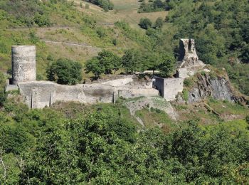
• Symbol: weiß auf rot: von den Zinnen eines Burgturmes gekröntes R
![Percorso A piedi Bacharach - Rheinburgenweg Zugangsweg Ruine Stahlberg - Photo](https://media.geolcdn.com/t/350/260/2f5acfe3-b3f6-459d-979d-ff91803ae091.jpeg&format=jpg&maxdim=2)
![A piedi A piedi](https://static1.geolcdn.com/sitytour/trail-icons/100.png)
Km
A piedi
![](/images/other/stat-length.png)
![](https://static1.geolcdn.com/siteimages/upload/files/1508320355ic_sort_den_pos_24dp.png)
![](https://static1.geolcdn.com/siteimages/upload/files/1508320355ic_sort_den_neg_24dp.png)
![](https://static1.geolcdn.com/siteimages/upload/files/16400158638029165_repeat_loop_refresh_sync_direction_icon.png)
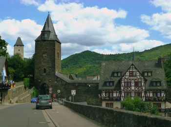
• Präsentiert die touristischen Angebote zwischen Rüdesheim und Bingen im Süden und dem Beginn des Siebengebirges im No...
3 percorsi visualizzati su 3
Applicazione GPS da escursionismo GRATUITA