![](/images/other/stat-length.png)
- Percorsi
- Outdoor
- Germany
- Renania Settentrionale-Vestfalia
- Kreis Lippe
- Horn-Bad Meinberg
Horn-Bad Meinberg, Kreis Lippe : I migliori sentieri, percorsi e passeggiate
Horn-Bad Meinberg: Scopri i migliori percorsi: 29 percorsi a piedi. Tutti questi percorsi, itinerari e attività outdoor sono disponibili nelle nostre app SityTrail per smartphone e tablet.
I percorsi migliori (0})
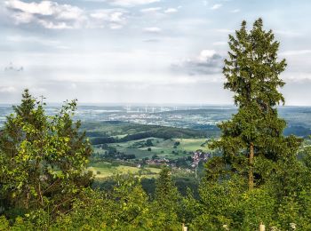
![Percorso A piedi Horn-Bad Meinberg - Pilgerweg](https://media.geolcdn.com/t/350/260/82208e22-56ad-4715-9507-28234728434e.jpeg&format=jpg&maxdim=2)
![A piedi A piedi](https://static1.geolcdn.com/sitytour/trail-icons/100.png)
Km
A piedi
![](/images/other/stat-length.png)
![](https://static1.geolcdn.com/siteimages/upload/files/1508320355ic_sort_den_pos_24dp.png)
![](https://static1.geolcdn.com/siteimages/upload/files/1508320355ic_sort_den_neg_24dp.png)
![](https://static1.geolcdn.com/siteimages/upload/files/16400158638029165_repeat_loop_refresh_sync_direction_icon.png)
• Trail created by katholische Kirchengemeinde Heilig-Kreuz Horn-Bad Meinberg. Symbol: unbekannt, Schwarzer "hiker" au...
![Percorso A piedi Horn-Bad Meinberg - Besinnungsweg (Kempen-Feldrom-Veldrom) - Photo](https://media.geolcdn.com/t/350/260/82208e22-56ad-4715-9507-28234728434e.jpeg&format=jpg&maxdim=2)
![A piedi A piedi](https://static1.geolcdn.com/sitytour/trail-icons/100.png)
Km
A piedi
![](/images/other/stat-length.png)
![](https://static1.geolcdn.com/siteimages/upload/files/1508320355ic_sort_den_pos_24dp.png)
![](https://static1.geolcdn.com/siteimages/upload/files/1508320355ic_sort_den_neg_24dp.png)
![](https://static1.geolcdn.com/siteimages/upload/files/16400158638029165_repeat_loop_refresh_sync_direction_icon.png)
• Trail created by katholische Kirchengemeinde Heilig-Kreuz Horn-Bad Meinberg.
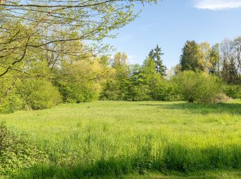
![Percorso A piedi Horn-Bad Meinberg - Oh! 8 - KinderErlebniswelt Natur - Photo](https://media.geolcdn.com/t/350/260/9fe25be8-744f-465d-9bd2-3708217eca3b.jpeg&format=jpg&maxdim=2)
![A piedi A piedi](https://static1.geolcdn.com/sitytour/trail-icons/100.png)
Km
A piedi
![](/images/other/stat-length.png)
![](https://static1.geolcdn.com/siteimages/upload/files/1508320355ic_sort_den_pos_24dp.png)
![](https://static1.geolcdn.com/siteimages/upload/files/1508320355ic_sort_den_neg_24dp.png)
![](https://static1.geolcdn.com/siteimages/upload/files/16400158638029165_repeat_loop_refresh_sync_direction_icon.png)
• Trail created by Naturpark Teutoburger Wald Eggegebirge.
![Percorso A piedi Horn-Bad Meinberg - Rundwanderweg A4 [Feldrom] - Photo](https://media.geolcdn.com/t/350/260/c3e2fda2-4a4b-4515-b251-ad31aeb36002.jpeg&format=jpg&maxdim=2)
![A piedi A piedi](https://static1.geolcdn.com/sitytour/trail-icons/100.png)
Km
A piedi
![](/images/other/stat-length.png)
![](https://static1.geolcdn.com/siteimages/upload/files/1508320355ic_sort_den_pos_24dp.png)
![](https://static1.geolcdn.com/siteimages/upload/files/1508320355ic_sort_den_neg_24dp.png)
![](https://static1.geolcdn.com/siteimages/upload/files/16400158638029165_repeat_loop_refresh_sync_direction_icon.png)
• Symbol: weiße Schrift "A4" auf schwarzen Grund
![Percorso A piedi Horn-Bad Meinberg - Rundwanderweg A2 [Feldrom] - Photo](https://media.geolcdn.com/t/350/260/82208e22-56ad-4715-9507-28234728434e.jpeg&format=jpg&maxdim=2)
![A piedi A piedi](https://static1.geolcdn.com/sitytour/trail-icons/100.png)
Km
A piedi
![](/images/other/stat-length.png)
![](https://static1.geolcdn.com/siteimages/upload/files/1508320355ic_sort_den_pos_24dp.png)
![](https://static1.geolcdn.com/siteimages/upload/files/1508320355ic_sort_den_neg_24dp.png)
![](https://static1.geolcdn.com/siteimages/upload/files/16400158638029165_repeat_loop_refresh_sync_direction_icon.png)
• Symbol: weiße Schrift "A2" auf schwarzen Grund
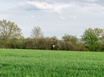
![Percorso A piedi Horn-Bad Meinberg - Zugangsweg Hermannshöhen - Horn-Bad Meinberg - Photo](https://media.geolcdn.com/t/350/260/481dc017-712c-4a92-87e6-77c38ebad9f4.jpeg&format=jpg&maxdim=2)
![A piedi A piedi](https://static1.geolcdn.com/sitytour/trail-icons/100.png)
Km
A piedi
![](/images/other/stat-length.png)
![](https://static1.geolcdn.com/siteimages/upload/files/1508320355ic_sort_den_pos_24dp.png)
![](https://static1.geolcdn.com/siteimages/upload/files/1508320355ic_sort_den_neg_24dp.png)
![](https://static1.geolcdn.com/siteimages/upload/files/16400158638029165_repeat_loop_refresh_sync_direction_icon.png)
• Trail created by Projektbüro Hermannshöhen.
![Percorso A piedi Horn-Bad Meinberg - Rundwanderweg A1 [Holzhausen-Externsteine] - Photo](https://media.geolcdn.com/t/350/260/917c6440-8043-45d4-9c08-101f3367a522.jpeg&format=jpg&maxdim=2)
![A piedi A piedi](https://static1.geolcdn.com/sitytour/trail-icons/100.png)
Km
A piedi
![](/images/other/stat-length.png)
![](https://static1.geolcdn.com/siteimages/upload/files/1508320355ic_sort_den_pos_24dp.png)
![](https://static1.geolcdn.com/siteimages/upload/files/1508320355ic_sort_den_neg_24dp.png)
![](https://static1.geolcdn.com/siteimages/upload/files/16400158638029165_repeat_loop_refresh_sync_direction_icon.png)
• Trail created by Lippischer Heimatbund.
![Percorso A piedi Horn-Bad Meinberg - Terrainkurweg 9 [Bad Meinberg] - Photo](https://media.geolcdn.com/t/350/260/415dab2e-d838-41c3-b2c1-c698395be57c.jpeg&format=jpg&maxdim=2)
![A piedi A piedi](https://static1.geolcdn.com/sitytour/trail-icons/100.png)
Km
A piedi
![](/images/other/stat-length.png)
![](https://static1.geolcdn.com/siteimages/upload/files/1508320355ic_sort_den_pos_24dp.png)
![](https://static1.geolcdn.com/siteimages/upload/files/1508320355ic_sort_den_neg_24dp.png)
![](https://static1.geolcdn.com/siteimages/upload/files/16400158638029165_repeat_loop_refresh_sync_direction_icon.png)
• Trail created by GesUndTourismus Horn-Bad Meinberg GmbH.
![Percorso A piedi Horn-Bad Meinberg - Terrainkurweg 5 [Bad Meinberg] - Photo](https://media.geolcdn.com/t/350/260/c6c364b8-a98c-4894-be50-01092c15d2a2.jpeg&format=jpg&maxdim=2)
![A piedi A piedi](https://static1.geolcdn.com/sitytour/trail-icons/100.png)
Km
A piedi
![](/images/other/stat-length.png)
![](https://static1.geolcdn.com/siteimages/upload/files/1508320355ic_sort_den_pos_24dp.png)
![](https://static1.geolcdn.com/siteimages/upload/files/1508320355ic_sort_den_neg_24dp.png)
![](https://static1.geolcdn.com/siteimages/upload/files/16400158638029165_repeat_loop_refresh_sync_direction_icon.png)
• Trail created by GesUndTourismus Horn-Bad Meinberg GmbH.
![Percorso A piedi Horn-Bad Meinberg - Terrainkurweg 4 [Bad Meinberg] - Photo](https://media.geolcdn.com/t/350/260/17855ced-c021-469c-b31b-b1f4ceaf95e0.jpeg&format=jpg&maxdim=2)
![A piedi A piedi](https://static1.geolcdn.com/sitytour/trail-icons/100.png)
Km
A piedi
![](/images/other/stat-length.png)
![](https://static1.geolcdn.com/siteimages/upload/files/1508320355ic_sort_den_pos_24dp.png)
![](https://static1.geolcdn.com/siteimages/upload/files/1508320355ic_sort_den_neg_24dp.png)
![](https://static1.geolcdn.com/siteimages/upload/files/16400158638029165_repeat_loop_refresh_sync_direction_icon.png)
• Trail created by GesUndTourismus Horn-Bad Meinberg GmbH.
![Percorso A piedi Horn-Bad Meinberg - Rundwanderweg A5 [Horn] - Photo](https://media.geolcdn.com/t/350/260/4fb4c3bc-36b1-4cb9-b69c-377d560ed1e3.jpeg&format=jpg&maxdim=2)
![A piedi A piedi](https://static1.geolcdn.com/sitytour/trail-icons/100.png)
Km
A piedi
![](/images/other/stat-length.png)
![](https://static1.geolcdn.com/siteimages/upload/files/1508320355ic_sort_den_pos_24dp.png)
![](https://static1.geolcdn.com/siteimages/upload/files/1508320355ic_sort_den_neg_24dp.png)
![](https://static1.geolcdn.com/siteimages/upload/files/16400158638029165_repeat_loop_refresh_sync_direction_icon.png)
• Trail created by Lippischer Heimatbund.
![Percorso A piedi Horn-Bad Meinberg - Rundwanderweg A2 [Holzhausen-Externsteine] - Photo](https://media.geolcdn.com/t/350/260/496f2643-585c-4ec3-ad5f-48d37358ba78.jpeg&format=jpg&maxdim=2)
![A piedi A piedi](https://static1.geolcdn.com/sitytour/trail-icons/100.png)
Km
A piedi
![](/images/other/stat-length.png)
![](https://static1.geolcdn.com/siteimages/upload/files/1508320355ic_sort_den_pos_24dp.png)
![](https://static1.geolcdn.com/siteimages/upload/files/1508320355ic_sort_den_neg_24dp.png)
![](https://static1.geolcdn.com/siteimages/upload/files/16400158638029165_repeat_loop_refresh_sync_direction_icon.png)
• Trail created by Lippischer Heimatbund.
![Percorso A piedi Horn-Bad Meinberg - Ruhe - Wanderweg Norderteich [Bad Meinberg] (VitalWanderWelt) - Photo](https://media.geolcdn.com/t/350/260/62948217-785e-4bf8-a3a7-9c99707dba50.jpeg&format=jpg&maxdim=2)
![A piedi A piedi](https://static1.geolcdn.com/sitytour/trail-icons/100.png)
Km
A piedi
![](/images/other/stat-length.png)
![](https://static1.geolcdn.com/siteimages/upload/files/1508320355ic_sort_den_pos_24dp.png)
![](https://static1.geolcdn.com/siteimages/upload/files/1508320355ic_sort_den_neg_24dp.png)
![](https://static1.geolcdn.com/siteimages/upload/files/16400158638029165_repeat_loop_refresh_sync_direction_icon.png)
• Trail created by ???. Symbol: weises V auf orangen Grund
![Percorso A piedi Horn-Bad Meinberg - Norderteich-Rundwanderweg [Billerbeck / Entenkrug] - Photo](https://media.geolcdn.com/t/350/260/0fd9e1b3-fa56-43c1-84a2-bd9d47765815.jpeg&format=jpg&maxdim=2)
![A piedi A piedi](https://static1.geolcdn.com/sitytour/trail-icons/100.png)
Km
A piedi
![](/images/other/stat-length.png)
![](https://static1.geolcdn.com/siteimages/upload/files/1508320355ic_sort_den_pos_24dp.png)
![](https://static1.geolcdn.com/siteimages/upload/files/1508320355ic_sort_den_neg_24dp.png)
![](https://static1.geolcdn.com/siteimages/upload/files/16400158638029165_repeat_loop_refresh_sync_direction_icon.png)
• Symbol: Weißer Text A3 auf schwarzem Grund
![Percorso A piedi Horn-Bad Meinberg - DSV nordic aktiv - rote Route [Bad Meinberg] (Nordic Walking) - Photo](https://media.geolcdn.com/t/350/260/415dab2e-d838-41c3-b2c1-c698395be57c.jpeg&format=jpg&maxdim=2)
![A piedi A piedi](https://static1.geolcdn.com/sitytour/trail-icons/100.png)
Km
A piedi
![](/images/other/stat-length.png)
![](https://static1.geolcdn.com/siteimages/upload/files/1508320355ic_sort_den_pos_24dp.png)
![](https://static1.geolcdn.com/siteimages/upload/files/1508320355ic_sort_den_neg_24dp.png)
![](https://static1.geolcdn.com/siteimages/upload/files/16400158638029165_repeat_loop_refresh_sync_direction_icon.png)
• Trail created by DSV. Symbol: weißer Pfeil auf rotem Grund + Text "DSV nordic aktiv"
![Percorso A piedi Horn-Bad Meinberg - Rundwanderweg A4 [Bauernkamp] - Photo](https://media.geolcdn.com/t/350/260/c79f5669-94e6-4aca-a5f1-993a25b95dc3.jpeg&format=jpg&maxdim=2)
![A piedi A piedi](https://static1.geolcdn.com/sitytour/trail-icons/100.png)
Km
A piedi
![](/images/other/stat-length.png)
![](https://static1.geolcdn.com/siteimages/upload/files/1508320355ic_sort_den_pos_24dp.png)
![](https://static1.geolcdn.com/siteimages/upload/files/1508320355ic_sort_den_neg_24dp.png)
![](https://static1.geolcdn.com/siteimages/upload/files/16400158638029165_repeat_loop_refresh_sync_direction_icon.png)
• Trail created by Lippischer Heimatbund. Symbol: weiße Schrift auf schwarzem Grund "A4"
![Percorso A piedi Horn-Bad Meinberg - Rundwanderweg [Entenkrug / Belle] - Photo](https://media.geolcdn.com/t/350/260/9e2da189-e14c-4292-a999-33745ed99a73.jpeg&format=jpg&maxdim=2)
![A piedi A piedi](https://static1.geolcdn.com/sitytour/trail-icons/100.png)
Km
A piedi
![](/images/other/stat-length.png)
![](https://static1.geolcdn.com/siteimages/upload/files/1508320355ic_sort_den_pos_24dp.png)
![](https://static1.geolcdn.com/siteimages/upload/files/1508320355ic_sort_den_neg_24dp.png)
![](https://static1.geolcdn.com/siteimages/upload/files/16400158638029165_repeat_loop_refresh_sync_direction_icon.png)
• Symbol: weißes A1 auf schwarzem Grund
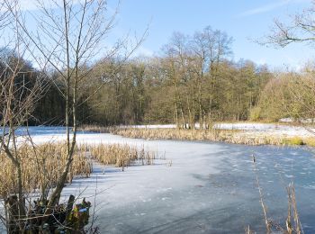
![Percorso A piedi Horn-Bad Meinberg - Themenweg M](https://media.geolcdn.com/t/350/260/0c76052b-4685-4552-8bc7-b2246bf963c2.jpeg&format=jpg&maxdim=2)
![A piedi A piedi](https://static1.geolcdn.com/sitytour/trail-icons/100.png)
Km
A piedi
![](/images/other/stat-length.png)
![](https://static1.geolcdn.com/siteimages/upload/files/1508320355ic_sort_den_pos_24dp.png)
![](https://static1.geolcdn.com/siteimages/upload/files/1508320355ic_sort_den_neg_24dp.png)
![](https://static1.geolcdn.com/siteimages/upload/files/16400158638029165_repeat_loop_refresh_sync_direction_icon.png)
• kombinierte Fahrrad- und Fußwandertour: Zwischen Holzhausen (Station 1) und Leopoldstal (Station 3) nur Fußwandern mö...
![Percorso A piedi Horn-Bad Meinberg - Rundwanderweg A2 [Schauinsland / Entenkrug] - Photo](https://media.geolcdn.com/t/350/260/0c76052b-4685-4552-8bc7-b2246bf963c2.jpeg&format=jpg&maxdim=2)
![A piedi A piedi](https://static1.geolcdn.com/sitytour/trail-icons/100.png)
Km
A piedi
![](/images/other/stat-length.png)
![](https://static1.geolcdn.com/siteimages/upload/files/1508320355ic_sort_den_pos_24dp.png)
![](https://static1.geolcdn.com/siteimages/upload/files/1508320355ic_sort_den_neg_24dp.png)
![](https://static1.geolcdn.com/siteimages/upload/files/16400158638029165_repeat_loop_refresh_sync_direction_icon.png)
• Symbol: Weißer Text A2 auf schwarzem Grund
![Percorso A piedi Horn-Bad Meinberg - Terrainkurweg 7 [Bad Meinberg] - Photo](https://media.geolcdn.com/t/350/260/c6c364b8-a98c-4894-be50-01092c15d2a2.jpeg&format=jpg&maxdim=2)
![A piedi A piedi](https://static1.geolcdn.com/sitytour/trail-icons/100.png)
Km
A piedi
![](/images/other/stat-length.png)
![](https://static1.geolcdn.com/siteimages/upload/files/1508320355ic_sort_den_pos_24dp.png)
![](https://static1.geolcdn.com/siteimages/upload/files/1508320355ic_sort_den_neg_24dp.png)
![](https://static1.geolcdn.com/siteimages/upload/files/16400158638029165_repeat_loop_refresh_sync_direction_icon.png)
• Trail created by GesUndTourismus Horn-Bad Meinberg GmbH.
20 percorsi visualizzati su 29
Applicazione GPS da escursionismo GRATUITA