![](/images/other/stat-length.png)
- Percorsi
- Outdoor
- Germany
- Baviera
- Landkreis Rhön-Grabfeld
- Bischofsheim i.d.Rhön
Bischofsheim i.d.Rhön, Landkreis Rhön-Grabfeld : I migliori sentieri, percorsi e passeggiate
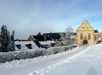
Bischofsheim i.d.Rhön: Scopri i migliori percorsi: 8 percorsi a piedi. Tutti questi percorsi, itinerari e attività outdoor sono disponibili nelle nostre app SityTrail per smartphone e tablet.
I percorsi migliori (0})
![Percorso A piedi Bischofsheim i.d.Rhön - Bischofsheim Rundweg 5 - Auf den Käuling - Photo](https://media.geolcdn.com/t/350/260/0eadad41-9bf4-4749-8598-1313c0d854e3.jpeg&format=jpg&maxdim=2)
![A piedi A piedi](https://static1.geolcdn.com/sitytour/trail-icons/100.png)
Km
A piedi
![](/images/other/stat-length.png)
![](https://static1.geolcdn.com/siteimages/upload/files/1508320355ic_sort_den_pos_24dp.png)
![](https://static1.geolcdn.com/siteimages/upload/files/1508320355ic_sort_den_neg_24dp.png)
![](https://static1.geolcdn.com/siteimages/upload/files/16400158638029165_repeat_loop_refresh_sync_direction_icon.png)
• Trail created by Naturpark Hessische Rhön. Symbol: white 5 on blue square
![Percorso A piedi Bischofsheim i.d.Rhön - Bischofsheim Rundweg 4 - Rund um den Finkelberg - Photo](https://media.geolcdn.com/t/350/260/40b76fc1-3ef7-463c-9480-43a7050dea62.jpeg&format=jpg&maxdim=2)
![A piedi A piedi](https://static1.geolcdn.com/sitytour/trail-icons/100.png)
Km
A piedi
![](/images/other/stat-length.png)
![](https://static1.geolcdn.com/siteimages/upload/files/1508320355ic_sort_den_pos_24dp.png)
![](https://static1.geolcdn.com/siteimages/upload/files/1508320355ic_sort_den_neg_24dp.png)
![](https://static1.geolcdn.com/siteimages/upload/files/16400158638029165_repeat_loop_refresh_sync_direction_icon.png)
• Trail created by Naturpark Hessische Rhön. Symbol: white 4 on blue square
![Percorso A piedi Bischofsheim i.d.Rhön - Bischofsheim Rundweg 2 (Unterweißenbrunn) - Zur Lourdesgrotte - Photo](https://media.geolcdn.com/t/350/260/19fd5735-0ead-443e-8d8a-a1500e3ed88e.jpeg&format=jpg&maxdim=2)
![A piedi A piedi](https://static1.geolcdn.com/sitytour/trail-icons/100.png)
Km
A piedi
![](/images/other/stat-length.png)
![](https://static1.geolcdn.com/siteimages/upload/files/1508320355ic_sort_den_pos_24dp.png)
![](https://static1.geolcdn.com/siteimages/upload/files/1508320355ic_sort_den_neg_24dp.png)
![](https://static1.geolcdn.com/siteimages/upload/files/16400158638029165_repeat_loop_refresh_sync_direction_icon.png)
• Trail created by Naturpark Hessische Rhön. Symbol: white 2 on blue square
![Percorso A piedi Bischofsheim i.d.Rhön - Bischofsheim Rundweg 1 - Zum Bauersberg - Photo](https://media.geolcdn.com/t/350/260/0eadad41-9bf4-4749-8598-1313c0d854e3.jpeg&format=jpg&maxdim=2)
![A piedi A piedi](https://static1.geolcdn.com/sitytour/trail-icons/100.png)
Km
A piedi
![](/images/other/stat-length.png)
![](https://static1.geolcdn.com/siteimages/upload/files/1508320355ic_sort_den_pos_24dp.png)
![](https://static1.geolcdn.com/siteimages/upload/files/1508320355ic_sort_den_neg_24dp.png)
![](https://static1.geolcdn.com/siteimages/upload/files/16400158638029165_repeat_loop_refresh_sync_direction_icon.png)
• Trail created by Naturpark Hessische Rhön. Symbol: white 1 on blue square
![Percorso A piedi Bischofsheim i.d.Rhön - Osterburg - Gemündener Hütte und Kreuzberg - Photo](https://media.geolcdn.com/t/350/260/b30704d0-ef83-4bcc-9322-e37b8c462709.jpeg&format=jpg&maxdim=2)
![A piedi A piedi](https://static1.geolcdn.com/sitytour/trail-icons/100.png)
Km
A piedi
![](/images/other/stat-length.png)
![](https://static1.geolcdn.com/siteimages/upload/files/1508320355ic_sort_den_pos_24dp.png)
![](https://static1.geolcdn.com/siteimages/upload/files/1508320355ic_sort_den_neg_24dp.png)
![](https://static1.geolcdn.com/siteimages/upload/files/16400158638029165_repeat_loop_refresh_sync_direction_icon.png)
• Trail created by Naturpark Hessische Rhön. Symbol: white 6 on blue square
![Percorso A piedi Bischofsheim i.d.Rhön - Kreuzberg - Rund ums Kloster - Photo](https://media.geolcdn.com/t/350/260/9af2d83d-556b-4c7c-9ae5-0bac678385ff.jpeg&format=jpg&maxdim=2)
![A piedi A piedi](https://static1.geolcdn.com/sitytour/trail-icons/100.png)
Km
A piedi
![](/images/other/stat-length.png)
![](https://static1.geolcdn.com/siteimages/upload/files/1508320355ic_sort_den_pos_24dp.png)
![](https://static1.geolcdn.com/siteimages/upload/files/1508320355ic_sort_den_neg_24dp.png)
![](https://static1.geolcdn.com/siteimages/upload/files/16400158638029165_repeat_loop_refresh_sync_direction_icon.png)
• Trail created by Naturpark Hessische Rhön. Symbol: white 2 on blue square
![Percorso A piedi Bischofsheim i.d.Rhön - Zubringer Der Hochrhöner, Bischofsheim - Photo](https://media.geolcdn.com/t/350/260/b30704d0-ef83-4bcc-9322-e37b8c462709.jpeg&format=jpg&maxdim=2)
![A piedi A piedi](https://static1.geolcdn.com/sitytour/trail-icons/100.png)
Km
A piedi
![](/images/other/stat-length.png)
![](https://static1.geolcdn.com/siteimages/upload/files/1508320355ic_sort_den_pos_24dp.png)
![](https://static1.geolcdn.com/siteimages/upload/files/1508320355ic_sort_den_neg_24dp.png)
![](https://static1.geolcdn.com/siteimages/upload/files/16400158638029165_repeat_loop_refresh_sync_direction_icon.png)
• Trail created by Rhönclub. Symbol: grünes Ö auf weissem Grund
![Percorso A piedi Bischofsheim i.d.Rhön - Bischofsheim Rundweg 6 - Zum Rhönhäuschen - Photo](https://media.geolcdn.com/t/350/260/f8586f10-a120-4c4b-9ce9-ea688b8791a7.jpeg&format=jpg&maxdim=2)
![A piedi A piedi](https://static1.geolcdn.com/sitytour/trail-icons/100.png)
Km
A piedi
![](/images/other/stat-length.png)
![](https://static1.geolcdn.com/siteimages/upload/files/1508320355ic_sort_den_pos_24dp.png)
![](https://static1.geolcdn.com/siteimages/upload/files/1508320355ic_sort_den_neg_24dp.png)
![](https://static1.geolcdn.com/siteimages/upload/files/16400158638029165_repeat_loop_refresh_sync_direction_icon.png)
• Trail created by Naturpark Hessische Rhön. Symbol: white 6 on blue square
8 percorsi visualizzati su 8
Applicazione GPS da escursionismo GRATUITA