![](/images/other/stat-length.png)
Landkreis Tirschenreuth, Baviera : I migliori sentieri, percorsi e passeggiate
Landkreis Tirschenreuth: Scopri i migliori percorsi: 85 percorsi a piedi. Tutti questi percorsi, itinerari e attività outdoor sono disponibili nelle nostre app SityTrail per smartphone e tablet.
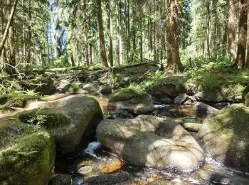
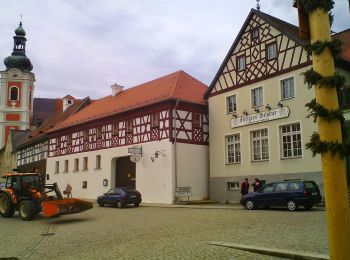
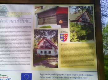
I percorsi migliori (0})
![Percorso A piedi Bärnau - Goldsteig Verbindungsweg Bärnau - Tachov - Photo](https://media.geolcdn.com/t/350/260/9d4c2b1a-5286-473e-ad9f-026784264d66.jpeg&format=jpg&maxdim=2)
![A piedi A piedi](https://static1.geolcdn.com/sitytour/trail-icons/100.png)
Km
A piedi
![](/images/other/stat-length.png)
![](https://static1.geolcdn.com/siteimages/upload/files/1508320355ic_sort_den_pos_24dp.png)
![](https://static1.geolcdn.com/siteimages/upload/files/1508320355ic_sort_den_neg_24dp.png)
![](https://static1.geolcdn.com/siteimages/upload/files/16400158638029165_repeat_loop_refresh_sync_direction_icon.png)
• Simbolo: blauer, stilisierter s-förmiger Weg auf weißem, rechteckigen Grund Sito web: https://zlatoustezkou.cz/rout...
![Percorso A piedi Neualbenreuth - Neualbenreuth: Auf stillen Waldpfaden zur Grenze - Photo](https://media.geolcdn.com/t/350/260/da23ae0e-15a2-4ebb-81d9-23741e0bbc84.jpeg&format=jpg&maxdim=2)
![A piedi A piedi](https://static1.geolcdn.com/sitytour/trail-icons/100.png)
Km
A piedi
![](/images/other/stat-length.png)
![](https://static1.geolcdn.com/siteimages/upload/files/1508320355ic_sort_den_pos_24dp.png)
![](https://static1.geolcdn.com/siteimages/upload/files/1508320355ic_sort_den_neg_24dp.png)
![](https://static1.geolcdn.com/siteimages/upload/files/16400158638029165_repeat_loop_refresh_sync_direction_icon.png)
• Simbolo: auf weißem Hintergrund ein gelber Punkt
![Percorso A piedi Neualbenreuth - Neualbenreuth: In einem Tag durch das Fraisch-Gebiet - Photo](https://media.geolcdn.com/t/350/260/03a83182-60a3-4efd-ae3e-013f5ce67585.jpeg&format=jpg&maxdim=2)
![A piedi A piedi](https://static1.geolcdn.com/sitytour/trail-icons/100.png)
Km
A piedi
![](/images/other/stat-length.png)
![](https://static1.geolcdn.com/siteimages/upload/files/1508320355ic_sort_den_pos_24dp.png)
![](https://static1.geolcdn.com/siteimages/upload/files/1508320355ic_sort_den_neg_24dp.png)
![](https://static1.geolcdn.com/siteimages/upload/files/16400158638029165_repeat_loop_refresh_sync_direction_icon.png)
• Percorso creato da Oberpfälzer Waldverein. Simbolo: Weißer Punkt auf grünem Hintergrund Sito web: http://wandern-i...
![Percorso A piedi Neualbenreuth - Alter Herrgott - Granatbrunnen - Photo](https://media.geolcdn.com/t/350/260/f00bb44f-3a31-494e-b91b-cb23ec59b052.jpeg&format=jpg&maxdim=2)
![A piedi A piedi](https://static1.geolcdn.com/sitytour/trail-icons/100.png)
Km
A piedi
![](/images/other/stat-length.png)
![](https://static1.geolcdn.com/siteimages/upload/files/1508320355ic_sort_den_pos_24dp.png)
![](https://static1.geolcdn.com/siteimages/upload/files/1508320355ic_sort_den_neg_24dp.png)
![](https://static1.geolcdn.com/siteimages/upload/files/16400158638029165_repeat_loop_refresh_sync_direction_icon.png)
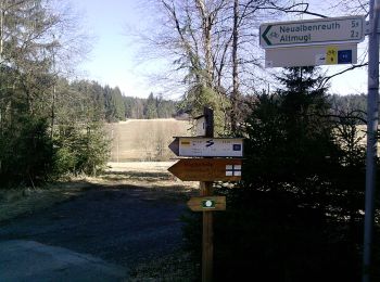
• Percorso creato da Oberpfälzer Waldverein Neualbenreuth. Simbolo: auf weißem Hintergrund ein diagonal steigender rot...
![Percorso A piedi Ebnath - Ebnath Rundwanderweg Nr. 3 - Photo](https://media.geolcdn.com/t/350/260/3f63cbe1-6a10-41c5-a013-7779d9cacd33.jpeg&format=jpg&maxdim=2)
![A piedi A piedi](https://static1.geolcdn.com/sitytour/trail-icons/100.png)
Km
A piedi
![](/images/other/stat-length.png)
![](https://static1.geolcdn.com/siteimages/upload/files/1508320355ic_sort_den_pos_24dp.png)
![](https://static1.geolcdn.com/siteimages/upload/files/1508320355ic_sort_den_neg_24dp.png)
![](https://static1.geolcdn.com/siteimages/upload/files/16400158638029165_repeat_loop_refresh_sync_direction_icon.png)
• Symbol: rote 3 auf weißem Grund
![Percorso A piedi Neualbenreuth - Alter Herrgott Weg - Photo](https://media.geolcdn.com/t/350/260/da23ae0e-15a2-4ebb-81d9-23741e0bbc84.jpeg&format=jpg&maxdim=2)
![A piedi A piedi](https://static1.geolcdn.com/sitytour/trail-icons/100.png)
Km
A piedi
![](/images/other/stat-length.png)
![](https://static1.geolcdn.com/siteimages/upload/files/1508320355ic_sort_den_pos_24dp.png)
![](https://static1.geolcdn.com/siteimages/upload/files/1508320355ic_sort_den_neg_24dp.png)
![](https://static1.geolcdn.com/siteimages/upload/files/16400158638029165_repeat_loop_refresh_sync_direction_icon.png)
• Trail created by Oberpfälzer Waldverein. Symbol: Blauer Balken auf weißem Hintergrund Sito web: https://wandern-in...
![Percorso A piedi Waldsassen - Muglbach Weg - Photo](https://media.geolcdn.com/t/350/260/e65b2066-a961-447a-bff6-6e75825cfedf.jpeg&format=jpg&maxdim=2)
![A piedi A piedi](https://static1.geolcdn.com/sitytour/trail-icons/100.png)
Km
A piedi
![](/images/other/stat-length.png)
![](https://static1.geolcdn.com/siteimages/upload/files/1508320355ic_sort_den_pos_24dp.png)
![](https://static1.geolcdn.com/siteimages/upload/files/1508320355ic_sort_den_neg_24dp.png)
![](https://static1.geolcdn.com/siteimages/upload/files/16400158638029165_repeat_loop_refresh_sync_direction_icon.png)
• Trail created by Oberpfälzer Waldverein. Symbol: Blaues Kreuz auf weißem Hintergrund Sito web: https://wandern-in-...
![Percorso A piedi Neualbenreuth - Ringelfelsen-Weg - Photo](https://media.geolcdn.com/t/350/260/95845725-0005-4d81-920c-73b4f09cdf34.jpeg&format=jpg&maxdim=2)
![A piedi A piedi](https://static1.geolcdn.com/sitytour/trail-icons/100.png)
Km
A piedi
![](/images/other/stat-length.png)
![](https://static1.geolcdn.com/siteimages/upload/files/1508320355ic_sort_den_pos_24dp.png)
![](https://static1.geolcdn.com/siteimages/upload/files/1508320355ic_sort_den_neg_24dp.png)
![](https://static1.geolcdn.com/siteimages/upload/files/16400158638029165_repeat_loop_refresh_sync_direction_icon.png)
• Trail created by Oberpfälzer Waldverein. Das osmc-Symbol gibt es nur mit blau in der linken unteren Ecke. Original i...
![Percorso A piedi Neualbenreuth - Neualbenreuth: Wanderweg Sibyllenbad Gedankental - Photo](https://media.geolcdn.com/t/350/260/95845725-0005-4d81-920c-73b4f09cdf34.jpeg&format=jpg&maxdim=2)
![A piedi A piedi](https://static1.geolcdn.com/sitytour/trail-icons/100.png)
Km
A piedi
![](/images/other/stat-length.png)
![](https://static1.geolcdn.com/siteimages/upload/files/1508320355ic_sort_den_pos_24dp.png)
![](https://static1.geolcdn.com/siteimages/upload/files/1508320355ic_sort_den_neg_24dp.png)
![](https://static1.geolcdn.com/siteimages/upload/files/16400158638029165_repeat_loop_refresh_sync_direction_icon.png)
• Trail created by Oberpfälzer Waldverein. Symbol: Schwarzer Punkt auf weißem Hintergrund
![Percorso A piedi Neualbenreuth - Neualbenreuth: Auf den Spuen der Waldsassener Äbte - Photo](https://media.geolcdn.com/t/350/260/5f042772-f8e8-470c-b546-2ed4e5c1411b.jpeg&format=jpg&maxdim=2)
![A piedi A piedi](https://static1.geolcdn.com/sitytour/trail-icons/100.png)
Km
A piedi
![](/images/other/stat-length.png)
![](https://static1.geolcdn.com/siteimages/upload/files/1508320355ic_sort_den_pos_24dp.png)
![](https://static1.geolcdn.com/siteimages/upload/files/1508320355ic_sort_den_neg_24dp.png)
![](https://static1.geolcdn.com/siteimages/upload/files/16400158638029165_repeat_loop_refresh_sync_direction_icon.png)
• Trail created by Oberpfälzer Waldverein. Symbol: Grüner Punkt auf weißem Hintergrund
![Percorso A piedi Bärnau - Silberhütte - Kopfstein - Photo](https://media.geolcdn.com/t/350/260/7759dbb8-edd6-42bc-af5d-f469a90c4d62.jpeg&format=jpg&maxdim=2)
![A piedi A piedi](https://static1.geolcdn.com/sitytour/trail-icons/100.png)
Km
A piedi
![](/images/other/stat-length.png)
![](https://static1.geolcdn.com/siteimages/upload/files/1508320355ic_sort_den_pos_24dp.png)
![](https://static1.geolcdn.com/siteimages/upload/files/1508320355ic_sort_den_neg_24dp.png)
![](https://static1.geolcdn.com/siteimages/upload/files/16400158638029165_repeat_loop_refresh_sync_direction_icon.png)
• Symbol: Rote schräg steigende Linie auf weißem, rechteckigen Grund
![Percorso A piedi Tirschenreuth - Tirschenreuth Rundwanderweg Nr. 10 - Photo](https://media.geolcdn.com/t/350/260/56b3f6bf-7c7d-4e4a-baf0-49b92b6987cf.jpeg&format=jpg&maxdim=2)
![A piedi A piedi](https://static1.geolcdn.com/sitytour/trail-icons/100.png)
Km
A piedi
![](/images/other/stat-length.png)
![](https://static1.geolcdn.com/siteimages/upload/files/1508320355ic_sort_den_pos_24dp.png)
![](https://static1.geolcdn.com/siteimages/upload/files/1508320355ic_sort_den_neg_24dp.png)
![](https://static1.geolcdn.com/siteimages/upload/files/16400158638029165_repeat_loop_refresh_sync_direction_icon.png)
• Trail created by Oberpfälzer Waldverein Tirschenreuth. Symbol: Rote 10 auf weißen Grund
![Percorso A piedi Waldershof - Schurbach - Waldershof - Photo](https://media.geolcdn.com/t/350/260/b1d41bec-ebce-4ee9-87a4-934bb590bea4.jpeg&format=jpg&maxdim=2)
![A piedi A piedi](https://static1.geolcdn.com/sitytour/trail-icons/100.png)
Km
A piedi
![](/images/other/stat-length.png)
![](https://static1.geolcdn.com/siteimages/upload/files/1508320355ic_sort_den_pos_24dp.png)
![](https://static1.geolcdn.com/siteimages/upload/files/1508320355ic_sort_den_neg_24dp.png)
![](https://static1.geolcdn.com/siteimages/upload/files/16400158638029165_repeat_loop_refresh_sync_direction_icon.png)
• Trail created by FGV.
![Percorso A piedi Kemnath - GEO-Erlebnisweg Kemnather Land - Waldeckrunde - Photo](https://media.geolcdn.com/t/350/260/5ef45f14-b35d-4340-aa30-c9aa60adabf6.jpeg&format=jpg&maxdim=2)
![A piedi A piedi](https://static1.geolcdn.com/sitytour/trail-icons/100.png)
Km
A piedi
![](/images/other/stat-length.png)
![](https://static1.geolcdn.com/siteimages/upload/files/1508320355ic_sort_den_pos_24dp.png)
![](https://static1.geolcdn.com/siteimages/upload/files/1508320355ic_sort_den_neg_24dp.png)
![](https://static1.geolcdn.com/siteimages/upload/files/16400158638029165_repeat_loop_refresh_sync_direction_icon.png)
• Trail created by GEOPARK Bayern-Böhmen. Markierung nur im Uhrzeigersinn
![Percorso A piedi Kemnath - GEO-Erlebnisweg Kemnather Land - Kemnathrunde - Photo](https://media.geolcdn.com/t/350/260/0466d926-e00b-4bf8-8184-850748a9e11d.jpeg&format=jpg&maxdim=2)
![A piedi A piedi](https://static1.geolcdn.com/sitytour/trail-icons/100.png)
Km
A piedi
![](/images/other/stat-length.png)
![](https://static1.geolcdn.com/siteimages/upload/files/1508320355ic_sort_den_pos_24dp.png)
![](https://static1.geolcdn.com/siteimages/upload/files/1508320355ic_sort_den_neg_24dp.png)
![](https://static1.geolcdn.com/siteimages/upload/files/16400158638029165_repeat_loop_refresh_sync_direction_icon.png)
• Trail created by GEOPARK Bayern-Böhmen. Markierung nur im Uhrzeigersinn
![Percorso A piedi Falkenberg - Falkenberg Rundwanderweg 6 - Photo](https://media.geolcdn.com/t/350/260/5d1a764f-d369-463b-84eb-5983451d6461.jpeg&format=jpg&maxdim=2)
![A piedi A piedi](https://static1.geolcdn.com/sitytour/trail-icons/100.png)
Km
A piedi
![](/images/other/stat-length.png)
![](https://static1.geolcdn.com/siteimages/upload/files/1508320355ic_sort_den_pos_24dp.png)
![](https://static1.geolcdn.com/siteimages/upload/files/1508320355ic_sort_den_neg_24dp.png)
![](https://static1.geolcdn.com/siteimages/upload/files/16400158638029165_repeat_loop_refresh_sync_direction_icon.png)
• Symbol: 6 dunkelrot
![Percorso A piedi Falkenberg - Falkenberg Rundwanderweg 2 - Photo](https://media.geolcdn.com/t/350/260/5d1a764f-d369-463b-84eb-5983451d6461.jpeg&format=jpg&maxdim=2)
![A piedi A piedi](https://static1.geolcdn.com/sitytour/trail-icons/100.png)
Km
A piedi
![](/images/other/stat-length.png)
![](https://static1.geolcdn.com/siteimages/upload/files/1508320355ic_sort_den_pos_24dp.png)
![](https://static1.geolcdn.com/siteimages/upload/files/1508320355ic_sort_den_neg_24dp.png)
![](https://static1.geolcdn.com/siteimages/upload/files/16400158638029165_repeat_loop_refresh_sync_direction_icon.png)
• Symbol: 2 dunkelblau
![Percorso A piedi Falkenberg - Falkenberg Rundwanderweg 5 - Photo](https://media.geolcdn.com/t/350/260/99d6129f-5585-4c03-ae91-1e0dc5cc3fa6.jpeg&format=jpg&maxdim=2)
![A piedi A piedi](https://static1.geolcdn.com/sitytour/trail-icons/100.png)
Km
A piedi
![](/images/other/stat-length.png)
![](https://static1.geolcdn.com/siteimages/upload/files/1508320355ic_sort_den_pos_24dp.png)
![](https://static1.geolcdn.com/siteimages/upload/files/1508320355ic_sort_den_neg_24dp.png)
![](https://static1.geolcdn.com/siteimages/upload/files/16400158638029165_repeat_loop_refresh_sync_direction_icon.png)
• Symbol: 5 blau
![Percorso A piedi Waldershof - Rundwanderweg Waldershof Nr. 2](https://media.geolcdn.com/t/350/260/b1d41bec-ebce-4ee9-87a4-934bb590bea4.jpeg&format=jpg&maxdim=2)
![A piedi A piedi](https://static1.geolcdn.com/sitytour/trail-icons/100.png)
Km
A piedi
![](/images/other/stat-length.png)
![](https://static1.geolcdn.com/siteimages/upload/files/1508320355ic_sort_den_pos_24dp.png)
![](https://static1.geolcdn.com/siteimages/upload/files/1508320355ic_sort_den_neg_24dp.png)
![](https://static1.geolcdn.com/siteimages/upload/files/16400158638029165_repeat_loop_refresh_sync_direction_icon.png)
• Trail created by FGV Waldershof. Symbol: schwarze 2 auf weißem Grund
![Percorso A piedi Waldershof - Rundwanderweg Waldershof Nr. 1](https://media.geolcdn.com/t/350/260/b1d41bec-ebce-4ee9-87a4-934bb590bea4.jpeg&format=jpg&maxdim=2)
![A piedi A piedi](https://static1.geolcdn.com/sitytour/trail-icons/100.png)
Km
A piedi
![](/images/other/stat-length.png)
![](https://static1.geolcdn.com/siteimages/upload/files/1508320355ic_sort_den_pos_24dp.png)
![](https://static1.geolcdn.com/siteimages/upload/files/1508320355ic_sort_den_neg_24dp.png)
![](https://static1.geolcdn.com/siteimages/upload/files/16400158638029165_repeat_loop_refresh_sync_direction_icon.png)
• Trail created by FGV Waldershof. Symbol: schwarze 1 auf weißem Grund
20 percorsi visualizzati su 85
Applicazione GPS da escursionismo GRATUITA