![](/images/other/stat-length.png)
Landkreis Kronach, Baviera : I migliori sentieri, percorsi e passeggiate
Landkreis Kronach: Scopri i migliori percorsi: 46 percorsi a piedi. Tutti questi percorsi, itinerari e attività outdoor sono disponibili nelle nostre app SityTrail per smartphone e tablet.
I percorsi migliori (0})
![Percorso A piedi Marktrodach - Rodachtal-Weg KC 11 - Photo](https://media.geolcdn.com/t/350/260/16f35098-1f4f-446e-85ad-f7685df38d07.jpeg&format=jpg&maxdim=2)
![A piedi A piedi](https://static1.geolcdn.com/sitytour/trail-icons/100.png)
Km
A piedi
![](/images/other/stat-length.png)
![](https://static1.geolcdn.com/siteimages/upload/files/1508320355ic_sort_den_pos_24dp.png)
![](https://static1.geolcdn.com/siteimages/upload/files/1508320355ic_sort_den_neg_24dp.png)
![](https://static1.geolcdn.com/siteimages/upload/files/16400158638029165_repeat_loop_refresh_sync_direction_icon.png)
• Trail created by Frankenwaldverein.
![Percorso A piedi Mitwitz - Kirchen-Wanderweg - Photo](https://media.geolcdn.com/t/350/260/04c95145-31f3-479b-a477-d161234d2246.jpeg&format=jpg&maxdim=2)
![A piedi A piedi](https://static1.geolcdn.com/sitytour/trail-icons/100.png)
Km
A piedi
![](/images/other/stat-length.png)
![](https://static1.geolcdn.com/siteimages/upload/files/1508320355ic_sort_den_pos_24dp.png)
![](https://static1.geolcdn.com/siteimages/upload/files/1508320355ic_sort_den_neg_24dp.png)
![](https://static1.geolcdn.com/siteimages/upload/files/16400158638029165_repeat_loop_refresh_sync_direction_icon.png)
• Trail created by Frankenwaldverein e.V.. nur teilweise markiert, Verlauf mit KC32 und KC34 Symbol: Violette Kirchen...
![Percorso A piedi Mitwitz - Wasserschloss-Runde - Photo](https://media.geolcdn.com/t/350/260/f3efc54f-c7b6-4e75-b61f-f0e3ab5df2e3.jpeg&format=jpg&maxdim=2)
![A piedi A piedi](https://static1.geolcdn.com/sitytour/trail-icons/100.png)
Km
A piedi
![](/images/other/stat-length.png)
![](https://static1.geolcdn.com/siteimages/upload/files/1508320355ic_sort_den_pos_24dp.png)
![](https://static1.geolcdn.com/siteimages/upload/files/1508320355ic_sort_den_neg_24dp.png)
![](https://static1.geolcdn.com/siteimages/upload/files/16400158638029165_repeat_loop_refresh_sync_direction_icon.png)
• Trail created by Frankenwaldverein e.V.. Symbol: Stilisierte Bäume und Wasserlauf auf blauem Hintergrund Sito web:...
![Percorso A piedi Küps - Tüschnitzer Lindenweg - Photo](https://media.geolcdn.com/t/350/260/c7cbf631-9498-41f9-8d64-efc342baabfc.jpeg&format=jpg&maxdim=2)
![A piedi A piedi](https://static1.geolcdn.com/sitytour/trail-icons/100.png)
Km
A piedi
![](/images/other/stat-length.png)
![](https://static1.geolcdn.com/siteimages/upload/files/1508320355ic_sort_den_pos_24dp.png)
![](https://static1.geolcdn.com/siteimages/upload/files/1508320355ic_sort_den_neg_24dp.png)
![](https://static1.geolcdn.com/siteimages/upload/files/16400158638029165_repeat_loop_refresh_sync_direction_icon.png)
• Auf manchen Wanderkarten auch KC 41, aber keine Markierung Symbol: Grüner Lindenbaum auf weißem Hintergrund
![Percorso A piedi Kronach - Kreuzberg-Weg KC 13 - Photo](https://media.geolcdn.com/t/350/260/16f35098-1f4f-446e-85ad-f7685df38d07.jpeg&format=jpg&maxdim=2)
![A piedi A piedi](https://static1.geolcdn.com/sitytour/trail-icons/100.png)
Km
A piedi
![](/images/other/stat-length.png)
![](https://static1.geolcdn.com/siteimages/upload/files/1508320355ic_sort_den_pos_24dp.png)
![](https://static1.geolcdn.com/siteimages/upload/files/1508320355ic_sort_den_neg_24dp.png)
![](https://static1.geolcdn.com/siteimages/upload/files/16400158638029165_repeat_loop_refresh_sync_direction_icon.png)
• Trail created by Frankenwaldverein.
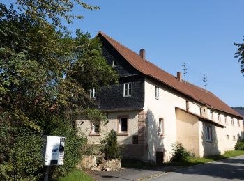
![Percorso A piedi Marktrodach - Jura-Weg KC 63 - Photo](https://media.geolcdn.com/t/350/260/67eba873-fe8d-4c84-981c-c8f3905c3392.jpeg&format=jpg&maxdim=2)
![A piedi A piedi](https://static1.geolcdn.com/sitytour/trail-icons/100.png)
Km
A piedi
![](/images/other/stat-length.png)
![](https://static1.geolcdn.com/siteimages/upload/files/1508320355ic_sort_den_pos_24dp.png)
![](https://static1.geolcdn.com/siteimages/upload/files/1508320355ic_sort_den_neg_24dp.png)
![](https://static1.geolcdn.com/siteimages/upload/files/16400158638029165_repeat_loop_refresh_sync_direction_icon.png)
• Trail created by Frankenwaldverein e.V.. Symbol: grün KC63 auf weißem Grund Sito web: https://www.frankenwaldverei...
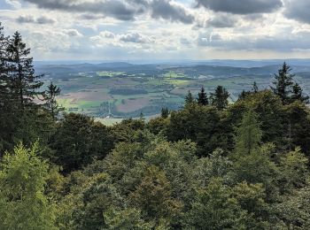
![Percorso A piedi Marktrodach - FrankenwaldSteigla Muschelkalkweg - Photo](https://media.geolcdn.com/t/350/260/334a0fb2-d503-40d8-86b7-e266fb9123eb.jpeg&format=jpg&maxdim=2)
![A piedi A piedi](https://static1.geolcdn.com/sitytour/trail-icons/100.png)
Km
A piedi
![](/images/other/stat-length.png)
![](https://static1.geolcdn.com/siteimages/upload/files/1508320355ic_sort_den_pos_24dp.png)
![](https://static1.geolcdn.com/siteimages/upload/files/1508320355ic_sort_den_neg_24dp.png)
![](https://static1.geolcdn.com/siteimages/upload/files/16400158638029165_repeat_loop_refresh_sync_direction_icon.png)
• Trail created by Frankenwaldverein.
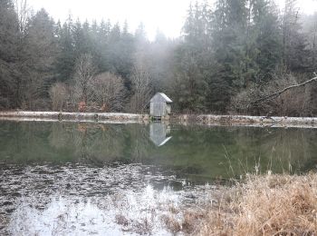
![Percorso A piedi Steinbach am Wald - Buchbacher-Weg - Photo](https://media.geolcdn.com/t/350/260/0e4aa044-235b-4733-a16f-a9063e377592.jpeg&format=jpg&maxdim=2)
![A piedi A piedi](https://static1.geolcdn.com/sitytour/trail-icons/100.png)
Km
A piedi
![](/images/other/stat-length.png)
![](https://static1.geolcdn.com/siteimages/upload/files/1508320355ic_sort_den_pos_24dp.png)
![](https://static1.geolcdn.com/siteimages/upload/files/1508320355ic_sort_den_neg_24dp.png)
![](https://static1.geolcdn.com/siteimages/upload/files/16400158638029165_repeat_loop_refresh_sync_direction_icon.png)
• Trail created by Frankenwaldverein.
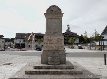
![Percorso A piedi Pressig - Kreuze-Weg - Photo](https://media.geolcdn.com/t/350/260/9c4a524b-be3a-4566-bf5c-1f43c70ae79b.jpeg&format=jpg&maxdim=2)
![A piedi A piedi](https://static1.geolcdn.com/sitytour/trail-icons/100.png)
Km
A piedi
![](/images/other/stat-length.png)
![](https://static1.geolcdn.com/siteimages/upload/files/1508320355ic_sort_den_pos_24dp.png)
![](https://static1.geolcdn.com/siteimages/upload/files/1508320355ic_sort_den_neg_24dp.png)
![](https://static1.geolcdn.com/siteimages/upload/files/16400158638029165_repeat_loop_refresh_sync_direction_icon.png)
• Trail created by Frankenwaldverein.
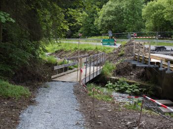
![Percorso A piedi Langenbacher Forst - Frankenwaldsteigla 12-Apostel-Weg - Photo](https://media.geolcdn.com/t/350/260/542c69fd-ea8f-4dca-992a-02be9f1f7edb.jpeg&format=jpg&maxdim=2)
![A piedi A piedi](https://static1.geolcdn.com/sitytour/trail-icons/100.png)
Km
A piedi
![](/images/other/stat-length.png)
![](https://static1.geolcdn.com/siteimages/upload/files/1508320355ic_sort_den_pos_24dp.png)
![](https://static1.geolcdn.com/siteimages/upload/files/1508320355ic_sort_den_neg_24dp.png)
![](https://static1.geolcdn.com/siteimages/upload/files/16400158638029165_repeat_loop_refresh_sync_direction_icon.png)
• Trail created by Frankenwaldverein.
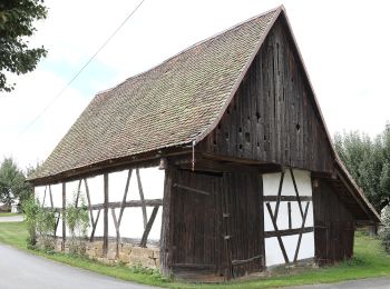
![Percorso A piedi Küps - Sieben-Fuhren-Weg - Photo](https://media.geolcdn.com/t/350/260/2bddbc66-080d-4c30-9b56-b3a29b790c54.jpeg&format=jpg&maxdim=2)
![A piedi A piedi](https://static1.geolcdn.com/sitytour/trail-icons/100.png)
Km
A piedi
![](/images/other/stat-length.png)
![](https://static1.geolcdn.com/siteimages/upload/files/1508320355ic_sort_den_pos_24dp.png)
![](https://static1.geolcdn.com/siteimages/upload/files/1508320355ic_sort_den_neg_24dp.png)
![](https://static1.geolcdn.com/siteimages/upload/files/16400158638029165_repeat_loop_refresh_sync_direction_icon.png)
• Trail created by Landkreis Lichtenfels. Symbol: Grüne 5 auf weißem Hintergrund
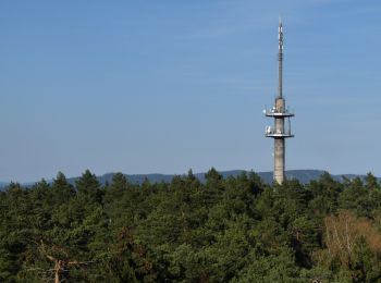
![Percorso A piedi Kronach - Kaltbucher Weg KC 12 - Photo](https://media.geolcdn.com/t/350/260/abe4d178-14be-41da-8412-9c27368734ef.jpeg&format=jpg&maxdim=2)
![A piedi A piedi](https://static1.geolcdn.com/sitytour/trail-icons/100.png)
Km
A piedi
![](/images/other/stat-length.png)
![](https://static1.geolcdn.com/siteimages/upload/files/1508320355ic_sort_den_pos_24dp.png)
![](https://static1.geolcdn.com/siteimages/upload/files/1508320355ic_sort_den_neg_24dp.png)
![](https://static1.geolcdn.com/siteimages/upload/files/16400158638029165_repeat_loop_refresh_sync_direction_icon.png)
• Trail created by Frankenwaldverein.
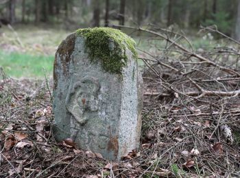
![Percorso A piedi Mitwitz - Bächleiner Weg - Photo](https://media.geolcdn.com/t/350/260/d4e989bc-b6b8-4e4a-8e10-5cc0e9060f76.jpeg&format=jpg&maxdim=2)
![A piedi A piedi](https://static1.geolcdn.com/sitytour/trail-icons/100.png)
Km
A piedi
![](/images/other/stat-length.png)
![](https://static1.geolcdn.com/siteimages/upload/files/1508320355ic_sort_den_pos_24dp.png)
![](https://static1.geolcdn.com/siteimages/upload/files/1508320355ic_sort_den_neg_24dp.png)
![](https://static1.geolcdn.com/siteimages/upload/files/16400158638029165_repeat_loop_refresh_sync_direction_icon.png)
• Trail created by Frankenwaldverein e.V.. Symbol: Grüne KC 33 auf weißem Hintergrund Sito web: https://frankenwaldv...
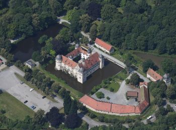
![Percorso A piedi Mitwitz - Häusles-Weg - Photo](https://media.geolcdn.com/t/350/260/93cf215b-b968-4f9e-9cee-e5bf5476ae3c.jpeg&format=jpg&maxdim=2)
![A piedi A piedi](https://static1.geolcdn.com/sitytour/trail-icons/100.png)
Km
A piedi
![](/images/other/stat-length.png)
![](https://static1.geolcdn.com/siteimages/upload/files/1508320355ic_sort_den_pos_24dp.png)
![](https://static1.geolcdn.com/siteimages/upload/files/1508320355ic_sort_den_neg_24dp.png)
![](https://static1.geolcdn.com/siteimages/upload/files/16400158638029165_repeat_loop_refresh_sync_direction_icon.png)
• Trail created by Frankenwaldverein e.V.. Symbol: Grüne KC 31 auf weißem Hintergrund Sito web: https://frankenwaldv...
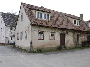
![Percorso A piedi Mitwitz - Heunischenburg-Weg - Photo](https://media.geolcdn.com/t/350/260/dc22e215-177c-4daf-b9a6-ff49482b6137.jpeg&format=jpg&maxdim=2)
![A piedi A piedi](https://static1.geolcdn.com/sitytour/trail-icons/100.png)
Km
A piedi
![](/images/other/stat-length.png)
![](https://static1.geolcdn.com/siteimages/upload/files/1508320355ic_sort_den_pos_24dp.png)
![](https://static1.geolcdn.com/siteimages/upload/files/1508320355ic_sort_den_neg_24dp.png)
![](https://static1.geolcdn.com/siteimages/upload/files/16400158638029165_repeat_loop_refresh_sync_direction_icon.png)
• Trail created by Frankenwaldverein e.V.. Symbol: Blaue 9 auf weißem Hintergrund Sito web: https://frankenwaldverei...
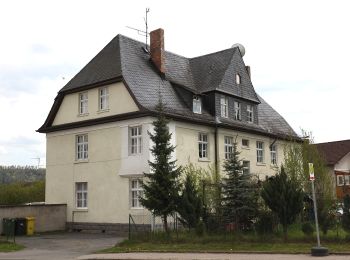
![Percorso A piedi Mitwitz - Klausenquellen-Weg - Photo](https://media.geolcdn.com/t/350/260/159d4241-f450-414b-876f-e050b6c53833.jpeg&format=jpg&maxdim=2)
![A piedi A piedi](https://static1.geolcdn.com/sitytour/trail-icons/100.png)
Km
A piedi
![](/images/other/stat-length.png)
![](https://static1.geolcdn.com/siteimages/upload/files/1508320355ic_sort_den_pos_24dp.png)
![](https://static1.geolcdn.com/siteimages/upload/files/1508320355ic_sort_den_neg_24dp.png)
![](https://static1.geolcdn.com/siteimages/upload/files/16400158638029165_repeat_loop_refresh_sync_direction_icon.png)
• Trail created by Frankenwaldverein E.V.. Symbol: Grüne KC 32 auf weißem Hintergrund Sito web: https://frankenwaldv...
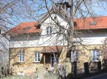
![Percorso A piedi Weißenbrunn - Wildenberger Buchenweg (Kronach) - Photo](https://media.geolcdn.com/t/350/260/1ea719ee-507e-4108-aaff-fec91027ca59.jpeg&format=jpg&maxdim=2)
![A piedi A piedi](https://static1.geolcdn.com/sitytour/trail-icons/100.png)
Km
A piedi
![](/images/other/stat-length.png)
![](https://static1.geolcdn.com/siteimages/upload/files/1508320355ic_sort_den_pos_24dp.png)
![](https://static1.geolcdn.com/siteimages/upload/files/1508320355ic_sort_den_neg_24dp.png)
![](https://static1.geolcdn.com/siteimages/upload/files/16400158638029165_repeat_loop_refresh_sync_direction_icon.png)
• Trail created by Frankenwaldverein;Landkreis Lichtenfels. Symbol: Grünes KC55 auf weißem Hintergrund
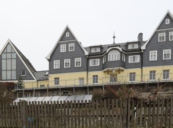
![Percorso A piedi Wilhelmsthal - Zechenweg KC 74 - Photo](https://media.geolcdn.com/t/350/260/100af95a-1ee6-45d7-b6b7-aec761d1e0e2.jpeg&format=jpg&maxdim=2)
![A piedi A piedi](https://static1.geolcdn.com/sitytour/trail-icons/100.png)
Km
A piedi
![](/images/other/stat-length.png)
![](https://static1.geolcdn.com/siteimages/upload/files/1508320355ic_sort_den_pos_24dp.png)
![](https://static1.geolcdn.com/siteimages/upload/files/1508320355ic_sort_den_neg_24dp.png)
![](https://static1.geolcdn.com/siteimages/upload/files/16400158638029165_repeat_loop_refresh_sync_direction_icon.png)
• Trail created by Frankenwaldverein.
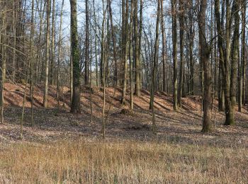
![Percorso A piedi Kronach - Glosberger Weg KC 14 - Photo](https://media.geolcdn.com/t/350/260/2aa4e3ab-4812-468b-9c3e-c3c9961b58e8.jpeg&format=jpg&maxdim=2)
![A piedi A piedi](https://static1.geolcdn.com/sitytour/trail-icons/100.png)
Km
A piedi
![](/images/other/stat-length.png)
![](https://static1.geolcdn.com/siteimages/upload/files/1508320355ic_sort_den_pos_24dp.png)
![](https://static1.geolcdn.com/siteimages/upload/files/1508320355ic_sort_den_neg_24dp.png)
![](https://static1.geolcdn.com/siteimages/upload/files/16400158638029165_repeat_loop_refresh_sync_direction_icon.png)
• Trail created by Frankenwaldverein.
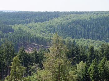
![Percorso A piedi Ludwigsstadt - Wetzsteinmacher Weg - Photo](https://media.geolcdn.com/t/350/260/029731e4-e210-4ee5-8fe4-19d413b5f440.jpeg&format=jpg&maxdim=2)
![A piedi A piedi](https://static1.geolcdn.com/sitytour/trail-icons/100.png)
Km
A piedi
![](/images/other/stat-length.png)
![](https://static1.geolcdn.com/siteimages/upload/files/1508320355ic_sort_den_pos_24dp.png)
![](https://static1.geolcdn.com/siteimages/upload/files/1508320355ic_sort_den_neg_24dp.png)
![](https://static1.geolcdn.com/siteimages/upload/files/16400158638029165_repeat_loop_refresh_sync_direction_icon.png)
• Symbol: Grüner Text R 44 auf weißem Grund
20 percorsi visualizzati su 46
Applicazione GPS da escursionismo GRATUITA