![](/images/other/stat-length.png)
- Percorsi
- Outdoor
- Germany
- Baviera
- Landkreis Rosenheim
- Nußdorf am Inn
Nußdorf am Inn, Landkreis Rosenheim : I migliori sentieri, percorsi e passeggiate
Nußdorf am Inn: Scopri i migliori percorsi: 14 percorsi a piedi. Tutti questi percorsi, itinerari e attività outdoor sono disponibili nelle nostre app SityTrail per smartphone e tablet.
I percorsi migliori (0})
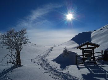
![Percorso A piedi Nußdorf am Inn - Kranzhorn über Bubenaualm - Photo](https://media.geolcdn.com/t/350/260/e3c5b70e-000e-4248-8f68-0461d1126b7e.jpeg&format=jpg&maxdim=2)
![A piedi A piedi](https://static1.geolcdn.com/sitytour/trail-icons/100.png)
Km
A piedi
![](/images/other/stat-length.png)
![](https://static1.geolcdn.com/siteimages/upload/files/1508320355ic_sort_den_pos_24dp.png)
![](https://static1.geolcdn.com/siteimages/upload/files/1508320355ic_sort_den_neg_24dp.png)
![](https://static1.geolcdn.com/siteimages/upload/files/16400158638029165_repeat_loop_refresh_sync_direction_icon.png)
• Symbol: Blaue Farbstreifen auf Steinen
![Percorso A piedi Nußdorf am Inn - Wanderweg 4 - Kranzhorn - Photo](https://media.geolcdn.com/t/350/260/e3c5b70e-000e-4248-8f68-0461d1126b7e.jpeg&format=jpg&maxdim=2)
![A piedi A piedi](https://static1.geolcdn.com/sitytour/trail-icons/100.png)
Km
A piedi
![](/images/other/stat-length.png)
![](https://static1.geolcdn.com/siteimages/upload/files/1508320355ic_sort_den_pos_24dp.png)
![](https://static1.geolcdn.com/siteimages/upload/files/1508320355ic_sort_den_neg_24dp.png)
![](https://static1.geolcdn.com/siteimages/upload/files/16400158638029165_repeat_loop_refresh_sync_direction_icon.png)
• Beschilderung ist alt und nicht mehr durchgängig. Weg ist NICHT identisch mit Wanderweg 4-Nußdorf (Grüne Schilder mit...
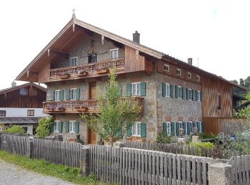
![Percorso A piedi Nußdorf am Inn - SalzAlpenZugweg Nußdorf/Daffnerwald-Almen - Photo](https://media.geolcdn.com/t/350/260/5e1c3d1c-01bf-4b0c-b23e-ae95a6e5f146.jpeg&format=jpg&maxdim=2)
![A piedi A piedi](https://static1.geolcdn.com/sitytour/trail-icons/100.png)
Km
A piedi
![](/images/other/stat-length.png)
![](https://static1.geolcdn.com/siteimages/upload/files/1508320355ic_sort_den_pos_24dp.png)
![](https://static1.geolcdn.com/siteimages/upload/files/1508320355ic_sort_den_neg_24dp.png)
![](https://static1.geolcdn.com/siteimages/upload/files/16400158638029165_repeat_loop_refresh_sync_direction_icon.png)
• Symbol: Gelber Hintergrund mit den Silhouetten dreier Gipfel in roter Farbe. Symbole sind an Bäumen gesprüht oder als...
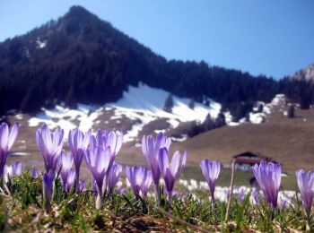
![Percorso A piedi Nußdorf am Inn - Buchberg - Euzenau - Heuberg - Photo](https://media.geolcdn.com/t/350/260/5186e337-950b-4dbd-8039-3b01edb2b748.jpeg&format=jpg&maxdim=2)
![A piedi A piedi](https://static1.geolcdn.com/sitytour/trail-icons/100.png)
Km
A piedi
![](/images/other/stat-length.png)
![](https://static1.geolcdn.com/siteimages/upload/files/1508320355ic_sort_den_pos_24dp.png)
![](https://static1.geolcdn.com/siteimages/upload/files/1508320355ic_sort_den_neg_24dp.png)
![](https://static1.geolcdn.com/siteimages/upload/files/16400158638029165_repeat_loop_refresh_sync_direction_icon.png)
• Beschilderung ist alt und nicht mehr durchgängig. Weg ist NICHT identisch mit Wanderweg 9-Nußdorf (Grüne Schilder mit...
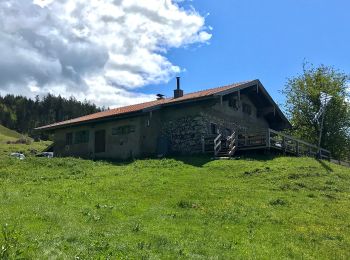
![Percorso A piedi Nußdorf am Inn - Wanderweg 33 - Samerberg - Photo](https://media.geolcdn.com/t/350/260/e4bd8726-65ea-49a1-8503-2e54d65e1897.jpeg&format=jpg&maxdim=2)
![A piedi A piedi](https://static1.geolcdn.com/sitytour/trail-icons/100.png)
Km
A piedi
![](/images/other/stat-length.png)
![](https://static1.geolcdn.com/siteimages/upload/files/1508320355ic_sort_den_pos_24dp.png)
![](https://static1.geolcdn.com/siteimages/upload/files/1508320355ic_sort_den_neg_24dp.png)
![](https://static1.geolcdn.com/siteimages/upload/files/16400158638029165_repeat_loop_refresh_sync_direction_icon.png)
• Trail created by Gemeinden Neubeuern, Nußdorf, Samerberg. Symbol: Grüne Schilder mit weißer Zahl oder gelbe Blechsch...
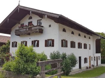
![Percorso A piedi Nußdorf am Inn - Nußdorf-Bichleralm-Heuberg - Photo](https://media.geolcdn.com/t/350/260/2bce1b0a-481b-4248-88bd-0c32ba41cee2.jpeg&format=jpg&maxdim=2)
![A piedi A piedi](https://static1.geolcdn.com/sitytour/trail-icons/100.png)
Km
A piedi
![](/images/other/stat-length.png)
![](https://static1.geolcdn.com/siteimages/upload/files/1508320355ic_sort_den_pos_24dp.png)
![](https://static1.geolcdn.com/siteimages/upload/files/1508320355ic_sort_den_neg_24dp.png)
![](https://static1.geolcdn.com/siteimages/upload/files/16400158638029165_repeat_loop_refresh_sync_direction_icon.png)
• Beschilderung ist alt und nicht mehr durchgängig. Weg ist NICHT identisch mit Wanderweg 2-Nußdorf (Grüne Schilder mit...
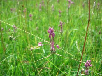
![Percorso A piedi Nußdorf am Inn - Nußdorf-Kirchwald-Daffnerwaldalm-Heuberg - Photo](https://media.geolcdn.com/t/350/260/c8b618b3-ec9b-4f33-bd2e-884fd7bf6cd9.jpeg&format=jpg&maxdim=2)
![A piedi A piedi](https://static1.geolcdn.com/sitytour/trail-icons/100.png)
Km
A piedi
![](/images/other/stat-length.png)
![](https://static1.geolcdn.com/siteimages/upload/files/1508320355ic_sort_den_pos_24dp.png)
![](https://static1.geolcdn.com/siteimages/upload/files/1508320355ic_sort_den_neg_24dp.png)
![](https://static1.geolcdn.com/siteimages/upload/files/16400158638029165_repeat_loop_refresh_sync_direction_icon.png)
• Beschilderung ist alt und nicht mehr durchgängig. Weg ist NICHT identisch mit Wanderweg 1-Nußdorf (Grüne Schilder mit...
![Percorso A piedi Nußdorf am Inn - Wanderweg 8 - Nußdorf - Photo](https://media.geolcdn.com/t/350/260/5e1c3d1c-01bf-4b0c-b23e-ae95a6e5f146.jpeg&format=jpg&maxdim=2)
![A piedi A piedi](https://static1.geolcdn.com/sitytour/trail-icons/100.png)
Km
A piedi
![](/images/other/stat-length.png)
![](https://static1.geolcdn.com/siteimages/upload/files/1508320355ic_sort_den_pos_24dp.png)
![](https://static1.geolcdn.com/siteimages/upload/files/1508320355ic_sort_den_neg_24dp.png)
![](https://static1.geolcdn.com/siteimages/upload/files/16400158638029165_repeat_loop_refresh_sync_direction_icon.png)
• Trail created by Gemeinden Neubeuern, Nußdorf, Samerberg. Symbol: Grüne Schilder mit weißer Zahl
![Percorso A piedi Nußdorf am Inn - Wanderweg 58 - Samerberg - Photo](https://media.geolcdn.com/t/350/260/5e1c3d1c-01bf-4b0c-b23e-ae95a6e5f146.jpeg&format=jpg&maxdim=2)
![A piedi A piedi](https://static1.geolcdn.com/sitytour/trail-icons/100.png)
Km
A piedi
![](/images/other/stat-length.png)
![](https://static1.geolcdn.com/siteimages/upload/files/1508320355ic_sort_den_pos_24dp.png)
![](https://static1.geolcdn.com/siteimages/upload/files/1508320355ic_sort_den_neg_24dp.png)
![](https://static1.geolcdn.com/siteimages/upload/files/16400158638029165_repeat_loop_refresh_sync_direction_icon.png)
• Trail created by Gemeinden Neubeuern, Nußdorf, Samerberg. Symbol: Grüne Schilder mit weißer Zahl oder gelbe Blechsch...
![Percorso A piedi Nußdorf am Inn - Wanderweg 4 - Nußdorf - Photo](https://media.geolcdn.com/t/350/260/5e1c3d1c-01bf-4b0c-b23e-ae95a6e5f146.jpeg&format=jpg&maxdim=2)
![A piedi A piedi](https://static1.geolcdn.com/sitytour/trail-icons/100.png)
Km
A piedi
![](/images/other/stat-length.png)
![](https://static1.geolcdn.com/siteimages/upload/files/1508320355ic_sort_den_pos_24dp.png)
![](https://static1.geolcdn.com/siteimages/upload/files/1508320355ic_sort_den_neg_24dp.png)
![](https://static1.geolcdn.com/siteimages/upload/files/16400158638029165_repeat_loop_refresh_sync_direction_icon.png)
• Trail created by Gemeinden Neubeuern, Nußdorf, Samerberg. Symbol: Grüne Schilder mit weißer Zahl
![Percorso A piedi Nußdorf am Inn - Wanderweg 2 - Nußdorf - Photo](https://media.geolcdn.com/t/350/260/5e1c3d1c-01bf-4b0c-b23e-ae95a6e5f146.jpeg&format=jpg&maxdim=2)
![A piedi A piedi](https://static1.geolcdn.com/sitytour/trail-icons/100.png)
Km
A piedi
![](/images/other/stat-length.png)
![](https://static1.geolcdn.com/siteimages/upload/files/1508320355ic_sort_den_pos_24dp.png)
![](https://static1.geolcdn.com/siteimages/upload/files/1508320355ic_sort_den_neg_24dp.png)
![](https://static1.geolcdn.com/siteimages/upload/files/16400158638029165_repeat_loop_refresh_sync_direction_icon.png)
• Trail created by Gemeinden Neubeuern, Nußdorf, Samerberg. Symbol: Grüne Schilder mit weißer Zahl
![Percorso A piedi Nußdorf am Inn - Wanderweg 5 - Nußdorf - Photo](https://media.geolcdn.com/t/350/260/c8b618b3-ec9b-4f33-bd2e-884fd7bf6cd9.jpeg&format=jpg&maxdim=2)
![A piedi A piedi](https://static1.geolcdn.com/sitytour/trail-icons/100.png)
Km
A piedi
![](/images/other/stat-length.png)
![](https://static1.geolcdn.com/siteimages/upload/files/1508320355ic_sort_den_pos_24dp.png)
![](https://static1.geolcdn.com/siteimages/upload/files/1508320355ic_sort_den_neg_24dp.png)
![](https://static1.geolcdn.com/siteimages/upload/files/16400158638029165_repeat_loop_refresh_sync_direction_icon.png)
• Trail created by Gemeinden Neubeuern, Nußdorf, Samerberg. Symbol: Grüne Schilder mit weißer Zahl
![Percorso A piedi Nußdorf am Inn - Wanderweg 11 - Nußdorf - Photo](https://media.geolcdn.com/t/350/260/c8b618b3-ec9b-4f33-bd2e-884fd7bf6cd9.jpeg&format=jpg&maxdim=2)
![A piedi A piedi](https://static1.geolcdn.com/sitytour/trail-icons/100.png)
Km
A piedi
![](/images/other/stat-length.png)
![](https://static1.geolcdn.com/siteimages/upload/files/1508320355ic_sort_den_pos_24dp.png)
![](https://static1.geolcdn.com/siteimages/upload/files/1508320355ic_sort_den_neg_24dp.png)
![](https://static1.geolcdn.com/siteimages/upload/files/16400158638029165_repeat_loop_refresh_sync_direction_icon.png)
• Trail created by Gemeinden Neubeuern, Nußdorf, Samerberg. Symbol: Grüne Schilder mit weißer Zahl
![Percorso A piedi Nußdorf am Inn - Mühlenweg - Photo](https://media.geolcdn.com/t/350/260/ext.jpg?maxdim=2&url=https%3A%2F%2Fstatic1.geolcdn.com%2Fsiteimages%2Fupload%2Ffiles%2F1545311037marcheuse_200dpi.jpg)
![A piedi A piedi](https://static1.geolcdn.com/sitytour/trail-icons/100.png)
Km
A piedi
![](/images/other/stat-length.png)
![](https://static1.geolcdn.com/siteimages/upload/files/1508320355ic_sort_den_pos_24dp.png)
![](https://static1.geolcdn.com/siteimages/upload/files/1508320355ic_sort_den_neg_24dp.png)
![](https://static1.geolcdn.com/siteimages/upload/files/16400158638029165_repeat_loop_refresh_sync_direction_icon.png)
• Symbol: Mühlrad
14 percorsi visualizzati su 14
Applicazione GPS da escursionismo GRATUITA