![](/images/other/stat-length.png)
- Percorsi
- Outdoor
- Germany
- Baviera
- Landkreis Miltenberg
- Bürgstadt
Bürgstadt, Landkreis Miltenberg : I migliori sentieri, percorsi e passeggiate
Bürgstadt: Scopri i migliori percorsi: 13 percorsi a piedi. Tutti questi percorsi, itinerari e attività outdoor sono disponibili nelle nostre app SityTrail per smartphone e tablet.
I percorsi migliori (0})
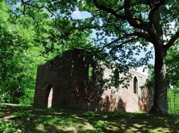
![Percorso A piedi Bürgstadt - Rundwanderweg Bürgstadt Stutz 3: Ringwall-Weg - Photo](https://media.geolcdn.com/t/350/260/859545fc-75c4-4048-bc9f-115ae79da6f9.jpeg&format=jpg&maxdim=2)
![A piedi A piedi](https://static1.geolcdn.com/sitytour/trail-icons/100.png)
Km
A piedi
![](/images/other/stat-length.png)
![](https://static1.geolcdn.com/siteimages/upload/files/1508320355ic_sort_den_pos_24dp.png)
![](https://static1.geolcdn.com/siteimages/upload/files/1508320355ic_sort_den_neg_24dp.png)
![](https://static1.geolcdn.com/siteimages/upload/files/16400158638029165_repeat_loop_refresh_sync_direction_icon.png)
• Symbol: Gelbe 3 im gelben Kreis
![Percorso A piedi Bürgstadt - Nordic Walking Bürgstadt, PP Stutz Nr. 5 - Photo](https://media.geolcdn.com/t/350/260/859545fc-75c4-4048-bc9f-115ae79da6f9.jpeg&format=jpg&maxdim=2)
![A piedi A piedi](https://static1.geolcdn.com/sitytour/trail-icons/100.png)
Km
A piedi
![](/images/other/stat-length.png)
![](https://static1.geolcdn.com/siteimages/upload/files/1508320355ic_sort_den_pos_24dp.png)
![](https://static1.geolcdn.com/siteimages/upload/files/1508320355ic_sort_den_neg_24dp.png)
![](https://static1.geolcdn.com/siteimages/upload/files/16400158638029165_repeat_loop_refresh_sync_direction_icon.png)
• Trail created by Markt Bürgstadt. Symbol: Nordic Walker, Ziffer 5, schwarz.
![Percorso A piedi Bürgstadt - Nordic Walking Bürgstadt, PP Stutz Nr. 2 - Photo](https://media.geolcdn.com/t/350/260/859545fc-75c4-4048-bc9f-115ae79da6f9.jpeg&format=jpg&maxdim=2)
![A piedi A piedi](https://static1.geolcdn.com/sitytour/trail-icons/100.png)
Km
A piedi
![](/images/other/stat-length.png)
![](https://static1.geolcdn.com/siteimages/upload/files/1508320355ic_sort_den_pos_24dp.png)
![](https://static1.geolcdn.com/siteimages/upload/files/1508320355ic_sort_den_neg_24dp.png)
![](https://static1.geolcdn.com/siteimages/upload/files/16400158638029165_repeat_loop_refresh_sync_direction_icon.png)
• Trail created by Markt Bürgstadt. Symbol: Nordic Walker, Ziffer 2, rot.
![Percorso A piedi Bürgstadt - Nordic Walking Bürgstadt, PP Stutz Nr. 4 - Photo](https://media.geolcdn.com/t/350/260/859545fc-75c4-4048-bc9f-115ae79da6f9.jpeg&format=jpg&maxdim=2)
![A piedi A piedi](https://static1.geolcdn.com/sitytour/trail-icons/100.png)
Km
A piedi
![](/images/other/stat-length.png)
![](https://static1.geolcdn.com/siteimages/upload/files/1508320355ic_sort_den_pos_24dp.png)
![](https://static1.geolcdn.com/siteimages/upload/files/1508320355ic_sort_den_neg_24dp.png)
![](https://static1.geolcdn.com/siteimages/upload/files/16400158638029165_repeat_loop_refresh_sync_direction_icon.png)
• Trail created by Markt Bürgstadt. Symbol: Nordic Walker, Ziffer 4, rot.
![Percorso A piedi Bürgstadt - Nordic Walking Bürgstadt, PP Stutz Nr. 1 - Photo](https://media.geolcdn.com/t/350/260/859545fc-75c4-4048-bc9f-115ae79da6f9.jpeg&format=jpg&maxdim=2)
![A piedi A piedi](https://static1.geolcdn.com/sitytour/trail-icons/100.png)
Km
A piedi
![](/images/other/stat-length.png)
![](https://static1.geolcdn.com/siteimages/upload/files/1508320355ic_sort_den_pos_24dp.png)
![](https://static1.geolcdn.com/siteimages/upload/files/1508320355ic_sort_den_neg_24dp.png)
![](https://static1.geolcdn.com/siteimages/upload/files/16400158638029165_repeat_loop_refresh_sync_direction_icon.png)
• Trail created by Markt Bürgstadt. Symbol: Nordic Walker, Ziffer 1, blau.
![Percorso A piedi Bürgstadt - Nordic Walking Bürgstadt, PP Stutz Nr. 3 - Photo](https://media.geolcdn.com/t/350/260/859545fc-75c4-4048-bc9f-115ae79da6f9.jpeg&format=jpg&maxdim=2)
![A piedi A piedi](https://static1.geolcdn.com/sitytour/trail-icons/100.png)
Km
A piedi
![](/images/other/stat-length.png)
![](https://static1.geolcdn.com/siteimages/upload/files/1508320355ic_sort_den_pos_24dp.png)
![](https://static1.geolcdn.com/siteimages/upload/files/1508320355ic_sort_den_neg_24dp.png)
![](https://static1.geolcdn.com/siteimages/upload/files/16400158638029165_repeat_loop_refresh_sync_direction_icon.png)
• Trail created by Markt Bürgstadt. Symbol: Nordic Walker, Ziffer 3, schwarz.
![Percorso A piedi Bürgstadt - Parkplatzrundwanderweg Bürgstadt Stutz : Bürgstädter Berg Weg - Photo](https://media.geolcdn.com/t/350/260/859545fc-75c4-4048-bc9f-115ae79da6f9.jpeg&format=jpg&maxdim=2)
![A piedi A piedi](https://static1.geolcdn.com/sitytour/trail-icons/100.png)
Km
A piedi
![](/images/other/stat-length.png)
![](https://static1.geolcdn.com/siteimages/upload/files/1508320355ic_sort_den_pos_24dp.png)
![](https://static1.geolcdn.com/siteimages/upload/files/1508320355ic_sort_den_neg_24dp.png)
![](https://static1.geolcdn.com/siteimages/upload/files/16400158638029165_repeat_loop_refresh_sync_direction_icon.png)
• Trail created by Geo-Naturpark Bergstraße-Odenwald. Symbol: Gelbe 5 im Kreis
![Percorso A piedi Bürgstadt - Rundwanderweg Bürgstadt Stutz 6: Wannenberg-Weg - Photo](https://media.geolcdn.com/t/350/260/859545fc-75c4-4048-bc9f-115ae79da6f9.jpeg&format=jpg&maxdim=2)
![A piedi A piedi](https://static1.geolcdn.com/sitytour/trail-icons/100.png)
Km
A piedi
![](/images/other/stat-length.png)
![](https://static1.geolcdn.com/siteimages/upload/files/1508320355ic_sort_den_pos_24dp.png)
![](https://static1.geolcdn.com/siteimages/upload/files/1508320355ic_sort_den_neg_24dp.png)
![](https://static1.geolcdn.com/siteimages/upload/files/16400158638029165_repeat_loop_refresh_sync_direction_icon.png)
• Trail created by Geo-Naturpark Bergstraße-Odenwald. Symbol: Gelbe 6 im gelben Kreis
![Percorso A piedi Bürgstadt - Rundwanderweg Bürgstadt, PP Stutz Nr. 4 - Eichenbuckelweg - Photo](https://media.geolcdn.com/t/350/260/859545fc-75c4-4048-bc9f-115ae79da6f9.jpeg&format=jpg&maxdim=2)
![A piedi A piedi](https://static1.geolcdn.com/sitytour/trail-icons/100.png)
Km
A piedi
![](/images/other/stat-length.png)
![](https://static1.geolcdn.com/siteimages/upload/files/1508320355ic_sort_den_pos_24dp.png)
![](https://static1.geolcdn.com/siteimages/upload/files/1508320355ic_sort_den_neg_24dp.png)
![](https://static1.geolcdn.com/siteimages/upload/files/16400158638029165_repeat_loop_refresh_sync_direction_icon.png)
• Trail created by Geo-Naturpark Bergstraße-Odenwald. Symbol: Gelbe 4 im Kreis
![Percorso A piedi Bürgstadt - Rundwanderweg Bürgstadt Stutz 7: Rund um den Wannenberg - Photo](https://media.geolcdn.com/t/350/260/859545fc-75c4-4048-bc9f-115ae79da6f9.jpeg&format=jpg&maxdim=2)
![A piedi A piedi](https://static1.geolcdn.com/sitytour/trail-icons/100.png)
Km
A piedi
![](/images/other/stat-length.png)
![](https://static1.geolcdn.com/siteimages/upload/files/1508320355ic_sort_den_pos_24dp.png)
![](https://static1.geolcdn.com/siteimages/upload/files/1508320355ic_sort_den_neg_24dp.png)
![](https://static1.geolcdn.com/siteimages/upload/files/16400158638029165_repeat_loop_refresh_sync_direction_icon.png)
• Trail created by Geo-Naturpark Bergstraße-Odenwald. Symbol: Gelbe 7 im Kreis
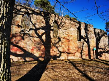
![Percorso A piedi Bürgstadt - Rundwanderweg Bürgstadt Stutz L: Geopark-Kulturpfad - Photo](https://media.geolcdn.com/t/350/260/e44b37da-8b8f-40b9-8eb2-c7239aacbd95.jpeg&format=jpg&maxdim=2)
![A piedi A piedi](https://static1.geolcdn.com/sitytour/trail-icons/100.png)
Km
A piedi
![](/images/other/stat-length.png)
![](https://static1.geolcdn.com/siteimages/upload/files/1508320355ic_sort_den_pos_24dp.png)
![](https://static1.geolcdn.com/siteimages/upload/files/1508320355ic_sort_den_neg_24dp.png)
![](https://static1.geolcdn.com/siteimages/upload/files/16400158638029165_repeat_loop_refresh_sync_direction_icon.png)
• Trail created by Geo-Naturpark Bergstraße-Odenwald. Symbol: Gelbes L im gelben Kreis Sito web: http://www.spessart...
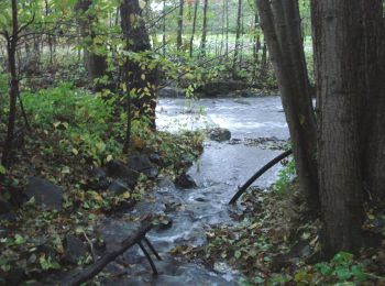
![Percorso A piedi Bürgstadt - Rundwanderweg Eichenbühl Kohlgrund 3: Hölle-Weg - Photo](https://media.geolcdn.com/t/350/260/7b0c836e-b266-466d-81d7-bc2a477f066e.jpeg&format=jpg&maxdim=2)
![A piedi A piedi](https://static1.geolcdn.com/sitytour/trail-icons/100.png)
Km
A piedi
![](/images/other/stat-length.png)
![](https://static1.geolcdn.com/siteimages/upload/files/1508320355ic_sort_den_pos_24dp.png)
![](https://static1.geolcdn.com/siteimages/upload/files/1508320355ic_sort_den_neg_24dp.png)
![](https://static1.geolcdn.com/siteimages/upload/files/16400158638029165_repeat_loop_refresh_sync_direction_icon.png)
• Trail created by Geo-Naturpark Bergstraße-Odenwald.
![Percorso A piedi Bürgstadt - Nordic Walking Bürgstadt, PP Stutz Nr. 6 - Photo](https://media.geolcdn.com/t/350/260/859545fc-75c4-4048-bc9f-115ae79da6f9.jpeg&format=jpg&maxdim=2)
![A piedi A piedi](https://static1.geolcdn.com/sitytour/trail-icons/100.png)
Km
A piedi
![](/images/other/stat-length.png)
![](https://static1.geolcdn.com/siteimages/upload/files/1508320355ic_sort_den_pos_24dp.png)
![](https://static1.geolcdn.com/siteimages/upload/files/1508320355ic_sort_den_neg_24dp.png)
![](https://static1.geolcdn.com/siteimages/upload/files/16400158638029165_repeat_loop_refresh_sync_direction_icon.png)
• Trail created by Markt Bürgstadt. Symbol: Nordic Walker, Ziffer 6, blau.
13 percorsi visualizzati su 13
Applicazione GPS da escursionismo GRATUITA