![](/images/other/stat-length.png)
- Percorsi
- Outdoor
- Germany
- Sassonia
- Vogtlandkreis
- Klingenthal
Klingenthal, Vogtlandkreis : I migliori sentieri, percorsi e passeggiate
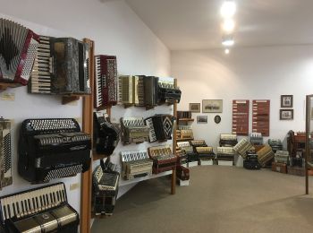
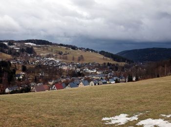
Klingenthal: Scopri i migliori percorsi: 4 percorsi a piedi. Tutti questi percorsi, itinerari e attività outdoor sono disponibili nelle nostre app SityTrail per smartphone e tablet.
I percorsi migliori (0})
![Percorso A piedi Klingenthal - Zwota - Photo](https://media.geolcdn.com/t/350/260/492a667a-9ed8-4f1c-b5aa-bb8cf00d76b6.jpeg&format=jpg&maxdim=2)
![A piedi A piedi](https://static1.geolcdn.com/sitytour/trail-icons/100.png)
Km
A piedi
![](/images/other/stat-length.png)
![](https://static1.geolcdn.com/siteimages/upload/files/1508320355ic_sort_den_pos_24dp.png)
![](https://static1.geolcdn.com/siteimages/upload/files/1508320355ic_sort_den_neg_24dp.png)
![](https://static1.geolcdn.com/siteimages/upload/files/16400158638029165_repeat_loop_refresh_sync_direction_icon.png)
• Gelber Balken auf weißem Grund Symbol: yellow bar on white background
![Percorso A piedi Klingenthal - gelbe Markierung - Photo](https://media.geolcdn.com/t/350/260/441bebc5-6103-43f1-8d92-3850cf14ea71.jpeg&format=jpg&maxdim=2)
![A piedi A piedi](https://static1.geolcdn.com/sitytour/trail-icons/100.png)
Km
A piedi
![](/images/other/stat-length.png)
![](https://static1.geolcdn.com/siteimages/upload/files/1508320355ic_sort_den_pos_24dp.png)
![](https://static1.geolcdn.com/siteimages/upload/files/1508320355ic_sort_den_neg_24dp.png)
![](https://static1.geolcdn.com/siteimages/upload/files/16400158638029165_repeat_loop_refresh_sync_direction_icon.png)
• Gelber Balken auf weißem Grund Symbol: yellow bar on white background
![Percorso A piedi Klingenthal - gelbe Markierung - Photo](https://media.geolcdn.com/t/350/260/ext.jpg?maxdim=2&url=https%3A%2F%2Fstatic1.geolcdn.com%2Fsiteimages%2Fupload%2Ffiles%2F1545311037marcheuse_200dpi.jpg)
![A piedi A piedi](https://static1.geolcdn.com/sitytour/trail-icons/100.png)
Km
A piedi
![](/images/other/stat-length.png)
![](https://static1.geolcdn.com/siteimages/upload/files/1508320355ic_sort_den_pos_24dp.png)
![](https://static1.geolcdn.com/siteimages/upload/files/1508320355ic_sort_den_neg_24dp.png)
![](https://static1.geolcdn.com/siteimages/upload/files/16400158638029165_repeat_loop_refresh_sync_direction_icon.png)
• Symbol: yellow bar on white background
![Percorso A piedi Klingenthal - Rundwanderweg Klingenthal-Zwota - Photo](https://media.geolcdn.com/t/350/260/44898a16-7c35-42f5-8612-f02ae3081798.jpeg&format=jpg&maxdim=2)
![A piedi A piedi](https://static1.geolcdn.com/sitytour/trail-icons/100.png)
Km
A piedi
![](/images/other/stat-length.png)
![](https://static1.geolcdn.com/siteimages/upload/files/1508320355ic_sort_den_pos_24dp.png)
![](https://static1.geolcdn.com/siteimages/upload/files/1508320355ic_sort_den_neg_24dp.png)
![](https://static1.geolcdn.com/siteimages/upload/files/16400158638029165_repeat_loop_refresh_sync_direction_icon.png)
• Juni 2013: im Abschnitt Klingenthal, ca. Kammweg 9, ist grüner Strich auf weißem Grund entlang des Grenzpfades ausges...
4 percorsi visualizzati su 4
Applicazione GPS da escursionismo GRATUITA