![](/images/other/stat-length.png)
- Percorsi
- Outdoor
- Switzerland
- Neuchâtel
- Sconosciuto
Sconosciuto, Neuchâtel : I migliori sentieri, percorsi e passeggiate
Sconosciuto: Scopri i migliori percorsi: 108 percorsi a piedi e 30 percorsi in bicicletta o MTB. Tutti questi percorsi, itinerari e attività outdoor sono disponibili nelle nostre app SityTrail per smartphone e tablet.
I percorsi migliori (0})
![Percorso A piedi La Chaux-de-Fonds - La Chaux-de-Fonds - Saut du Doubs - Photo](https://media.geolcdn.com/t/350/260/e6429c78-51f2-4265-a7d3-a2fdd44acab9.jpeg&format=jpg&maxdim=2)
![A piedi A piedi](https://static1.geolcdn.com/sitytour/trail-icons/100.png)
Km
A piedi
![](/images/other/stat-length.png)
![](https://static1.geolcdn.com/siteimages/upload/files/1508320355ic_sort_den_pos_24dp.png)
![](https://static1.geolcdn.com/siteimages/upload/files/1508320355ic_sort_den_neg_24dp.png)
![](https://static1.geolcdn.com/siteimages/upload/files/16400158638029165_repeat_loop_refresh_sync_direction_icon.png)
• Symbol: gelbe Raute
![Percorso A piedi Lignières - Lignières - Chasseral Hôtel - Photo](https://media.geolcdn.com/t/350/260/5c8e04bd-58c3-483b-8a8c-7d9ee4aefb71.jpeg&format=jpg&maxdim=2)
![A piedi A piedi](https://static1.geolcdn.com/sitytour/trail-icons/100.png)
Km
A piedi
![](/images/other/stat-length.png)
![](https://static1.geolcdn.com/siteimages/upload/files/1508320355ic_sort_den_pos_24dp.png)
![](https://static1.geolcdn.com/siteimages/upload/files/1508320355ic_sort_den_neg_24dp.png)
![](https://static1.geolcdn.com/siteimages/upload/files/16400158638029165_repeat_loop_refresh_sync_direction_icon.png)
• Symbol: gelbe Raute
![Percorso A piedi Enges - Enges - fixme - Photo](https://media.geolcdn.com/t/350/260/dda376a7-efa3-4d1e-b891-ea53f5dea48e.jpeg&format=jpg&maxdim=2)
![A piedi A piedi](https://static1.geolcdn.com/sitytour/trail-icons/100.png)
Km
A piedi
![](/images/other/stat-length.png)
![](https://static1.geolcdn.com/siteimages/upload/files/1508320355ic_sort_den_pos_24dp.png)
![](https://static1.geolcdn.com/siteimages/upload/files/1508320355ic_sort_den_neg_24dp.png)
![](https://static1.geolcdn.com/siteimages/upload/files/16400158638029165_repeat_loop_refresh_sync_direction_icon.png)
• Trail created by Neuchâtel Rando. Symbol: losange jaune
![Percorso A piedi La Côte-aux-Fées - La Côte-aux-Fées - Buttes - Photo](https://media.geolcdn.com/t/350/260/4ddaa482-5cf5-46b7-b784-db7dcb3959dd.jpeg&format=jpg&maxdim=2)
![A piedi A piedi](https://static1.geolcdn.com/sitytour/trail-icons/100.png)
Km
A piedi
![](/images/other/stat-length.png)
![](https://static1.geolcdn.com/siteimages/upload/files/1508320355ic_sort_den_pos_24dp.png)
![](https://static1.geolcdn.com/siteimages/upload/files/1508320355ic_sort_den_neg_24dp.png)
![](https://static1.geolcdn.com/siteimages/upload/files/16400158638029165_repeat_loop_refresh_sync_direction_icon.png)
• Symbol: losange jaune
![Percorso A piedi Val-de-Travers - Petite Robella - Hôtel du Chasseron - Photo](https://media.geolcdn.com/t/350/260/0bf4a378-a248-44d3-808c-d2ab1b2031e3.jpeg&format=jpg&maxdim=2)
![A piedi A piedi](https://static1.geolcdn.com/sitytour/trail-icons/100.png)
Km
A piedi
![](/images/other/stat-length.png)
![](https://static1.geolcdn.com/siteimages/upload/files/1508320355ic_sort_den_pos_24dp.png)
![](https://static1.geolcdn.com/siteimages/upload/files/1508320355ic_sort_den_neg_24dp.png)
![](https://static1.geolcdn.com/siteimages/upload/files/16400158638029165_repeat_loop_refresh_sync_direction_icon.png)
• Symbol: losange jaune
![Percorso A piedi Le Locle - Hôtel du Saut du Doubs - Gare des Brenets - Photo](https://media.geolcdn.com/t/350/260/4e2b223b-5d1f-4722-b3d5-d37a87436a7c.jpeg&format=jpg&maxdim=2)
![A piedi A piedi](https://static1.geolcdn.com/sitytour/trail-icons/100.png)
Km
A piedi
![](/images/other/stat-length.png)
![](https://static1.geolcdn.com/siteimages/upload/files/1508320355ic_sort_den_pos_24dp.png)
![](https://static1.geolcdn.com/siteimages/upload/files/1508320355ic_sort_den_neg_24dp.png)
![](https://static1.geolcdn.com/siteimages/upload/files/16400158638029165_repeat_loop_refresh_sync_direction_icon.png)
• Trail created by Neuchâtel Rando. Symbol: losange jaune
![Percorso A piedi Le Locle - Les Frêtes - fixme - Photo](https://media.geolcdn.com/t/350/260/0dfa81c4-ea86-4670-a9e2-4edd9205728f.jpeg&format=jpg&maxdim=2)
![A piedi A piedi](https://static1.geolcdn.com/sitytour/trail-icons/100.png)
Km
A piedi
![](/images/other/stat-length.png)
![](https://static1.geolcdn.com/siteimages/upload/files/1508320355ic_sort_den_pos_24dp.png)
![](https://static1.geolcdn.com/siteimages/upload/files/1508320355ic_sort_den_neg_24dp.png)
![](https://static1.geolcdn.com/siteimages/upload/files/16400158638029165_repeat_loop_refresh_sync_direction_icon.png)
• Symbol: gelbe Raute
![Percorso A piedi Les Planchettes - Barrage du Châtelot - Saut du Doubs - Photo](https://media.geolcdn.com/t/350/260/c02ae770-bade-4d71-b842-d1ab9da9220c.jpeg&format=jpg&maxdim=2)
![A piedi A piedi](https://static1.geolcdn.com/sitytour/trail-icons/100.png)
Km
A piedi
![](/images/other/stat-length.png)
![](https://static1.geolcdn.com/siteimages/upload/files/1508320355ic_sort_den_pos_24dp.png)
![](https://static1.geolcdn.com/siteimages/upload/files/1508320355ic_sort_den_neg_24dp.png)
![](https://static1.geolcdn.com/siteimages/upload/files/16400158638029165_repeat_loop_refresh_sync_direction_icon.png)
• Trail created by Neuchâtel Rando. Symbol: losange jaune
![Percorso A piedi Boudry - Treymont - Ferme Robert - Photo](https://media.geolcdn.com/t/350/260/d92570c9-484e-47a3-8245-db01307f6a1c.jpeg&format=jpg&maxdim=2)
![A piedi A piedi](https://static1.geolcdn.com/sitytour/trail-icons/100.png)
Km
A piedi
![](/images/other/stat-length.png)
![](https://static1.geolcdn.com/siteimages/upload/files/1508320355ic_sort_den_pos_24dp.png)
![](https://static1.geolcdn.com/siteimages/upload/files/1508320355ic_sort_den_neg_24dp.png)
![](https://static1.geolcdn.com/siteimages/upload/files/16400158638029165_repeat_loop_refresh_sync_direction_icon.png)
• Trail created by Neuchâtel Rando. Symbol: losange jaune
![Percorso A piedi Boudry - Treymont - fixme - Photo](https://media.geolcdn.com/t/350/260/d92570c9-484e-47a3-8245-db01307f6a1c.jpeg&format=jpg&maxdim=2)
![A piedi A piedi](https://static1.geolcdn.com/sitytour/trail-icons/100.png)
Km
A piedi
![](/images/other/stat-length.png)
![](https://static1.geolcdn.com/siteimages/upload/files/1508320355ic_sort_den_pos_24dp.png)
![](https://static1.geolcdn.com/siteimages/upload/files/1508320355ic_sort_den_neg_24dp.png)
![](https://static1.geolcdn.com/siteimages/upload/files/16400158638029165_repeat_loop_refresh_sync_direction_icon.png)
• Trail created by Neuchâtel Rando. Treymont - fixme Symbol: losange jaune
![Percorso A piedi Val-de-Travers - Ferme du Soliat - La Banderette - Photo](https://media.geolcdn.com/t/350/260/592b5f1a-c4f5-43de-8e09-4f7fd6995df5.jpeg&format=jpg&maxdim=2)
![A piedi A piedi](https://static1.geolcdn.com/sitytour/trail-icons/100.png)
Km
A piedi
![](/images/other/stat-length.png)
![](https://static1.geolcdn.com/siteimages/upload/files/1508320355ic_sort_den_pos_24dp.png)
![](https://static1.geolcdn.com/siteimages/upload/files/1508320355ic_sort_den_neg_24dp.png)
![](https://static1.geolcdn.com/siteimages/upload/files/16400158638029165_repeat_loop_refresh_sync_direction_icon.png)
• Trail created by Neuchâtel Rando. Symbol: losange jaune
![Percorso A piedi Val-de-Ruz - Mont Dar - Vue des Alpes - Photo](https://media.geolcdn.com/t/350/260/e749b2eb-93da-4562-bb4d-f0c0275db1c0.jpeg&format=jpg&maxdim=2)
![A piedi A piedi](https://static1.geolcdn.com/sitytour/trail-icons/100.png)
Km
A piedi
![](/images/other/stat-length.png)
![](https://static1.geolcdn.com/siteimages/upload/files/1508320355ic_sort_den_pos_24dp.png)
![](https://static1.geolcdn.com/siteimages/upload/files/1508320355ic_sort_den_neg_24dp.png)
![](https://static1.geolcdn.com/siteimages/upload/files/16400158638029165_repeat_loop_refresh_sync_direction_icon.png)
• Symbol: gelbe Raute
![Percorso A piedi Rochefort - La Tourne-Noiraigue - Photo](https://media.geolcdn.com/t/350/260/dev_e7bff545-be9c-4842-af57-0430bbaa1ff3.jpeg&format=jpg&maxdim=2)
![A piedi A piedi](https://static1.geolcdn.com/sitytour/trail-icons/100.png)
Km
A piedi
![](/images/other/stat-length.png)
![](https://static1.geolcdn.com/siteimages/upload/files/1508320355ic_sort_den_pos_24dp.png)
![](https://static1.geolcdn.com/siteimages/upload/files/1508320355ic_sort_den_neg_24dp.png)
![](https://static1.geolcdn.com/siteimages/upload/files/16400158638029165_repeat_loop_refresh_sync_direction_icon.png)
• Symbol: losange jaune
![Percorso A piedi Val-de-Ruz - Grand Chezard-Villars - Photo](https://media.geolcdn.com/t/350/260/3bf5ff30-7d47-4dfe-9d27-eeef3ea7f5c4.jpeg&format=jpg&maxdim=2)
![A piedi A piedi](https://static1.geolcdn.com/sitytour/trail-icons/100.png)
Km
A piedi
![](/images/other/stat-length.png)
![](https://static1.geolcdn.com/siteimages/upload/files/1508320355ic_sort_den_pos_24dp.png)
![](https://static1.geolcdn.com/siteimages/upload/files/1508320355ic_sort_den_neg_24dp.png)
![](https://static1.geolcdn.com/siteimages/upload/files/16400158638029165_repeat_loop_refresh_sync_direction_icon.png)
• Symbol: gelbe Raute
![Percorso A piedi Neuchâtel - Valangin - Serroue - Photo](https://media.geolcdn.com/t/350/260/07c9ba61-39b6-4bdc-a450-07ef30b251ee.jpeg&format=jpg&maxdim=2)
![A piedi A piedi](https://static1.geolcdn.com/sitytour/trail-icons/100.png)
Km
A piedi
![](/images/other/stat-length.png)
![](https://static1.geolcdn.com/siteimages/upload/files/1508320355ic_sort_den_pos_24dp.png)
![](https://static1.geolcdn.com/siteimages/upload/files/1508320355ic_sort_den_neg_24dp.png)
![](https://static1.geolcdn.com/siteimages/upload/files/16400158638029165_repeat_loop_refresh_sync_direction_icon.png)
• Trail created by Neuchâtel Rando. Valangin - Serroue Symbol: losange jaune
![Percorso A piedi Val-de-Travers - Les Oeuillons-Le Soliat - Photo](https://media.geolcdn.com/t/350/260/d6dbfe3d-16a5-4a11-88ea-3fe674f56dd4.jpeg&format=jpg&maxdim=2)
![A piedi A piedi](https://static1.geolcdn.com/sitytour/trail-icons/100.png)
Km
A piedi
![](/images/other/stat-length.png)
![](https://static1.geolcdn.com/siteimages/upload/files/1508320355ic_sort_den_pos_24dp.png)
![](https://static1.geolcdn.com/siteimages/upload/files/1508320355ic_sort_den_neg_24dp.png)
![](https://static1.geolcdn.com/siteimages/upload/files/16400158638029165_repeat_loop_refresh_sync_direction_icon.png)
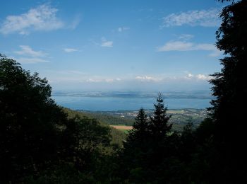
• Trail created by Neuchâtel Rando. Les Oeuillons-Le Soliat Symbol: losange jaune
![Percorso A piedi Boudry - Pont des Clées-Forêt de Boudry - Photo](https://media.geolcdn.com/t/350/260/6dd4f205-a5f0-4f72-8119-0f6c4b55d529.jpeg&format=jpg&maxdim=2)
![A piedi A piedi](https://static1.geolcdn.com/sitytour/trail-icons/100.png)
Km
A piedi
![](/images/other/stat-length.png)
![](https://static1.geolcdn.com/siteimages/upload/files/1508320355ic_sort_den_pos_24dp.png)
![](https://static1.geolcdn.com/siteimages/upload/files/1508320355ic_sort_den_neg_24dp.png)
![](https://static1.geolcdn.com/siteimages/upload/files/16400158638029165_repeat_loop_refresh_sync_direction_icon.png)
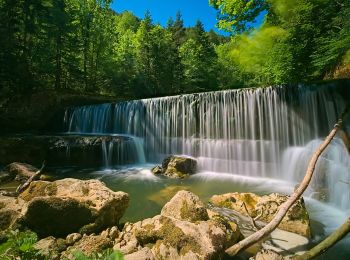
• Trail created by Neuchâtel Rando. Pont des Clées-Forêt de Boudry Symbol: losange jaune
![Percorso A piedi Neuchâtel - Chaumont Funiculaire - Les Trois Bornes - Photo](https://media.geolcdn.com/t/350/260/23e5e340-5107-423a-b9a3-89dda724c054.jpeg&format=jpg&maxdim=2)
![A piedi A piedi](https://static1.geolcdn.com/sitytour/trail-icons/100.png)
Km
A piedi
![](/images/other/stat-length.png)
![](https://static1.geolcdn.com/siteimages/upload/files/1508320355ic_sort_den_pos_24dp.png)
![](https://static1.geolcdn.com/siteimages/upload/files/1508320355ic_sort_den_neg_24dp.png)
![](https://static1.geolcdn.com/siteimages/upload/files/16400158638029165_repeat_loop_refresh_sync_direction_icon.png)
• Trail created by Neuchâtel Rando. Chaumont Funiculaire - Les Trois Bornes Symbol: losange jaune
20 percorsi visualizzati su 236
Applicazione GPS da escursionismo GRATUITA
Attività
Regioni vicine
- Boudry
- Brot-Plamboz
- Cornaux
- Cortaillod
- Enges
- Hauterive (NE)
- La Brévine
- La Chaux-de-Fonds
- La Chaux-du-Milieu
- La Côte-aux-Fées
- La Grande-Béroche
- La Sagne
- La Tène
- Le Cerneux-Péquignot
- Le Landeron
- Le Locle
- Les Planchettes
- Les Ponts-de-Martel
- Les Verrières
- Lignières
- Milvignes
- Neuchâtel
- Rochefort
- Saint-Blaise
- Val-de-Ruz
- Val-de-Travers