![](/images/other/stat-length.png)
Bezirk Sankt Veit an der Glan, Carinzia : I migliori sentieri, percorsi e passeggiate
Bezirk Sankt Veit an der Glan: Scopri i migliori percorsi: 12 percorsi a piedi. Tutti questi percorsi, itinerari e attività outdoor sono disponibili nelle nostre app SityTrail per smartphone e tablet.
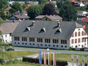
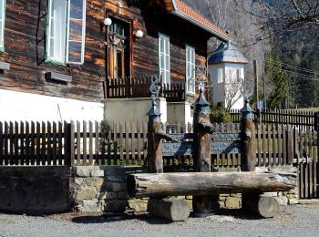
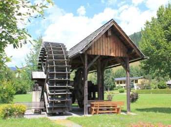
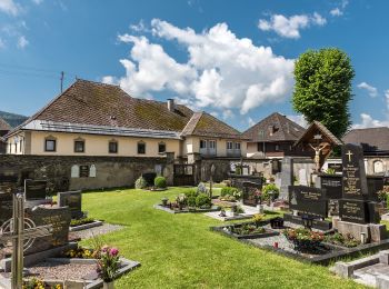
I percorsi migliori (0})
![Percorso A piedi Liebenfels - Ulrichsberg-Gedächtniswanderung - Photo](https://media.geolcdn.com/t/350/260/9b27c872-b99c-4a74-a029-7ddbcec5cf93.jpeg&format=jpg&maxdim=2)
![A piedi A piedi](https://static1.geolcdn.com/sitytour/trail-icons/100.png)
Km
A piedi
![](/images/other/stat-length.png)
![](https://static1.geolcdn.com/siteimages/upload/files/1508320355ic_sort_den_pos_24dp.png)
![](https://static1.geolcdn.com/siteimages/upload/files/1508320355ic_sort_den_neg_24dp.png)
![](https://static1.geolcdn.com/siteimages/upload/files/16400158638029165_repeat_loop_refresh_sync_direction_icon.png)
• Trail created by ÖAV - Sektion Klagenfurt.
![Percorso A piedi Frauenstein - Pulst-Sörg-Lorenziberg-Runde - Photo](https://media.geolcdn.com/t/350/260/de79d99f-df3f-4fa2-bcdb-261b2ed15353.jpeg&format=jpg&maxdim=2)
![A piedi A piedi](https://static1.geolcdn.com/sitytour/trail-icons/100.png)
Km
A piedi
![](/images/other/stat-length.png)
![](https://static1.geolcdn.com/siteimages/upload/files/1508320355ic_sort_den_pos_24dp.png)
![](https://static1.geolcdn.com/siteimages/upload/files/1508320355ic_sort_den_neg_24dp.png)
![](https://static1.geolcdn.com/siteimages/upload/files/16400158638029165_repeat_loop_refresh_sync_direction_icon.png)
• Trail created by ÖAV – Sektion Klagenfurt.
![Percorso A piedi Hüttenberg - Saualpen-Nordrunde - Photo](https://media.geolcdn.com/t/350/260/077f9a46-c65c-4128-9f0c-95f81e612863.jpeg&format=jpg&maxdim=2)
![A piedi A piedi](https://static1.geolcdn.com/sitytour/trail-icons/100.png)
Km
A piedi
![](/images/other/stat-length.png)
![](https://static1.geolcdn.com/siteimages/upload/files/1508320355ic_sort_den_pos_24dp.png)
![](https://static1.geolcdn.com/siteimages/upload/files/1508320355ic_sort_den_neg_24dp.png)
![](https://static1.geolcdn.com/siteimages/upload/files/16400158638029165_repeat_loop_refresh_sync_direction_icon.png)
• Trail created by ÖAV – Sektion Klagenfurt. diese Nordrunde verläuft im Uhrzeigersinn
![Percorso A piedi Sankt Veit an der Glan - St. Donat-Magdalensberg-Achter - Photo](https://media.geolcdn.com/t/350/260/03424e4a-b077-4695-b62d-02f12a07919f.jpeg&format=jpg&maxdim=2)
![A piedi A piedi](https://static1.geolcdn.com/sitytour/trail-icons/100.png)
Km
A piedi
![](/images/other/stat-length.png)
![](https://static1.geolcdn.com/siteimages/upload/files/1508320355ic_sort_den_pos_24dp.png)
![](https://static1.geolcdn.com/siteimages/upload/files/1508320355ic_sort_den_neg_24dp.png)
![](https://static1.geolcdn.com/siteimages/upload/files/16400158638029165_repeat_loop_refresh_sync_direction_icon.png)
• Trail created by ÖAV – Sektion Klagenfurt.
![Percorso A piedi Friesach - Friesach-Deutschhauserberg-Runde - Photo](https://media.geolcdn.com/t/350/260/0a50377b-aea3-472b-bedf-3b5b58b74d4c.jpeg&format=jpg&maxdim=2)
![A piedi A piedi](https://static1.geolcdn.com/sitytour/trail-icons/100.png)
Km
A piedi
![](/images/other/stat-length.png)
![](https://static1.geolcdn.com/siteimages/upload/files/1508320355ic_sort_den_pos_24dp.png)
![](https://static1.geolcdn.com/siteimages/upload/files/1508320355ic_sort_den_neg_24dp.png)
![](https://static1.geolcdn.com/siteimages/upload/files/16400158638029165_repeat_loop_refresh_sync_direction_icon.png)
• Trail created by ÖAV – Sektion Klagenfurt – Metnitztal – Friesacher Feld - Friesach-Deutschhauserberg-Runde https://w...
![Percorso A piedi Eberstein - Eberstein's Sehenswürdigkeiten (Rundwanderung) - Photo](https://media.geolcdn.com/t/350/260/1bcdbfbd-5e67-4223-ae4d-e90f056fa883.jpeg&format=jpg&maxdim=2)
![A piedi A piedi](https://static1.geolcdn.com/sitytour/trail-icons/100.png)
Km
A piedi
![](/images/other/stat-length.png)
![](https://static1.geolcdn.com/siteimages/upload/files/1508320355ic_sort_den_pos_24dp.png)
![](https://static1.geolcdn.com/siteimages/upload/files/1508320355ic_sort_den_neg_24dp.png)
![](https://static1.geolcdn.com/siteimages/upload/files/16400158638029165_repeat_loop_refresh_sync_direction_icon.png)
• Trail created by ÖAV – Sektion Klagenfurt – Görtschitztal – Eberstein’s Sehenswürdigkeiten https://www.outdooractive....
![Percorso A piedi Glödnitz - Mödringberg - Photo](https://media.geolcdn.com/t/350/260/d93080b8-df85-43ea-bf61-b5fcef783f78.jpeg&format=jpg&maxdim=2)
![A piedi A piedi](https://static1.geolcdn.com/sitytour/trail-icons/100.png)
Km
A piedi
![](/images/other/stat-length.png)
![](https://static1.geolcdn.com/siteimages/upload/files/1508320355ic_sort_den_pos_24dp.png)
![](https://static1.geolcdn.com/siteimages/upload/files/1508320355ic_sort_den_neg_24dp.png)
![](https://static1.geolcdn.com/siteimages/upload/files/16400158638029165_repeat_loop_refresh_sync_direction_icon.png)
• Symbol: rot-weiss-rot
![Percorso A piedi Glödnitz - Altenmarkt-Weissberg - Photo](https://media.geolcdn.com/t/350/260/35c97064-b870-43ac-a1ac-b3f16e3b0a27.jpeg&format=jpg&maxdim=2)
![A piedi A piedi](https://static1.geolcdn.com/sitytour/trail-icons/100.png)
Km
A piedi
![](/images/other/stat-length.png)
![](https://static1.geolcdn.com/siteimages/upload/files/1508320355ic_sort_den_pos_24dp.png)
![](https://static1.geolcdn.com/siteimages/upload/files/1508320355ic_sort_den_neg_24dp.png)
![](https://static1.geolcdn.com/siteimages/upload/files/16400158638029165_repeat_loop_refresh_sync_direction_icon.png)
• Symbol: rot-weiss-rot
![Percorso A piedi Deutsch-Griffen - Deutschgriffen-Albern-Rundweg - Photo](https://media.geolcdn.com/t/350/260/758b3e71-931b-45f6-9808-c653e5476b4b.jpeg&format=jpg&maxdim=2)
![A piedi A piedi](https://static1.geolcdn.com/sitytour/trail-icons/100.png)
Km
A piedi
![](/images/other/stat-length.png)
![](https://static1.geolcdn.com/siteimages/upload/files/1508320355ic_sort_den_pos_24dp.png)
![](https://static1.geolcdn.com/siteimages/upload/files/1508320355ic_sort_den_neg_24dp.png)
![](https://static1.geolcdn.com/siteimages/upload/files/16400158638029165_repeat_loop_refresh_sync_direction_icon.png)
• http://wiki.openstreetmap.org/wiki/WikiProject_Austria#Wanderwege Symbol: Schwarzer Text 37 auf gelbem Grund
![Percorso A piedi Deutsch-Griffen - Wanderweg Deutschgriffen - Hochrindl - Photo](https://media.geolcdn.com/t/350/260/e3d95fe2-d016-4404-91e2-06af18edccb5.jpeg&format=jpg&maxdim=2)
![A piedi A piedi](https://static1.geolcdn.com/sitytour/trail-icons/100.png)
Km
A piedi
![](/images/other/stat-length.png)
![](https://static1.geolcdn.com/siteimages/upload/files/1508320355ic_sort_den_pos_24dp.png)
![](https://static1.geolcdn.com/siteimages/upload/files/1508320355ic_sort_den_neg_24dp.png)
![](https://static1.geolcdn.com/siteimages/upload/files/16400158638029165_repeat_loop_refresh_sync_direction_icon.png)
• http://wiki.openstreetmap.org/wiki/WikiProject_Austria#Wanderwege Symbol: Schwarzer Text 31 auf gelbem Grund
![Percorso A piedi Hüttenberg - Geierkogelrunde - Photo](https://media.geolcdn.com/t/350/260/9679cc70-b524-4d1a-9180-de6ab1f5725e.jpeg&format=jpg&maxdim=2)
![A piedi A piedi](https://static1.geolcdn.com/sitytour/trail-icons/100.png)
Km
A piedi
![](/images/other/stat-length.png)
![](https://static1.geolcdn.com/siteimages/upload/files/1508320355ic_sort_den_pos_24dp.png)
![](https://static1.geolcdn.com/siteimages/upload/files/1508320355ic_sort_den_neg_24dp.png)
![](https://static1.geolcdn.com/siteimages/upload/files/16400158638029165_repeat_loop_refresh_sync_direction_icon.png)
• Trail created by Wolfsberg. Symbol: rot-weiss-rot
![Percorso A piedi Liebenfels - Vierbergelauf - Photo](https://media.geolcdn.com/t/350/260/54174a2b-9ca6-42ca-bc1e-75a842ce877c.jpeg&format=jpg&maxdim=2)
![A piedi A piedi](https://static1.geolcdn.com/sitytour/trail-icons/100.png)
Km
A piedi
![](/images/other/stat-length.png)
![](https://static1.geolcdn.com/siteimages/upload/files/1508320355ic_sort_den_pos_24dp.png)
![](https://static1.geolcdn.com/siteimages/upload/files/1508320355ic_sort_den_neg_24dp.png)
![](https://static1.geolcdn.com/siteimages/upload/files/16400158638029165_repeat_loop_refresh_sync_direction_icon.png)
12 percorsi visualizzati su 12
Applicazione GPS da escursionismo GRATUITA