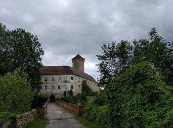
![](/images/other/stat-length.png)
- Percorsi
- Outdoor
- Austria
- Oberösterreich
- Bezirk Urfahr-Umgebung
Bezirk Urfahr-Umgebung, Oberösterreich : I migliori sentieri, percorsi e passeggiate
Bezirk Urfahr-Umgebung: Scopri i migliori percorsi: 84 percorsi a piedi. Tutti questi percorsi, itinerari e attività outdoor sono disponibili nelle nostre app SityTrail per smartphone e tablet.
I percorsi migliori (0})
![Percorso A piedi Ottenschlag im Mühlkreis - Wanderweg 97 - Photo](https://media.geolcdn.com/t/350/260/45d157d6-b821-4875-a774-94ad8906eb2e.jpeg&format=jpg&maxdim=2)
![A piedi A piedi](https://static1.geolcdn.com/sitytour/trail-icons/100.png)
Km
A piedi
![](/images/other/stat-length.png)
![](https://static1.geolcdn.com/siteimages/upload/files/1508320355ic_sort_den_pos_24dp.png)
![](https://static1.geolcdn.com/siteimages/upload/files/1508320355ic_sort_den_neg_24dp.png)
![](https://static1.geolcdn.com/siteimages/upload/files/16400158638029165_repeat_loop_refresh_sync_direction_icon.png)
• Symbol: rot-weiss-rot
![Percorso A piedi Schenkenfelden - Wanderweg 62 - Photo](https://media.geolcdn.com/t/350/260/5088698e-a5b9-41c2-889f-3f76d3de30d8.jpeg&format=jpg&maxdim=2)
![A piedi A piedi](https://static1.geolcdn.com/sitytour/trail-icons/100.png)
Km
A piedi
![](/images/other/stat-length.png)
![](https://static1.geolcdn.com/siteimages/upload/files/1508320355ic_sort_den_pos_24dp.png)
![](https://static1.geolcdn.com/siteimages/upload/files/1508320355ic_sort_den_neg_24dp.png)
![](https://static1.geolcdn.com/siteimages/upload/files/16400158638029165_repeat_loop_refresh_sync_direction_icon.png)
• Symbol: rot-weiss-rot
![Percorso A piedi Schenkenfelden - Wanderweg 61 - Photo](https://media.geolcdn.com/t/350/260/d021891a-515b-45b7-b6ea-10a8c6d31157.jpeg&format=jpg&maxdim=2)
![A piedi A piedi](https://static1.geolcdn.com/sitytour/trail-icons/100.png)
Km
A piedi
![](/images/other/stat-length.png)
![](https://static1.geolcdn.com/siteimages/upload/files/1508320355ic_sort_den_pos_24dp.png)
![](https://static1.geolcdn.com/siteimages/upload/files/1508320355ic_sort_den_neg_24dp.png)
![](https://static1.geolcdn.com/siteimages/upload/files/16400158638029165_repeat_loop_refresh_sync_direction_icon.png)
• Symbol: rot-weiss-rot
![Percorso A piedi Schenkenfelden - Wanderweg 65 - Photo](https://media.geolcdn.com/t/350/260/126dbe98-8f86-4124-bd10-b7d04d159f86.jpeg&format=jpg&maxdim=2)
![A piedi A piedi](https://static1.geolcdn.com/sitytour/trail-icons/100.png)
Km
A piedi
![](/images/other/stat-length.png)
![](https://static1.geolcdn.com/siteimages/upload/files/1508320355ic_sort_den_pos_24dp.png)
![](https://static1.geolcdn.com/siteimages/upload/files/1508320355ic_sort_den_neg_24dp.png)
![](https://static1.geolcdn.com/siteimages/upload/files/16400158638029165_repeat_loop_refresh_sync_direction_icon.png)
• Symbol: rot-weiss-rot
![Percorso A piedi Schenkenfelden - Märchenwanderweg - Photo](https://media.geolcdn.com/t/350/260/d021891a-515b-45b7-b6ea-10a8c6d31157.jpeg&format=jpg&maxdim=2)
![A piedi A piedi](https://static1.geolcdn.com/sitytour/trail-icons/100.png)
Km
A piedi
![](/images/other/stat-length.png)
![](https://static1.geolcdn.com/siteimages/upload/files/1508320355ic_sort_den_pos_24dp.png)
![](https://static1.geolcdn.com/siteimages/upload/files/1508320355ic_sort_den_neg_24dp.png)
![](https://static1.geolcdn.com/siteimages/upload/files/16400158638029165_repeat_loop_refresh_sync_direction_icon.png)
• Trail created by Verein Lebenswertes Schenkenfelden. Symbol: Weißer Zwerg auf grünem Grund
![Percorso A piedi Steyregg - 3 Buchen Weg - Photo](https://media.geolcdn.com/t/350/260/4bacca63-a8d1-45f1-ab57-007b5153619f.jpeg&format=jpg&maxdim=2)
![A piedi A piedi](https://static1.geolcdn.com/sitytour/trail-icons/100.png)
Km
A piedi
![](/images/other/stat-length.png)
![](https://static1.geolcdn.com/siteimages/upload/files/1508320355ic_sort_den_pos_24dp.png)
![](https://static1.geolcdn.com/siteimages/upload/files/1508320355ic_sort_den_neg_24dp.png)
![](https://static1.geolcdn.com/siteimages/upload/files/16400158638029165_repeat_loop_refresh_sync_direction_icon.png)
• Trail created by Stadtgemeinde Steyregg. Symbol: rot-weiss-rot
![Percorso A piedi Steyregg - Pfenningberg-Gipfelwanderweg - Photo](https://media.geolcdn.com/t/350/260/4bacca63-a8d1-45f1-ab57-007b5153619f.jpeg&format=jpg&maxdim=2)
![A piedi A piedi](https://static1.geolcdn.com/sitytour/trail-icons/100.png)
Km
A piedi
![](/images/other/stat-length.png)
![](https://static1.geolcdn.com/siteimages/upload/files/1508320355ic_sort_den_pos_24dp.png)
![](https://static1.geolcdn.com/siteimages/upload/files/1508320355ic_sort_den_neg_24dp.png)
![](https://static1.geolcdn.com/siteimages/upload/files/16400158638029165_repeat_loop_refresh_sync_direction_icon.png)
• Trail created by Stadtgemeinde Steyregg. Symbol: rot-weiss-rot
![Percorso A piedi Vorderweißenbach - Steinerne Mühl Weg - Photo](https://media.geolcdn.com/t/350/260/1248ec60-2e25-4827-a4c2-29736c88c1c6.jpeg&format=jpg&maxdim=2)
![A piedi A piedi](https://static1.geolcdn.com/sitytour/trail-icons/100.png)
Km
A piedi
![](/images/other/stat-length.png)
![](https://static1.geolcdn.com/siteimages/upload/files/1508320355ic_sort_den_pos_24dp.png)
![](https://static1.geolcdn.com/siteimages/upload/files/1508320355ic_sort_den_neg_24dp.png)
![](https://static1.geolcdn.com/siteimages/upload/files/16400158638029165_repeat_loop_refresh_sync_direction_icon.png)
• Trail created by Traumarena. http://wiki.openstreetmap.org/wiki/WikiProject_Austria/Wanderwege Symbol: Wanderer auf...
![Percorso A piedi Bad Leonfelden - Nordwaldkammweg Verbindungsweg V8 - Photo](https://media.geolcdn.com/t/350/260/88d15571-8747-49c7-b81f-659a84a71e0c.jpeg&format=jpg&maxdim=2)
![A piedi A piedi](https://static1.geolcdn.com/sitytour/trail-icons/100.png)
Km
A piedi
![](/images/other/stat-length.png)
![](https://static1.geolcdn.com/siteimages/upload/files/1508320355ic_sort_den_pos_24dp.png)
![](https://static1.geolcdn.com/siteimages/upload/files/1508320355ic_sort_den_neg_24dp.png)
![](https://static1.geolcdn.com/siteimages/upload/files/16400158638029165_repeat_loop_refresh_sync_direction_icon.png)
• Trail created by Alpenverein.
![Percorso A piedi Vorderweißenbach - Wassersteig - Photo](https://media.geolcdn.com/t/350/260/c2f06a4d-c1eb-41e6-a2e6-b205d9183d3c.jpeg&format=jpg&maxdim=2)
![A piedi A piedi](https://static1.geolcdn.com/sitytour/trail-icons/100.png)
Km
A piedi
![](/images/other/stat-length.png)
![](https://static1.geolcdn.com/siteimages/upload/files/1508320355ic_sort_den_pos_24dp.png)
![](https://static1.geolcdn.com/siteimages/upload/files/1508320355ic_sort_den_neg_24dp.png)
![](https://static1.geolcdn.com/siteimages/upload/files/16400158638029165_repeat_loop_refresh_sync_direction_icon.png)
• Trail created by Gemeinde Vorderweißenbach. Symbol: 27a auf gelben Schild
![Percorso A piedi Kirchschlag bei Linz - Speichmühle-Kirchschlag - Photo](https://media.geolcdn.com/t/350/260/347f3024-e410-4454-90c8-c8c5bfbe925d.jpeg&format=jpg&maxdim=2)
![A piedi A piedi](https://static1.geolcdn.com/sitytour/trail-icons/100.png)
Km
A piedi
![](/images/other/stat-length.png)
![](https://static1.geolcdn.com/siteimages/upload/files/1508320355ic_sort_den_pos_24dp.png)
![](https://static1.geolcdn.com/siteimages/upload/files/1508320355ic_sort_den_neg_24dp.png)
![](https://static1.geolcdn.com/siteimages/upload/files/16400158638029165_repeat_loop_refresh_sync_direction_icon.png)
• Symbol: rot-weiss-rot mit schwarzer Aufschrift 17 oder nur rot-weiß-rot
![Percorso A piedi Bad Leonfelden - Miesenwald-Runde - Photo](https://media.geolcdn.com/t/350/260/7893eb2d-2ad3-4677-80e4-3a8b22389954.jpeg&format=jpg&maxdim=2)
![A piedi A piedi](https://static1.geolcdn.com/sitytour/trail-icons/100.png)
Km
A piedi
![](/images/other/stat-length.png)
![](https://static1.geolcdn.com/siteimages/upload/files/1508320355ic_sort_den_pos_24dp.png)
![](https://static1.geolcdn.com/siteimages/upload/files/1508320355ic_sort_den_neg_24dp.png)
![](https://static1.geolcdn.com/siteimages/upload/files/16400158638029165_repeat_loop_refresh_sync_direction_icon.png)
• Trail created by Österreichischer Alpenverein. Symbol: Ausgefüllter grüner Kreis (meist auf gelbem Grund, manchmal n...
![Percorso A piedi Kirchschlag bei Linz - Kirchschlag 6er - Photo](https://media.geolcdn.com/t/350/260/89aeab92-5c1d-4f2d-86db-4abd9a2ec13e.jpeg&format=jpg&maxdim=2)
![A piedi A piedi](https://static1.geolcdn.com/sitytour/trail-icons/100.png)
Km
A piedi
![](/images/other/stat-length.png)
![](https://static1.geolcdn.com/siteimages/upload/files/1508320355ic_sort_den_pos_24dp.png)
![](https://static1.geolcdn.com/siteimages/upload/files/1508320355ic_sort_den_neg_24dp.png)
![](https://static1.geolcdn.com/siteimages/upload/files/16400158638029165_repeat_loop_refresh_sync_direction_icon.png)
• Symbol: braunes Schild mit schawrzer Aufschrift "Kirschschlag" schwarzem Text "6er" und rotem Hinweispfeil auf der re...
![Percorso A piedi Kirchschlag bei Linz - Kirchschlag 1er - Photo](https://media.geolcdn.com/t/350/260/62c3f557-6379-4375-918c-d3ba7d06727b.jpeg&format=jpg&maxdim=2)
![A piedi A piedi](https://static1.geolcdn.com/sitytour/trail-icons/100.png)
Km
A piedi
![](/images/other/stat-length.png)
![](https://static1.geolcdn.com/siteimages/upload/files/1508320355ic_sort_den_pos_24dp.png)
![](https://static1.geolcdn.com/siteimages/upload/files/1508320355ic_sort_den_neg_24dp.png)
![](https://static1.geolcdn.com/siteimages/upload/files/16400158638029165_repeat_loop_refresh_sync_direction_icon.png)
• Symbol: gelbes Schild mit schawrzer Aufschrift "Kirschschlag" schwarzem Text "1er" und rotem Hinweispfeil auf der rec...
![Percorso A piedi Kirchschlag bei Linz - Untergeng-Kirchschlag - Photo](https://media.geolcdn.com/t/350/260/34c105d1-90a2-464f-ba7f-d585ffbbf199.jpeg&format=jpg&maxdim=2)
![A piedi A piedi](https://static1.geolcdn.com/sitytour/trail-icons/100.png)
Km
A piedi
![](/images/other/stat-length.png)
![](https://static1.geolcdn.com/siteimages/upload/files/1508320355ic_sort_den_pos_24dp.png)
![](https://static1.geolcdn.com/siteimages/upload/files/1508320355ic_sort_den_neg_24dp.png)
![](https://static1.geolcdn.com/siteimages/upload/files/16400158638029165_repeat_loop_refresh_sync_direction_icon.png)
• Trail created by Österreichischer Alpenverein Sektion Rodllland. Symbol: rot-weiss-rot 14
![Percorso A piedi Kirchschlag bei Linz - Kirchschlag 2er - Photo](https://media.geolcdn.com/t/350/260/b246ddb3-530e-427a-8a06-258dad3ce602.jpeg&format=jpg&maxdim=2)
![A piedi A piedi](https://static1.geolcdn.com/sitytour/trail-icons/100.png)
Km
A piedi
![](/images/other/stat-length.png)
![](https://static1.geolcdn.com/siteimages/upload/files/1508320355ic_sort_den_pos_24dp.png)
![](https://static1.geolcdn.com/siteimages/upload/files/1508320355ic_sort_den_neg_24dp.png)
![](https://static1.geolcdn.com/siteimages/upload/files/16400158638029165_repeat_loop_refresh_sync_direction_icon.png)
• Symbol: Violettes Schild mit Schawrzer Aufschrift "Kirschschlag" weißem Text "2er" und rotem hiweispfeil auf der rech...
![Percorso A piedi Zwettl an der Rodl - Wanderweg 31 - Photo](https://media.geolcdn.com/t/350/260/61794fe5-6829-41e1-b091-04857efc6fea.jpeg&format=jpg&maxdim=2)
![A piedi A piedi](https://static1.geolcdn.com/sitytour/trail-icons/100.png)
Km
A piedi
![](/images/other/stat-length.png)
![](https://static1.geolcdn.com/siteimages/upload/files/1508320355ic_sort_den_pos_24dp.png)
![](https://static1.geolcdn.com/siteimages/upload/files/1508320355ic_sort_den_neg_24dp.png)
![](https://static1.geolcdn.com/siteimages/upload/files/16400158638029165_repeat_loop_refresh_sync_direction_icon.png)
• Symbol: rot-weiss-rot
![Percorso A piedi Hellmonsödt - AT-19 - Photo](https://media.geolcdn.com/t/350/260/02881a25-c23c-48f4-9933-335cb03edb79.jpeg&format=jpg&maxdim=2)
![A piedi A piedi](https://static1.geolcdn.com/sitytour/trail-icons/100.png)
Km
A piedi
![](/images/other/stat-length.png)
![](https://static1.geolcdn.com/siteimages/upload/files/1508320355ic_sort_den_pos_24dp.png)
![](https://static1.geolcdn.com/siteimages/upload/files/1508320355ic_sort_den_neg_24dp.png)
![](https://static1.geolcdn.com/siteimages/upload/files/16400158638029165_repeat_loop_refresh_sync_direction_icon.png)
• Symbol: eRot-weiß-rot mit schwarzer Zahl 19
![Percorso A piedi Sonnberg im Mühlkreis - Mühlviertler Sterngartl Rundweg - Photo](https://media.geolcdn.com/t/350/260/5b99adca-b0b1-48c6-9f6c-32dc78115849.jpeg&format=jpg&maxdim=2)
![A piedi A piedi](https://static1.geolcdn.com/sitytour/trail-icons/100.png)
Km
A piedi
![](/images/other/stat-length.png)
![](https://static1.geolcdn.com/siteimages/upload/files/1508320355ic_sort_den_pos_24dp.png)
![](https://static1.geolcdn.com/siteimages/upload/files/1508320355ic_sort_den_neg_24dp.png)
![](https://static1.geolcdn.com/siteimages/upload/files/16400158638029165_repeat_loop_refresh_sync_direction_icon.png)
• Symbol: blaue Blume auf weißen Grund, darunter der schwarze Text "MÜHLVIERTLER STERN GARTL RUNDWEG"
![Percorso A piedi Kirchschlag bei Linz - Speichmühle-Wildberg - Photo](https://media.geolcdn.com/t/350/260/5935fc67-3c82-42ab-9050-2dfa41ebd2bc.jpeg&format=jpg&maxdim=2)
![A piedi A piedi](https://static1.geolcdn.com/sitytour/trail-icons/100.png)
Km
A piedi
![](/images/other/stat-length.png)
![](https://static1.geolcdn.com/siteimages/upload/files/1508320355ic_sort_den_pos_24dp.png)
![](https://static1.geolcdn.com/siteimages/upload/files/1508320355ic_sort_den_neg_24dp.png)
![](https://static1.geolcdn.com/siteimages/upload/files/16400158638029165_repeat_loop_refresh_sync_direction_icon.png)
• Symbol: rot-weiss-rot
20 percorsi visualizzati su 84
Applicazione GPS da escursionismo GRATUITA
Attività
Regioni vicine
- Alberndorf in der Riedmark
- Altenberg bei Linz
- Bad Leonfelden
- Eidenberg
- Feldkirchen an der Donau
- Goldwörth
- Gramastetten
- Haibach im Mühlkreis
- Hellmonsödt
- Herzogsdorf
- Kirchschlag bei Linz
- Lichtenberg
- Oberneukirchen
- Ottenschlag im Mühlkreis
- Ottensheim
- Puchenau
- Reichenthal
- Schenkenfelden
- Sonnberg im Mühlkreis
- Steyregg
- Vorderweißenbach
- Walding
- Zwettl an der Rodl