![](/images/other/stat-length.png)
- Percorsi
- Outdoor
- Austria
- Stiria
- Bezirk Hartberg-Fürstenfeld
- Hartberg Umgebung
Hartberg Umgebung, Bezirk Hartberg-Fürstenfeld : I migliori sentieri, percorsi e passeggiate
Hartberg Umgebung: Scopri i migliori percorsi: 7 percorsi a piedi. Tutti questi percorsi, itinerari e attività outdoor sono disponibili nelle nostre app SityTrail per smartphone e tablet.
I percorsi migliori (0})
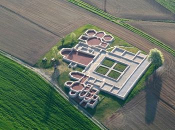
![Percorso A piedi Hartberg Umgebung - Löffelbach - Villa Rustica - Burg Neuberg - Sportplatz Schildbach - Löffenbach (II) - Photo](https://media.geolcdn.com/t/350/260/435820f5-6204-4c3d-a056-0ebf7fea6b43.jpeg&format=jpg&maxdim=2)
![A piedi A piedi](https://static1.geolcdn.com/sitytour/trail-icons/100.png)
Km
A piedi
![](/images/other/stat-length.png)
![](https://static1.geolcdn.com/siteimages/upload/files/1508320355ic_sort_den_pos_24dp.png)
![](https://static1.geolcdn.com/siteimages/upload/files/1508320355ic_sort_den_neg_24dp.png)
![](https://static1.geolcdn.com/siteimages/upload/files/16400158638029165_repeat_loop_refresh_sync_direction_icon.png)
• Symbol: braunes Kleeblatt mit röm. Zahl II
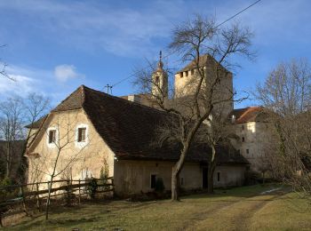
![Percorso A piedi Hartberg Umgebung - Löffelbach - Villa Rustica - Burg Neuberg - Löffenbach (I) - Photo](https://media.geolcdn.com/t/350/260/7662d677-9ccc-4427-a9eb-a8c9a1c8776e.jpeg&format=jpg&maxdim=2)
![A piedi A piedi](https://static1.geolcdn.com/sitytour/trail-icons/100.png)
Km
A piedi
![](/images/other/stat-length.png)
![](https://static1.geolcdn.com/siteimages/upload/files/1508320355ic_sort_den_pos_24dp.png)
![](https://static1.geolcdn.com/siteimages/upload/files/1508320355ic_sort_den_neg_24dp.png)
![](https://static1.geolcdn.com/siteimages/upload/files/16400158638029165_repeat_loop_refresh_sync_direction_icon.png)
• Symbol: blaues Kleeblatt mit röm. Zahl I
![Percorso A piedi Hartberg Umgebung - Löffelbach - Häckerberg - Flattendorf-Aue - St. Anna - Löffelbach (IV) - Photo](https://media.geolcdn.com/t/350/260/435820f5-6204-4c3d-a056-0ebf7fea6b43.jpeg&format=jpg&maxdim=2)
![A piedi A piedi](https://static1.geolcdn.com/sitytour/trail-icons/100.png)
Km
A piedi
![](/images/other/stat-length.png)
![](https://static1.geolcdn.com/siteimages/upload/files/1508320355ic_sort_den_pos_24dp.png)
![](https://static1.geolcdn.com/siteimages/upload/files/1508320355ic_sort_den_neg_24dp.png)
![](https://static1.geolcdn.com/siteimages/upload/files/16400158638029165_repeat_loop_refresh_sync_direction_icon.png)
• Einige Streckenabschnitte nicht markiert Symbol: gelbes Kleeblatt mit röm. Zahl IV bzw. gelb-weiß
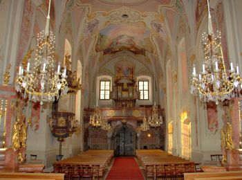
![Percorso A piedi Hartberg Umgebung - Kurweg (V) - Photo](https://media.geolcdn.com/t/350/260/7a813856-0bc8-49ef-8b6f-334a63796daa.jpeg&format=jpg&maxdim=2)
![A piedi A piedi](https://static1.geolcdn.com/sitytour/trail-icons/100.png)
Km
A piedi
![](/images/other/stat-length.png)
![](https://static1.geolcdn.com/siteimages/upload/files/1508320355ic_sort_den_pos_24dp.png)
![](https://static1.geolcdn.com/siteimages/upload/files/1508320355ic_sort_den_neg_24dp.png)
![](https://static1.geolcdn.com/siteimages/upload/files/16400158638029165_repeat_loop_refresh_sync_direction_icon.png)
• Symbol: grünes Kleeblatt mit röm. Zahl V
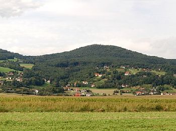
![Percorso A piedi Hartberg Umgebung - Drehscheibenweg (W2) - Photo](https://media.geolcdn.com/t/350/260/4a7e0eb9-fe71-432f-9ee2-11ab57da2922.jpeg&format=jpg&maxdim=2)
![A piedi A piedi](https://static1.geolcdn.com/sitytour/trail-icons/100.png)
Km
A piedi
![](/images/other/stat-length.png)
![](https://static1.geolcdn.com/siteimages/upload/files/1508320355ic_sort_den_pos_24dp.png)
![](https://static1.geolcdn.com/siteimages/upload/files/1508320355ic_sort_den_neg_24dp.png)
![](https://static1.geolcdn.com/siteimages/upload/files/16400158638029165_repeat_loop_refresh_sync_direction_icon.png)
![Percorso A piedi Hartberg Umgebung - Herrschaftsweg (W3) - Photo](https://media.geolcdn.com/t/350/260/4a7e0eb9-fe71-432f-9ee2-11ab57da2922.jpeg&format=jpg&maxdim=2)
![A piedi A piedi](https://static1.geolcdn.com/sitytour/trail-icons/100.png)
Km
A piedi
![](/images/other/stat-length.png)
![](https://static1.geolcdn.com/siteimages/upload/files/1508320355ic_sort_den_pos_24dp.png)
![](https://static1.geolcdn.com/siteimages/upload/files/1508320355ic_sort_den_neg_24dp.png)
![](https://static1.geolcdn.com/siteimages/upload/files/16400158638029165_repeat_loop_refresh_sync_direction_icon.png)
![Percorso A piedi Hartberg Umgebung - Jungbrunnenweg (W4) - Photo](https://media.geolcdn.com/t/350/260/4a7e0eb9-fe71-432f-9ee2-11ab57da2922.jpeg&format=jpg&maxdim=2)
![A piedi A piedi](https://static1.geolcdn.com/sitytour/trail-icons/100.png)
Km
A piedi
![](/images/other/stat-length.png)
![](https://static1.geolcdn.com/siteimages/upload/files/1508320355ic_sort_den_pos_24dp.png)
![](https://static1.geolcdn.com/siteimages/upload/files/1508320355ic_sort_den_neg_24dp.png)
![](https://static1.geolcdn.com/siteimages/upload/files/16400158638029165_repeat_loop_refresh_sync_direction_icon.png)
7 percorsi visualizzati su 7
Applicazione GPS da escursionismo GRATUITA