![](/images/other/stat-length.png)
- Percorsi
- Outdoor
- Austria
- Bassa Austria
- Bezirk Neunkirchen
- Gemeinde Thomasberg
Gemeinde Thomasberg, Bezirk Neunkirchen : I migliori sentieri, percorsi e passeggiate
Gemeinde Thomasberg: Scopri i migliori percorsi: 5 percorsi a piedi. Tutti questi percorsi, itinerari e attività outdoor sono disponibili nelle nostre app SityTrail per smartphone e tablet.
I percorsi migliori (0})
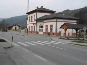
![Percorso A piedi Gemeinde Thomasberg - Grimmenstein - Kulmriegel - Landeskrankenhaus Grimmenstein - Hochriegel - Photo](https://media.geolcdn.com/t/350/260/607745ab-90e6-40df-9e2e-ad37d487f721.jpeg&format=jpg&maxdim=2)
![A piedi A piedi](https://static1.geolcdn.com/sitytour/trail-icons/100.png)
Km
A piedi
![](/images/other/stat-length.png)
![](https://static1.geolcdn.com/siteimages/upload/files/1508320355ic_sort_den_pos_24dp.png)
![](https://static1.geolcdn.com/siteimages/upload/files/1508320355ic_sort_den_neg_24dp.png)
![](https://static1.geolcdn.com/siteimages/upload/files/16400158638029165_repeat_loop_refresh_sync_direction_icon.png)
• Symbol: grünes Schild mit Schuh
![Percorso A piedi Gemeinde Thomasberg - Friedbachweg (Grimmenstein) - Dermahof - Photo](https://media.geolcdn.com/t/350/260/be9786a8-b70b-4eff-bf77-04bc30075bbd.jpeg&format=jpg&maxdim=2)
![A piedi A piedi](https://static1.geolcdn.com/sitytour/trail-icons/100.png)
Km
A piedi
![](/images/other/stat-length.png)
![](https://static1.geolcdn.com/siteimages/upload/files/1508320355ic_sort_den_pos_24dp.png)
![](https://static1.geolcdn.com/siteimages/upload/files/1508320355ic_sort_den_neg_24dp.png)
![](https://static1.geolcdn.com/siteimages/upload/files/16400158638029165_repeat_loop_refresh_sync_direction_icon.png)
• Symbol: roter, waagrechter Balken
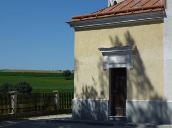
![Percorso A piedi Gemeinde Thomasberg - Maria Schnee - Prägart - Wiesfleck - Photo](https://media.geolcdn.com/t/350/260/355ec2ac-e5d1-4a7a-a36b-1505ebd370e8.jpeg&format=jpg&maxdim=2)
![A piedi A piedi](https://static1.geolcdn.com/sitytour/trail-icons/100.png)
Km
A piedi
![](/images/other/stat-length.png)
![](https://static1.geolcdn.com/siteimages/upload/files/1508320355ic_sort_den_pos_24dp.png)
![](https://static1.geolcdn.com/siteimages/upload/files/1508320355ic_sort_den_neg_24dp.png)
![](https://static1.geolcdn.com/siteimages/upload/files/16400158638029165_repeat_loop_refresh_sync_direction_icon.png)
• Trail created by Österreichischer Touristenklub, Sektion "Jogler" Wien. Symbol: blauer, waagrechter Balken
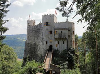
![Percorso A piedi Gemeinde Thomasberg - Petersbaumgarten - Buchberg - Kienegg - Photo](https://media.geolcdn.com/t/350/260/3ccbf498-9e89-4a3c-8516-a79689a7053b.jpeg&format=jpg&maxdim=2)
![A piedi A piedi](https://static1.geolcdn.com/sitytour/trail-icons/100.png)
Km
A piedi
![](/images/other/stat-length.png)
![](https://static1.geolcdn.com/siteimages/upload/files/1508320355ic_sort_den_pos_24dp.png)
![](https://static1.geolcdn.com/siteimages/upload/files/1508320355ic_sort_den_neg_24dp.png)
![](https://static1.geolcdn.com/siteimages/upload/files/16400158638029165_repeat_loop_refresh_sync_direction_icon.png)
• Trail created by Marktgemeinde Warth. Symbol: gelber Punkt
![Percorso A piedi Gemeinde Thomasberg - Edlitz - Kulma - Photo](https://media.geolcdn.com/t/350/260/ext.jpg?maxdim=2&url=https%3A%2F%2Fstatic1.geolcdn.com%2Fsiteimages%2Fupload%2Ffiles%2F1545311037marcheuse_200dpi.jpg)
![A piedi A piedi](https://static1.geolcdn.com/sitytour/trail-icons/100.png)
Km
A piedi
![](/images/other/stat-length.png)
![](https://static1.geolcdn.com/siteimages/upload/files/1508320355ic_sort_den_pos_24dp.png)
![](https://static1.geolcdn.com/siteimages/upload/files/1508320355ic_sort_den_neg_24dp.png)
![](https://static1.geolcdn.com/siteimages/upload/files/16400158638029165_repeat_loop_refresh_sync_direction_icon.png)
• Trail created by Tourismusverband Bucklige Welt. Symbol: text: I1
5 percorsi visualizzati su 5
Applicazione GPS da escursionismo GRATUITA