![](/images/other/stat-length.png)
- Percorsi
- Nautico
- France
- Provenza-Alpi-Costa Azzurra
- Alpes-de-Haute-Provence
- Montagnac-Montpezat
- Montpezat
Montpezat, Montagnac-Montpezat, Nautico : I migliori sentieri, percorsi e passeggiate
Montpezat: Scopri i migliori percorsi: 7 canoa - kayak. Tutti questi percorsi, itinerari e attività outdoor sono disponibili nelle nostre app SityTrail per smartphone e tablet.
I percorsi migliori (0})
![Percorso Canoa - kayak Montagnac-Montpezat - SityTrail - Gorges de Baudinard - Photo](https://media.geolcdn.com/t/350/260/ext.jpg?maxdim=2&url=https%3A%2F%2Fmedia.geolcdn.com%2Ff%2Fcc7d0795-42ce-43de-8ac7-0c53f0f7947f.JPG)
![Canoa - kayak Canoa - kayak](https://static1.geolcdn.com/sitytour/trail-icons/703.png)
Km
Canoa - kayak
![](/images/other/stat-length.png)
![](https://static1.geolcdn.com/siteimages/upload/files/1508320355ic_sort_den_pos_24dp.png)
![](https://static1.geolcdn.com/siteimages/upload/files/1508320355ic_sort_den_neg_24dp.png)
![](https://static1.geolcdn.com/siteimages/upload/files/16400158638029165_repeat_loop_refresh_sync_direction_icon.png)
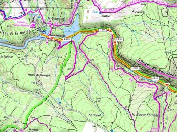
• De Montpezat au pont Sylvestre départ en canoë vers le barrage de St Croix et retour.
![Percorso Canoa - kayak Montagnac-Montpezat - canoé 1 belambra - Photo](https://media.geolcdn.com/t/350/260/ext.jpg?maxdim=2&url=https%3A%2F%2Fmedia.geolcdn.com%2Ff%2F4ce349f4-5e1a-46a4-b788-f3f0bd17c3a5.jpg)
![Canoa - kayak Canoa - kayak](https://static1.geolcdn.com/sitytour/trail-icons/703.png)
Km
Canoa - kayak
![](/images/other/stat-length.png)
![](https://static1.geolcdn.com/siteimages/upload/files/1508320355ic_sort_den_pos_24dp.png)
![](https://static1.geolcdn.com/siteimages/upload/files/1508320355ic_sort_den_neg_24dp.png)
![](https://static1.geolcdn.com/siteimages/upload/files/16400158638029165_repeat_loop_refresh_sync_direction_icon.png)
![Percorso Canoa - kayak Montagnac-Montpezat - Gorges de Baudinard - Photo](https://media.geolcdn.com/t/350/260/ext.jpg?maxdim=2&url=https%3A%2F%2Fsecurestorage.geolives.com%2Fsitytour%2Ftrail-bg%2Fdefault.jpg)
![Canoa - kayak Canoa - kayak](https://static1.geolcdn.com/sitytour/trail-icons/703.png)
Km
Canoa - kayak
![](/images/other/stat-length.png)
![](https://static1.geolcdn.com/siteimages/upload/files/1508320355ic_sort_den_pos_24dp.png)
![](https://static1.geolcdn.com/siteimages/upload/files/1508320355ic_sort_den_neg_24dp.png)
![](https://static1.geolcdn.com/siteimages/upload/files/16400158638029165_repeat_loop_refresh_sync_direction_icon.png)
![Percorso Canoa - kayak Montagnac-Montpezat - kayak - Photo](https://media.geolcdn.com/t/350/260/ext.jpg?maxdim=2&url=https%3A%2F%2Fsecurestorage.geolives.com%2Fsitytour%2Ftrail-bg%2Fdefault.jpg)
![Canoa - kayak Canoa - kayak](https://static1.geolcdn.com/sitytour/trail-icons/703.png)
Km
Canoa - kayak
![](/images/other/stat-length.png)
![](https://static1.geolcdn.com/siteimages/upload/files/1508320355ic_sort_den_pos_24dp.png)
![](https://static1.geolcdn.com/siteimages/upload/files/1508320355ic_sort_den_neg_24dp.png)
![](https://static1.geolcdn.com/siteimages/upload/files/16400158638029165_repeat_loop_refresh_sync_direction_icon.png)
![Percorso Canoa - kayak Montagnac-Montpezat - Lacs de Quinson et Artignosc - Photo](https://media.geolcdn.com/t/350/260/ext.jpg?maxdim=2&url=https%3A%2F%2Fsecurestorage.geolives.com%2Fsitytour%2Ftrail-bg%2Fdefault.jpg)
![Canoa - kayak Canoa - kayak](https://static1.geolcdn.com/sitytour/trail-icons/703.png)
Km
Canoa - kayak
![](/images/other/stat-length.png)
![](https://static1.geolcdn.com/siteimages/upload/files/1508320355ic_sort_den_pos_24dp.png)
![](https://static1.geolcdn.com/siteimages/upload/files/1508320355ic_sort_den_neg_24dp.png)
![](https://static1.geolcdn.com/siteimages/upload/files/16400158638029165_repeat_loop_refresh_sync_direction_icon.png)
![Percorso Canoa - kayak Montagnac-Montpezat - gorges de baudinard kayak - Photo](https://media.geolcdn.com/t/350/260/ext.jpg?maxdim=2&url=https%3A%2F%2Fsecurestorage.geolives.com%2Fsitytour%2Ftrail-bg%2Fdefault.jpg)
![Canoa - kayak Canoa - kayak](https://static1.geolcdn.com/sitytour/trail-icons/703.png)
Km
Canoa - kayak
![](/images/other/stat-length.png)
![](https://static1.geolcdn.com/siteimages/upload/files/1508320355ic_sort_den_pos_24dp.png)
![](https://static1.geolcdn.com/siteimages/upload/files/1508320355ic_sort_den_neg_24dp.png)
![](https://static1.geolcdn.com/siteimages/upload/files/16400158638029165_repeat_loop_refresh_sync_direction_icon.png)
![Percorso Canoa - kayak Montagnac-Montpezat - dans les gorges de Baudinard - Photo](https://media.geolcdn.com/t/350/260/ext.jpg?maxdim=2&url=https%3A%2F%2Fsecurestorage.geolives.com%2Fsitytour%2Ftrail-bg%2Fdefault.jpg)
![Canoa - kayak Canoa - kayak](https://static1.geolcdn.com/sitytour/trail-icons/703.png)
Km
Canoa - kayak
![](/images/other/stat-length.png)
![](https://static1.geolcdn.com/siteimages/upload/files/1508320355ic_sort_den_pos_24dp.png)
![](https://static1.geolcdn.com/siteimages/upload/files/1508320355ic_sort_den_neg_24dp.png)
![](https://static1.geolcdn.com/siteimages/upload/files/16400158638029165_repeat_loop_refresh_sync_direction_icon.png)
7 percorsi visualizzati su 7
Applicazione GPS da escursionismo GRATUITA