![](/images/other/stat-length.png)
Slovakia, A piedi : I migliori sentieri, percorsi e passeggiate
Slovakia: Scopri i 223 migliori percorsi escursionistici a piedi e in bicicletta. Il catalogo curato dai nostri escursionisti è pieno di bei paesaggi che aspettano solo di essere esplorati. Scarica questi percorsi in SityTrail, la nostra applicazione di GPS da escursionismo gratuita disponibile per Android e iOS.
I percorsi migliori (0})
![Percorso A piedi okres Čadca - NS Javorníky - Photo](https://media.geolcdn.com/t/350/260/e32c7fac-bf64-4198-87d3-f7164f2f2c3b.jpeg&format=jpg&maxdim=2)
![A piedi A piedi](https://static1.geolcdn.com/sitytour/trail-icons/100.png)
Km
A piedi
![](/images/other/stat-length.png)
![](https://static1.geolcdn.com/siteimages/upload/files/1508320355ic_sort_den_pos_24dp.png)
![](https://static1.geolcdn.com/siteimages/upload/files/1508320355ic_sort_den_neg_24dp.png)
![](https://static1.geolcdn.com/siteimages/upload/files/16400158638029165_repeat_loop_refresh_sync_direction_icon.png)
• Percorso creato da cz:KČT.
![Percorso A piedi okres Piešťany - Lazová 100 - Photo](https://media.geolcdn.com/t/350/260/a2d9c759-82f4-47ef-9741-614567f2f638.jpeg&format=jpg&maxdim=2)
![A piedi A piedi](https://static1.geolcdn.com/sitytour/trail-icons/100.png)
Km
A piedi
![](/images/other/stat-length.png)
![](https://static1.geolcdn.com/siteimages/upload/files/1508320355ic_sort_den_pos_24dp.png)
![](https://static1.geolcdn.com/siteimages/upload/files/1508320355ic_sort_den_neg_24dp.png)
![](https://static1.geolcdn.com/siteimages/upload/files/16400158638029165_repeat_loop_refresh_sync_direction_icon.png)
• Sito web: http://www.lazovka.wbl.sk/
![Percorso A piedi okres Nové Mesto nad Váhom - Náučný chodník Brestovec - Stará Myjava - Topolecká - Photo](https://media.geolcdn.com/t/350/260/0f1a443f-2206-4c7f-8559-a63027eb9211.jpeg&format=jpg&maxdim=2)
![A piedi A piedi](https://static1.geolcdn.com/sitytour/trail-icons/100.png)
Km
A piedi
![](/images/other/stat-length.png)
![](https://static1.geolcdn.com/siteimages/upload/files/1508320355ic_sort_den_pos_24dp.png)
![](https://static1.geolcdn.com/siteimages/upload/files/1508320355ic_sort_den_neg_24dp.png)
![](https://static1.geolcdn.com/siteimages/upload/files/16400158638029165_repeat_loop_refresh_sync_direction_icon.png)
• Simbolo: education
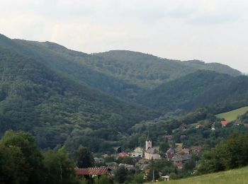
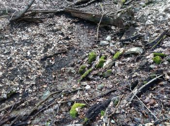
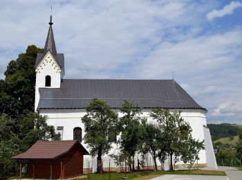
![Percorso A piedi okres Čadca - [Ž] Smutníky - Morávka - Photo](https://media.geolcdn.com/t/350/260/711b18ef-66da-41e6-978a-f7bd02caa4fc.jpeg&format=jpg&maxdim=2)
![A piedi A piedi](https://static1.geolcdn.com/sitytour/trail-icons/100.png)
Km
A piedi
![](/images/other/stat-length.png)
![](https://static1.geolcdn.com/siteimages/upload/files/1508320355ic_sort_den_pos_24dp.png)
![](https://static1.geolcdn.com/siteimages/upload/files/1508320355ic_sort_den_neg_24dp.png)
![](https://static1.geolcdn.com/siteimages/upload/files/16400158638029165_repeat_loop_refresh_sync_direction_icon.png)
• Percorso creato da cz:KČT.
![Percorso A piedi okres Piešťany - Náučný chodník ŠTERUSY - REBRO - SPROSNÁ - ORLIE SKALY - Photo](https://media.geolcdn.com/t/350/260/c6e569f5-4a6e-4993-b4f5-2618b64ab74a.jpeg&format=jpg&maxdim=2)
![A piedi A piedi](https://static1.geolcdn.com/sitytour/trail-icons/100.png)
Km
A piedi
![](/images/other/stat-length.png)
![](https://static1.geolcdn.com/siteimages/upload/files/1508320355ic_sort_den_pos_24dp.png)
![](https://static1.geolcdn.com/siteimages/upload/files/1508320355ic_sort_den_neg_24dp.png)
![](https://static1.geolcdn.com/siteimages/upload/files/16400158638029165_repeat_loop_refresh_sync_direction_icon.png)
• Percorso creato da EPH. Simbolo: education
![Percorso A piedi okres Prešov - Lemešanská špacírka - Photo](https://media.geolcdn.com/t/350/260/6e46b55b-597e-4092-912f-e639f73f3504.jpeg&format=jpg&maxdim=2)
![A piedi A piedi](https://static1.geolcdn.com/sitytour/trail-icons/100.png)
Km
A piedi
![](/images/other/stat-length.png)
![](https://static1.geolcdn.com/siteimages/upload/files/1508320355ic_sort_den_pos_24dp.png)
![](https://static1.geolcdn.com/siteimages/upload/files/1508320355ic_sort_den_neg_24dp.png)
![](https://static1.geolcdn.com/siteimages/upload/files/16400158638029165_repeat_loop_refresh_sync_direction_icon.png)
• Percorso creato da Záhrada pohybu. symbol for all 4 routes is actually green backslash but routes have separate colo...
![Percorso A piedi okres Prešov - Lemešanská špacírka - Photo](https://media.geolcdn.com/t/350/260/d902bd68-daa0-46ab-8bf9-0b34eb0fda3e.jpeg&format=jpg&maxdim=2)
![A piedi A piedi](https://static1.geolcdn.com/sitytour/trail-icons/100.png)
Km
A piedi
![](/images/other/stat-length.png)
![](https://static1.geolcdn.com/siteimages/upload/files/1508320355ic_sort_den_pos_24dp.png)
![](https://static1.geolcdn.com/siteimages/upload/files/1508320355ic_sort_den_neg_24dp.png)
![](https://static1.geolcdn.com/siteimages/upload/files/16400158638029165_repeat_loop_refresh_sync_direction_icon.png)
• Percorso creato da Záhrada pohybu. symbol for all 4 routes is actually green backslash but routes have separate colo...
![Percorso A piedi okres Prešov - Lemešanská špacírka - Photo](https://media.geolcdn.com/t/350/260/9505ea50-e5c8-4de3-b7c2-c32fdccb83f9.jpeg&format=jpg&maxdim=2)
![A piedi A piedi](https://static1.geolcdn.com/sitytour/trail-icons/100.png)
Km
A piedi
![](/images/other/stat-length.png)
![](https://static1.geolcdn.com/siteimages/upload/files/1508320355ic_sort_den_pos_24dp.png)
![](https://static1.geolcdn.com/siteimages/upload/files/1508320355ic_sort_den_neg_24dp.png)
![](https://static1.geolcdn.com/siteimages/upload/files/16400158638029165_repeat_loop_refresh_sync_direction_icon.png)
• Percorso creato da Záhrada pohybu. symbol for all 4 routes is actually green backslash but routes have separate colo...
![Percorso A piedi okres Prešov - Lemešanská špacírka - Photo](https://media.geolcdn.com/t/350/260/bd4c5be0-bc9a-41d4-ad85-8bce42b62091.jpeg&format=jpg&maxdim=2)
![A piedi A piedi](https://static1.geolcdn.com/sitytour/trail-icons/100.png)
Km
A piedi
![](/images/other/stat-length.png)
![](https://static1.geolcdn.com/siteimages/upload/files/1508320355ic_sort_den_pos_24dp.png)
![](https://static1.geolcdn.com/siteimages/upload/files/1508320355ic_sort_den_neg_24dp.png)
![](https://static1.geolcdn.com/siteimages/upload/files/16400158638029165_repeat_loop_refresh_sync_direction_icon.png)
• Percorso creato da Záhrada pohybu. symbol for all 4 routes is actually green backslash but routes have separate colo...
![Percorso A piedi okres Žilina - Náučný chodník Strečnianskym chotárom - Photo](https://media.geolcdn.com/t/350/260/75c8fa19-9857-41bf-b48a-21469725d75e.jpeg&format=jpg&maxdim=2)
![A piedi A piedi](https://static1.geolcdn.com/sitytour/trail-icons/100.png)
Km
A piedi
![](/images/other/stat-length.png)
![](https://static1.geolcdn.com/siteimages/upload/files/1508320355ic_sort_den_pos_24dp.png)
![](https://static1.geolcdn.com/siteimages/upload/files/1508320355ic_sort_den_neg_24dp.png)
![](https://static1.geolcdn.com/siteimages/upload/files/16400158638029165_repeat_loop_refresh_sync_direction_icon.png)
• Simbolo: education
![Percorso A piedi okres Detva - Náučný chodník Mikuláša Esterházyho / za cestou skla - Photo](https://media.geolcdn.com/t/350/260/66289b18-1cef-41ca-9ed0-5e40f9314df3.jpeg&format=jpg&maxdim=2)
![A piedi A piedi](https://static1.geolcdn.com/sitytour/trail-icons/100.png)
Km
A piedi
![](/images/other/stat-length.png)
![](https://static1.geolcdn.com/siteimages/upload/files/1508320355ic_sort_den_pos_24dp.png)
![](https://static1.geolcdn.com/siteimages/upload/files/1508320355ic_sort_den_neg_24dp.png)
![](https://static1.geolcdn.com/siteimages/upload/files/16400158638029165_repeat_loop_refresh_sync_direction_icon.png)
• Percorso creato da obec Detvianska huta.
![Percorso A piedi okres Poprad - Náučný chodník Fľak - Photo](https://media.geolcdn.com/t/350/260/15416d24-31e2-4c50-85d2-d3d99d495d6e.jpeg&format=jpg&maxdim=2)
![A piedi A piedi](https://static1.geolcdn.com/sitytour/trail-icons/100.png)
Km
A piedi
![](/images/other/stat-length.png)
![](https://static1.geolcdn.com/siteimages/upload/files/1508320355ic_sort_den_pos_24dp.png)
![](https://static1.geolcdn.com/siteimages/upload/files/1508320355ic_sort_den_neg_24dp.png)
![](https://static1.geolcdn.com/siteimages/upload/files/16400158638029165_repeat_loop_refresh_sync_direction_icon.png)
• Percorso creato da Lesy mesta Spišská Belá, s.r.o.. Sito web: https://spisskabela.sk/navstevnik/vylety-do-okolia/n...
![Percorso A piedi okres Snina - Zvonica na bojisku I. sv. vojny pod vrchom Skory - Photo](https://media.geolcdn.com/t/350/260/743a5d9b-a199-49f1-bb97-ac237b4703b1.jpeg&format=jpg&maxdim=2)
![A piedi A piedi](https://static1.geolcdn.com/sitytour/trail-icons/100.png)
Km
A piedi
![](/images/other/stat-length.png)
![](https://static1.geolcdn.com/siteimages/upload/files/1508320355ic_sort_den_pos_24dp.png)
![](https://static1.geolcdn.com/siteimages/upload/files/1508320355ic_sort_den_neg_24dp.png)
![](https://static1.geolcdn.com/siteimages/upload/files/16400158638029165_repeat_loop_refresh_sync_direction_icon.png)
• Percorso creato da Klub vojenskej histórie Beskydy a obec Hostovice. Simbolo: education
![Percorso A piedi okres Veľký Krtíš - Turisticko-náučný chordník Meričkovka - Photo](https://media.geolcdn.com/t/350/260/161fe00a-c709-4499-a954-6268440539cf.jpeg&format=jpg&maxdim=2)
![A piedi A piedi](https://static1.geolcdn.com/sitytour/trail-icons/100.png)
Km
A piedi
![](/images/other/stat-length.png)
![](https://static1.geolcdn.com/siteimages/upload/files/1508320355ic_sort_den_pos_24dp.png)
![](https://static1.geolcdn.com/siteimages/upload/files/1508320355ic_sort_den_neg_24dp.png)
![](https://static1.geolcdn.com/siteimages/upload/files/16400158638029165_repeat_loop_refresh_sync_direction_icon.png)
• Simbolo: education
![Percorso A piedi okres Trenčín - Jastrabská](https://media.geolcdn.com/t/350/260/f5d2ba1c-1e38-4c67-a22d-c29bd6bc1e9a.jpeg&format=jpg&maxdim=2)
![A piedi A piedi](https://static1.geolcdn.com/sitytour/trail-icons/100.png)
Km
A piedi
![](/images/other/stat-length.png)
![](https://static1.geolcdn.com/siteimages/upload/files/1508320355ic_sort_den_pos_24dp.png)
![](https://static1.geolcdn.com/siteimages/upload/files/1508320355ic_sort_den_neg_24dp.png)
![](https://static1.geolcdn.com/siteimages/upload/files/16400158638029165_repeat_loop_refresh_sync_direction_icon.png)
• Percorso creato da Obec Trenčianske Jastrabie. Simbolo: white:black
![Percorso A piedi okres Banská Bystrica - SK-5694M - Photo](https://media.geolcdn.com/t/350/260/bdc30763-9c83-4bf4-baad-fbf256ae9c12.jpeg&format=jpg&maxdim=2)
![A piedi A piedi](https://static1.geolcdn.com/sitytour/trail-icons/100.png)
Km
A piedi
![](/images/other/stat-length.png)
![](https://static1.geolcdn.com/siteimages/upload/files/1508320355ic_sort_den_pos_24dp.png)
![](https://static1.geolcdn.com/siteimages/upload/files/1508320355ic_sort_den_neg_24dp.png)
![](https://static1.geolcdn.com/siteimages/upload/files/16400158638029165_repeat_loop_refresh_sync_direction_icon.png)
• Percorso creato da KST. Simbolo: local
![Percorso A piedi okres Trenčín - IVV6 - VLADOV CHODNÍK (maratónska trasa) - Photo](https://media.geolcdn.com/t/350/260/6431251b-aa09-4a8f-af79-8add328de865.jpeg&format=jpg&maxdim=2)
![A piedi A piedi](https://static1.geolcdn.com/sitytour/trail-icons/100.png)
Km
A piedi
![](/images/other/stat-length.png)
![](https://static1.geolcdn.com/siteimages/upload/files/1508320355ic_sort_den_pos_24dp.png)
![](https://static1.geolcdn.com/siteimages/upload/files/1508320355ic_sort_den_neg_24dp.png)
![](https://static1.geolcdn.com/siteimages/upload/files/16400158638029165_repeat_loop_refresh_sync_direction_icon.png)
• Percorso creato da KST. Simbolo: none
![Percorso A piedi okres Trenčín - Náučný chodník Putovanie za živou vodou - Photo](https://media.geolcdn.com/t/350/260/ac746b1f-6dc8-4b61-94b6-b4ce8051929e.jpeg&format=jpg&maxdim=2)
![A piedi A piedi](https://static1.geolcdn.com/sitytour/trail-icons/100.png)
Km
A piedi
![](/images/other/stat-length.png)
![](https://static1.geolcdn.com/siteimages/upload/files/1508320355ic_sort_den_pos_24dp.png)
![](https://static1.geolcdn.com/siteimages/upload/files/1508320355ic_sort_den_neg_24dp.png)
![](https://static1.geolcdn.com/siteimages/upload/files/16400158638029165_repeat_loop_refresh_sync_direction_icon.png)
• Simbolo: none
![Percorso A piedi okres Považská Bystrica - SK-Local marking made by village Slopna. There are guidepost with defined color for paths, but without physical marking. There are no guideposts outside the Slopna territory even if the path is ending elsewhere. - Photo](https://media.geolcdn.com/t/350/260/c7c1c3c4-4fca-4c0a-906b-a25ff26e4233.jpeg&format=jpg&maxdim=2)
![A piedi A piedi](https://static1.geolcdn.com/sitytour/trail-icons/100.png)
Km
A piedi
![](/images/other/stat-length.png)
![](https://static1.geolcdn.com/siteimages/upload/files/1508320355ic_sort_den_pos_24dp.png)
![](https://static1.geolcdn.com/siteimages/upload/files/1508320355ic_sort_den_neg_24dp.png)
![](https://static1.geolcdn.com/siteimages/upload/files/16400158638029165_repeat_loop_refresh_sync_direction_icon.png)
• Percorso creato da Obec Slopná. Local marking made by village Slopna. There are guidepost with defined color for pat...
![Percorso A piedi okres Trenčín - IVV5 - JANOV CHODNÍK (dlhá rodinná trasa) - Photo](https://media.geolcdn.com/t/350/260/4b9f1942-e6b0-405b-a1d0-c332aba9276a.jpeg&format=jpg&maxdim=2)
![A piedi A piedi](https://static1.geolcdn.com/sitytour/trail-icons/100.png)
Km
A piedi
![](/images/other/stat-length.png)
![](https://static1.geolcdn.com/siteimages/upload/files/1508320355ic_sort_den_pos_24dp.png)
![](https://static1.geolcdn.com/siteimages/upload/files/1508320355ic_sort_den_neg_24dp.png)
![](https://static1.geolcdn.com/siteimages/upload/files/16400158638029165_repeat_loop_refresh_sync_direction_icon.png)
• Percorso creato da KST. Simbolo: none
20 percorsi visualizzati su 223
Applicazione GPS da escursionismo GRATUITA