![](/images/other/stat-length.png)
- Percorsi
- A piedi
- Netherlands
- Utrecht
- Sconosciuto
Sconosciuto, Utrecht, A piedi : I migliori sentieri, percorsi e passeggiate
Sconosciuto: Scopri i migliori percorsi: 81 a piedi, 96 marcia e 21 corsa a piedi. Tutti questi percorsi, itinerari e attività outdoor sono disponibili nelle nostre app SityTrail per smartphone e tablet.
I percorsi migliori (0})
![Percorso A piedi Soest - Wandelroute De Paltz - Photo](https://media.geolcdn.com/t/350/260/c32c3301-b885-465e-beab-2c2cd91aa901.jpeg&format=jpg&maxdim=2)
![A piedi A piedi](https://static1.geolcdn.com/sitytour/trail-icons/100.png)
Km
A piedi
![](/images/other/stat-length.png)
![](https://static1.geolcdn.com/siteimages/upload/files/1508320355ic_sort_den_pos_24dp.png)
![](https://static1.geolcdn.com/siteimages/upload/files/1508320355ic_sort_den_neg_24dp.png)
![](https://static1.geolcdn.com/siteimages/upload/files/16400158638029165_repeat_loop_refresh_sync_direction_icon.png)
• Trail created by Utrechts Landschap. Sito web: https://www.utrechtslandschap.nl/routes/wandelen/de-paltz
![Percorso A piedi Rhenen - NS-wandeling Blauwe Kamer - Photo](https://media.geolcdn.com/t/350/260/a8a6d689-8221-4caf-9a16-60dbeb60affd.jpeg&format=jpg&maxdim=2)
![A piedi A piedi](https://static1.geolcdn.com/sitytour/trail-icons/100.png)
Km
A piedi
![](/images/other/stat-length.png)
![](https://static1.geolcdn.com/siteimages/upload/files/1508320355ic_sort_den_pos_24dp.png)
![](https://static1.geolcdn.com/siteimages/upload/files/1508320355ic_sort_den_neg_24dp.png)
![](https://static1.geolcdn.com/siteimages/upload/files/16400158638029165_repeat_loop_refresh_sync_direction_icon.png)
• Een aaneenschakeling van hoogtepunten: de weidse uiterwaarden van de Nederrijn, natuurgebied de Blauwe Kamer en de Gr...
![Percorso A piedi De Ronde Venen - NS-wandeling Gein en Vecht - Photo](https://media.geolcdn.com/t/350/260/5a4e7146-8327-40a6-a153-30870fe1d0a7.jpeg&format=jpg&maxdim=2)
![A piedi A piedi](https://static1.geolcdn.com/sitytour/trail-icons/100.png)
Km
A piedi
![](/images/other/stat-length.png)
![](https://static1.geolcdn.com/siteimages/upload/files/1508320355ic_sort_den_pos_24dp.png)
![](https://static1.geolcdn.com/siteimages/upload/files/1508320355ic_sort_den_neg_24dp.png)
![](https://static1.geolcdn.com/siteimages/upload/files/16400158638029165_repeat_loop_refresh_sync_direction_icon.png)
• Een mooie wandelroute waarbij twee idyllische rivieren in één route gecombineerd worden. Sito web: https://www.ns.nl...
![Percorso A piedi De Ronde Venen - Bellopad - Photo](https://media.geolcdn.com/t/350/260/8675d646-5995-47a4-b8be-147487a8b3a0.jpeg&format=jpg&maxdim=2)
![A piedi A piedi](https://static1.geolcdn.com/sitytour/trail-icons/100.png)
Km
A piedi
![](/images/other/stat-length.png)
![](https://static1.geolcdn.com/siteimages/upload/files/1508320355ic_sort_den_pos_24dp.png)
![](https://static1.geolcdn.com/siteimages/upload/files/1508320355ic_sort_den_neg_24dp.png)
![](https://static1.geolcdn.com/siteimages/upload/files/16400158638029165_repeat_loop_refresh_sync_direction_icon.png)
• Sito web: http://bellopad.nl/
![Percorso A piedi Leusden - Rondwandeling Stoutenburgerpad - Photo](https://media.geolcdn.com/t/350/260/39355b4a-1f66-4503-95d8-7d815a611fa0.jpeg&format=jpg&maxdim=2)
![A piedi A piedi](https://static1.geolcdn.com/sitytour/trail-icons/100.png)
Km
A piedi
![](/images/other/stat-length.png)
![](https://static1.geolcdn.com/siteimages/upload/files/1508320355ic_sort_den_pos_24dp.png)
![](https://static1.geolcdn.com/siteimages/upload/files/1508320355ic_sort_den_neg_24dp.png)
![](https://static1.geolcdn.com/siteimages/upload/files/16400158638029165_repeat_loop_refresh_sync_direction_icon.png)
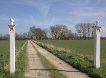
• Wandelen over boerenland, een historisch landgoed en langs beken in het buitengebied van Amersfoort en Leusden. Sito...
![Percorso A piedi Soest - Wandelroute Munitiepark - Photo](https://media.geolcdn.com/t/350/260/6d8a7fcd-bd6a-4648-9fd5-54d220069a5f.jpeg&format=jpg&maxdim=2)
![A piedi A piedi](https://static1.geolcdn.com/sitytour/trail-icons/100.png)
Km
A piedi
![](/images/other/stat-length.png)
![](https://static1.geolcdn.com/siteimages/upload/files/1508320355ic_sort_den_pos_24dp.png)
![](https://static1.geolcdn.com/siteimages/upload/files/1508320355ic_sort_den_neg_24dp.png)
![](https://static1.geolcdn.com/siteimages/upload/files/16400158638029165_repeat_loop_refresh_sync_direction_icon.png)
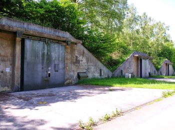
• Trail created by Utrechts Landschap. Sito web: https://www.utrechtslandschap.nl/routes/wandelen/munitiepark-soeste...
![Percorso A piedi Zeist - Kozakkenput - Photo](https://media.geolcdn.com/t/350/260/dev_cdd52c89-5435-4aa0-9205-dd2430298eb1.jpeg&format=jpg&maxdim=2)
![A piedi A piedi](https://static1.geolcdn.com/sitytour/trail-icons/100.png)
Km
A piedi
![](/images/other/stat-length.png)
![](https://static1.geolcdn.com/siteimages/upload/files/1508320355ic_sort_den_pos_24dp.png)
![](https://static1.geolcdn.com/siteimages/upload/files/1508320355ic_sort_den_neg_24dp.png)
![](https://static1.geolcdn.com/siteimages/upload/files/16400158638029165_repeat_loop_refresh_sync_direction_icon.png)
• Trail created by Utrechts landschap. Symbol: blue Sito web: https://www.utrechtslandschap.nl/routes/wandelen/kozak...
![Percorso A piedi Leusden - Wandelroute Akkersesteeg - Photo](https://media.geolcdn.com/t/350/260/19c29cf6-c5b8-46b0-925a-36c183119685.jpeg&format=jpg&maxdim=2)
![A piedi A piedi](https://static1.geolcdn.com/sitytour/trail-icons/100.png)
Km
A piedi
![](/images/other/stat-length.png)
![](https://static1.geolcdn.com/siteimages/upload/files/1508320355ic_sort_den_pos_24dp.png)
![](https://static1.geolcdn.com/siteimages/upload/files/1508320355ic_sort_den_neg_24dp.png)
![](https://static1.geolcdn.com/siteimages/upload/files/16400158638029165_repeat_loop_refresh_sync_direction_icon.png)
• Trail created by Den Treek Henschoten.
![Percorso A piedi Leusden - Wandelroute Ringheuvels - Photo](https://media.geolcdn.com/t/350/260/77fc2be0-d63a-4895-a789-d0db89dd16fa.jpeg&format=jpg&maxdim=2)
![A piedi A piedi](https://static1.geolcdn.com/sitytour/trail-icons/100.png)
Km
A piedi
![](/images/other/stat-length.png)
![](https://static1.geolcdn.com/siteimages/upload/files/1508320355ic_sort_den_pos_24dp.png)
![](https://static1.geolcdn.com/siteimages/upload/files/1508320355ic_sort_den_neg_24dp.png)
![](https://static1.geolcdn.com/siteimages/upload/files/16400158638029165_repeat_loop_refresh_sync_direction_icon.png)
• Trail created by Den Treek Henschoten.
![Percorso A piedi Utrechtse Heuvelrug - Aderwinkelpad - Photo](https://media.geolcdn.com/t/350/260/c9e88ba2-a48c-4f30-b56f-4399ee7bf6fd.jpeg&format=jpg&maxdim=2)
![A piedi A piedi](https://static1.geolcdn.com/sitytour/trail-icons/100.png)
Km
A piedi
![](/images/other/stat-length.png)
![](https://static1.geolcdn.com/siteimages/upload/files/1508320355ic_sort_den_pos_24dp.png)
![](https://static1.geolcdn.com/siteimages/upload/files/1508320355ic_sort_den_neg_24dp.png)
![](https://static1.geolcdn.com/siteimages/upload/files/16400158638029165_repeat_loop_refresh_sync_direction_icon.png)
• Trail created by www.klompenpaden.nl.
![Percorso A piedi Woudenberg - Oudenhorsterpad - Photo](https://media.geolcdn.com/t/350/260/ffd1c3d0-6d62-49b6-8159-516ed81b73a9.jpeg&format=jpg&maxdim=2)
![A piedi A piedi](https://static1.geolcdn.com/sitytour/trail-icons/100.png)
Km
A piedi
![](/images/other/stat-length.png)
![](https://static1.geolcdn.com/siteimages/upload/files/1508320355ic_sort_den_pos_24dp.png)
![](https://static1.geolcdn.com/siteimages/upload/files/1508320355ic_sort_den_neg_24dp.png)
![](https://static1.geolcdn.com/siteimages/upload/files/16400158638029165_repeat_loop_refresh_sync_direction_icon.png)
• Trail created by www.klompenpaden.nl. Symbol: Gele klompjes / Yellow wooden shoes
![Percorso A piedi Woudenberg - Dashorsterpad (Klompenpad blauw) - Photo](https://media.geolcdn.com/t/350/260/9284dbc8-7e9f-4233-a72d-34eefa3c12f2.jpeg&format=jpg&maxdim=2)
![A piedi A piedi](https://static1.geolcdn.com/sitytour/trail-icons/100.png)
Km
A piedi
![](/images/other/stat-length.png)
![](https://static1.geolcdn.com/siteimages/upload/files/1508320355ic_sort_den_pos_24dp.png)
![](https://static1.geolcdn.com/siteimages/upload/files/1508320355ic_sort_den_neg_24dp.png)
![](https://static1.geolcdn.com/siteimages/upload/files/16400158638029165_repeat_loop_refresh_sync_direction_icon.png)
• Trail created by www.klompenpaden.nl. Symbol: Blauwe klompjes / Blue wooden shoes
![Percorso A piedi Renswoude - Daatselaarsepad - Photo](https://media.geolcdn.com/t/350/260/dev_cc291910-e008-4a28-82f4-59f67034a36b.jpeg&format=jpg&maxdim=2)
![A piedi A piedi](https://static1.geolcdn.com/sitytour/trail-icons/100.png)
Km
A piedi
![](/images/other/stat-length.png)
![](https://static1.geolcdn.com/siteimages/upload/files/1508320355ic_sort_den_pos_24dp.png)
![](https://static1.geolcdn.com/siteimages/upload/files/1508320355ic_sort_den_neg_24dp.png)
![](https://static1.geolcdn.com/siteimages/upload/files/16400158638029165_repeat_loop_refresh_sync_direction_icon.png)
• Trail created by www.klompenpaden.nl. Symbol: Blauwe klompjes / Blue wooden shoes
![Percorso A piedi Utrechtse Heuvelrug - Cotlandenpad - Photo](https://media.geolcdn.com/t/350/260/d00d5589-b4b6-4b58-97b4-ecf684df0e2f.jpeg&format=jpg&maxdim=2)
![A piedi A piedi](https://static1.geolcdn.com/sitytour/trail-icons/100.png)
Km
A piedi
![](/images/other/stat-length.png)
![](https://static1.geolcdn.com/siteimages/upload/files/1508320355ic_sort_den_pos_24dp.png)
![](https://static1.geolcdn.com/siteimages/upload/files/1508320355ic_sort_den_neg_24dp.png)
![](https://static1.geolcdn.com/siteimages/upload/files/16400158638029165_repeat_loop_refresh_sync_direction_icon.png)
• Trail created by www.klompenpaden.nl.
![Percorso A piedi Rhenen - Grift en Graftenpad - Photo](https://media.geolcdn.com/t/350/260/8ba69674-cdf9-4575-9a24-0b4bad74ecb7.jpeg&format=jpg&maxdim=2)
![A piedi A piedi](https://static1.geolcdn.com/sitytour/trail-icons/100.png)
Km
A piedi
![](/images/other/stat-length.png)
![](https://static1.geolcdn.com/siteimages/upload/files/1508320355ic_sort_den_pos_24dp.png)
![](https://static1.geolcdn.com/siteimages/upload/files/1508320355ic_sort_den_neg_24dp.png)
![](https://static1.geolcdn.com/siteimages/upload/files/16400158638029165_repeat_loop_refresh_sync_direction_icon.png)
• Trail created by www.klompenpaden.nl. Symbol: Wooden shoes / Klompjes
![Percorso A piedi Leusden - Rondwandeling De Troet - Photo](https://media.geolcdn.com/t/350/260/aa357892-9030-45cc-996b-fc44d363a8ff.jpeg&format=jpg&maxdim=2)
![A piedi A piedi](https://static1.geolcdn.com/sitytour/trail-icons/100.png)
Km
A piedi
![](/images/other/stat-length.png)
![](https://static1.geolcdn.com/siteimages/upload/files/1508320355ic_sort_den_pos_24dp.png)
![](https://static1.geolcdn.com/siteimages/upload/files/1508320355ic_sort_den_neg_24dp.png)
![](https://static1.geolcdn.com/siteimages/upload/files/16400158638029165_repeat_loop_refresh_sync_direction_icon.png)
• Trail created by Den Treek Henschoten.
![Percorso A piedi De Ronde Venen - Groene Wissel: Abcoude - Photo](https://media.geolcdn.com/t/350/260/fecfb0c7-9632-4893-9bdf-281879cebffa.jpeg&format=jpg&maxdim=2)
![A piedi A piedi](https://static1.geolcdn.com/sitytour/trail-icons/100.png)
Km
A piedi
![](/images/other/stat-length.png)
![](https://static1.geolcdn.com/siteimages/upload/files/1508320355ic_sort_den_pos_24dp.png)
![](https://static1.geolcdn.com/siteimages/upload/files/1508320355ic_sort_den_neg_24dp.png)
![](https://static1.geolcdn.com/siteimages/upload/files/16400158638029165_repeat_loop_refresh_sync_direction_icon.png)
• Sito web: https://www.wandelzoekpagina.nl/groene_wissels/lijst.php
![Percorso A piedi Houten - Rietplas & Schonauwen - Photo](https://media.geolcdn.com/t/350/260/fb6d407e-dcd2-436a-957b-c7fa0e7874fe.jpeg&format=jpg&maxdim=2)
![A piedi A piedi](https://static1.geolcdn.com/sitytour/trail-icons/100.png)
Km
A piedi
![](/images/other/stat-length.png)
![](https://static1.geolcdn.com/siteimages/upload/files/1508320355ic_sort_den_pos_24dp.png)
![](https://static1.geolcdn.com/siteimages/upload/files/1508320355ic_sort_den_neg_24dp.png)
![](https://static1.geolcdn.com/siteimages/upload/files/16400158638029165_repeat_loop_refresh_sync_direction_icon.png)
• Trail created by Gemeente Houten.
![Percorso A piedi Utrechtse Heuvelrug - Kaapse bossen Rood - Photo](https://media.geolcdn.com/t/350/260/6d083619-a766-480f-9199-99aaa66a535a.jpeg&format=jpg&maxdim=2)
![A piedi A piedi](https://static1.geolcdn.com/sitytour/trail-icons/100.png)
Km
A piedi
![](/images/other/stat-length.png)
![](https://static1.geolcdn.com/siteimages/upload/files/1508320355ic_sort_den_pos_24dp.png)
![](https://static1.geolcdn.com/siteimages/upload/files/1508320355ic_sort_den_neg_24dp.png)
![](https://static1.geolcdn.com/siteimages/upload/files/16400158638029165_repeat_loop_refresh_sync_direction_icon.png)
• Symbol: red bar
![Percorso A piedi Stichtse Vecht - Vredelantsepad - Photo](https://media.geolcdn.com/t/350/260/5d38b9a4-de44-4490-acb3-113a7c7bce3f.jpeg&format=jpg&maxdim=2)
![A piedi A piedi](https://static1.geolcdn.com/sitytour/trail-icons/100.png)
Km
A piedi
![](/images/other/stat-length.png)
![](https://static1.geolcdn.com/siteimages/upload/files/1508320355ic_sort_den_pos_24dp.png)
![](https://static1.geolcdn.com/siteimages/upload/files/1508320355ic_sort_den_neg_24dp.png)
![](https://static1.geolcdn.com/siteimages/upload/files/16400158638029165_repeat_loop_refresh_sync_direction_icon.png)
• Op klompenpaden.nl vindt u de mooiste wandelroutes over boerenland in de provincies Utrecht en Gelderland. Ieder Klom...
20 percorsi visualizzati su 198
Applicazione GPS da escursionismo GRATUITA