![](/images/other/stat-length.png)
Carro, La Spezia, A piedi : I migliori sentieri, percorsi e passeggiate
Carro: Scopri i migliori percorsi: 9 a piedi. Tutti questi percorsi, itinerari e attività outdoor sono disponibili nelle nostre app SityTrail per smartphone e tablet.
I percorsi migliori (0})
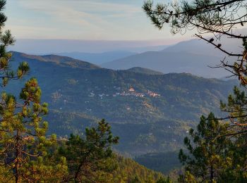
![Percorso A piedi Carro - Carro – Travo - Ziona – Case Luxiata – Colle Gruzze (Quattro Strade) - Photo](https://media.geolcdn.com/t/350/260/58618f47-6112-4047-83dc-28abba47be69.jpeg&format=jpg&maxdim=2)
![A piedi A piedi](https://static1.geolcdn.com/sitytour/trail-icons/100.png)
Km
A piedi
![](/images/other/stat-length.png)
![](https://static1.geolcdn.com/siteimages/upload/files/1508320355ic_sort_den_pos_24dp.png)
![](https://static1.geolcdn.com/siteimages/upload/files/1508320355ic_sort_den_neg_24dp.png)
![](https://static1.geolcdn.com/siteimages/upload/files/16400158638029165_repeat_loop_refresh_sync_direction_icon.png)
• relation mantained by AlfredoSP (CAI-SP) Symbol: some old white red flag Sito web: https://www.cailaspezia.it/
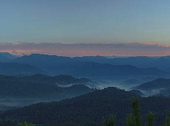
![Percorso A piedi Carro - Pavareto – Casun du Rissu – Colle Gruzze (Quattro Strade) - Photo](https://media.geolcdn.com/t/350/260/f43187b3-05f0-4e1d-ad74-3d495779203d.jpeg&format=jpg&maxdim=2)
![A piedi A piedi](https://static1.geolcdn.com/sitytour/trail-icons/100.png)
Km
A piedi
![](/images/other/stat-length.png)
![](https://static1.geolcdn.com/siteimages/upload/files/1508320355ic_sort_den_pos_24dp.png)
![](https://static1.geolcdn.com/siteimages/upload/files/1508320355ic_sort_den_neg_24dp.png)
![](https://static1.geolcdn.com/siteimages/upload/files/16400158638029165_repeat_loop_refresh_sync_direction_icon.png)
• relation mantained by AlfredoSP (CAI-SP) Symbol: 621 on white red flag Sito web: https://www.cailaspezia.it/
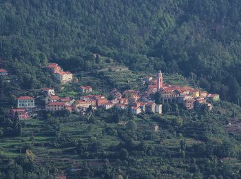
![Percorso A piedi Carro - Pavareto – La Mola – Sella Monte Stronzi - Photo](https://media.geolcdn.com/t/350/260/06791805-8d5c-4193-bace-a2b66b75f814.jpeg&format=jpg&maxdim=2)
![A piedi A piedi](https://static1.geolcdn.com/sitytour/trail-icons/100.png)
Km
A piedi
![](/images/other/stat-length.png)
![](https://static1.geolcdn.com/siteimages/upload/files/1508320355ic_sort_den_pos_24dp.png)
![](https://static1.geolcdn.com/siteimages/upload/files/1508320355ic_sort_den_neg_24dp.png)
![](https://static1.geolcdn.com/siteimages/upload/files/16400158638029165_repeat_loop_refresh_sync_direction_icon.png)
• relation mantained by AlfredoSP (CAI-SP) Symbol: 620 on white red flag Sito web: https://www.cailaspezia.it/
![Percorso A piedi Carro - Ponte Santa Margherita - Santuario di San Rocco - Photo](https://media.geolcdn.com/t/350/260/ext.jpg?maxdim=2&url=https%3A%2F%2Fstatic1.geolcdn.com%2Fsiteimages%2Fupload%2Ffiles%2F1545311037marcheuse_200dpi.jpg)
![A piedi A piedi](https://static1.geolcdn.com/sitytour/trail-icons/100.png)
Km
A piedi
![](/images/other/stat-length.png)
![](https://static1.geolcdn.com/siteimages/upload/files/1508320355ic_sort_den_pos_24dp.png)
![](https://static1.geolcdn.com/siteimages/upload/files/1508320355ic_sort_den_neg_24dp.png)
![](https://static1.geolcdn.com/siteimages/upload/files/16400158638029165_repeat_loop_refresh_sync_direction_icon.png)
• relation mantained by AlfredoSP (CAI-SP) Symbol: unmarked Sito web: https://www.cailaspezia.it/
![Percorso A piedi Carro - Piano Craviola - Canale della Comuna – Bivio 623 (Costa Le Cerrete) - Photo](https://media.geolcdn.com/t/350/260/ext.jpg?maxdim=2&url=https%3A%2F%2Fstatic1.geolcdn.com%2Fsiteimages%2Fupload%2Ffiles%2F1545311037marcheuse_200dpi.jpg)
![A piedi A piedi](https://static1.geolcdn.com/sitytour/trail-icons/100.png)
Km
A piedi
![](/images/other/stat-length.png)
![](https://static1.geolcdn.com/siteimages/upload/files/1508320355ic_sort_den_pos_24dp.png)
![](https://static1.geolcdn.com/siteimages/upload/files/1508320355ic_sort_den_neg_24dp.png)
![](https://static1.geolcdn.com/siteimages/upload/files/16400158638029165_repeat_loop_refresh_sync_direction_icon.png)
• relation mantained by AlfredoSP (CAI-SP) Symbol: some old white red flag Sito web: https://www.cailaspezia.it/
![Percorso A piedi Carro - Carro – Castello – Case Cannate – Valdiamaro - Piano Craviola (Bivio 625 e 628) - Photo](https://media.geolcdn.com/t/350/260/ext.jpg?maxdim=2&url=https%3A%2F%2Fstatic1.geolcdn.com%2Fsiteimages%2Fupload%2Ffiles%2F1545311037marcheuse_200dpi.jpg)
![A piedi A piedi](https://static1.geolcdn.com/sitytour/trail-icons/100.png)
Km
A piedi
![](/images/other/stat-length.png)
![](https://static1.geolcdn.com/siteimages/upload/files/1508320355ic_sort_den_pos_24dp.png)
![](https://static1.geolcdn.com/siteimages/upload/files/1508320355ic_sort_den_neg_24dp.png)
![](https://static1.geolcdn.com/siteimages/upload/files/16400158638029165_repeat_loop_refresh_sync_direction_icon.png)
• relation mantained by AlfredoSP (CAI-SP) Symbol: some old white red flag Sito web: https://www.cailaspezia.it/
![Percorso A piedi Carro - Ziona – Cian da Moa – Bivio 625 (Cerreta) - Photo](https://media.geolcdn.com/t/350/260/ext.jpg?maxdim=2&url=https%3A%2F%2Fstatic1.geolcdn.com%2Fsiteimages%2Fupload%2Ffiles%2F1545311037marcheuse_200dpi.jpg)
![A piedi A piedi](https://static1.geolcdn.com/sitytour/trail-icons/100.png)
Km
A piedi
![](/images/other/stat-length.png)
![](https://static1.geolcdn.com/siteimages/upload/files/1508320355ic_sort_den_pos_24dp.png)
![](https://static1.geolcdn.com/siteimages/upload/files/1508320355ic_sort_den_neg_24dp.png)
![](https://static1.geolcdn.com/siteimages/upload/files/16400158638029165_repeat_loop_refresh_sync_direction_icon.png)
• relation mantained by AlfredoSP (CAI-SP) Symbol: unmarked Sito web: https://www.cailaspezia.it/
![Percorso A piedi Carro - Carro – Sepponi – Trambacco - Cerreta – Stanga – Monte Rocche – Monte Vagie - Photo](https://media.geolcdn.com/t/350/260/ext.jpg?maxdim=2&url=https%3A%2F%2Fstatic1.geolcdn.com%2Fsiteimages%2Fupload%2Ffiles%2F1545311037marcheuse_200dpi.jpg)
![A piedi A piedi](https://static1.geolcdn.com/sitytour/trail-icons/100.png)
Km
A piedi
![](/images/other/stat-length.png)
![](https://static1.geolcdn.com/siteimages/upload/files/1508320355ic_sort_den_pos_24dp.png)
![](https://static1.geolcdn.com/siteimages/upload/files/1508320355ic_sort_den_neg_24dp.png)
![](https://static1.geolcdn.com/siteimages/upload/files/16400158638029165_repeat_loop_refresh_sync_direction_icon.png)
• relation mantained by AlfredoSP (CAI-SP) Symbol: some old white red flag Sito web: https://www.cailaspezia.it/
![Percorso A piedi Carro - Casa Del Monte – Grata – Pera – Rio di Colla – Casone del Pittore - Costa Le Cerrete - Photo](https://media.geolcdn.com/t/350/260/ext.jpg?maxdim=2&url=https%3A%2F%2Fstatic1.geolcdn.com%2Fsiteimages%2Fupload%2Ffiles%2F1545311037marcheuse_200dpi.jpg)
![A piedi A piedi](https://static1.geolcdn.com/sitytour/trail-icons/100.png)
Km
A piedi
![](/images/other/stat-length.png)
![](https://static1.geolcdn.com/siteimages/upload/files/1508320355ic_sort_den_pos_24dp.png)
![](https://static1.geolcdn.com/siteimages/upload/files/1508320355ic_sort_den_neg_24dp.png)
![](https://static1.geolcdn.com/siteimages/upload/files/16400158638029165_repeat_loop_refresh_sync_direction_icon.png)
• relation mantained by AlfredoSP (CAI-SP) Symbol: some old white red flag Sito web: https://www.cailaspezia.it/
9 percorsi visualizzati su 9
Applicazione GPS da escursionismo GRATUITA