![](/images/other/stat-length.png)
Greece, A piedi : I migliori sentieri, percorsi e passeggiate
Greece: Scopri i 551 migliori percorsi escursionistici a piedi e in bicicletta. Il catalogo curato dai nostri escursionisti è pieno di bei paesaggi che aspettano solo di essere esplorati. Scarica questi percorsi in SityTrail, la nostra applicazione di GPS da escursionismo gratuita disponibile per Android e iOS.
I percorsi migliori (0})
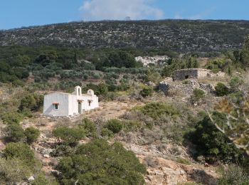
![Percorso A piedi Δημοτική Ενότητα Κυθήρων - M41 Mylopotamos Trail (long loop) - Photo](https://media.geolcdn.com/t/350/260/2f73411d-c491-4617-b6e1-53059594d683.jpeg&format=jpg&maxdim=2)
![A piedi A piedi](https://static1.geolcdn.com/sitytour/trail-icons/100.png)
Km
A piedi
![](/images/other/stat-length.png)
![](https://static1.geolcdn.com/siteimages/upload/files/1508320355ic_sort_den_pos_24dp.png)
![](https://static1.geolcdn.com/siteimages/upload/files/1508320355ic_sort_den_neg_24dp.png)
![](https://static1.geolcdn.com/siteimages/upload/files/16400158638029165_repeat_loop_refresh_sync_direction_icon.png)
• Trail created by Kythera Hiking. Symbol: blue-white bars
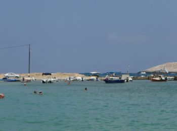
![Percorso A piedi - Katholiko-Stavros - Photo](https://media.geolcdn.com/t/350/260/86aa59bf-5ccf-4261-8400-4e974258cb19.jpeg&format=jpg&maxdim=2)
![A piedi A piedi](https://static1.geolcdn.com/sitytour/trail-icons/100.png)
Km
A piedi
![](/images/other/stat-length.png)
![](https://static1.geolcdn.com/siteimages/upload/files/1508320355ic_sort_den_pos_24dp.png)
![](https://static1.geolcdn.com/siteimages/upload/files/1508320355ic_sort_den_neg_24dp.png)
![](https://static1.geolcdn.com/siteimages/upload/files/16400158638029165_repeat_loop_refresh_sync_direction_icon.png)
• Symbol: blue dot
![Percorso A piedi - Ομαλός-Καλλέργν μέσω Κουκουλέ - Photo](https://media.geolcdn.com/t/350/260/19eb5317-6381-4fed-ad28-fb823c500cd7.jpeg&format=jpg&maxdim=2)
![A piedi A piedi](https://static1.geolcdn.com/sitytour/trail-icons/100.png)
Km
A piedi
![](/images/other/stat-length.png)
![](https://static1.geolcdn.com/siteimages/upload/files/1508320355ic_sort_den_pos_24dp.png)
![](https://static1.geolcdn.com/siteimages/upload/files/1508320355ic_sort_den_neg_24dp.png)
![](https://static1.geolcdn.com/siteimages/upload/files/16400158638029165_repeat_loop_refresh_sync_direction_icon.png)
• Symbol: red/blue stripes
![Percorso A piedi - Papoures - Photo](https://media.geolcdn.com/t/350/260/8795d2c2-18c3-4fa5-8ddb-dd17c4eeef41.jpeg&format=jpg&maxdim=2)
![A piedi A piedi](https://static1.geolcdn.com/sitytour/trail-icons/100.png)
Km
A piedi
![](/images/other/stat-length.png)
![](https://static1.geolcdn.com/siteimages/upload/files/1508320355ic_sort_den_pos_24dp.png)
![](https://static1.geolcdn.com/siteimages/upload/files/1508320355ic_sort_den_neg_24dp.png)
![](https://static1.geolcdn.com/siteimages/upload/files/16400158638029165_repeat_loop_refresh_sync_direction_icon.png)
• Symbol: red dot
![Percorso A piedi - Pathway to Taygetos Peak - Photo](https://media.geolcdn.com/t/350/260/dceeab5a-d813-401c-b510-da4d15bdf3eb.jpeg&format=jpg&maxdim=2)
![A piedi A piedi](https://static1.geolcdn.com/sitytour/trail-icons/100.png)
Km
A piedi
![](/images/other/stat-length.png)
![](https://static1.geolcdn.com/siteimages/upload/files/1508320355ic_sort_den_pos_24dp.png)
![](https://static1.geolcdn.com/siteimages/upload/files/1508320355ic_sort_den_neg_24dp.png)
![](https://static1.geolcdn.com/siteimages/upload/files/16400158638029165_repeat_loop_refresh_sync_direction_icon.png)
• Trail created by Alpine Club of Kalamata. Symbol: red square on white ground
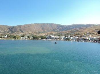
![Percorso A piedi - Andros Routes 15 - Photo](https://media.geolcdn.com/t/350/260/320a3f32-d856-42a1-9cd6-c3bd3a456cce.jpeg&format=jpg&maxdim=2)
![A piedi A piedi](https://static1.geolcdn.com/sitytour/trail-icons/100.png)
Km
A piedi
![](/images/other/stat-length.png)
![](https://static1.geolcdn.com/siteimages/upload/files/1508320355ic_sort_den_pos_24dp.png)
![](https://static1.geolcdn.com/siteimages/upload/files/1508320355ic_sort_den_neg_24dp.png)
![](https://static1.geolcdn.com/siteimages/upload/files/16400158638029165_repeat_loop_refresh_sync_direction_icon.png)
• Trail created by Andros Routes. Symbol: red_rectangle Sito web: https://www.androsroutes.gr/
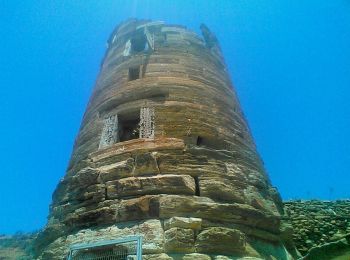
![Percorso A piedi - Andros Routes 15a - Photo](https://media.geolcdn.com/t/350/260/a14d5702-efda-4809-955d-545c0483c57e.jpeg&format=jpg&maxdim=2)
![A piedi A piedi](https://static1.geolcdn.com/sitytour/trail-icons/100.png)
Km
A piedi
![](/images/other/stat-length.png)
![](https://static1.geolcdn.com/siteimages/upload/files/1508320355ic_sort_den_pos_24dp.png)
![](https://static1.geolcdn.com/siteimages/upload/files/1508320355ic_sort_den_neg_24dp.png)
![](https://static1.geolcdn.com/siteimages/upload/files/16400158638029165_repeat_loop_refresh_sync_direction_icon.png)
• Trail created by Andros Routes. Symbol: red_rectangle Sito web: https://www.androsroutes.gr/
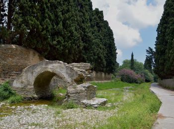
![Percorso A piedi - Andros Routes 17 - Photo](https://media.geolcdn.com/t/350/260/3ea9cf68-964d-42cd-bcce-620627ae00e4.jpeg&format=jpg&maxdim=2)
![A piedi A piedi](https://static1.geolcdn.com/sitytour/trail-icons/100.png)
Km
A piedi
![](/images/other/stat-length.png)
![](https://static1.geolcdn.com/siteimages/upload/files/1508320355ic_sort_den_pos_24dp.png)
![](https://static1.geolcdn.com/siteimages/upload/files/1508320355ic_sort_den_neg_24dp.png)
![](https://static1.geolcdn.com/siteimages/upload/files/16400158638029165_repeat_loop_refresh_sync_direction_icon.png)
• Trail created by Andros Routes. Symbol: red_rectangle Sito web: https://www.androsroutes.gr/
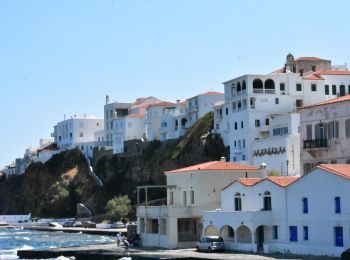
![Percorso A piedi - Andros Routes 10 - Photo](https://media.geolcdn.com/t/350/260/8babceff-8d5c-426f-9e4c-4a955b7453a2.jpeg&format=jpg&maxdim=2)
![A piedi A piedi](https://static1.geolcdn.com/sitytour/trail-icons/100.png)
Km
A piedi
![](/images/other/stat-length.png)
![](https://static1.geolcdn.com/siteimages/upload/files/1508320355ic_sort_den_pos_24dp.png)
![](https://static1.geolcdn.com/siteimages/upload/files/1508320355ic_sort_den_neg_24dp.png)
![](https://static1.geolcdn.com/siteimages/upload/files/16400158638029165_repeat_loop_refresh_sync_direction_icon.png)
• Trail created by Andros Routes. Symbol: red_rectangle Sito web: https://www.androsroutes.gr/
![Percorso A piedi - Andros Routes 5 - Photo](https://media.geolcdn.com/t/350/260/3ea9cf68-964d-42cd-bcce-620627ae00e4.jpeg&format=jpg&maxdim=2)
![A piedi A piedi](https://static1.geolcdn.com/sitytour/trail-icons/100.png)
Km
A piedi
![](/images/other/stat-length.png)
![](https://static1.geolcdn.com/siteimages/upload/files/1508320355ic_sort_den_pos_24dp.png)
![](https://static1.geolcdn.com/siteimages/upload/files/1508320355ic_sort_den_neg_24dp.png)
![](https://static1.geolcdn.com/siteimages/upload/files/16400158638029165_repeat_loop_refresh_sync_direction_icon.png)
• Trail created by Andros Routes. Symbol: red_rectangle Sito web: https://www.androsroutes.gr/
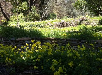
![Percorso A piedi - Andros Routes 18 - Photo](https://media.geolcdn.com/t/350/260/70a7c804-9701-41c4-be94-83e75bfd7b66.jpeg&format=jpg&maxdim=2)
![A piedi A piedi](https://static1.geolcdn.com/sitytour/trail-icons/100.png)
Km
A piedi
![](/images/other/stat-length.png)
![](https://static1.geolcdn.com/siteimages/upload/files/1508320355ic_sort_den_pos_24dp.png)
![](https://static1.geolcdn.com/siteimages/upload/files/1508320355ic_sort_den_neg_24dp.png)
![](https://static1.geolcdn.com/siteimages/upload/files/16400158638029165_repeat_loop_refresh_sync_direction_icon.png)
• Trail created by Andros Routes. Symbol: red_rectangle Sito web: https://www.androsroutes.gr/
![Percorso A piedi - Andros Routes 1 - Photo](https://media.geolcdn.com/t/350/260/70a7c804-9701-41c4-be94-83e75bfd7b66.jpeg&format=jpg&maxdim=2)
![A piedi A piedi](https://static1.geolcdn.com/sitytour/trail-icons/100.png)
Km
A piedi
![](/images/other/stat-length.png)
![](https://static1.geolcdn.com/siteimages/upload/files/1508320355ic_sort_den_pos_24dp.png)
![](https://static1.geolcdn.com/siteimages/upload/files/1508320355ic_sort_den_neg_24dp.png)
![](https://static1.geolcdn.com/siteimages/upload/files/16400158638029165_repeat_loop_refresh_sync_direction_icon.png)
• Trail created by Andros Routes. Symbol: red_rectangle Sito web: https://www.androsroutes.gr/
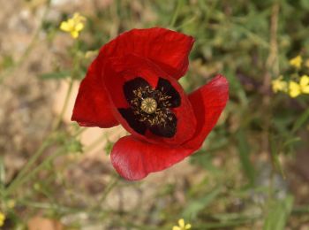
![Percorso A piedi - Andros Routes 11 - Photo](https://media.geolcdn.com/t/350/260/6909892e-51ec-4943-a3a7-329549f59973.jpeg&format=jpg&maxdim=2)
![A piedi A piedi](https://static1.geolcdn.com/sitytour/trail-icons/100.png)
Km
A piedi
![](/images/other/stat-length.png)
![](https://static1.geolcdn.com/siteimages/upload/files/1508320355ic_sort_den_pos_24dp.png)
![](https://static1.geolcdn.com/siteimages/upload/files/1508320355ic_sort_den_neg_24dp.png)
![](https://static1.geolcdn.com/siteimages/upload/files/16400158638029165_repeat_loop_refresh_sync_direction_icon.png)
• Trail created by Andros Routes. Symbol: red_rectangle Sito web: https://www.androsroutes.gr/
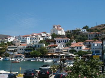
![Percorso A piedi - Andros Routes 16 - Photo](https://media.geolcdn.com/t/350/260/38a81b7b-5f15-48d9-88ff-562f4c47b63f.jpeg&format=jpg&maxdim=2)
![A piedi A piedi](https://static1.geolcdn.com/sitytour/trail-icons/100.png)
Km
A piedi
![](/images/other/stat-length.png)
![](https://static1.geolcdn.com/siteimages/upload/files/1508320355ic_sort_den_pos_24dp.png)
![](https://static1.geolcdn.com/siteimages/upload/files/1508320355ic_sort_den_neg_24dp.png)
![](https://static1.geolcdn.com/siteimages/upload/files/16400158638029165_repeat_loop_refresh_sync_direction_icon.png)
• Trail created by Andros Routes. Symbol: red_rectangle Sito web: https://www.androsroutes.gr/
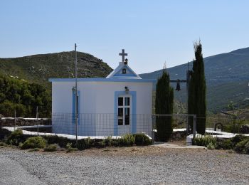
![Percorso A piedi - Andros Routes 14 - Photo](https://media.geolcdn.com/t/350/260/fbc799c1-eea5-49a7-a7f5-f23f098bcc56.jpeg&format=jpg&maxdim=2)
![A piedi A piedi](https://static1.geolcdn.com/sitytour/trail-icons/100.png)
Km
A piedi
![](/images/other/stat-length.png)
![](https://static1.geolcdn.com/siteimages/upload/files/1508320355ic_sort_den_pos_24dp.png)
![](https://static1.geolcdn.com/siteimages/upload/files/1508320355ic_sort_den_neg_24dp.png)
![](https://static1.geolcdn.com/siteimages/upload/files/16400158638029165_repeat_loop_refresh_sync_direction_icon.png)
• Trail created by Andros Routes. Symbol: red_rectangle Sito web: https://www.androsroutes.gr/
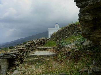
![Percorso A piedi - Andros Routes 4 - Photo](https://media.geolcdn.com/t/350/260/1d4f6d94-82f0-4904-9335-aa62fec7d026.jpeg&format=jpg&maxdim=2)
![A piedi A piedi](https://static1.geolcdn.com/sitytour/trail-icons/100.png)
Km
A piedi
![](/images/other/stat-length.png)
![](https://static1.geolcdn.com/siteimages/upload/files/1508320355ic_sort_den_pos_24dp.png)
![](https://static1.geolcdn.com/siteimages/upload/files/1508320355ic_sort_den_neg_24dp.png)
![](https://static1.geolcdn.com/siteimages/upload/files/16400158638029165_repeat_loop_refresh_sync_direction_icon.png)
• Trail created by Andros Routes. Symbol: red_rectangle Sito web: https://www.androsroutes.gr/
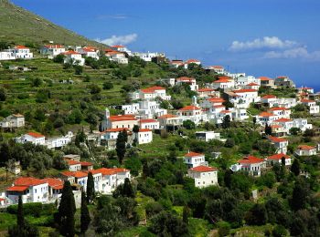
![Percorso A piedi - Andros Routes 3 - Photo](https://media.geolcdn.com/t/350/260/91ada0e4-3f6e-4426-8b80-971c602833f2.jpeg&format=jpg&maxdim=2)
![A piedi A piedi](https://static1.geolcdn.com/sitytour/trail-icons/100.png)
Km
A piedi
![](/images/other/stat-length.png)
![](https://static1.geolcdn.com/siteimages/upload/files/1508320355ic_sort_den_pos_24dp.png)
![](https://static1.geolcdn.com/siteimages/upload/files/1508320355ic_sort_den_neg_24dp.png)
![](https://static1.geolcdn.com/siteimages/upload/files/16400158638029165_repeat_loop_refresh_sync_direction_icon.png)
• Trail created by Andros Routes. Symbol: red_rectangle Sito web: https://www.androsroutes.gr/
![Percorso A piedi - Andros Routes 2 - Photo](https://media.geolcdn.com/t/350/260/8babceff-8d5c-426f-9e4c-4a955b7453a2.jpeg&format=jpg&maxdim=2)
![A piedi A piedi](https://static1.geolcdn.com/sitytour/trail-icons/100.png)
Km
A piedi
![](/images/other/stat-length.png)
![](https://static1.geolcdn.com/siteimages/upload/files/1508320355ic_sort_den_pos_24dp.png)
![](https://static1.geolcdn.com/siteimages/upload/files/1508320355ic_sort_den_neg_24dp.png)
![](https://static1.geolcdn.com/siteimages/upload/files/16400158638029165_repeat_loop_refresh_sync_direction_icon.png)
• Trail created by Andros Routes. Symbol: red_rectangle Sito web: https://www.androsroutes.gr/
![Percorso A piedi - Andros Routes 8 - Photo](https://media.geolcdn.com/t/350/260/8babceff-8d5c-426f-9e4c-4a955b7453a2.jpeg&format=jpg&maxdim=2)
![A piedi A piedi](https://static1.geolcdn.com/sitytour/trail-icons/100.png)
Km
A piedi
![](/images/other/stat-length.png)
![](https://static1.geolcdn.com/siteimages/upload/files/1508320355ic_sort_den_pos_24dp.png)
![](https://static1.geolcdn.com/siteimages/upload/files/1508320355ic_sort_den_neg_24dp.png)
![](https://static1.geolcdn.com/siteimages/upload/files/16400158638029165_repeat_loop_refresh_sync_direction_icon.png)
• Trail created by Andros Routes. Symbol: red_rectangle Sito web: https://www.androsroutes.gr/
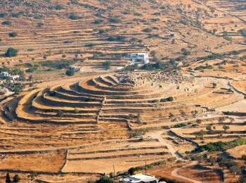
![Percorso A piedi - Ίος Χώρα-Agios Prokopios (via Profiti Ilias Rachi) (Μονοπάτι) - Photo](https://media.geolcdn.com/t/350/260/07a280e8-5a16-4e5d-b8a8-083862382127.jpeg&format=jpg&maxdim=2)
![A piedi A piedi](https://static1.geolcdn.com/sitytour/trail-icons/100.png)
Km
A piedi
![](/images/other/stat-length.png)
![](https://static1.geolcdn.com/siteimages/upload/files/1508320355ic_sort_den_pos_24dp.png)
![](https://static1.geolcdn.com/siteimages/upload/files/1508320355ic_sort_den_neg_24dp.png)
![](https://static1.geolcdn.com/siteimages/upload/files/16400158638029165_repeat_loop_refresh_sync_direction_icon.png)
• Symbol: 3
20 percorsi visualizzati su 551
Applicazione GPS da escursionismo GRATUITA
Attività
Regioni vicine
- Αποκεντρωμένη Διοίκηση Αιγαίου
- Αποκεντρωμένη Διοίκηση Αττικής
- Αποκεντρωμένη Διοίκηση Ηπείρου - Δυτικής Μακεδονίας
- Αποκεντρωμένη Διοίκηση Θεσσαλίας - Στερεάς Ελλάδος
- Αποκεντρωμένη Διοίκηση Κρήτης
- Αποκεντρωμένη Διοίκηση Μακεδονίας - Θράκης
- Αποκεντρωμένη Διοίκηση Πελοποννήσου, Δυτικής Ελλάδας και Ιονίου