


19,5 km | 44 km-effort
Prads: Scopri i migliori percorsi: 2 a piedi, 45 marcia e 1 sentiero. Tutti questi percorsi, itinerari e attività outdoor sono disponibili nelle nostre app SityTrail per smartphone e tablet.
Marcia


Marcia
Marcia
Marcia

Sentiero

Marcia
Marcia
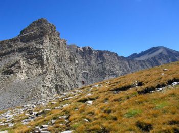
• Sublime!!!

Marcia
Marcia
Marcia

A piedi
• Rando secteur Digne les Bains (Alpes de Haute-Provence) Départ de Saume Longe Rejoindre la cabane de Val Pousane. Crê...
Marcia
Marcia
Marcia
Marcia
A piedi
Marcia
Marcia
Marcia
Marcia
20 percorsi visualizzati su 48
Applicazione GPS da escursionismo GRATUITA
 SityTrail
IGN / Istituti geografici
SityTrail World
Il mondo è tuo